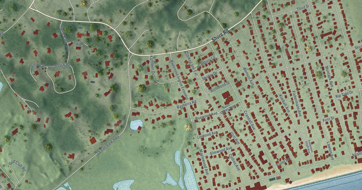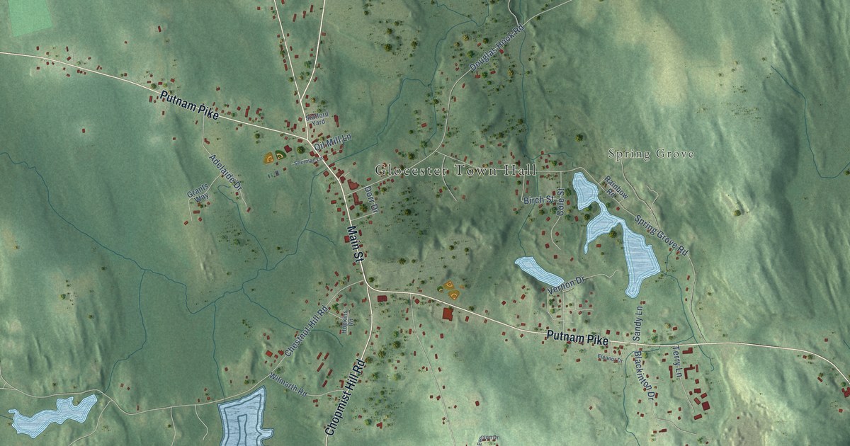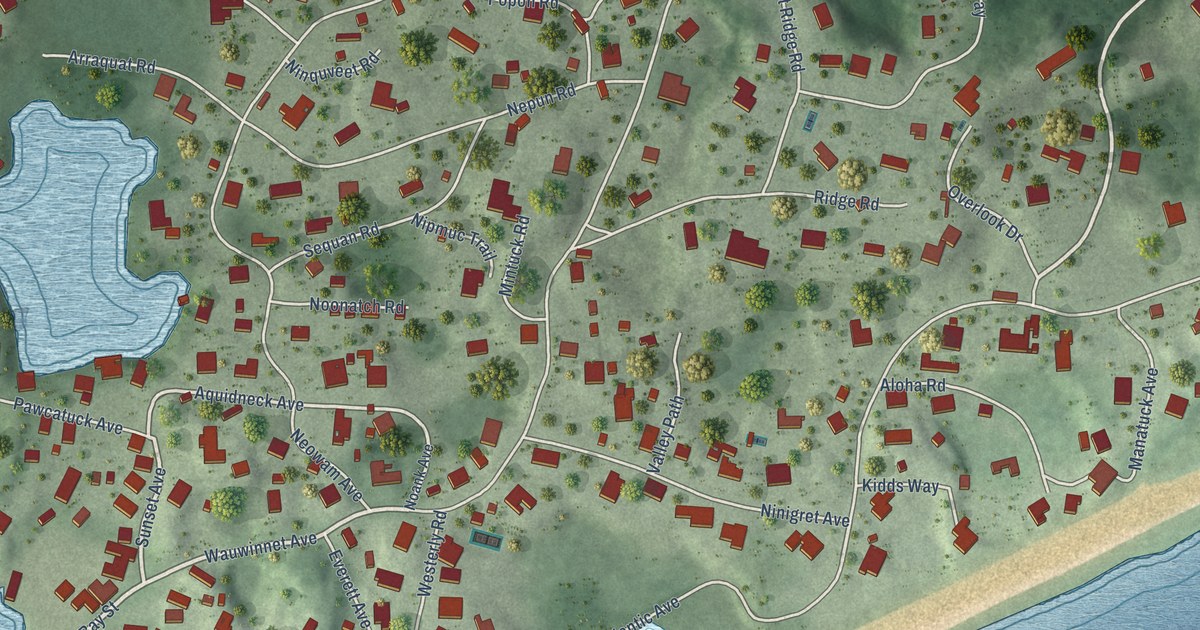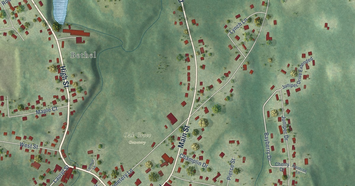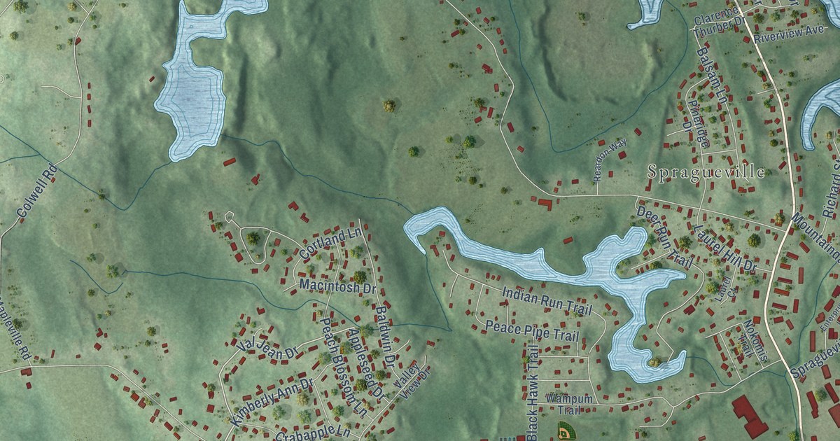
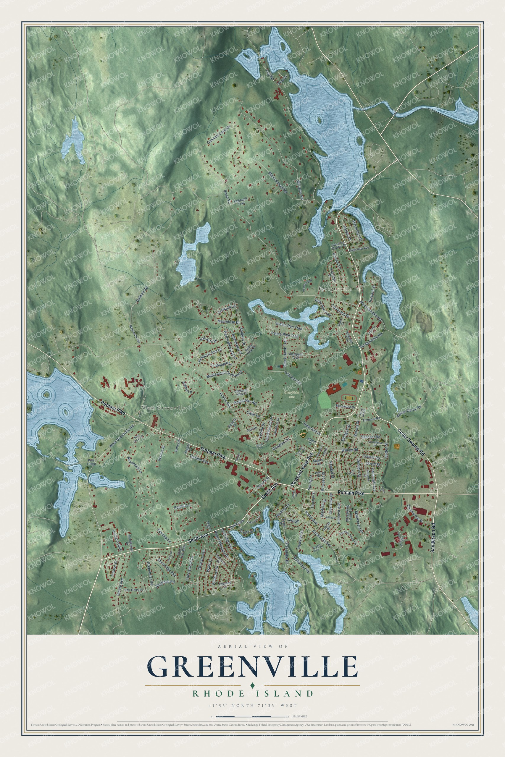
This beautifully detailed map of Greenville, Rhode Island was created in 2026 using aerial imagery combined with modern topographical, census, street and landmark data. It's a modern aerial view of Greenville in Providence County, Rhode Island, that combines modern data with a vintage aesthetic. The roads feature printed names, and if you look closely you can find your exact house accurately shown in its correct location.
Explore an aerial view of Greenville, Rhode Island
On this map you'll find West Greenville, Spragueville, Deerfield Park, Sanderson Road, Putnam Pike, Pleasant View Avenue, Smith Avenue, Cedar Swamp Road, West Greenville Road, Aspen Lane, Kimberly Ann Drive, Maplecrest Drive, and more. Each red shape is a building, so zoom in on the preview and look for yours.
Here is a piece of Greenville history. Greenville grew up around the crossroads where Resolved Waterman built the earliest tavern on record in Smithfield in 1733, when the Putnam Pike was finished. A grist mill started by the first Resolved Waterman ran there into the nineteenth century, and an academy opened in 1813. In the 1840s three textile mills were built in Greenville on the last three water power sites in Smithfield. By 1850 Greenville had become a substantial village. That's from the state Historical Preservation Commission.
Greenville is a community in Providence County. The Census Bureau counted 9,061 people here in 2020.
Take a closer look at the Greenville map
Names on this map
These names are printed on this map.
Places: West Greenville, Spragueville and Deerfield Park.
Streets and roads: Sanderson Road, Putnam Pike, Pleasant View Avenue, Smith Avenue, Cedar Swamp Road, West Greenville Road, Aspen Lane, Kimberly Ann Drive, Maplecrest Drive, Val Jean Drive, Cherrywood Drive, Sophia Lane.
More street names, A to Z
Albert Street, Appleseed Drive, Appletown Road, Appletree Lane, Asa Street, Austin Avenue, Baldwin Drive, Balsam Lane, Barnes Street, Battey Drive, Baxter Lane, Bayou Drive, Beverly Circle, Bewlay Street, Black Hawk Trail, Breezy Knoll Road, Calista Street, Candlewood Drive, Chestnut Hills Court, Church Street, Cider Lane, Clarence Thurber Drive, Colwell Road, Commerce Street, Concord Street, Connors Farm Drive, Continental Road, Coolridge Avenue, Cortland Lane, Cottage Avenue, Crabapple Lane, Crestview Drive, Cypress Drive, Danecroft Avenue, David Street, Deerfield Drive, Deer Run Trail, Douglas Circle, Elmhurst Drive, Enterprise Lane, Factory Pond Circle, Fair Oaks Lane, Fanning Lane, Garden Avenue, Garnet Lane, Greenbrier Road, Greenlake Drive, Greenville Avenue, Halsey Drive, Hattie Avenue, Hawkins Street, Hillcrest Avenue, Indian Run Trail, Jean Drive, Joyce Ann Drive, Lakeview Drive, Lark Industrial Drive, Lark Road, Laurel Court, Laurel Hill Drive, Lawnacre Drive, Lisa Ann Circle, Log Road, Lucille Drive, Macarthur Drive, Macintosh Drive, Mann School Road, Mapleville Road, Maplewood Orchard Drive, Mayfield Street, Mountaindale Road, Mowry Road, Newton Drive, Nokomis Trail, Oakhurst Drive, Orchard Avenue, Orchard Gate, Pamela Drive, Peace Pipe Trail, Peach Blossom Lane, Pine Drive, Pine Grove Circle, Pine Ledge, Pineridge Drive, Pleasant View Circle, Prospect Street, Quaker Lane, Randall Street, Reardon Way, Richard Street, River Street, Riverview Avenue, Robert Street, Roger Williams Drive, Rosemary Lane, Rosewood Drive, Ruffstone Road, Sheffield Road, Sherwood Lane, Spencer Road, Sprague Street, Spragueville Road, Spring Street, Steere Avenue, Stephen Street, Stonehenge Drive, Stone Post Way, Sturbridge Avenue, Sutton Street, Swan Road, Tamarac Drive, Terrace Drive, Thibeault Trail, Thornton Street, Tucker Road, Tunmore Road, Valley View Drive, Vaughn Street, Vernon Street, Wade Drive, Walter Carey Road, Wampum Trail, Whispering Pine Terrace, Williams Road, Willow Road.
See it on a wall
The Greenville map as a framed print. Swipe for more.


Created by KNOWOL in 2026. The buildings are small red shapes, the roads carry their printed names, and shaded relief shows the shape of the land. The title panel reads "AERIAL VIEW OF GREENVILLE, RHODE ISLAND" with 41°53' NORTH 71°33' WEST.
It suits a den, a classroom or a front hall, and it makes a gift for anyone with Greenville roots. Open the preview and find the block you know. See sizes and frames for the Greenville map.