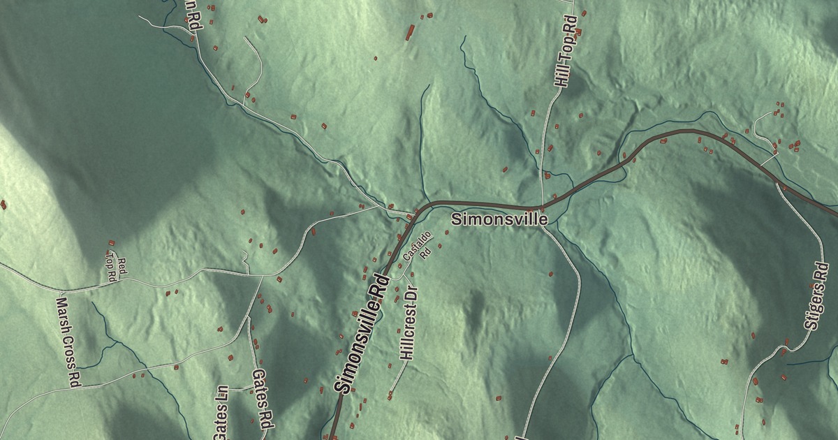
In Andover, the town office sits on Weston Andover Road, and the old brick inn at Simonsville still watches the crossroads on Route 11. This map prints Simonsville and Middletown, with Simonsville Road, Weston Andover Road, Lovejoy Brook Road, Gates Road, East Hill Road and North Hill Road running through the town.
Andover is in Windsor County, on the east side of the Green Mountains.
KNOWOL made this map in 2026 from public survey data and gave it the look of an old atlas. The shaded terrain comes from United States Geological Survey elevation data, and the roads and the town line come from the Census Bureau. Andover covers 28.8 square miles, almost all of it land, and it had 568 people at the 2020 census. Click here to purchase a print of this map for your wall.
A town split by its mountains
Governor Benning Wentworth of New Hampshire granted Andover on October 13, 1761, to Nathaniel House and his associates, one of many towns he chartered in what’s now Windsor County that year. The first Andover was bigger than today’s. Markham Mountain and Terrible Mountain ran north and south through the middle of it, and the families in the western half, called West Town, found it so hard to reach the eastern half that they asked the legislature for a town of their own. It set them off as Weston on October 26, 1799.
Howard Hill, in the southern part of town, is named for the family that settled there in the 1780s. Captain Solomon Howard built a large brick house there that became the neighborhood’s gathering place, later called “Solomon’s Temple,” and a town history of 1886 remembers the young men meeting at his home after planting for ball games, wrestling and shooting at a mark, with supper in his house at night. Beginning in the fall of 1909, Finnish families came to Andover and bought farms that had been, or were about to be, abandoned, many of them by way of Fitchburg, Massachusetts. By the 1920s more than 30 Finnish families had settled here, most of them on East Hill, which earned the name “Finn Hill,” and a few still have descendants in town, among them the Kalinen family.
Born in Andover
Alvin Adams was born in Andover in 1804 and was left an orphan at eight when his parents died within a week of each other. He went to Boston to make his way, and in 1840 he started an express freight route between Boston and New York under the name Adams and Company, a forerunner of Adams Express and one of the first companies to carry express shipments by rail in the United States. Ira S. Haseltine, born here in 1821, helped found Richland Center, Wisconsin, planning its layout and choosing its name, and later represented Missouri in Congress. Albert Gutterson, born in Andover in 1887, won the gold medal in the long jump at the 1912 Summer Olympics, setting a new Olympic record of 7.60 meters, and the University of Vermont’s Gutterson Fieldhouse is named for him.
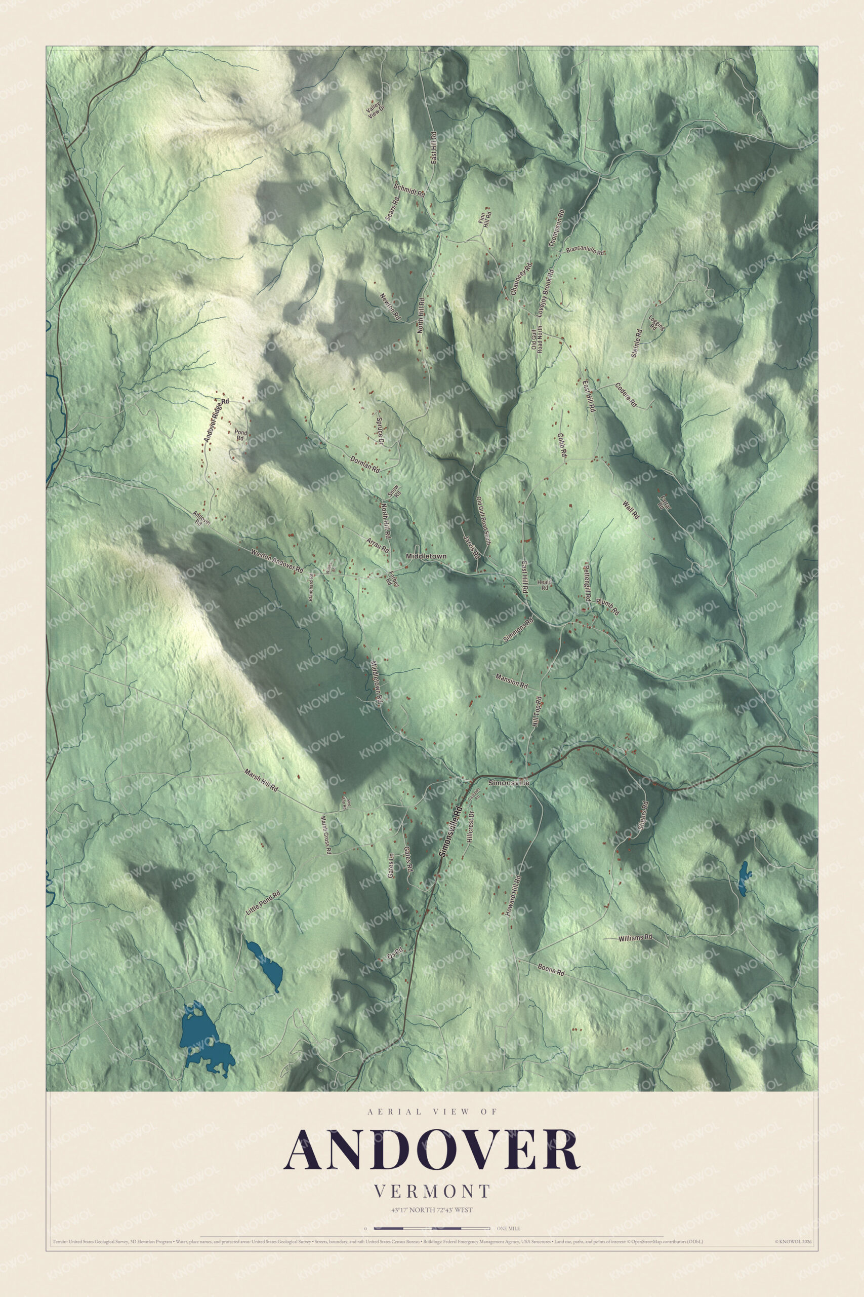
Click to explore a larger preview. The digital watermark does not appear on printed maps.
Names on this map
These names are printed on this map.
Places: Simonsville and Middletown.
Streets and roads: Simonsville Road, Lovejoy Brook Road, Weston Andover Road, Gates Road, East Hill Road, North Hill Road, Middletown Road, Howard Hill Road, Marsh Hill Road, Andover Ridge Road, Little Pond Road, Hill Top Road.
More street names, A to Z
Andover Road, Arrau Road, Biancaniello Road, Blanchard Road, Boone Road, Castaldo Road, Chauncey Road, Cobb Road, Codere Road, Dorman Road, Farrar Road, Finn Hill Road, Forbes Road, Gates Lane, Heald Road, Hillcrest Drive, Jarvis Road, Logging Road, Mansion Road, Marsh Cross Road, Newton Road, Old Gulf Road North, Old Gulf Road South, Os Road, Pettengill Road, Plumb Road, Pond Road, Red Top Road, Schmidt Road, Sears Road, Simmons Road, Snow Road, Spruce Drive, Steinle Road, Stigers Road, Thompson Road, Valley View Drive, Wall Road, Williams Road, Willies Lane.
See it on a wall
The Andover map as a framed print. Swipe for more.


Simonsville and the hill roads
Simonsville is a crossroads village in the southern center of town, and the inn there stands at the western corner of Route 11 and Middletown Road, which leads to the center of Weston. Edward Simons built it of local brick in 1826, though a plate over the door says 1820. It has a three-level porch, served as a general store and post office until 1950, and has been a meeting place for the town ever since it was built. Frederick Rowell bought it in 1910, and it was long known as Rowell’s Inn; it was listed on the National Register of Historic Places in 1979, and its page says new owners renamed it The Inn Between and Which Way Tavern in 2024.
Peter Adams, an early settler on East Hill who died in 1832, is buried in the East Hill Cemetery. East Hill Road, Weston Andover Road, North Hill Road, Gates Road and Lovejoy Brook Road are printed on the map as well.
This Andover map is a fine addition to an office, library or den, and it can even help teach children the geography and history of a hill town that once took in Weston too. It’s made for anyone who calls Andover home, from Simonsville to East Hill. KNOWOL created it in 2026, and it’s printed on museum quality archival paper. Zoom in on the preview above to explore the details, then click here to get your copy of the Andover, Vermont map.

Sources