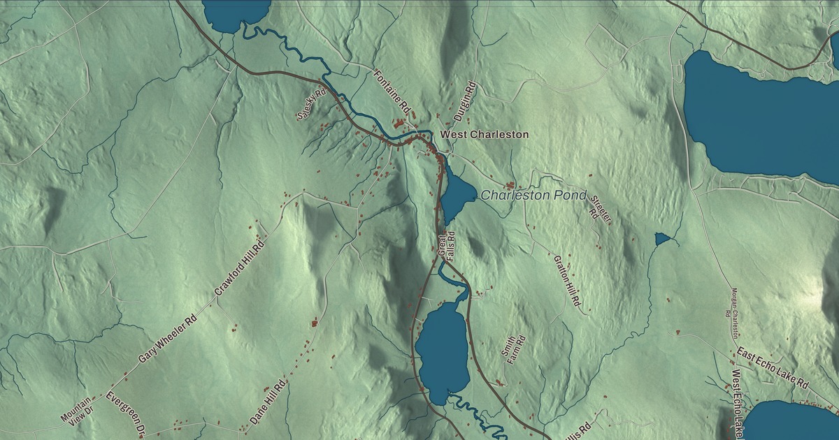
If you know Charleston, you know the Clyde River, the two villages it ties together and the cold, deep water of Echo Lake. This map prints West Charleston and East Charleston, Echo Lake, Charleston Pond and Toad Pond, and the roads between them: West Echo Lake Road, East Echo Lake Road, Westmore Road, Moody Hill Road, Gary Wheeler Road and Evergreen Drive.
Charleston is a town in Orleans County, in Vermont’s Northeast Kingdom.
KNOWOL made this map in 2026 from public survey data, with the look of an old county atlas. The hills are shaded from United States Geological Survey elevation data, and the roads and the town line come from the Census Bureau. Charleston covers 38.6 square miles, a little over a square mile of it water, and it had 1,021 people at the 2020 census. Click here to purchase a print of this map for your wall.
A town first called Navy
Charleston dates to 1780, when Vermont granted the land on November 10 under the name Navy. The grant went to Commodore Abraham Whipple of Rhode Island, a Continental Navy captain, along with fifty to sixty of his shipmates, and Whipple’s own biography calls him the first named proprietor of Charleston, Vermont. He’s better known for firing the first cannon shot at the Royal Navy in the Revolution, in 1775, and for helping found Marietta, Ohio. The first settler, Abner Allen of Barton, arrived in 1803, and the town organized in 1806.
On November 6, 1825, Navy became Charleston. The town page says the new name was presumably taken from a naval battle off Charleston, South Carolina, a city Whipple had helped defend in 1779 and 1780. Long before any of this, the Abenaki told of a large pond here that “ran away,” much like Runaway Pond.
Charleston grew into a mill town in the late 1800s and early 1900s, and its population reached a high of about 1,700. In 1908 a round barn went up in town that was possibly the largest such structure in New England. It burned in 1918, but its big stone foundation can still be seen along the Ten Mile Square Road.
The Clyde River and its ponds
The Clyde is the largest stream in Charleston, running northwest nearly through the middle of town on its way to Lake Memphremagog. Its current is mostly slow, but there are falls in the western part of town, where the river drops more than 100 feet. Dams were built at West Charleston in 1928 and at Pensioners Pond in 1929. Pensioners Pond is named for the pension of a Revolutionary War soldier who used its water power. Toad Pond sits above it, near the great swamp on the Brownington line, and below Pensioners Pond the river opens into Charleston Pond before heading on toward Derby.
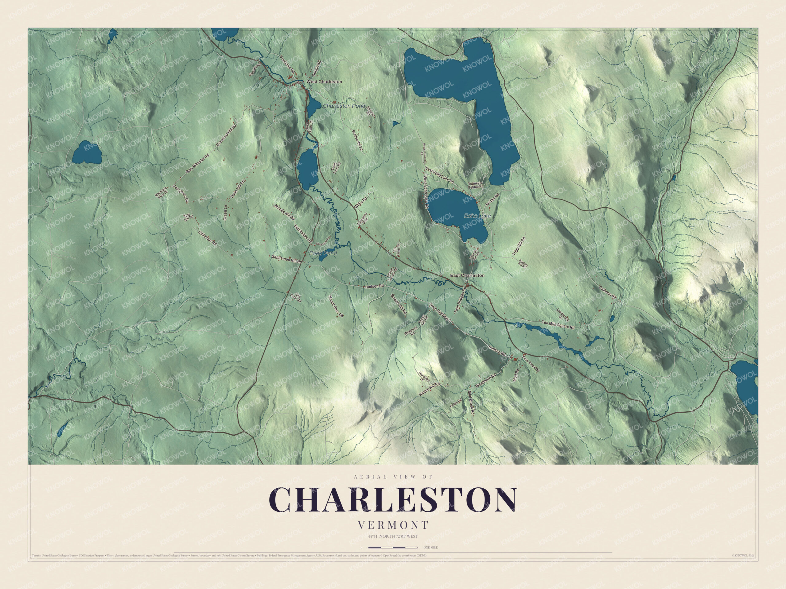
Click to explore a larger preview. The digital watermark does not appear on printed maps.
Names on this map
These names are printed on this map.
Places: West Charleston, East Charleston, Echo Lake, Charleston Pond and Toad Pond.
Streets and roads: West Echo Lake Road, Gary Wheeler Road, Evergreen Drive, Town Highway 1, Westmore Road, East Echo Lake Road, Moody Hill Road, Hudson Road, Dane Hill Road, Ten Mile Square Road, Sanderson Hill Road, Crawford Hill Road.
More street names, A to Z
Allen Farm Road, Barney's Pebble Road, Batchelder Road, Bly Farm Road, Bowen Hill Road, Buck Brook Road, Calhoun Road, Carpenter Boulevard, Center School Road, Chilafoux Road, Church Hill Road, Coles Road, Crowe Hill Road, Durgin Road, Fontaine Road, Gay Hill Road, Gratton Hill Road, Great Falls Road, Green Lane, Hinton Hill Road, Hopkins Hill Road, Jordan Road, Leadership Drive, Line Farm Road, Mad Brook Road, Morgan-Charleston Road, Mountain View Drive, Mount Bess Road, Mud Road, Paradise Lane, Salesky Road, Smith Farm Road, Streeter Road, Tripp Hill Road, Twin Bridges Road, Westover Road, Willis Road.
See it on a wall
The Charleston map as a framed print. Swipe for more.


Echo Lake
Echo Lake lies a mile from East Charleston. Whitelaw, Vermont’s first surveyor general, called it Echo Pond because any sound made near it came back from several directions at once. The lake covers 530 acres, runs a mile and a half long and reaches 129 feet deep. It’s fed by the outlet of Lake Seymour in Morgan, and it’s one of only two deep, cold lakes in the whole Clyde River system, the other being Lake Seymour. That cold water holds rainbow, brook and lake trout and landlocked salmon. A concrete dam at the outlet was finished in 1922.
The lake had one famous summer neighbor. The physicist Robert Mills, who worked out what’s now called Yang-Mills theory with C. N. Yang in 1954, spent summer and winter breaks with his family at their place on Echo Lake, and he spent his final months there. Benjamin Hunkins, born in Charleston in 1810, went west and served in the Wisconsin territorial legislature.
Finding your way around
Start in West Charleston, where a dam went across the river in 1928, and follow the Clyde upstream to East Charleston, where the outlet of Echo Lake joins it just south of the village. From there, East Echo Lake Road and West Echo Lake Road lead toward the lake. Westmore Road, Moody Hill Road, Gary Wheeler Road and Evergreen Drive are printed on the map too, and Toad Pond and Charleston Pond both drain to the same river.
Hang this map of Charleston in an office, library or den, or use it to teach children the geography and history of the old Navy grant. It’s for everyone who calls Charleston home and shows the town as it looks today, from Charleston Pond to Echo Lake. KNOWOL created it in 2026, printed on museum quality archival paper. Zoom in on the preview above to explore the details, then click here to get your copy of the Charleston, Vermont map.

Sources