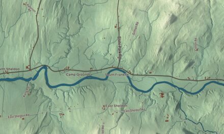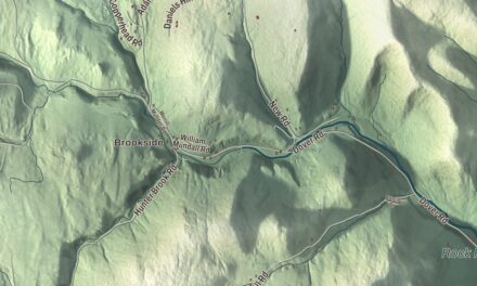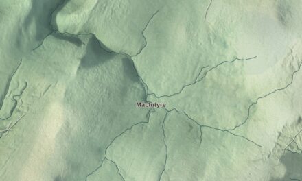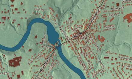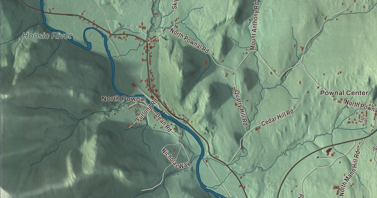
Pownal is the southwesternmost town in Vermont, bordered by Massachusetts to the south and New York to the west, with the Hoosic River running through its western villages and Route 7 passing through Pownal Center at the town’s geographic center. This map prints Main Street, Middle Pownal Road, Old Military Road, Northwest Hill Road, Hogsback Road and Barber Pond Road, with North Pownal, Pownal Center, the Hoosic River and Barber Pond.
Pownal is a town in Bennington County, Vermont.
KNOWOL made this map in 2026 from public survey data and gave it the look of an old county atlas, shading the hills from United States Geological Survey elevation data and drawing the roads and town line from the Census Bureau. The town covers 46.7 square miles, and 3,258 people lived here at the 2020 census. Click here to purchase a print of this map for your wall.
On the edge of the Grants
In the Woodland period the Mahican people lived here, and the southwestern corner of Pownal was once part of Rensselaerswyck, the Dutch patroonship that reached east from Albany; the first European settlers may have come in the 1730s, perhaps Dutch tenants. New Hampshire’s governor, Benning Wentworth, chartered the town in January 1760 and named it for Thomas Pownall, royal governor of Massachusetts, and the town organized that March. Settlers, mostly of English descent, came from Massachusetts, Connecticut and Rhode Island. In 1766, 185 heads of households in Pownal petitioned King George III to recognize their land claims, and when New York and the New Hampshire grantees came to blows over the land, a number of Pownal men joined Ethan Allen’s Green Mountain Boys. The Revolution divided the town, and when Burgoyne’s campaign reached the area, Vermonters fought on both sides.
The Mooar-Wright House, built about 1750 or 1764, is one of the oldest houses in Vermont and possibly the oldest. Some believe Dutch settlers built it and others credit John Defoe, a Loyalist, and the date hasn’t been confirmed by tree-ring dating. The Pownal Center Community Church was organized in 1794 as the Union Church, serving Baptists and Methodists and open to any denomination; its first building was made of logs, and the present church of 1849 is owned jointly by the town and the church.
Two future presidents
Chester A. Arthur, while studying law, took a job teaching at a school in North Pownal. Three years later James A. Garfield, then a student at nearby Williams College, was hired to teach penmanship at the same school, though the two never crossed paths as teachers. Both went on to the White House, Garfield as the 20th president and Arthur as the 21st.
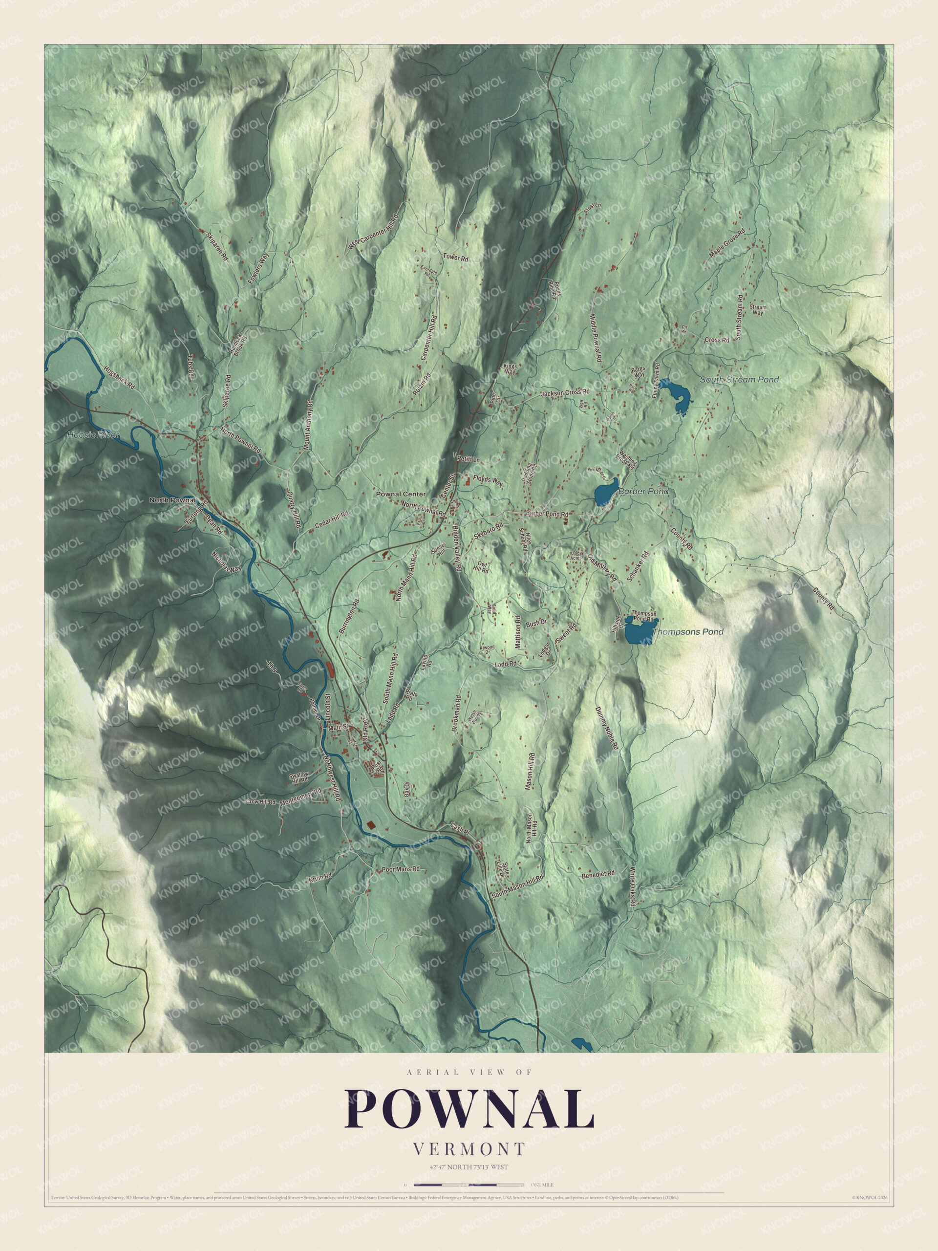
Click to explore a larger preview. The digital watermark does not appear on printed maps.
Names on this map
These names are printed on this map.
Places: North Pownal, Pownal Center, Thompsons Pond, South Stream Pond, Barber Pond and Hoosic River.
Streets and roads: Barber Pond Road, Northwest Hill Road, Main Street, Hogsback Road, Old Military Road, Middle Pownal Road, South Stream Road, North Pownal Road, Carpenter Hill Road, County Road, Mount Anthony Road, Skiparee Road.
More street names, A to Z
Atwood Drive, Barbs Way, Benedict Road, Brookman Road, Burrington Road, Bush Drive, Cash Place, Cedar Hill Road, Center Street, Church Street, Cross Road, Crow Hill Road, Dean Road, Dummy Noble Road, East Court, Everdale Road, Farm Road, Field Way, Floyds Way, Fowlers Way, Frost Lane, Funny Farm Road, Furlong Road, Hemlock Brook Road, Hidden Valley Road, Hillside Drive, Jackson Cross Road, Kings Way, Krum Road, Ladd Road, Lavino Road, Ledgar Drive, Lincoln Street, Maple Grove Road, Mason Hill Road, Mattison Road, Montgomery Road, Nicholas Way, Niles School Road, North Mann Hill Road, North Mason Hill Road, Oak Drive, Old Route 7, Owl Hill Road, Pace Road, Palmer Drive, Park View Drive, Peaks Pine Road, Petitt Lane, Pine Circle, Pine Ridge Drive, Pit Road, Poor Mans Road, Post Road, Pratt Road, Pudding Stone Road, Quarry Hill Road, Roizin Road, Sandy Acres, Sarah Lane, Schanker Road, Skyboro Road, South Mann Hill Road, South Mason Hill Road, State Line Drive, Stream Way, Sunset Hill, Swallow Hill Road, Sweet Road, Th 8, Thompson Pond Road, Tower Road, Tubs Road, Vien Road, Washing Brook Road, Welsh Woods, West Carpenter Hill Road, White Oaks Road.
See it on a wall
The Pownal map as a framed print. Swipe for more.


Mills on the Hoosic
The Hoosic River flows through Pownal on its way from the Berkshires to the Hudson. It forms the western edge of Pownal village and runs through the middle of North Pownal, and Route 346 follows it between the two. Cotton and woolen mills ran in the town through the 1800s, and the wool trade peaked between 1820 and 1840. In North Pownal an 18th-century gristmill gave way to a woolen mill in 1849, and the Plunkett & Barber Company built a cotton mill there in 1866. In August 1910 the photographer Lewis Hine took a picture of twelve-year-old Addie Card at work in the North Pownal cotton mill, and the image was later used on a United States stamp honoring the first child labor laws, and it inspired Elizabeth Winthrop’s novel Counting on Grace. Lime quarries worked in North Pownal until 1936. From 1907 to 1927 the Berkshire Street Railway’s trolleys ran from Williamstown through Pownal to Bennington, and the brick power station still stands along Route 7.
Pownal people
Abraham B. Gardner, born in Pownal in 1819, was speaker of the Vermont House and lieutenant governor from 1865 to 1867. Samuel S. Ellsworth, born here in 1790, went on to Congress from New York. Amby McConnell grew up in North Pownal and began playing baseball there before joining the Boston Red Sox in 1908, where the fans once voted him the team’s most popular player of the season. The poet Barbara Howes lived in Pownal after the middle 1960s, and her collected poems were nominated for the National Book Award in 1995. In 1910 the YMCA’s Camp Ilium in Pownal was where S. F. Lester of Troy, New York, led 30 scouts, and the town’s page says he was the first person to hold the Scoutmaster position approved by the Boy Scouts of America. The town’s page says the Long Trail begins in Pownal at the Massachusetts line, where it shares its path with the Appalachian Trail.
On the map, start with North Pownal and Pownal Center, then follow Barber Pond Road, Northwest Hill Road, Main Street, Hogsback Road, Old Military Road and Middle Pownal Road across town. Thompsons Pond, South Stream Pond, Barber Pond and the Hoosic River are printed as well. Pownal dates to 1760.
This map of Pownal is made for everyone who calls Pownal home, and it shows the town as it looks today, from Pownal Center down to the Hoosic River. Hang it in an office, library or den, or use it to teach children the geography and history of their town. It’s printed on museum quality archival paper. Zoom in on the preview above to explore the details, then click here to get your copy of the Pownal, Vermont map.

Sources
- Pownal, Vermont, Wikipedia
- Town histories and representatives, P towns, Vermont Legislature
- Mooar-Wright House, Wikipedia
- Chester A. Arthur, Wikipedia
- James A. Garfield, Wikipedia
- Hoosic River, Wikipedia
- North Pownal, Vermont, Wikipedia
- Pownal (CDP), Vermont, Wikipedia
- Pownal Center, Vermont, Wikipedia
- Lewis Hine, Wikipedia
- Abraham B. Gardner, Wikipedia
- Samuel S. Ellsworth, Wikipedia
- Amby McConnell, Wikipedia
- Barbara Howes, Wikipedia