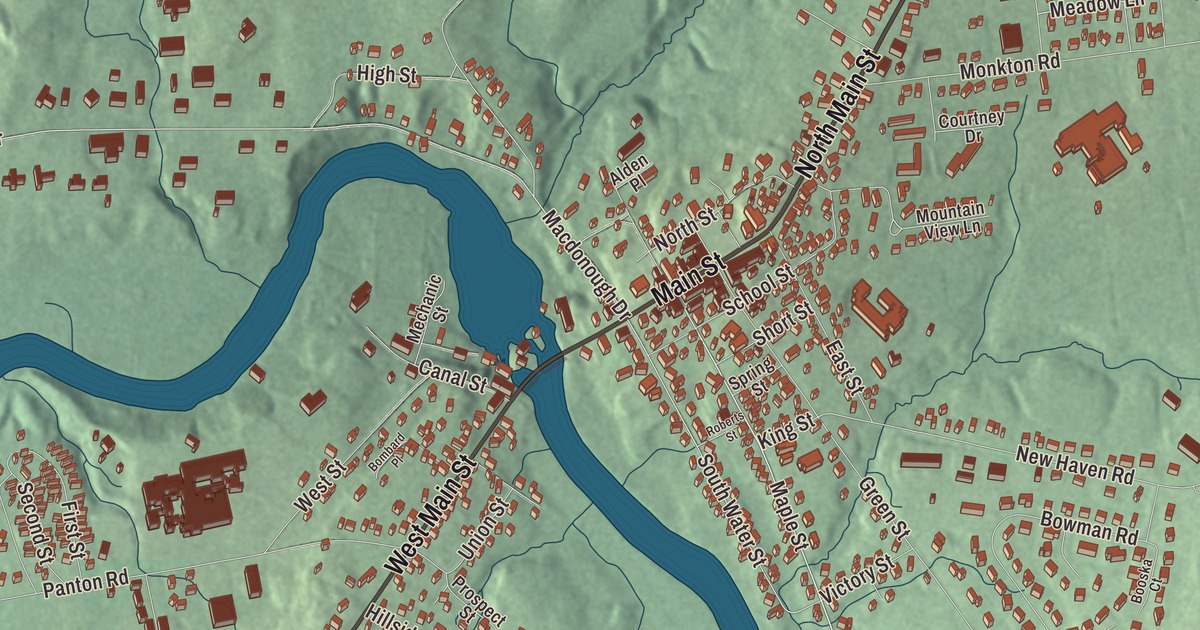
Vergennes grew up at a bend in Otter Creek, where the water drops over a 37-foot falls about seven miles above Lake Champlain. This map prints Main Street, North Main Street, West Main Street, Maple Street, South Maple Street and Armory Lane.
Vergennes is a city in Addison County, Vermont.
KNOWOL made this map in 2026 from public survey data and gave it the look of an old county atlas. The ground is shaded from United States Geological Survey elevation data, and the streets and city line are drawn from the Census Bureau. The city covers 2.5 square miles, and 2,553 people lived here at the 2020 census. Click here to purchase a print of this map for your wall.
Vermont’s first city
Vergennes was one of the first industrial places on the creek: a sawmill went up at the falls in 1764, and Donald MacIntosh settled here in 1766. On October 23, 1788, Vermont made Vergennes a city out of corners of Ferrisburgh, New Haven and Panton that met at the falls. It was the first city chartered in the state, and the only one in Vermont that was never first chartered as a town or village. Its founders chose a city government in anticipation of making it an industrial center. The name honors the Frenchman Charles Gravier, comte de Vergennes, who greatly aided the American cause in the Revolution. Today Vergennes is the only city in Addison County and the smallest of Vermont’s ten cities by population.
The falls powered sawmills, gristmills and later factories, and Vergennes also sat where two major stagecoach routes crossed. The Monkton Iron Works, founded in 1807, became one of the nation’s largest iron foundries of the early 1800s. In the War of 1812 the city became a military base, with ready access to Lake Champlain down the creek. Thomas Macdonough built and armed his fleet here, including the corvette Saratoga and the sloop Eagle, while the ironworks made the fittings for his ships and most of the cannon shot the Army used in the north. That fleet defeated the British on Lake Champlain at the Battle of Plattsburgh in 1814. A Macdonough Monument went up on the city green in 1925, and Vergennes Union High School’s mascot is the Commodores.
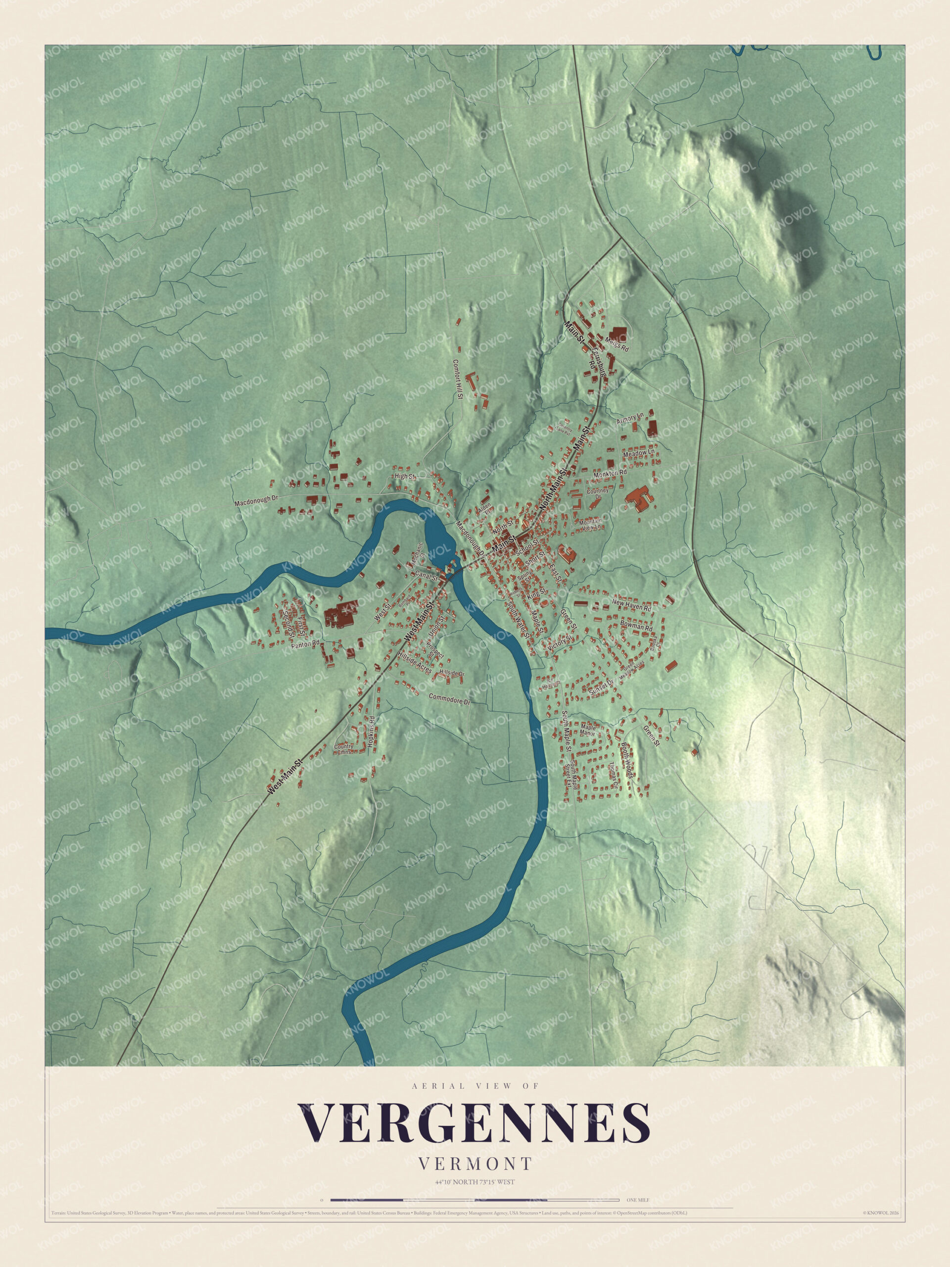
Click to explore a larger preview. The digital watermark does not appear on printed maps.
Names on this map
These names are printed on this map.
Streets and roads: Main Street, North Main Street, West Main Street, Maple Street, South Maple Street, Armory Lane, Hillside Acres, Meadow Lane, Macdonough Drive, South Water Street, Green Street, Comfort Hill Street.
More street names, A to Z
Alden Place, Bombard Place, Booska Court, Booth Woods, Bowman Road, Canal Street, Commodore Drive, Country Cmns, Courtney Drive, Coventry Lane Pvt, East Street, Ferrisburg Road, First Street, Green Meadow Acres, High Street, Hillside Drive, Hopkins Road, Ice House Court, King Street, Maple Manor, Mechanic Street, Meigs Road, Monkton Road, Mountain View Lane, New Haven Road, North Street, Panton Road, Prospect Street, Roberts Street, School Street, Second Street, Short Street, South Maple Street Extension, Spring Street, Sunset Drive, Thomas Circle, Union Street, Victory Street, West Street.
See it on a wall
The Vergennes map as a framed print. Swipe for more.


Main Street and the neighborhoods
The commercial and industrial heart of the city, along Main Street from Mechanic Street to Monkton Road, has been a National Register historic district since 1976. It reaches north along both banks of Otter Creek to take in what’s left of the ironworks and Macdonough’s shipyard, and it holds City Hall and the Bixby Memorial Free Library, which opened in 1912 with money left by a local business owner, William Gove Bixby. South of Main Street, the Vergennes Residential Historic District along Water, Maple and Green streets keeps houses built by everyone from mill owners to laborers, along with the Congregational Church and the brick Gothic St. Peter’s Catholic Church. On West Main Street stand two houses of the Strong family. The Gen. Samuel Strong House, built about 1796, is one of Vermont’s finest examples of late Georgian and early Federal building; Strong led the local militia in the War of 1812 and helped organize local forces for the Battle of Plattsburgh. His son Samuel Paddock Strong, president of the Bank of Vergennes and of the Rutland and Burlington Railroad, had the Greek Revival house at 94 West Main Street built in the 1830s, and it’s now the Strong House Inn.
Stephen Bates, born enslaved in Virginia in 1842, freed himself by fleeing to Union lines in 1862 and worked as coachman for Congressman Frederick E. Woodbridge of Vergennes, settling in the city in 1869. In 1879 the city elected him sheriff and police chief, and he served for 25 years, the first Black chief law enforcement officer in Vermont. The city unveiled a marker to him at City Park in 2021. Down by the city dock, Philomene Daniels and her husband Louis ran the Daniels Boat Line, carrying freight and passengers down Otter Creek and across the lake to Westport, New York. She earned her pilot’s license in 1887 and is believed to be the first woman given a steamship captain’s license. The sculptor Margaret Foley, who grew up in Vergennes, went from the spinning room of a Lowell mill to a studio of her own in Rome. Ethan Allen Hitchcock, a grandson of Ethan Allen, was born here and served as a major general in the Civil War. In 2022 passenger trains came back, when Amtrak’s Ethan Allen Express began stopping at the Ferrisburgh-Vergennes station just north of the city, the first passenger service since 1953.
On the map, start on Main Street, then follow North Main Street, West Main Street, Maple Street, South Maple Street and Armory Lane. Vergennes dates to 1788.
This map of Vergennes is made for everyone who calls Vergennes home, and it shows the city as it looks today, from Main Street to West Main Street and Armory Lane. Hang it in an office, library or den, or use it to teach children the geography and history of their city. It’s printed on museum quality archival paper. Zoom in on the preview above to explore the details, then click here to get your copy of the Vergennes, Vermont map.

Sources
- Vergennes, Vermont, Wikipedia
- Town histories and representatives, V towns, Vermont Legislature
- Otter Creek (Vermont), Wikipedia
- Vergennes Historic District, Wikipedia
- Thomas Macdonough, Wikipedia
- Bixby Memorial Free Library, Wikipedia
- Vergennes Residential Historic District, Wikipedia
- Gen. Samuel Strong House, Wikipedia
- Samuel Paddock Strong House, Wikipedia
- Stephen Bates (sheriff), Wikipedia
- Capts. Louis and Philomene Daniels House, Wikipedia
- Margaret Foley, Wikipedia
- Ethan A. Hitchcock (general), Wikipedia