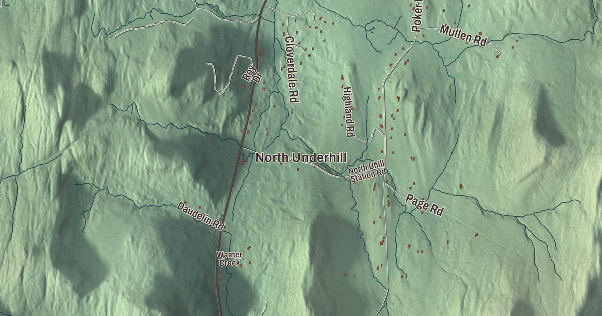
Underhill reaches from Route 15 on its western side to the top of Mount Mansfield, the highest summit in Vermont. This map prints Underhill Center, North Underhill and Stevensville, with Pleasant Valley Road, Range Road, Covey Road, Park Street, Irish Settlement Road and Poker Hill Road.
Underhill is a town in Chittenden County, Vermont.
KNOWOL made this map in 2026 from public survey data, shading the mountain and the hills from United States Geological Survey elevation data and drawing the roads and town line from the Census Bureau, all in the style of an old county atlas. The town covers 51.4 square miles, and 3,129 people lived here at the 2020 census. Click here to purchase a print of this map for your wall.
The town under the Chin
New Hampshire granted Underhill on June 8, 1763, and the town was organized on March 9, 1795. Its eastern edge climbs Mount Mansfield, the highest mountain in Vermont at 4,393 feet. Seen from the east or west, the ridge looks like a long human profile with a forehead, nose, lips and chin. The Chin, its highest point, is in Underhill, while the Nose is over the line in Stowe. The Abenaki called it Mozôdebiwajok, Moosehead Mountain. The mountain’s English name comes from the old town of Mansfield, which turned out to be mostly mountainside once it was surveyed. The western part of Mansfield was annexed to Underhill in 1839.
The west side of the mountain has drawn visitors since the middle of the 1800s. In 1858 a small hotel called the Halfway House went up to give hikers lodging and a stable, and it stood until 1939. The state opened Underhill State Park on the west slope in 1933, and a Civilian Conservation Corps crew based there built much of it by 1940, including the picnic lodge, some of the lean-tos and the ranger station. Those buildings were listed on the National Register of Historic Places in 2002. From the park the Sunset Ridge Trail is the most direct of four routes to the summit ridge, about 3 miles. The Browns River starts as a stream on the same slope and runs down through the park, meeting Stevensville Brook and Clay Brook just east of Underhill Center.
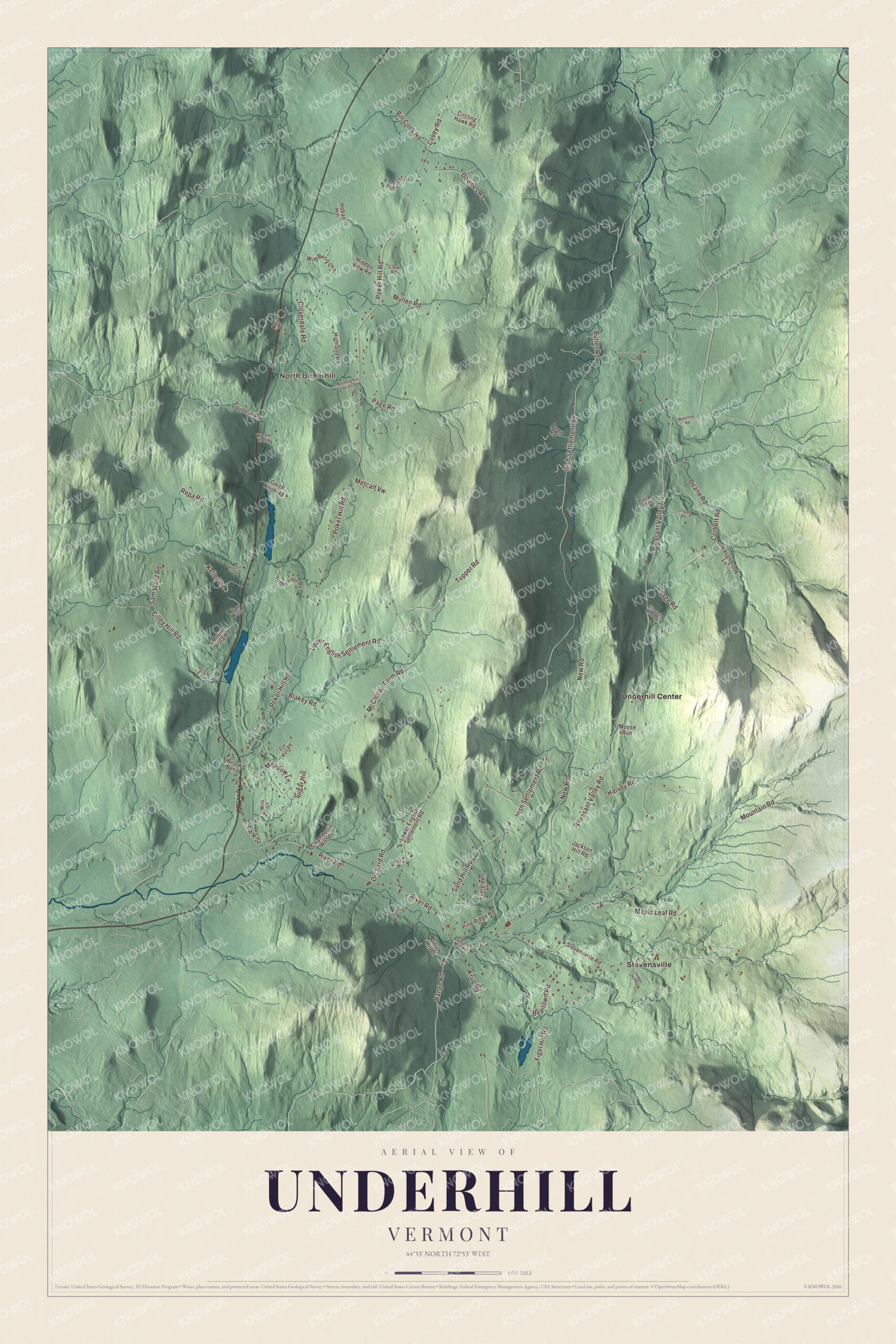
Click to explore a larger preview. The digital watermark does not appear on printed maps.
Names on this map
These names are printed on this map.
Places: North Underhill, Stevensville and Underhill Center.
Streets and roads: Pleasant Valley Road, Range Road, Covey Road, Park Street, Irish Settlement Road, Poker Hill Road, New Road, Mountain Road, River Road, Upper English Settlement Road, Beartown Road, Cilley Hill Road.
More street names, A to Z
Bill Cook Road, Blakey Road, Brook Bend, Butler Road, Chads Road, Chamberlin Woods, Circling Hawk Road, Clark Road, Cloverdale Road, Corbett Road, Daudelin Road, Deane Road, Doon Road, Downes Road, Ellsworth Meadow, Evergreen Lane, Figel Hill Road, Fox Run Road, Gerts Knob Road, Harvey Road, Hawk Ridge, Hidden View Road, Highland Road, Hill Crest Lane, Hobart Hill, Jackson Hill Road, Keds Lane, Kelley Road, Krug Road, Ledge Hill Road, Lower English Settlement Road, Maple Leaf Road, McClellan Farm Road, Meadow Lane, Metcalf Vw, Mins Lane, Moose Run, Mount Vista Road, Mullen Road, North Uhill Station Road, Orchard Road, Page Road, Paul Cook Road, Pine Ridge Road, Repa Road, Romar Drive, Roy Drive, Russin Drive, Sage Road, Sam Ward Road, Sand Hill Road, Snyder Road, South Hill Drive, Steam Mill Road, Stevensville Road, Sugar Hill, Timber Ridge Road, Tupper Road, Warner Creek, Waughbrook Lane, Westman Road, Wild Berry Lane.
See it on a wall
The Underhill map as a framed print. Swipe for more.


Two villages
The town has two villages, each with its own post office. Underhill Flats sits on the western side along Route 15 and is shared with neighboring Jericho. Underhill Center sits around the crossing of River Road and Pleasant Valley Road, nearer the mountain, and holds the town hall and offices, a small swimming pond, Casey’s Hill, the town’s sledding hill, and St. Thomas Church. Its first, wooden church was built in 1854 and 1855 to serve 63 Irish immigrant farming and logging families. After it burned in December 1890, the parish laid a new cornerstone in August 1891 before about 1,000 people. The Victorian Gothic church that followed, designed by George H. Guernsey, has a spire about 100 feet tall and a 2,900-pound bell hung in 1895.
Maple has its own place in Underhill. In 1946 Governor Mortimer Proctor gave the state the old Harvey Farm, a sugar bush since at least the later 1800s, and it became the University of Vermont’s Proctor Maple Research Center on Harvey Road. It’s the only facility of its type in the United States, and its first buildings and century-old sugar bush are on the National Register. Udney Hay, a deputy quartermaster general in the Revolution whom George Washington recommended for quartermaster general of the army, moved to Underhill in 1796 and represented the town in the state assembly from 1798. Thomas Cale, born here in 1848, studied at Bell Academy in Underhill Flats, taught school in Underhill Center and later served the District of Alaska as its delegate to Congress. Bernard J. Leddy, born in Underhill in 1910, became a federal judge for the District of Vermont.
On the map, begin in Underhill Center on Pleasant Valley Road, then find Stevensville, North Underhill, Range Road, Covey Road, Park Street, Irish Settlement Road and Poker Hill Road. Underhill dates to 1763.
This map of Underhill is made for everyone who calls Underhill home, and it shows the town as it looks today, from Underhill Center and Stevensville to North Underhill. Hang it in an office, library or den, or use it to teach children the geography and history of their town. It’s printed on museum quality archival paper. Zoom in on the preview above to explore the details, then click here to get your copy of the Underhill, Vermont map.

Sources
- Underhill, Vermont, Wikipedia
- Town histories and representatives, U towns, Vermont Legislature
- Mount Mansfield, Wikipedia
- Underhill State Park, Wikipedia
- Browns River (Vermont), Wikipedia
- Underhill Flats, Vermont, Wikipedia
- St. Thomas Church (Underhill, Vermont), Wikipedia
- Proctor Maple Research Center, Wikipedia
- Udney Hay, Wikipedia
- Thomas Cale, Wikipedia
- Bernard J. Leddy, Wikipedia