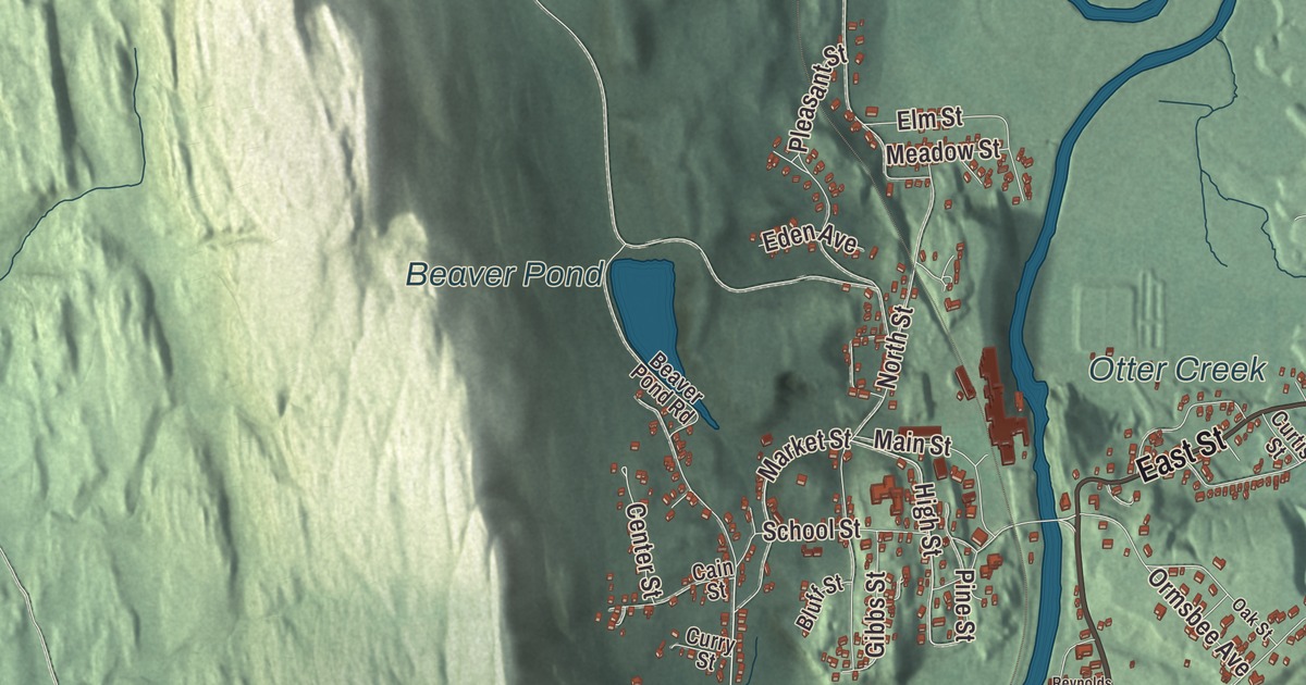
Proctor is a marble town on Otter Creek, built where the creek drops over Sutherland Falls, with Main Street crossing the water on a bridge faced in locally quarried marble. This map prints Main Street, South Street, East Street, Park Street, West Street and Olympus Road, with Otter Creek, Beaver Pond and Reynolds Reservoir.
Proctor is a town in Rutland County, Vermont.
KNOWOL made this map in 2026 from public survey data and gave it the look of an old county atlas, shading the hills from United States Geological Survey elevation data and drawing the roads and town line from the Census Bureau. The town covers 7.6 square miles, and 1,763 people lived here at the 2020 census. Click here to purchase a print of this map for your wall.
Marble at Sutherland Falls
High-quality marble turned up in Rutland early in the 1800s, and in the 1830s a large deposit of nearly solid marble was found in what is now West Rutland. Small firms were quarrying by the 1840s, but the business paid only after the railroad reached Rutland in 1851. Around the same time, the old quarries of Carrara in Italy had grown so deep that many could hardly be worked, and Rutland quickly became one of the leading producers of marble in the world. In 1886, when Rutland’s village was incorporated, most of the old town was split off as West Rutland and Proctor, which between them held most of the marble quarries. Proctor was formed around the old settlement of Sutherland Falls from parts of Rutland and Pittsford, incorporated on November 18, 1886, and organized the next March. It was named for Redfield Proctor, who owned nearly all of it, and he was the town’s first representative in the legislature, in 1888.
The Proctors and Vermont Marble
Redfield Proctor, a Civil War colonel and Rutland lawyer, became a manager of the Sutherland Falls Marble Company in 1869. In 1880 it merged into the Vermont Marble Company with Proctor as its first president, and the company became one of the largest marble producers in the world, supplying stone for the United States Supreme Court Building, Arlington National Cemetery, the USS Arizona Memorial, the West Virginia and Oregon state capitols and Yale’s Beinecke Rare Book and Manuscript Library. Proctor himself was governor of Vermont from 1878 to 1880, secretary of war from 1889 to 1891 and a United States senator from 1891 until his death in 1908.
Three more governors came out of the family. His son Fletcher D. Proctor, raised in Proctor, became president of Vermont Marble in 1889 and governor from 1906 to 1908, and he told the state it had “a higher duty than to live cheaply.” Redfield Proctor Jr., born in Proctor in 1879, trained as an engineer at MIT, served as governor from 1923 to 1925 and later ran the company. Fletcher’s son Mortimer R. Proctor, also born in town, was president of the village of Proctor in 1930, speaker of the Vermont House and governor from 1945 to 1947, and set up a trust that supports the arts, education and religion in Proctor. Redfield Jr. and Mortimer are buried in the South Street Cemetery. Frank C. Partridge, who rose from treasurer to chairman of Vermont Marble and served briefly in the United States Senate, also lived and died here, and F. Ray Keyser Jr., governor from 1961 to 1963, later ran the company as chief executive.
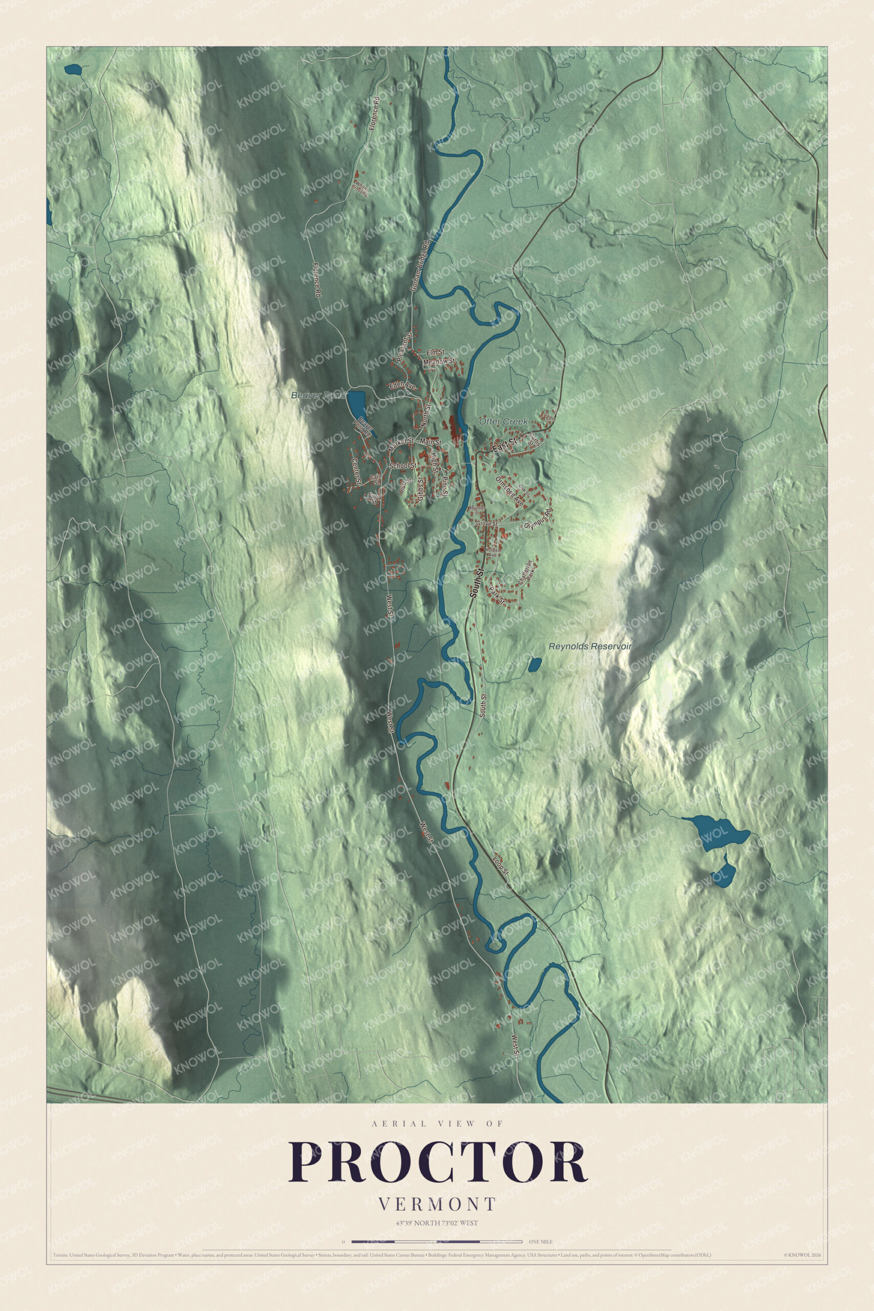
Click to explore a larger preview. The digital watermark does not appear on printed maps.
Names on this map
These names are printed on this map.
Places: Beaver Pond, Otter Creek, Reynolds Reservoir and Chatterton Park.
Streets and roads: South Street, East Street, Park Street, Olympus Road, West Street, Main Street, High Street, Market Street, Florence Road, Gorham Bridge Road, North Street, Pleasant Street.
More street names, A to Z
Beaver Pond Road, Bluff Street, Cain Street, Center Street, Curry Street, Curtis Street, Eden Avenue, Elm Street, Garden Street, Gibbs Street, Grove Street, Holden Avenue, Loop Street, Meadow Street, Oak Street, Ormsbee Avenue, Pine Street, Reynolds Street, School Street, Whites Crossing.
See it on a wall
The Proctor map as a framed print. Swipe for more.


The marble village
The village of Proctor fills the northern half of the town, in the valley of Otter Creek and up the steep hillsides on either side. The Marble Bridge, formally the Fletcher D. Proctor Memorial Bridge, carries Main Street over Otter Creek in the center of the village. Built in 1915 and widened in 1935 and 1936 with Works Progress Administration money, it has three concrete arches faced in locally quarried gray marble and marble balustrades along its sides. In 2004 the Proctor Marble Arch Bridge restoration project received the Marble Institute Award of Merit for “commitment to preservation of the original stonework.” Overlooking the falls, a former Vermont Marble building held the Vermont Marble Museum for nearly 90 years, with busts of nearly every president and a working carvers’ studio; the museum closed for good in 2024. Route 3 runs through the village, north to Pittsford and south toward Rutland.
Wilson Castle was built in 1885 by Dr. John Johnson and his English wife in a blend of Dutch, Scottish, Queen Anne and Romanesque styles, with 32 rooms, 84 stained glass windows and a facade of English brick and French marble. Herbert Lee Wilson, a pioneer of AM radio, bought it in 1939 and set up a radio station in its stable, and the house has been open for tours since 1962. On the town’s northern line, the Gorham Covered Bridge of 1841 crosses Otter Creek into Pittsford; Abraham Owen built it with his apprentice Nicholas M. Powers, and it’s one of Vermont’s oldest surviving covered bridges.
On the map, start with South Street, then follow East Street, Park Street, Olympus Road, West Street and Main Street across town. Beaver Pond, Otter Creek and Reynolds Reservoir are printed too. Proctor dates to 1886.
This map of Proctor is made for everyone who calls Proctor home, and it shows the town as it looks today, from the Marble Bridge on Main Street to Beaver Pond. Hang it in an office, library or den, or use it to teach children the geography and history of their town. It’s printed on museum quality archival paper. Zoom in on the preview above to explore the details, then click here to get your copy of the Proctor, Vermont map.

Sources
- Proctor, Vermont, Wikipedia
- Town histories and representatives, P towns, Vermont Legislature
- Proctor (CDP), Vermont, Wikipedia
- Redfield Proctor, Wikipedia
- Vermont Marble Museum, Wikipedia
- Fletcher D. Proctor, Wikipedia
- Redfield Proctor Jr., Wikipedia
- Mortimer R. Proctor, Wikipedia
- Frank C. Partridge, Wikipedia
- F. Ray Keyser Jr., Wikipedia
- Marble Bridge (Proctor, Vermont), Wikipedia
- Wilson Castle, Wikipedia
- Gorham Covered Bridge, Wikipedia
- Vermont Route 3, Wikipedia