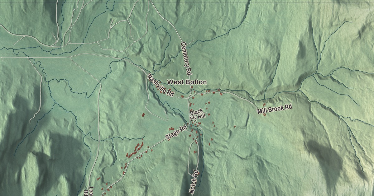
U.S. Route 2 follows the north bank of the Winooski River through Bolton, and up in the northeast corner of town is the Bolton Valley ski area. This map prints the Winooski River and Preston Pond, West Bolton and Bolton Valley, and the Theodore Roosevelt Highway, Bolton Valley Access Road, Notch Road, Honey Hollow Road, Stage Road and Cemetery Road.
Bolton is in eastern Chittenden County, on the Washington County line.
KNOWOL made this map in 2026 from public survey data and gave it the look of an old atlas. The shaded terrain comes from United States Geological Survey elevation data, and Bolton has plenty of it: the main crest of the Green Mountains runs north to south through the east of town, and the Winooski River cuts through the range south of the town center. The roads and the town line come from the Census Bureau. Bolton covers 42.5 square miles, and it had 1,301 people at the 2020 census. Click here to purchase a print of this map for your wall.
A town along the river
Bolton was chartered on June 7, 1763, and Huntington’s northeast corner was added to it in 1794. John Hayward’s Gazetteer of Vermont, published in 1849, names the first settlers as Noah Dewey, Peter Dilse, James Moore, Thomas Palmer, Robert Stinson, and John and Robert Kenedy. Hayward found the town “very mountainous and broken,” with only a small part fit to settle, and nearly everyone living along the Winooski. He noted that the railroad from Boston to Burlington passed through, and that the town lay midway between Montpelier and Burlington, its post office 18 miles from each.
The road along the river is older than the railroad. The Winooski Turnpike between Burlington and Montpelier was chartered in 1805 and followed the river’s flat banks, and it stayed a toll road until 1852. In 1919 the route became part of the Theodore Roosevelt International Highway, an auto trail from Portland, Maine, to Portland, Oregon, named for the late president, and in 1926 it became part of U.S. Route 2. Interstate 89 follows the valley too, but it has no exit in Bolton.
Bolton’s school carries the name of Ellen Pinneo Smilie, born in 1849 at Pinneo Flats in Bolton. After the flood of 1927 washed away the schoolhouse she’d gone to as a girl, she gave $1,000 toward a new school on Pinneo Flats, and her will left money to the Memorial School. When Interstate 89 cut off that building, part of the present school went up in 1960. The cartoonist Alison Bechdel, author of Fun Home and Vermont’s third Cartoonist Laureate, lives in Bolton.
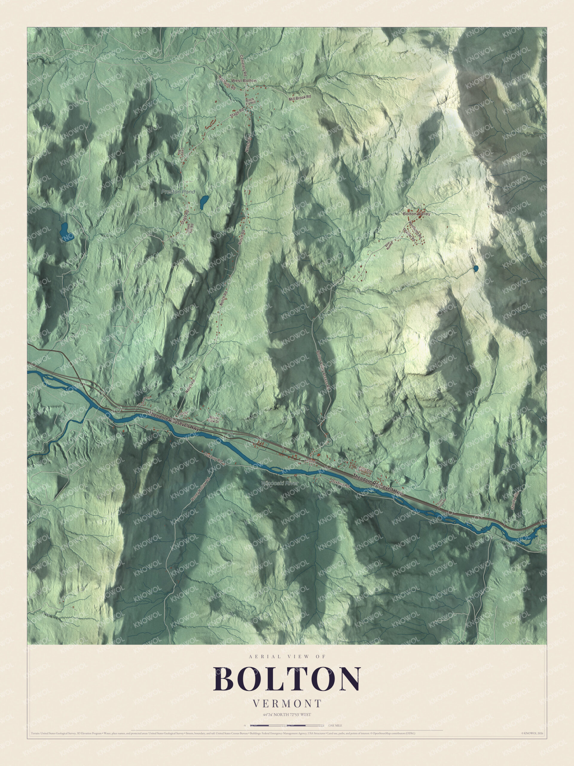
Click to explore a larger preview. The digital watermark does not appear on printed maps.
Names on this map
These names are printed on this map.
Places: West Bolton, Bolton Valley, Preston Pond and Winooski River.
Streets and roads: Theodore Roosevelt Highway, Cemetery Road, Stage Road, Honey Hollow Road, Notch Road, Bolton Valley Access Road, Duxbury Road, Mill Brook Road, East Street, Sharkyville, Nashville Road, Mount View Drive.
More street names, A to Z
Bear Run Road, Black Fly Hill, Joiner Lane, Leary Road, Meadow Lane, Pineo Brook Road, Rosewood Lane, Stone Hill Road, Thacher Road, Wentworth Road.
See it on a wall
The Bolton map as a framed print. Swipe for more.


The four corners of Bolton
The town’s page describes four settled parts. Bolton proper lies in the Winooski valley on the north side of the river. West Bolton is in the northwest corner and is reached mainly from Jericho. A thin strip south of the river, called “the back side of the river,” can only be reached by road through Richmond and Duxbury. And a few year-round residents live near the ski area in the northeast. That’s Bolton Valley, founded in 1966 by Ralph DesLauriers and his father; in 2017 DesLauriers and a small group of investors bought it back. It’s one of the few ski areas in Vermont that face west, with 71 trails, night skiing and 100 kilometers of Nordic trails, and since 2009 a wind turbine has turned near the top of the Vista Quad chairlift.
The Long Trail passes through Bolton on its way from Camel’s Hump to Mount Mansfield. Preston Pond, Notch Road, Honey Hollow Road, Stage Road and Cemetery Road are printed on the map as well.
This map of Bolton is right for an office, library or den, and it can even help teach children the geography and history of a mountain town on the Winooski. It’s made for everyone who calls Bolton home and shows the town as it looks today, from West Bolton to Bolton Valley. KNOWOL created it in 2026, and it’s printed on museum quality archival paper. Zoom in on the preview above to explore the details, then click here to get your copy of the Bolton, Vermont map.

Sources