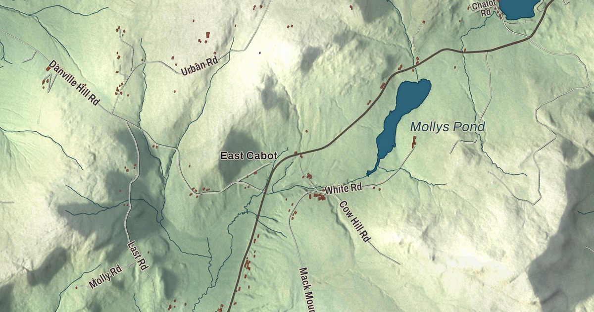
Cabot is where the Winooski River starts and where the cheese comes from, and its village sits on the banks of the young river. This map prints Joes Pond, West Hill Pond and Mollys Pond, East Cabot, Lower Cabot and South Cabot, and Main Street, Coits Pond Road, Bothfeld Hill Road, West Shore Road, Ducharme Road and Bricketts Crossing Road.
Cabot is a town in the northeast corner of Washington County, Vermont.
KNOWOL made this map in 2026 from public survey data and gave it the feel of an old county atlas. The relief shading comes from United States Geological Survey elevation data and the roads and the town line from the Census Bureau. Cabot is a six-mile-square town of 38.5 square miles, and it had 1,443 people at the 2020 census. Click here to purchase a print of this map for your wall.
From the Plain to the river
Vermont granted Cabot in 1780 and chartered it on August 17, 1781. The settler Lyman Hitchcock named it for his wife, Sophia Cabot, no relation to the explorers John and Sebastian Cabot, and in 1788 he became the first town clerk. Settlement began up on Cabot Plain, which had been called Fortification Hill or Johnson’s Plain when soldiers camped there. Benjamin Webster arrived first, in 1783.
Cabot Plain lies on the Bayley-Hazen Military Road. In 1776 Colonel Jacob Bayley and a crew of 110 men began cutting a road from Newbury toward St. Johns, Quebec, to supply an army meant to take Canada. When word came that the army had been beaten, they stopped on Cabot Plain and went home. General Moses Hazen took the work up again in 1778, and the road was finished only as far as Hazen’s Notch in Lowell. The road was never completed, but it opened the northern country to settlers. Markers on Cabot Plain show the old road and Hazen’s camp.
Around 1796 town officials moved business a mile downhill to the center of town, and by about 1826 it had moved again, down to the new settlement in the valley by the Winooski River, where it still is. Mills, shops and farms followed the river south to Lower Cabot, which had a woolen mill of its own.
Cabot cheese
The Cabot Creamery opened in 1893, mainly to make butter and get more value from the town’s milk. In 1919 it was organized as a cooperative by 94 farmers with 863 cows among them, each paying in by the number of cattle they owned, and it began making cheese in 1930. It’s now known across the country for its cheddar and is still the town’s largest employer, at the original site.
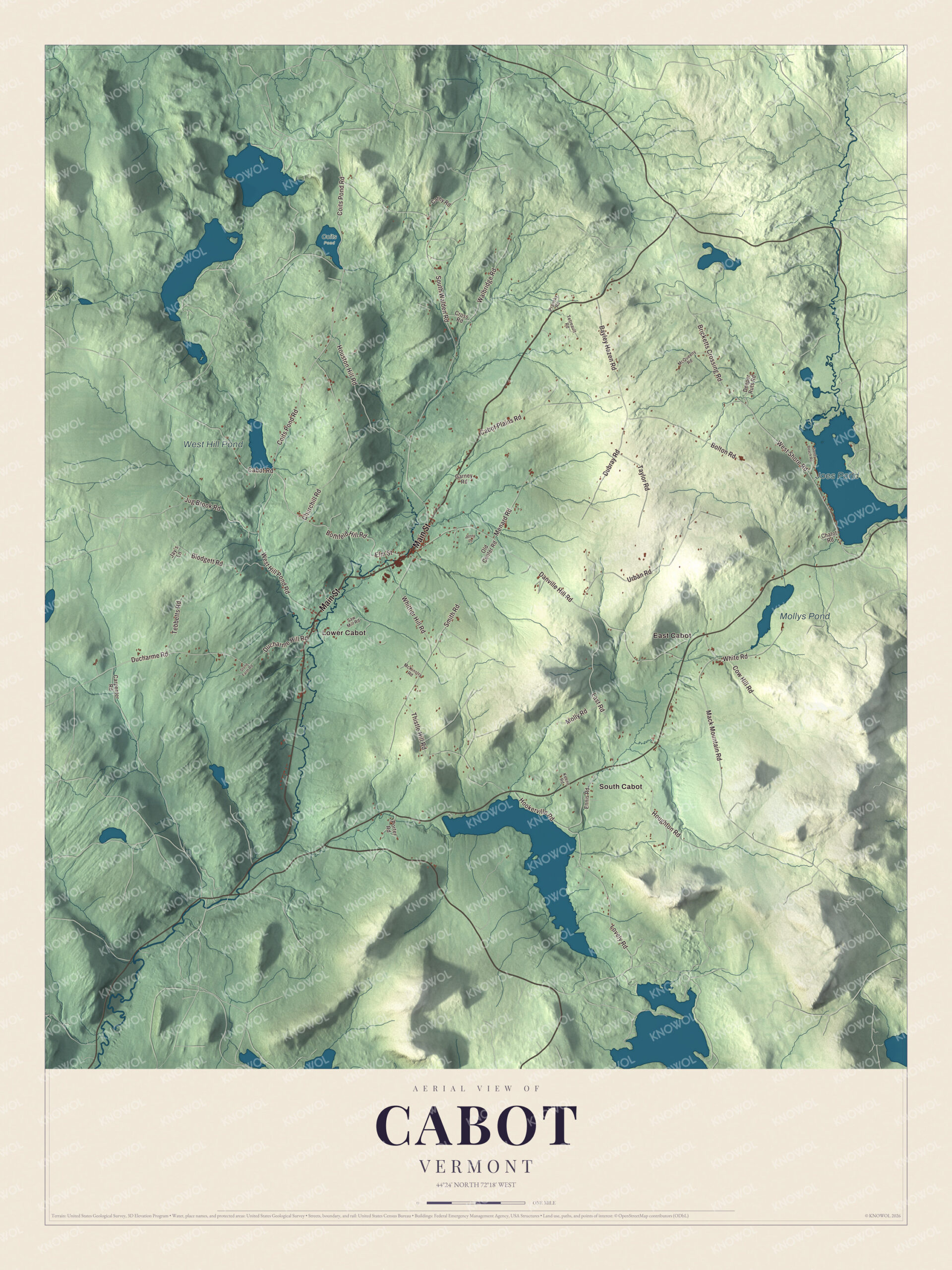
Click to explore a larger preview. The digital watermark does not appear on printed maps.
Names on this map
These names are printed on this map.
Places: Joes Pond, West Hill Pond, Mollys Pond, Coits Pond, East Cabot, Lower Cabot and South Cabot.
Streets and roads: Main Street, Coits Pond Road, Bothfeld Hill Road, West Shore Road, Ducharme Road, Bricketts Crossing Road, Ducharme Hill Road, South Walden Road, Hookerville Road, Danville Hill Road, Cabot Plains Road, Urban Road.
More street names, A to Z
Bayley Hazen Road, Blodgett Road, Bolton Road, Cabot Road, Carpenter Road, Cathy Road, Chatot Road, Churchill Road, Cow Hill Road, Cross Road, Deeper Ruts Road, Dubray Road, Elm Street, Ennis Road, Garney Road, Houghton Road, Houston Hill Road, Jay's Lane, Jenny Lane, Jug Brook Road, Keene Road, Last Road, Lovely Road, Mack Mountain Road, McKinstry Road, McQueeny Road, Menard Road, Molly Road, Old Center Road, Porter Road, Pransky Road, Sandy Beach Road, Saw Mill Road, Smith Road, Stone Farm Road, Taylor Road, Tebbetts Road, Tetreault Road, Thistle Hill Road, Walbridge Road, West Hill Pond Road, White Road, Whittier Hill Road.
See it on a wall
The Cabot map as a framed print. Swipe for more.


Ponds on the divide
Coits Pond is where the Winooski River begins its run of about 90 miles to Lake Champlain. Mollys Pond sits right on the divide, with one outlet flowing east toward the Connecticut River and another west into the Winooski. West Hill Pond was the “great field” to the first settlers, the only cleared ground for miles before a dam on the brook made it a shallow pond, and Joes Pond, shared with Danville, is three miles long and covers 396 acres. Joes Pond and Mollys Pond carry the names of Joe, a scout who served under Bayley and Hazen in the Revolution, and his wife, Molly, who lived on an island in Joes Pond after the war. Molly’s Falls Pond, a reservoir dammed in the 1920s, lies entirely in Cabot inside a state park of more than 1,000 acres.
Zerah Colburn, born in Cabot in 1804, was a child prodigy who could do enormous sums in his head: at seven he took six seconds to work out the hours in thirty-eight years, two months and seven days. The poet Ellen Bryant Voigt, who served as Vermont’s poet laureate and won a MacArthur Fellowship, made her home in Cabot. The Cabot Historical Society keeps its collections in a two-story school and community hall built in 1849, and it also cares for a restored one-room schoolhouse on West Hill. East Cabot, South Cabot, Bothfeld Hill Road, West Shore Road, Ducharme Road and Bricketts Crossing Road are all printed on the map.
Hang this map of Cabot in an office, library or den, or use it to teach children the geography and history of the town where the Winooski begins. It’s made for everyone who calls Cabot home and shows the town as it looks today, from Cabot Plain to Joes Pond. KNOWOL created it in 2026, and it’s printed on museum quality archival paper. Zoom in on the preview above to explore the details, then click here to get your copy of the Cabot, Vermont map.

Sources
- Cabot, Vermont, Wikipedia
- Town histories and representatives, C towns, Vermont Legislature
- Bayley Hazen Military Road, Wikipedia
- Cabot Creamery, Wikipedia
- Winooski River, Wikipedia
- Joe (Revolutionary War scout), Wikipedia
- Molly’s Falls Pond State Park, Wikipedia
- Zerah Colburn, Wikipedia
- Ellen Bryant Voigt, Wikipedia