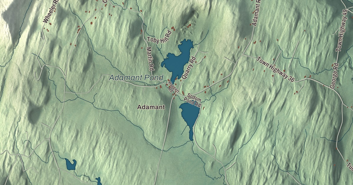
Calais grew up as five separate village centers, each in its own fold of the hills. This map prints Adamant and North Calais, East Calais, Kents Corners and Maple Corner, Mirror Lake, Curtis Pond and Adamant Pond, and West County Road, Kent Hill Road, Fowler Road, North Calais Road, Singleton Road and Old West Church Road.
Calais is a town in Washington County, Vermont.
KNOWOL made this map in 2026 from public survey data, with the look of an old atlas. The shaded hills come from United States Geological Survey elevation data, and the roads and the town line come from the Census Bureau. Calais covers 38.6 square miles and had 1,661 people at the 2020 census. Its waters include Curtis Pond, Nelson Pond, Bliss Pond, Number 10 Pond, also called Mirror Lake, and part of Woodbury Lake. Click here to purchase a print of this map for your wall.
Named for a French port
Vermont granted the town on October 21, 1780, to Colonel Jacob Davis, Stephen Fay and their company, and chartered it on August 15, 1781. Davis named it Calais, after the French port, at a time when Americans were grateful to France for its help in the Revolution. The town organized on March 23, 1795. The Wheelock and Parker families were the first to settle, late in the 18th century. In the early and middle 1800s, Vermont’s wool boom turned much of Calais into sheep pasture, and photographs from that time show hills nearly bare of trees. After the Civil War the farms turned from sheep to dairy, and new families came to work them.
The town’s five village centers grew up apart from one another because of the folded, hilly ground, and each has its own story. Even the name of the village of Pekin is uncertain. One story says a local farmer planted wheat sent home by a missionary friend in Peking, China, though no records support it, and another account points to the Abenaki word pekan, meaning fisher.
Kents Corner and the Old West Church
Kents Corner grew up where Kent Hill Road crosses Old West Church Road. Remember Kent built his log cabin there in 1797, and when the north and south road became part of the stagecoach route between Montpelier and Montreal, the Kents added a tavern and a store. The tavern survives as a fine Federal brick house that has served lately as a local history museum. The Kents Corner Historic District, listed in 1973 and greatly enlarged in 2006, now reaches south past the Old West Church to Bliss and Fowler roads, and it takes in the old church that’s now the Calais Town Hall and a 19th-century sawmill.
The Old West Church, on Old West Church Road 0.8 miles south of the crossroads, was built from 1823 to 1825 in a style already old-fashioned for its day. It has no modern amenities: the plain pine box pews are original, and wood stoves put in at the back in 1831 still heat it.
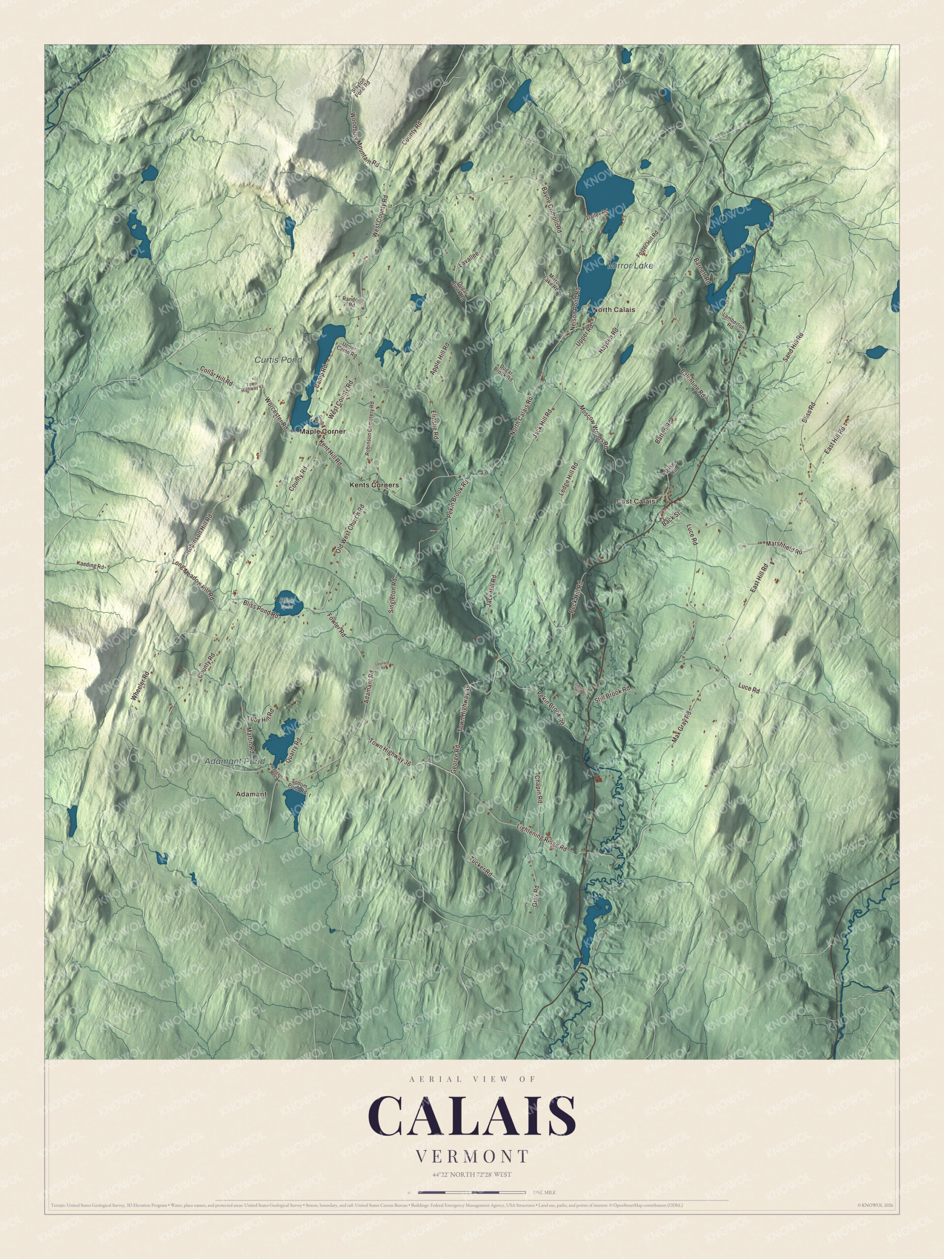
Click to explore a larger preview. The digital watermark does not appear on printed maps.
Names on this map
These names are printed on this map.
Places: Adamant, North Calais, East Calais, Mirror Lake, Curtis Pond, Adamant Pond, Bliss Pond, Kents Corners and Maple Corner.
Streets and roads: West County Road, Kent Hill Road, Fowler Road, North Calais Road, Singleton Road, Old West Church Road, Adamant Road, Upper Road, Quarry Road, County Road, Lightening Ridge Road, Town Highway 36.
More street names, A to Z
Apple Hill Road, Back Street, Balentine Road, Barnett Road, Batten Road, Bayne Comolli Road, Bliss Pond Road, Bliss Road, Camp Road, Chapin Road, Collar Hill Road, Dailey Road, Dugar Brook Road, Duke Road, East Hill Road, Elmslie Road, Foster Hill Road, George Road, Going Road, Gosselin Hill Road, Gray Road, Haggett Road, Hayden Road, Jack Hill Road, Kaeding Road, Lamberton Road, Lavallee, Ledge Hill Road, Leonard Road, Long Meadow Hill Road, Luce Road, Marshfield Road, Martin Road, Max Gray Road, Mirror Lake Road, Moscow Woods Road, Nelson Pond Road, Peck Hill Road, Pekin Brook Road, Random Road, Robinson Cemetery Road, Robinson Hill Road, Sand Hill Road, Slayton Pond Road, Sodom Pond Road, Still Brook Road, Toby Hill Road, Town Highway 41, Town Highway 49, Tucker Road, Upper Camp Road, Wheeler Road, Woodbury Mountain Road, Worcester Road.
See it on a wall
The Calais map as a framed print. Swipe for more.


North Calais, Adamant and Maple Corner
North Calais lines North Calais Road along Pekin Brook, below Mirror Lake. Its mills once processed wool for the farms around it, and the village sat on the stage route from Montpelier to Newport and on into Canada. The ruins of the mills and of a large early tavern still line the brook, and the North Calais Village Historic District was listed in 2010. Adamant, on the town line with East Montpelier, was a granite quarry village, and in 1905 its people asked the legislature for the new name, chosen, some say, to suggest the hardness of granite. The Adamant Co-op, founded in 1935, is called the state’s oldest cooperative, and the Adamant Music School, started in 1942 by the pianist Edwine Behre, the writer Alice Mary Kimball and the photographer Harry Godfrey, still brings pianists to the village every summer. Maple Corner, at the south end of Curtis Pond, has the Maple Corner Store, the Calais post office and the town swimming area.
Calais has drawn writers. The cookbook author Louise Andrews Kent, known to readers as Mrs. Appleyard, kept a home here and moved to Calais for good in 1959. The writer Kenward Elmslie and the lyricist John Latouche bought a farmhouse in Calais in 1953, and from the 1970s on Elmslie ran his Z Press from it. Dora V. Wheelock, born in Calais in 1847, became a writer and a leader of the temperance movement in Nebraska. East Calais, West County Road, Kent Hill Road and Singleton Road are printed on the map along with the rest.
This map of Calais is right at home in an office, library or den, and it can even help teach children the geography and history of a hill town of five villages. It’s made for everyone who calls Calais home and shows the town as it looks today, from Adamant to North Calais. KNOWOL created it in 2026, and it’s printed on museum quality archival paper. Zoom in on the preview above to explore the details, then click here to get your copy of the Calais, Vermont map.

Sources
- Calais, Vermont, Wikipedia
- Town histories and representatives, C towns, Vermont Legislature
- Kents Corner Historic District, Wikipedia
- Old West Church (Calais, Vermont), Wikipedia
- North Calais Village Historic District, Wikipedia
- Adamant, Vermont, Wikipedia
- Adamant Music School, Wikipedia
- Maple Corner, Vermont, Wikipedia
- Louise Andrews Kent, Wikipedia
- Kenward Elmslie, Wikipedia
- Dora V. Wheelock, Wikipedia