
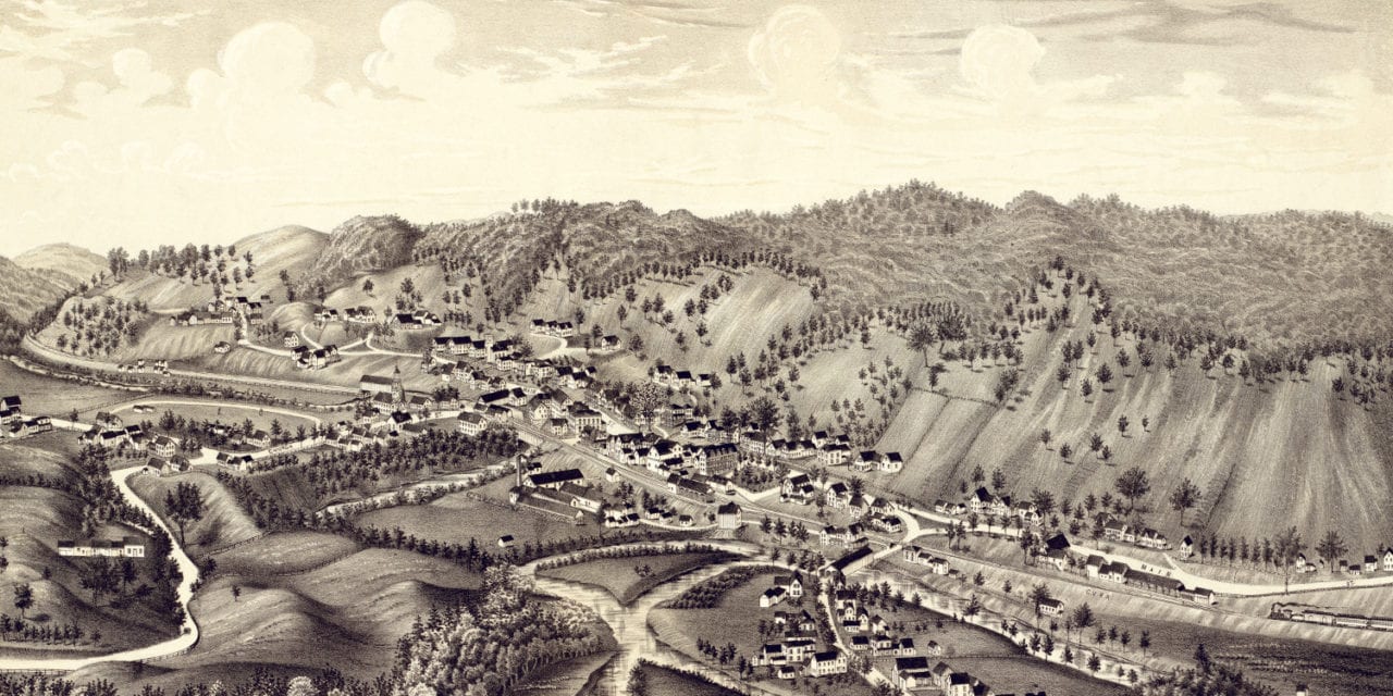
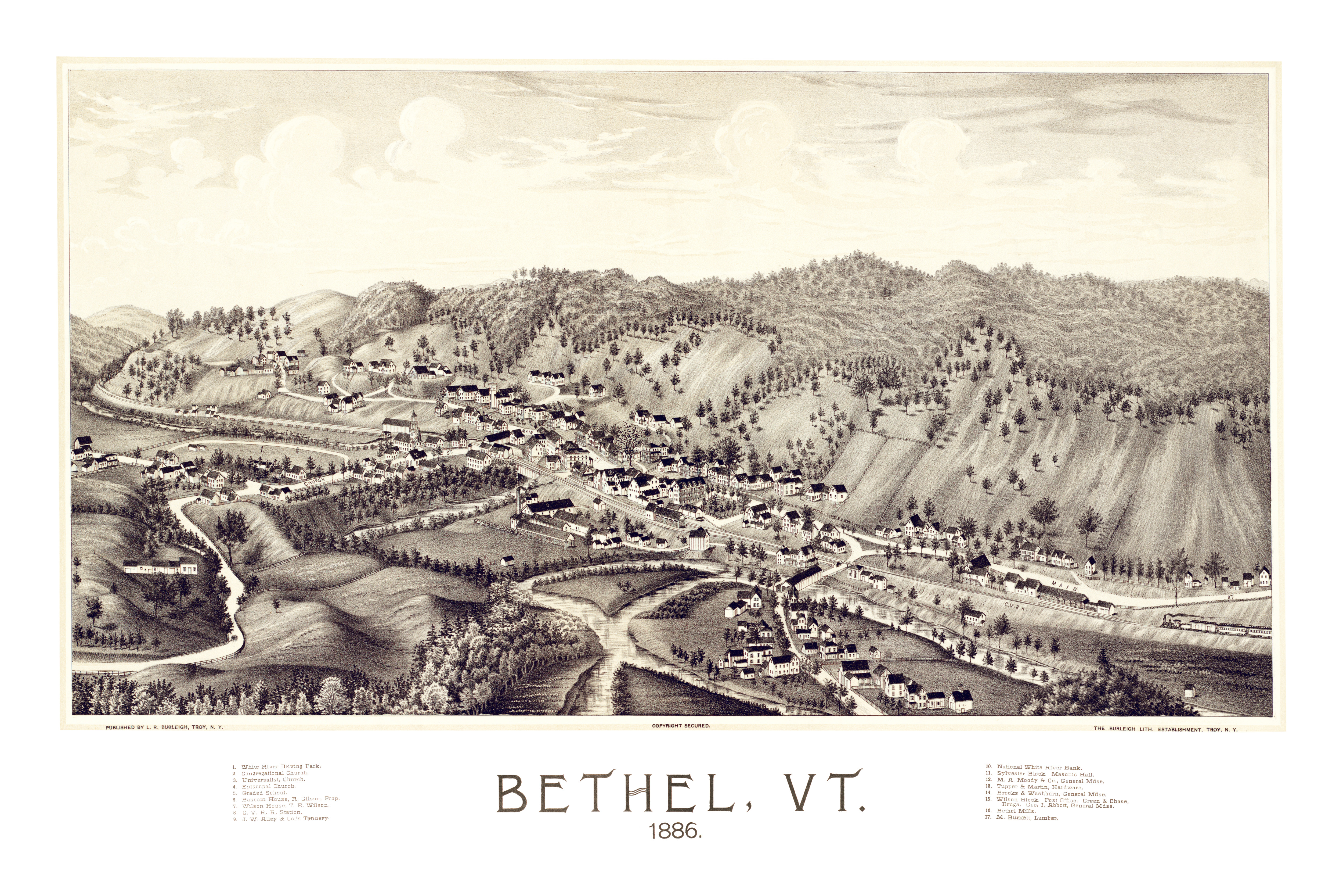
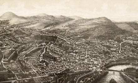
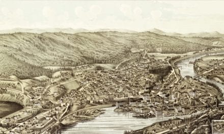
This map of Bethel, Vermont was created in 1886 by Lucien R. Burleigh, an artist and cartographer who spent his career traveling across America creating detailed bird’s eye view maps of small towns and their landmarks. When Burleigh visited Bethel, he hand drew this beautifully detailed map.
Bethel landmarks highlighted on the map include White River Driving Park, Bascom House, National White River Bank, Sylvester Block, Masonic Hall, and Bethel Mills.
This vintage map of Bethel, VT has been restored by KNOWOL. Reproductions of the map are available here.
Click here to see the full map of Bethel, VT in 1886.
This old map of Bethel will make an attractive addition to your office, library, or den, and can even be used to teach children the geography and history of the area. When you’re done exploring, click here to get yours!


