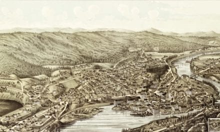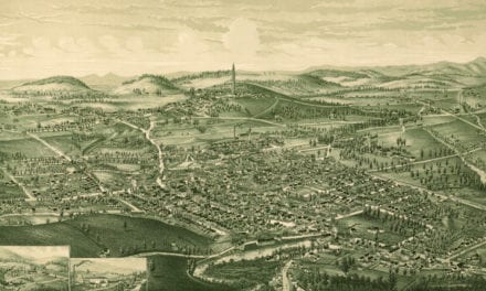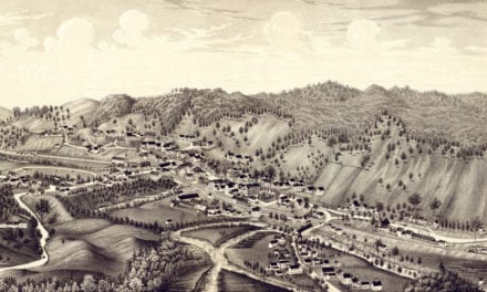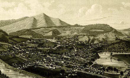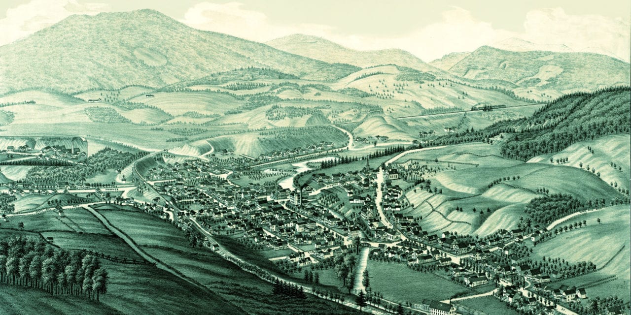
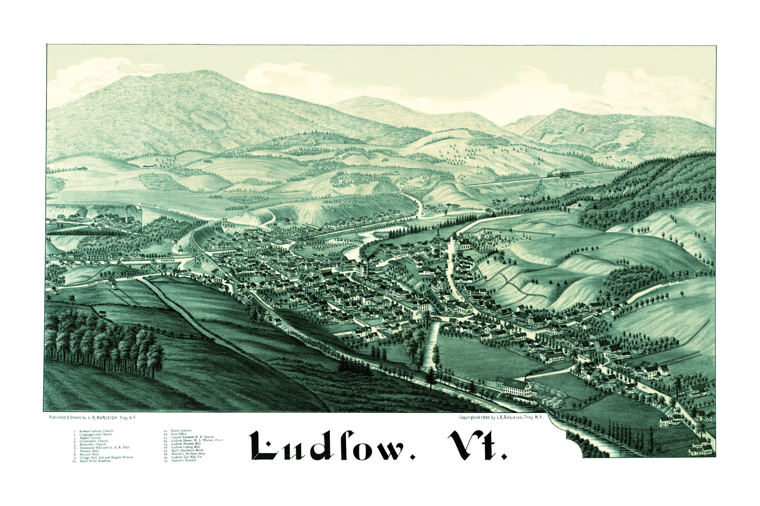
This historic old map of Ludlow, Vermont was created in 1885 by Lucien R. Burleigh, a prominent 19th century map maker. The map shows a bird’s eye view of Ludlow as it was, including street names and old landmarks.
Landmarks on the map include Hammond Hall, Phoenix Hall, Masonic Hall, Black River Academy, Central Vermont Railroad Station, Ludlow House, Ludlow Woolen Mill, Jail & Engine House, Ludlow Listing Mill, Ball’s Hardware Block, Warner’s Machine Shop, Ludlow Toy Manufacturing, Sawyer’s Tannery, and more.
This historic map of Ludlow, VT has been restored by KNOWOL. Reproductions of the map are available here.
Bird’s Eye View of Ludlow, Vermont in 1885
 This historic map of Ludlow, VT will make an attractive addition to your office, library, or den, and can even be used to teach children the geography and history of the area. When you’re done exploring, click here to get your copy.