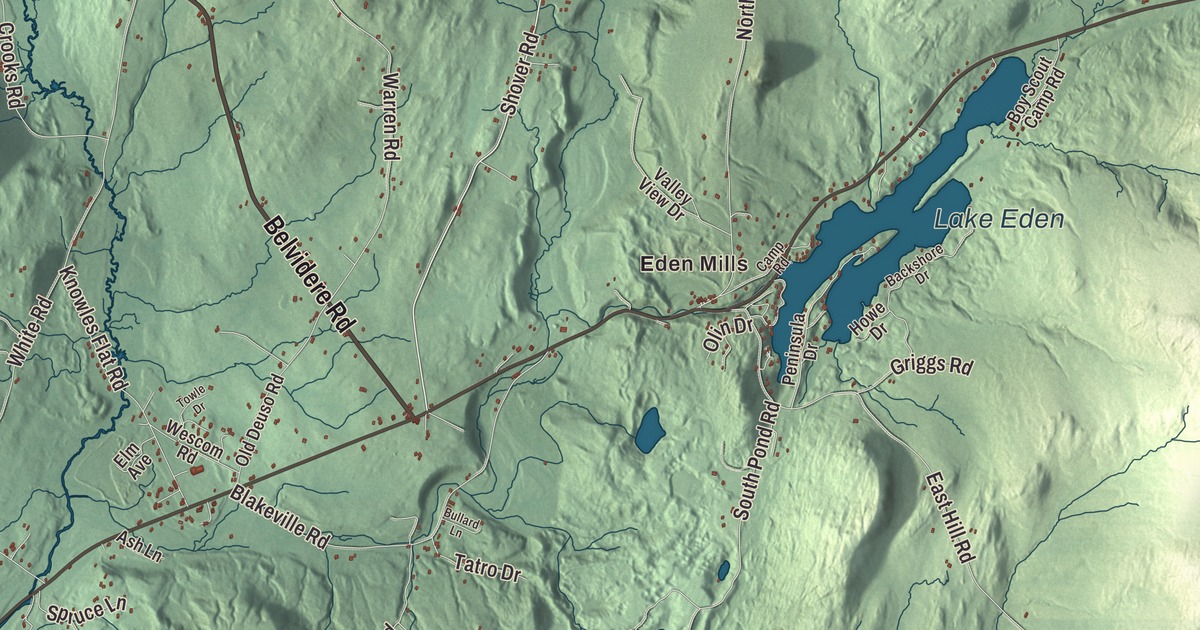
Eden is big country: more than 64 square miles of hills, ponds and woods, with the two villages of Eden and Eden Mills side by side in the middle. This map prints Eden Mills, Lake Eden, South Pond, Belvidere Pond and Big Muddy Pond, and the roads that wind between them, from Belvidere Road and Shover Road to East Hill Road, North Road, Square Road and Crooks Road.
Eden is a town in Lamoille County, Vermont.
KNOWOL made this map in 2026 from public survey data and gave it the look of an old county atlas. The relief is shaded from United States Geological Survey elevation data, and the roads and town line come from the Census Bureau. Eden covers 64.3 square miles, 15.9 of them conserved land, and it had 1,338 people at the 2020 census. Click here to purchase a print of this map for your wall.
A grant for the Green Mountain Boys
Vermont granted Eden on November 7, 1780, and chartered it on August 28, 1781, to 72 Green Mountain Boys who had fought in the Revolutionary War. None of those veterans ever settled here. The town history says no one did until after 1800, and Eden organized on March 31, 1802. For its first decades it was part of Orleans County, and it stayed there until Lamoille County was formed in 1836.
The villages of Eden and Eden Mills each have their own ZIP Code. Eden sits to the west and Eden Mills to the east, and Vermont Route 100 passes through both on its way across the center of town. In Eden village, Route 118 branches off to the northwest toward Montgomery. Eden Notch is at the northern edge of town on Route 100.
Lake Eden and the high ground
Lake Eden covers 198 acres, and roughly 120 family camps line its shores. It’s a popular summer place, and each fall a lottery decides who gets the RV sites for the following summer. The middle of town drains southwest to the Lamoille River by way of the Gihon River, while the eastern side drains south through Boomhour Branch and Wiley Brook to the Green River. Up on the crest of the Green Mountains, the Long Trail crosses Eden. Finished in 1930, it runs 273 miles from the Massachusetts line to Canada and is the oldest long-distance trail in the United States.
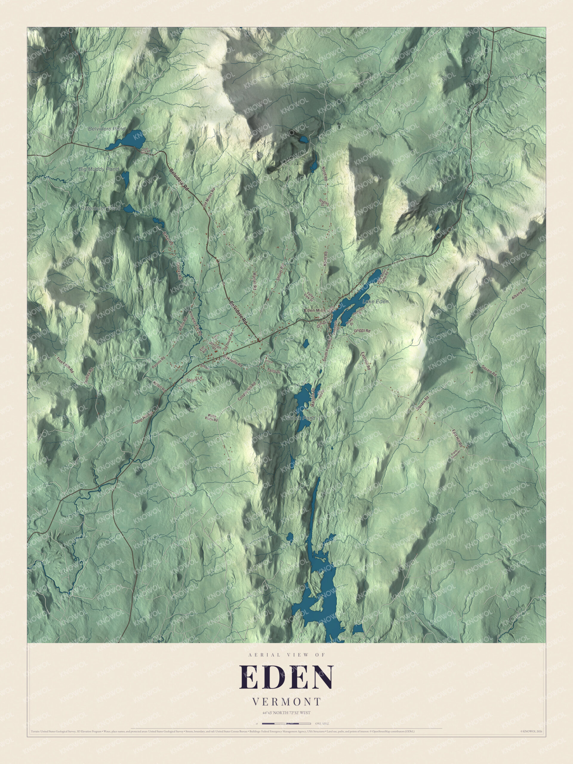
Click to explore a larger preview. The digital watermark does not appear on printed maps.
Names on this map
These names are printed on this map.
Places: Eden Mills, Lake Eden, South Pond, Belvidere Pond, Big Muddy Pond and Ritterbush Pond.
Streets and roads: Belvidere Road, Shover Road, East Hill Road, North Road, Square Road, Crooks Road, Warren Road, Knowles Flat Road, Cooper Hill Road, Albany Road, Blakeville Road, Old Mines Road.
More street names, A to Z
Ash Lane, Backshore Drive, Baker Road, Boy Scout Camp Road, Bullard Lane, Camp Road, Dudley Road, Edsel Rich Road, Elm Avenue, Frank Brown Place, Griggs Road, Gut Pond Drive, Howe Drive, Kittell Road, Marjorie Drive, Ober Hill Road, Old Deuso Road, Olin Drive, Paronto Road, Peninsula Drive, South Pond Road, Spruce Lane, Stygles Drive, Tatro Drive, Towle Drive, Tree Farm Road, Valley View Drive, Waite Place Road, Wescom Road, White Road.
See it on a wall
The Eden map as a framed print. Swipe for more.


In the northwest part of town, the Babcock Nature Preserve is a tract of land that Vermont’s state colleges use to teach geology, field biology and the study of birds. Eden is one of the largest towns in Vermont by area, and its school, Eden Central School on Knowles Flat Road, teaches children from pre-K through sixth grade.
Frank Plumley was born in Eden in 1844. He became a lawyer, chief justice of the Vermont Court of Claims and a United States congressman, and in 1903 President Theodore Roosevelt appointed him umpire of the mixed commissions of Great Britain and Venezuela and of the Netherlands and Venezuela, which sat in Caracas. Harold C. Sylvester, an associate justice of the Vermont Supreme Court, was also born in Eden, and the news analyst Philip Cummings kept a summer home in Eden Mills.
On the map, follow Belvidere Road, Shover Road, East Hill Road, North Road, Square Road and Crooks Road. Eden Mills is printed too, and Lake Eden, South Pond, Belvidere Pond and Big Muddy Pond are all labeled on the map.
Whether your summers were spent at a camp on Lake Eden or your winters on East Hill Road, this map is made for everyone who calls Eden home. It shows the town as it looks today, and it can hang in an office, library or den or help teach children the geography and history of the town. KNOWOL created it in 2026, and it’s printed on museum quality archival paper. Zoom in on the preview above to explore the details, then click here to get your copy of the Eden, Vermont map.

Sources