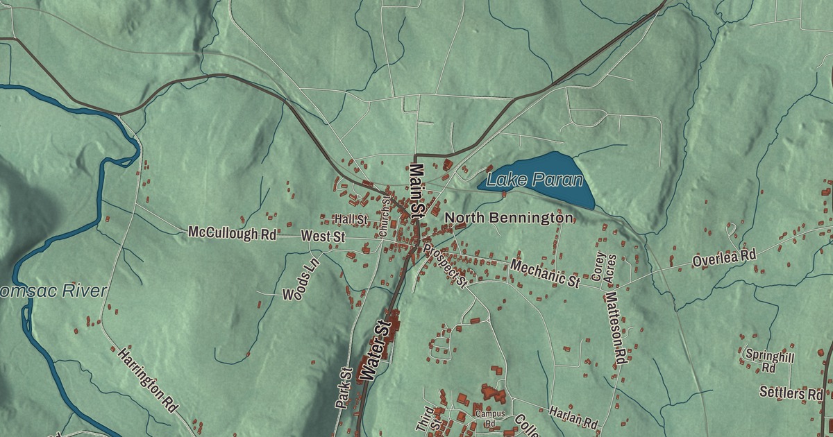
On the hill at Old Bennington stands the Battle Monument, a 306-foot stone obelisk that its page calls the tallest human-made structure in Vermont. This map prints Old Bennington, North Bennington and Paper Mill Village, Lake Paran and the Walloomsac River, and Main Street, North Street, South Street, Water Street, Northside Drive and North Bennington Road.
Bennington is one of the two shire towns of Bennington County, in the southwest corner of Vermont, with New York on its western line.
KNOWOL made this map in 2026 from public survey data and gave it the look of an old atlas. The shaded terrain comes from United States Geological Survey elevation data: Mount Anthony, 2,350 feet, part of the Taconic Range, rises in the southwest, and Bald Mountain fills the northeast corner, though its summit is just over the line in Woodford. The streets and the town line come from the Census Bureau. Bennington covers 42.5 square miles, and with 15,333 people at the 2020 census it’s the most populous town in southern Vermont. Click here to purchase a print of this map for your wall.
The first of the grants
The land belonged to the Western Abenaki before colonists came. On January 3, 1749, Governor Benning Wentworth of New Hampshire chartered the town and named it for himself, granting it to William Williams and 61 others, most of them from Portsmouth. It was the first of the New Hampshire Grants, and the town’s page calls it the oldest town chartered in Vermont, though Brattleboro had been settled earlier as a fort. Settlement waited until 1761, when Captain Samuel Robinson, who had camped in the valley on his way home from the French and Indian War, led four families from Hardwick and two from Amherst, Massachusetts, to the hill now called Old Bennington.
The town’s name went into history on August 16, 1777. Burgoyne’s British army sent two detachments to seize a store of weapons and food kept in Bennington, and General John Stark’s New Hampshire militia beat them, helped at the end by Seth Warner’s Green Mountain Boys. The fighting itself took place a few miles west, in Walloomsac, New York. The storehouse stood where the Battle Monument stands now. Its cornerstone was laid in 1887, it was finished in 1889, and President Benjamin Harrison came for the dedication in 1891. An elevator rises to an observation level at 200 feet, with views into Massachusetts and New York, and the monument is a Vermont State Historic Site. Close by was the Catamount Tavern, where Ethan Allen and the Green Mountain Boys planned their capture of Fort Ticonderoga in 1775.
Poets, potters and painters
Old Bennington’s green is the setting of the Old First Church, organized in 1762, whose present meetinghouse went up in the early 1800s and is one of the state’s best examples of Federal church architecture. Beside it, in the cemetery the legislature named “Vermont’s Sacred Acre,” Robert Frost is buried. Down the hill, the Bennington Museum on Main Street holds the largest public collection of paintings by Grandma Moses, along with the schoolhouse she attended, Bennington pottery, and the Bennington flag, one of the oldest stars and stripes in existence. Shirley Jackson lived and died in North Bennington, and her memoirs depict life in Bennington at mid-century. In sports, the Mount Anthony Patriots had won 38 straight Vermont state wrestling championships as of 2025, which the town’s page calls the national record.
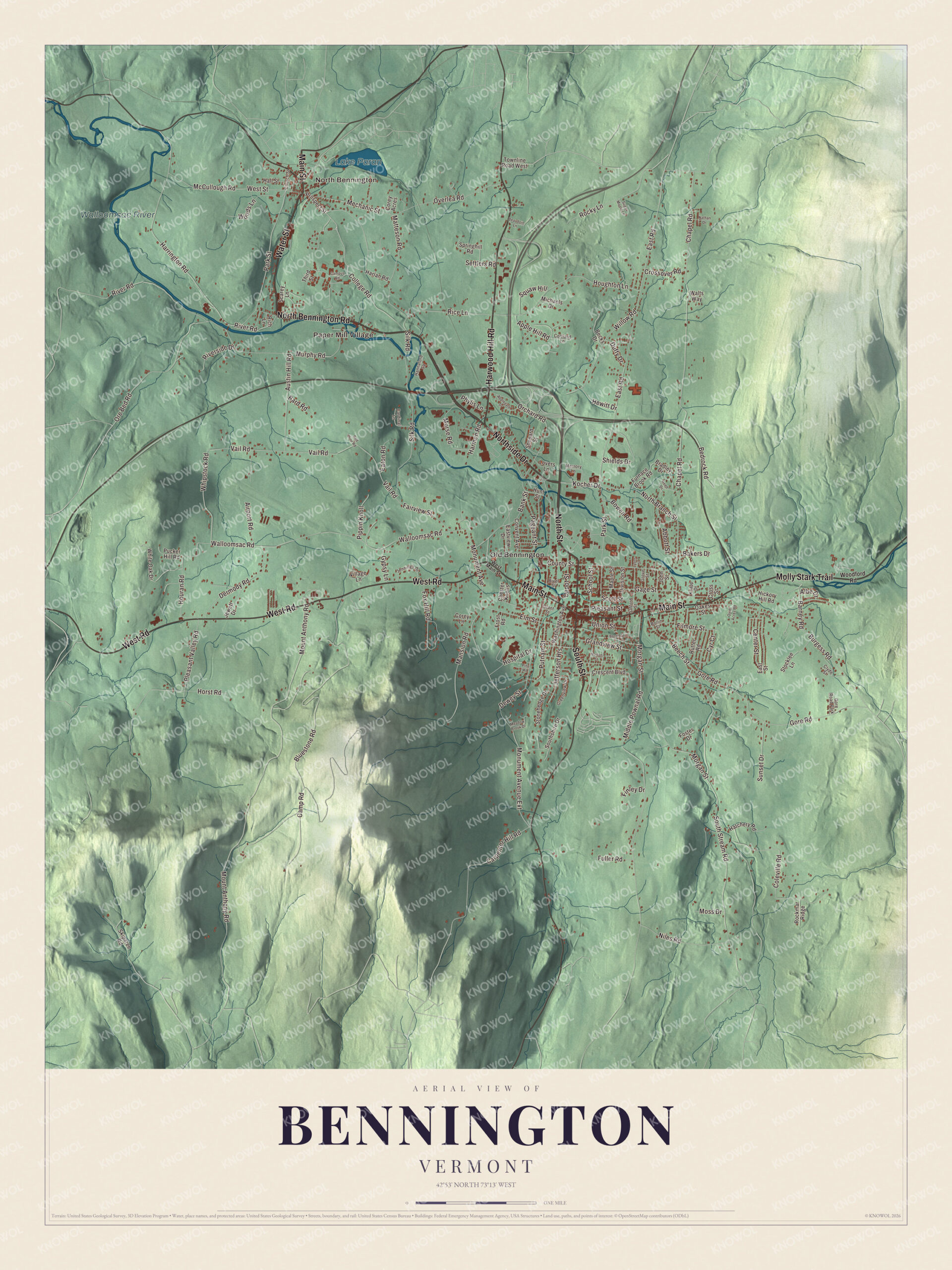
Click to explore a larger preview. The digital watermark does not appear on printed maps.
Names on this map
These names are printed on this map.
Places: North Bennington, Paper Mill Village, Old Bennington, Lake Paran, Walloomsac River and Gore Road Park.
Streets and roads: North Bennington Road, North Street, Water Street, Northside Drive, South Street, Main Street, Harwood Hill Road, Molly Stark Trail, West Road, West Street, Kocher Drive, Bank Street.
More street names, A to Z
Abbott Street, Airport Road, Albe Drive, Applegate Drive, Apple Hill Road, Austin Hill Road, Bakers Drive, Bard Road, Barney Road, Beaudoin Lane, Becks Drive, Bedrock Road, Beech Street, Bluestone Road, Booth Terrace, Bowen Road, Bradley Drive, Burgess Road, Camp Road, Campus Road, Cardinal Lane, Carpenter Hill Road, Center Street, Chapel Road, Chester Knolls, Church Street, Clyde Street, Coleville Road, College Road, Convent Avenue, Corey Acres, Corey Lane, Cortland Lane, County Street, Crescent Boulevard, Crossover Road, Cross Street, Cyr Court, Depot Street, Dermody Road, Dewey Street, Division Street, Duffy Drive, East Road, East Street, Eastview Drive, Eaton Road, Elm Street, Fairview Street, Filmore Street, Finley Drive, Foster Drive, Fox Hill Road, Frost Road, Fuller Road, Furnace Brook Road, Gage Street, Gore Road, Grandview Street, Grant Street, Greenview Drive, Grove Street, Gypsy Lane, Hall Street, Hannaford Square, Harlan Road, Harmon Road, Harrington Road, Hatchery Road, Hewitt Drive, Hickory Hill Road, Horst Road, Hospital Drive, Houghton Lane, Houran Road, Hunt Street, Jefferson Heights, Jennings Drive, Jewett Drive, John Street, Knapp Drive, Lovers Lane, Lyons Street, Mansion Road, Maple Street, Matteson Road, McCullough Road, Meadow Brook Drive, Mechanic Street, Memory Lane, Michaels Drive, Middle Pownal Road, Monument Avenue, Monument Avenue Extension, Morgan Street, Morse Road, Moss Drive, Mount Anthony Road, Murphy Road, Nathan Drive, Niles Road, North Branch Street, Norton Street, Oakes Street, Orchard Road, Ore Bed Road, Overlea Road, Pageant Street, Park Street, Phylis Lane, Pine Road, Pippin Knoll, Pleasant Street, Pleasant Valley Road, Prospect Street, Pucker Hill Road, Putnam Street, Quiet Acres Road, Red Pine Road, Reed Drive, Rice Lane, Rich Lane, River Road, Riverside Drive, River Street, Rockmar Ridge, Rocky Lane, Rollin Street, Rutter Road, Safford Street, Scarey Lane, School Street, Scott Street, Settlers Road, Shepard Street, Shields Drive, Silk Road, Skiparee Road, Southshire Drive, South Stream Road, Springhill Road, Stocklee Lane, Stonehedge Drive, Sugar Maple Lane, Sunset Drive, Third Street, Townline Road West, Union Street, Vail Road, Village Lane, Walloomsac Road, Walts Way, Washington Avenue, West Main Street, Whipstock Road, White Oak Drive, Willow Road, Woodford Road, Woods Lane.
See it on a wall
The Bennington map as a framed print. Swipe for more.


From Main Street to Paper Mill Village
Downtown grew around the crossroads below Old Bennington, at the junction of Main, North and South streets. North and South streets carry U.S. Route 7 and Main Street carries Route 9, and the Downtown Bennington Historic District runs along them, with the 1846 town hall, the 1936 county courthouse, and buildings from the early 19th to the mid-20th century. The Walloomsac River, a 16.8-mile tributary of the Hoosic whose name comes from the Native American Wal-loom-sac, runs past the north side of downtown, and the town’s page notes a river walk beside it. In the north of town, Bennington’s big-box stores are mostly along Northside Drive and Kocher Drive.
Northwest of downtown, the Walloomsac forms the southern edge of North Bennington, an incorporated village of 1,716 people. Bennington College sits on a hill at the village’s southeast border, and the village is home to the Park-McCullough House, a 35-room Victorian country house. Every January, Lake Paran in North Bennington hosts the Winter Festival and Penguin Plunge for Special Olympics Vermont. Just south of the college, at Paper Mill Village, the Paper Mill Village Bridge carries Murphy Road over the Walloomsac beside a former paper mill. Charles F. Sears built it in 1889, it was rebuilt in 2000, and at 125 feet it’s the longest covered bridge in Bennington County. Water Street and North Bennington Road are printed on the map as well.
This map of Bennington is a fine fit for an office, library or den, and it can even help teach children the geography and history of the town where the Bennington battle got its name. It’s made for everyone who calls Bennington home and shows the town as it looks today, from Old Bennington to Lake Paran. KNOWOL created it in 2026, and it’s printed on museum quality archival paper. Zoom in on the preview above to explore the details, then click here to get your copy of the Bennington, Vermont map.

Sources
- Bennington, Vermont, Wikipedia
- Bennington Battle Monument, Wikipedia
- Old Bennington, Vermont, Wikipedia
- First Congregational Church of Bennington, Wikipedia
- Bennington Museum, Wikipedia
- Downtown Bennington Historic District, Wikipedia
- Walloomsac River, Wikipedia
- North Bennington, Vermont, Wikipedia
- Paper Mill Village Bridge, Wikipedia