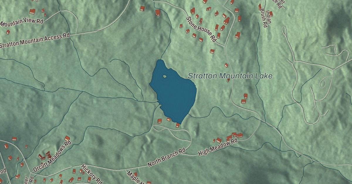
Stratton Mountain is the resort community at the northern foot of the mountain, gathered around the base of the ski area and the golf course. This map prints Stratton Mountain Road, Mountain View Road, Windtree Road, West Ridge Road, Middle Ridge Road and High Meadow Road, along with Stratton Mountain Lake.
Stratton Mountain is a community in Bennington County and Windham County, Vermont.
KNOWOL made this map in 2026 from public survey data and gave it the look of an old county atlas, shading the hills from United States Geological Survey elevation data and drawing the roads and boundary line from the Census Bureau. Stratton Mountain is a resort community and census-designated place at the northern foot of Stratton Mountain, first listed before the 2020 census, and the community has its own statistical boundary. Its southern half, with the base of the ski area, lies in the town of Stratton in Windham County, and its northern half, with the Stratton Golf Course, lies in the town of Winhall in Bennington County. In 2020, Stratton Mountain had 335 residents. Click here to purchase a print of this map for your wall.
A ski area from the start
Stratton Mountain ski area opened in December 1961 on the mountain’s northern peak, with three double chairlifts, installed by what was then a unique helicopter method, and a three-story base lodge. The facilities were first rate, but the muddy access road was so bad the press called it a “tank-proving ground,” and it was paved before the second season. Two T-bar lifts came for the third season, and the new Snow Bowl opened 30 acres of terrain in the fourth. When the base lodge was enlarged a few seasons later, a group of Austrian ski instructors, the Innsbruck Trio, started European-style après-ski evenings there. They became known as the Stratton Mountain Boys and a big part of how the mountain marketed itself. The Sun Bowl followed soon after, with a new base area and five miles of trails.
In 1978 the resort hosted World Cup races, and the twin brothers Phil and Steve Mahre won the men’s giant slalom and slalom. In the 1980s Stratton became the first ski area to allow snowboarding, an ally to Jake Burton, who built his first snowboard while living in nearby Manchester. It was also home to the first snowboard school and, later, the first half pipe and formal terrain park on the East Coast, and from 1985 to 2012 it hosted the Burton U.S. Open Snowboarding Championships before the event moved to Vail.
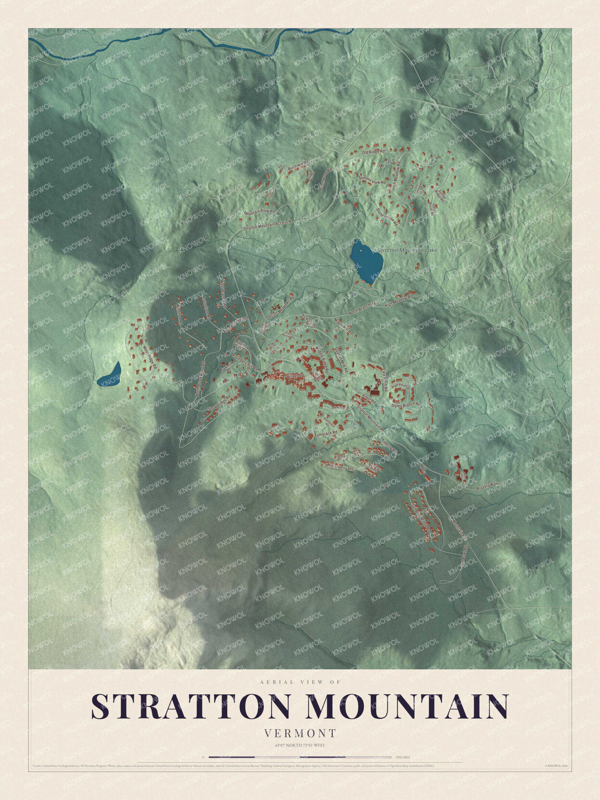
Click to explore a larger preview. The digital watermark does not appear on printed maps.
Names on this map
These names are printed on this map.
Places: Stratton Mountain Lake.
Streets and roads: Mountain View Road, Stratton Mountain Road, Windtree Road, West Ridge Road, Middle Ridge Road, High Meadow Road, Stratton Mountain Access Road, North Brookwood Road, North Branch Road, Sun Bowl Ridge Road, Quarter Mile Road, Treetop Road.
More street names, A to Z
Arbor Road, Balsam Corner, Basswood Row, Beechwood Road, Birch Hill Road, Brazers Way, Burr Oak Road, Corner Rock Road, Dogwood Trail, East Birch Road, East Round Road, Flowing Spring Road, Founders Hill Road, Garry West Way, Hickory Road, High Point Drive, Indian Brush Road, Maple Hill Road, Mountain Road, North Brookwood, Ober Tal Drive, Old Ridge Road, Orcutt Meadows Road, Red Maple, Roundtree Road, Sawmill Road, Shattarack Road, Silver Birch Road, Snowbridge Road, Stone House Road, Styles Branch Road, Summit View Road, Sun Bowl Road, Sunset Ridge Road, Tamarack Road, The Hollow Road, Village Square, Village Walk, West Branch Road, West Round Road, Winterberry Heights, World Cup.
See it on a wall
The Stratton Mountain map as a framed print. Swipe for more.


The school on the mountain
Warren Hellman and Donald Tarinelli founded Stratton Mountain School here in 1972, a college preparatory high school that trains winter athletes in alpine and Nordic skiing and snowboarding. It has produced 46 Olympians who’ve won six medals. Ross Powers, class of 1997, won snowboard halfpipe bronze at Nagano in 1998 and gold at Salt Lake City in 2002, and since 2010 he’s directed the school’s snowboarding program. He lives in the town of Stratton. Lindsey Jacobellis, class of 2003, won silver in snowboard cross at Turin in 2006 and two golds at Beijing in 2022, and Mac Forehand won silver in freeski big air at the 2026 Winter Olympics in Italy. From the village, Stratton Mountain Access Road runs north to Route 30 in Bondville, and Pikes Falls Road leads southeast to Route 30 in Jamaica.
On the map, start with Mountain View Road, then follow Stratton Mountain Road, Windtree Road, West Ridge Road, Middle Ridge Road and High Meadow Road through the community. Stratton Mountain Lake is printed too.
This map of Stratton Mountain is made for everyone who calls Stratton Mountain home, and it shows the community as it looks today, from Stratton Mountain Road and Mountain View Road to West Ridge Road and Stratton Mountain Lake. Hang it in an office, library or den, or use it to teach children the geography and history of their mountain. It’s printed on museum quality archival paper. Zoom in on the preview above to explore the details, then click here to get your copy of the Stratton Mountain, Vermont map.

Sources