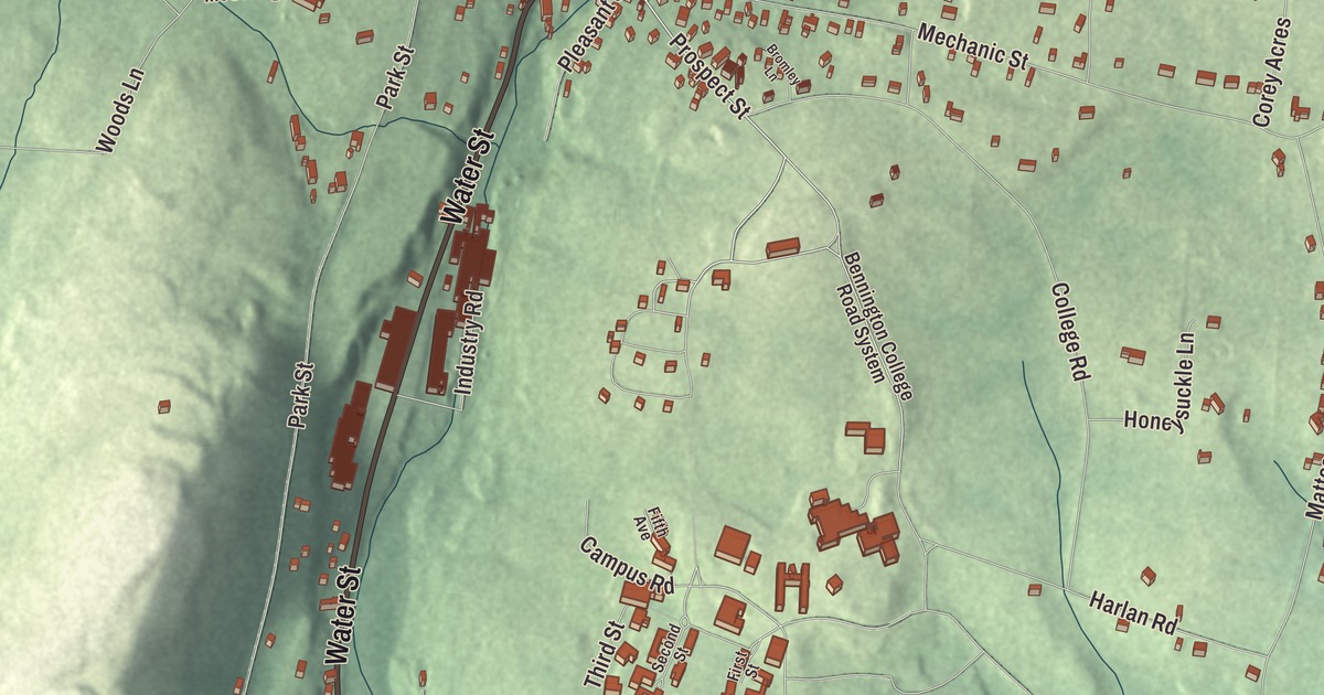
North Bennington fills the northwest part of the town of Bennington, with the Walloomsac River along its southern edge and Bennington College on a hill at its southeast border. This map prints Main Street, Water Street, North Bennington Road, Bank Street, Prospect Street and Houghton Street across the village.
North Bennington is a village in Bennington County, Vermont.
KNOWOL made this map in 2026 from public survey data and gave it the look of an old county atlas, shading the hills from United States Geological Survey elevation data and drawing the streets and village line from the Census Bureau. North Bennington is an incorporated village within the town of Bennington, and it has its own incorporated-place boundary, 1.89 square miles with the town of Shaftsbury along its northern side. At the 2020 census 1,716 people lived here. Click here to purchase a print of this map for your wall.
The village remains active today. Routes 67 and 67A meet at its center, the McCullough Free Library and two independent grade schools serve it, and manufacturers including Dion Snowshoes, National Hanger Company, PortaBrace and Sterling Gun Drills are based here. The North Bennington Historic District, listed on the National Register of Historic Places in 1980, covers 112 acres with 164 contributing buildings.
A railroad junction
The Bennington and Rutland Railroad opened in 1853, with a branch from North Bennington to White Creek on the New York line, and when the Lebanon Springs Railroad was built south from Bennington in 1869, North Bennington stood at the junction of two through routes. The brick depot at Depot Street and Buckley Road went up in 1880, a Second Empire building with a mansard roof of colored slate, a cut marble foundation and a mansard tower over the street side. Passenger trains, the Green Mountain Flyer and the Mount Royal among them, stopped here until 1953, and the depot, listed on the National Register in 1973, survives as a reminder of the village’s years as a rail hub.
Stereographs and Kiddie-Kars on Water Street
At 140 Water Street, on Paran Brook just above its mouth at the Walloomsac, stands the old mill complex of the H. C. White Company. Hawley C. White, a North Bennington native who had learned to grind optical lenses in New York City, came home in 1874 and bought this property in 1878. His company made stereoscope viewers, and from 1899 it sent photographers out across the world to make stereograph cards; in the 1910s it turned to wooden children’s furniture and the Kiddie-Kar, a three-wheeled scooter. The company closed in 1935. Its buildings, dating from 1887 to 1919 around a mill pond, were listed on the National Register in 2017 and now hold offices, light industry and apartments.
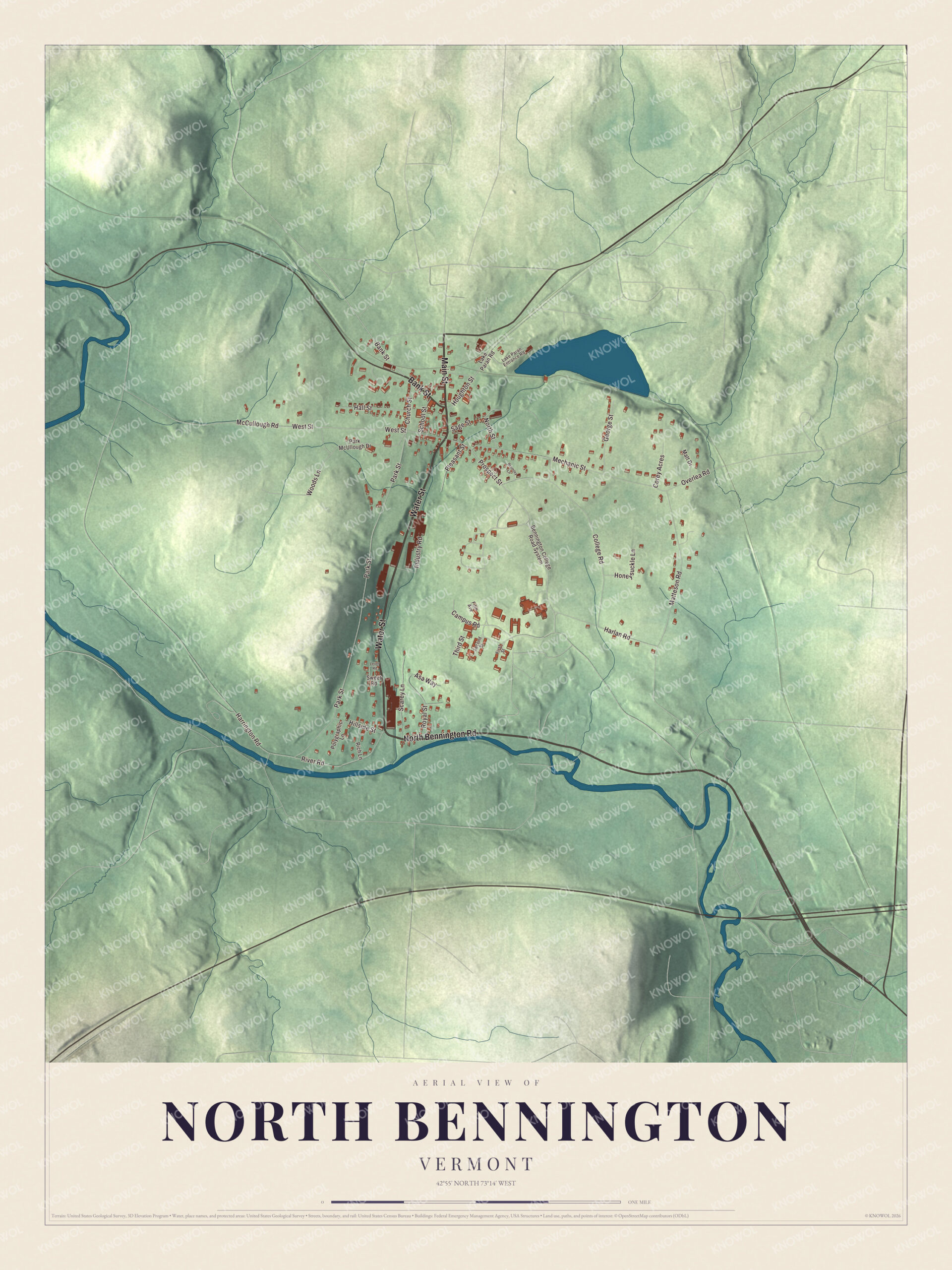
Click to explore a larger preview. The digital watermark does not appear on printed maps.
Names on this map
These names are printed on this map.
Streets and roads: Main Street, Water Street, North Bennington Road, Bank Street, Prospect Street, Houghton Street, West Street, River Road, Campus Road, Park Street, College Road, Mechanic Street.
More street names, A to Z
Asa Way, Bennington College Road System, Bromley Lane, Church Street, Corey Acres, Fifth Avenue, First Street, George Street, Hall Street, Harlan Road, Harrington Road, Hillside Street, Honeysuckle Lane, Industry Road, Lake Paran Entrance Road, Lake Paran Road, Lever Road, Matt Drive, Matteson Road, McCullough Road, North Street, Overlea Road, Park McUllough Drive, Pleasant Street, Polygraphic Lane, Rich Lane, Royal Street, Sage Street, Scarey Lane, School Street, Second Street, Sweet Road, Third Street, Woods Lane.
See it on a wall
The North Bennington map as a framed print. Swipe for more.


The Park-McCullough House
Off Route 67A stands the Park-McCullough House, a 35-room Second Empire mansion on 200 acres, which its page counts among the best-preserved Victorian mansions in New England. Trenor W. Park, a lawyer who made his fortune running John C. Fremont’s mines in California, built it in 1864 and 1865 on land he bought from his father-in-law, Governor Hiland Hall, and the family moved in on Christmas Day, 1865. Park also founded the First National Bank of North Bennington. His daughter Eliza later owned the house with her husband, John G. McCullough, governor of Vermont from 1902 to 1904, and the family renovated it in 1889 and 1890, largely to entertain President Benjamin Harrison when he came to dedicate the Bennington Battle Monument. A nonprofit owns it now, and it’s open to the public. In 1921 Eliza McCullough gave the village the John G. McCullough Free Library in her husband’s memory, and their daughter Esther Morgan McCullough, born in North Bennington and raised in the mansion, wrote novels and for a time directed the Vermont Symphony Orchestra.
Writers on the hill
Bennington College was founded as a women’s college in 1932, and the line between North Bennington and Bennington cuts across its grounds. Shirley Jackson settled in North Bennington in 1945, when her husband, the critic Stanley Edgar Hyman, joined the college faculty, and she lived here until her death in 1965. Since at least 2015 the village has kept Shirley Jackson Day every June 27, the day on which her story “The Lottery” takes place. The novelist Jamaica Kincaid, who married the composer and Bennington College professor Allen Shawn, lives in North Bennington too.
On the map, start on Main Street, then follow Water Street, North Bennington Road, Bank Street, Prospect Street and Houghton Street across the village; every one of those streets is printed. Houghton Street is the side street that leads toward Lake Paran.
This map of North Bennington is made for everyone who calls North Bennington home, and it shows the village as it looks today, from the Water Street mill to the depot. Hang it in an office, library or den, or use it to teach children the geography and history of their village. It’s printed on museum quality archival paper. Zoom in on the preview above to explore the details, then click here to get your copy of the North Bennington, Vermont map.

Sources
- North Bennington, Vermont, Wikipedia
- North Bennington station, Wikipedia
- H.C. White Company Mill Complex, Wikipedia
- Park-McCullough Historic House, Wikipedia
- Hiland Hall, Wikipedia
- John G. McCullough, Wikipedia
- McCullough Free Library, Wikipedia
- Esther Morgan McCullough, Wikipedia
- Bennington College, Wikipedia
- Shirley Jackson, Wikipedia
- Jamaica Kincaid, Wikipedia
- Vermont Route 67, Wikipedia