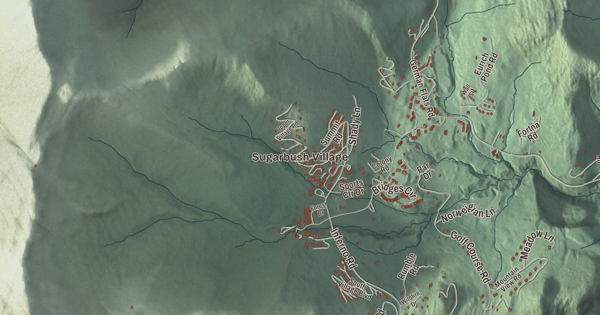
Warren is set between the two ranges of the Green Mountains, where the Mad River flows north toward Waitsfield, and the center of Vermont’s population falls inside its town line. This map prints Sugarbush Village, Alpine Village and East Warren, with Airport Road, Roxbury Mountain Road, Beech Street, West Hill Road, Lincoln Gap Road, Plunkton Road, Warren Lake and the Mad River.
Warren is a town in Washington County, Vermont.
KNOWOL made this map in 2026 from public survey data and gave it the look of an old county atlas, with the two mountain ranges shaded from United States Geological Survey elevation data and the roads and town line drawn from the Census Bureau. The town covers 40.0 square miles, and 1,977 people lived here at the 2020 census. Click here to purchase a print of this map for your wall.
A mill village on the Mad River
Vermont granted Warren on November 9, 1780, and chartered it on October 20, 1789, to John Throop and 67 others. It was named for Dr. Joseph Warren, the Revolutionary War patriot, and it belonged to Addison County until 1829. The first settlers, Samuel Lard and Seth Leavitt, arrived in 1797. Mills on the Mad River ground grain and sawed lumber and clapboards, farmers grew hay on the fertile intervales, and by 1839, when 766 people lived in town, cattle and about 4,000 sheep grazed the hills. Milk and maple syrup became important goods.
The village took shape along Main Street on the east bank of the river in the 1820s, drawn by water power on the Mad River and the brooks that feed it. Its cemetery and common were laid out in 1826, its first school opened in 1835 and its first church in 1838, and by the 1870s as many as nine mills worked near the village. Fires and floods in the early 1900s destroyed all of them, but the village itself survives as a well-preserved 19th-century mill village, on the National Register since 1992, along with one old dam on the Mad River. At the south end of the village, the Warren Covered Bridge carries Covered Bridge Road over the river. Its queen post trusses are covered on the inside as well as the outside, making it one of only two bridges left in the state built that way. A sign on it calls it the Lincoln Gap covered bridge.
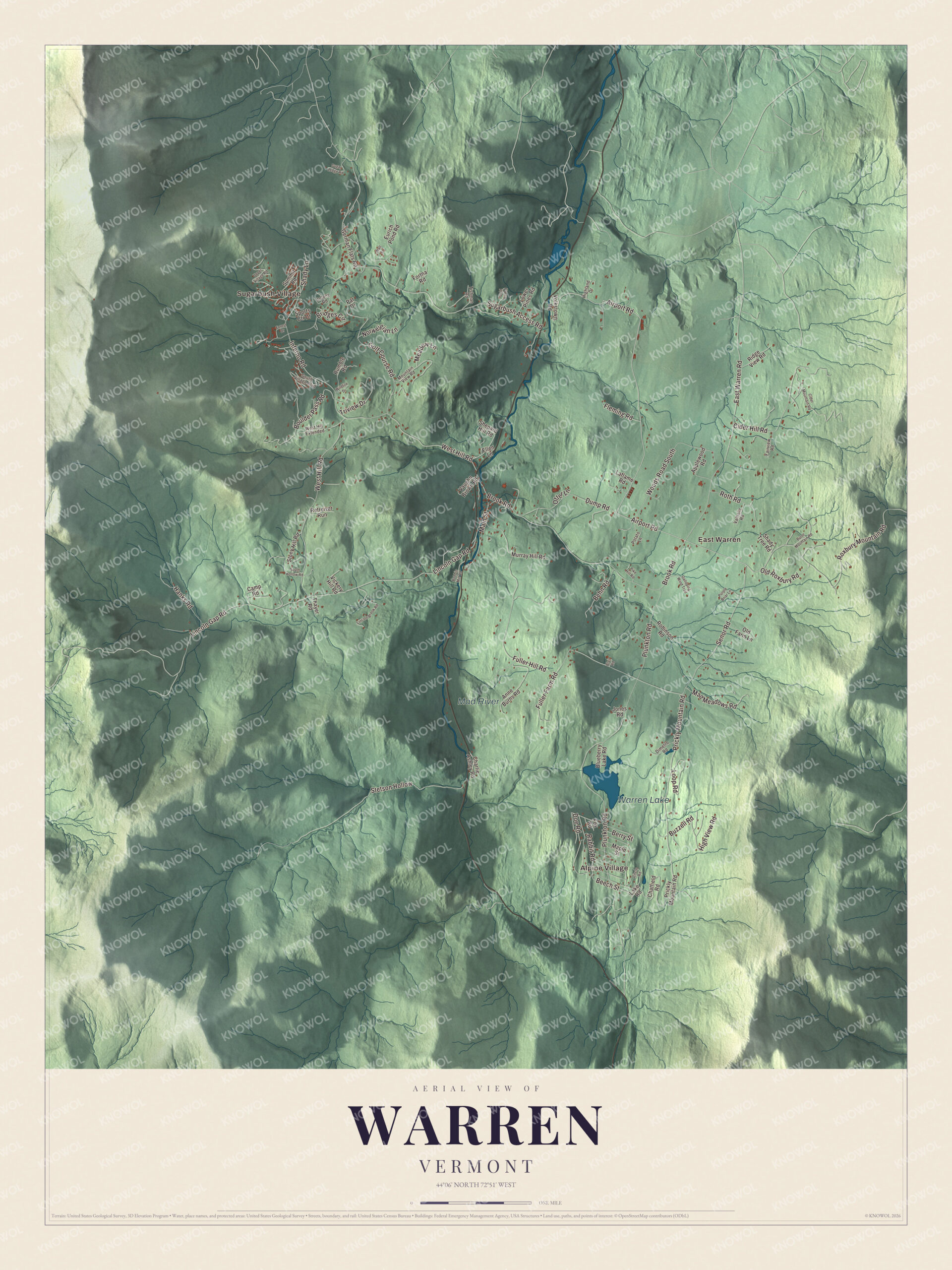
Click to explore a larger preview. The digital watermark does not appear on printed maps.
Names on this map
These names are printed on this map.
Places: Sugarbush Village, Alpine Village, East Warren, Warren Lake and Mad River.
Streets and roads: Airport Road, Roxbury Mountain Road, Beech Street, West Hill Road, Lincoln Gap Road, Plunkton Road, Sugarbush Access Road, Fuller Hill Road, Brook Road, East Warren Road, Golf Course Road, Senor Road.
More street names, A to Z
Anne Burns Road, Applewood Road, Behn Road, Berry Street, Blair Road, Blueberry Lake Road, Bobbin Mill Road, Boulder Pass Road, Bridges Circle, Burnt Mountain Road, Buzzell Road, Camp Road, Charlie Ashley Road, Chatfield Road, Cider Hill Road, Cider Mountain Road, Circle Road, Colony Road, Dimetro Road, Doe Road, Dump Road, Ellen Lane, Eurich Pond Road, Fairview Road, Fleming Road, Forest Drive, Fortna Road, Fox Road, Fuller Farm Road, Galloping Wind Trail, German Flats Road, Gold Hill Road, Hanks Road, Highland Drive, High View Road, Inferno Road, Jones Road, Laflame Road, Lake Road, Lincoln Brook Road, Loop Road, Lower Pines Road, Mad Meadows Road, Main Street, Maple Street, Meadow Lane, Mountain View Road, Murray Hill Road, Norweigian Lane, Old Farm Lane, Old Roxbury Road, Otter Lane, Par Drive, Pike Hill Road, Potato Lane, Prickly Mountain Road, Purple Briar Lane, Rabbit Road, Retreiver Run, Ridge View Road, Robinson Road, Roth Road, Rumble Road, Shady Lane, Shady Tree Road, Shepard Hill Road, South Hollow Road, South Village Boulevard, Sports Ctr Drive, Stetson Hollow, Stony Hill Road, Sugar Ledge Road, Summit Road, Thayer Road, Tishman Road, Triview Drive, Upper Village Road, Valhalla Road, Vaughn Brown Road, Vickery Hill Road, Volkstown Road, Wall Street, West Hill Extended, Wildfire Drive, Woods Road South.
See it on a wall
The Warren map as a framed print. Swipe for more.


Ski hills, gliders and the gap
In the late 1930s the Warren Outing Club put up the first ski tow in the Mad River Valley. Then on December 25, 1958, Damon and Sara Gadd and Jack Murphy opened Sugarbush on the northeast side of Lincoln Peak, with an Italian-built three-seat gondola that was, at the time, the nation’s longest lift. Sugarbush grew into one of the largest ski resorts in New England, with a vertical drop of 2,600 feet, second in Vermont only to Killington. Two nautical miles east of the town center, the Warren-Sugarbush Airport hosts glider rides from May to September and turns into a Nordic ski center in winter.
About a quarter of the town lies in the Green Mountain National Forest. The Long Trail, the oldest long-distance trail in the United States, crosses the town on its way from Massachusetts to Canada, along the summit ridge of Lincoln Peak. Lincoln Gap Road crosses Lincoln Gap, whose high point is just over the line in Lincoln. At 2,424 feet it’s the highest mountain pass in Vermont you can drive. The Warren side is paved and the Lincoln side is gravel, and the road isn’t plowed in winter. Its paved stretch gives the gap the steepest paved mile of public highway in the country, a popular challenge for cyclists.
On the map, start in Sugarbush Village or Alpine Village, then follow Airport Road, Roxbury Mountain Road, Beech Street, West Hill Road, Lincoln Gap Road and Plunkton Road. Then look outward toward East Warren. Warren Lake and the Mad River are printed too. Warren dates to 1789.
This map of Warren is made for everyone who calls Warren home, and it shows the town as it looks today, from Sugarbush Village to East Warren and Lincoln Gap Road. Hang it in an office, library or den, or use it to teach children the geography and history of their town. It’s printed on museum quality archival paper. Zoom in on the preview above to explore the details, then click here to get your copy of the Warren, Vermont map.

Sources
- Warren, Vermont, Wikipedia
- Town histories and representatives, W towns, Vermont Legislature
- Warren Village Historic District, Wikipedia
- Warren Covered Bridge, Wikipedia
- Sugarbush Resort, Wikipedia
- Warren-Sugarbush Airport, Wikipedia
- Long Trail, Wikipedia
- Lincoln Peak (Vermont), Wikipedia
- Lincoln Gap (Vermont), Wikipedia