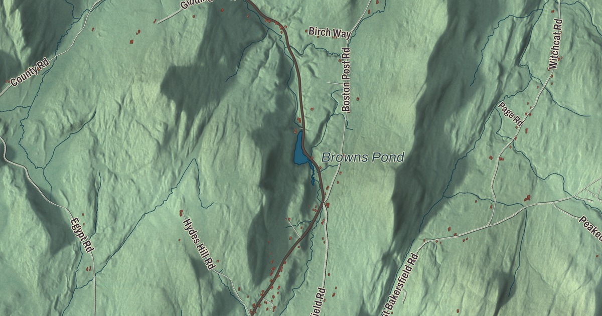
Bakersfield has been called an old academy town, and the brick academy with its clock tower still stands in the village, set back from Route 108. This map prints Browns Pond and Kings Hill Pond, with Fairfield Road, East Bakersfield Road, County Road, Barnes Road, Cross Road and Butterfield Road reaching out across the town.
Bakersfield is in Franklin County, in its southeastern corner along the Lamoille County line.
KNOWOL made this map in 2026 from public survey data and gave it the look of an old atlas. The shaded terrain comes from United States Geological Survey elevation data: the Cold Hollow Mountains fill the eastern end of town and reach 3,261 feet just north of the Lamoille County line, and the town drains to the Missisquoi River and on to Lake Champlain. The roads and the town line come from the Census Bureau. Bakersfield covers 44.6 square miles, and it had 1,273 people at the 2020 census. Click here to purchase a print of this map for your wall.
Joseph Baker’s 10,000 acres
The town’s story begins in 1791, when Joseph Baker of Westborough, Massachusetts, bought 10,000 acres here; the village is named for him. His son-in-law Stephen Maynard and his nephew Jonas Brigham came first with their families. Baker built a gristmill and a sawmill on Baker’s Pond in 1794, Maynard opened a tavern two years later, and in 1797 a school started in a log cabin where the Post Road meets what’s now Route 108. In 1804 Baker deeded five acres for a town common and a burying ground, and in 1811 Maynard built a Federal style house north of the village to serve as the first post office. There were 12 school districts by 1839, and in 1840 the town had 1,258 residents.
An academy town
Its academies prepared students for college, and public speaking was encouraged for the boys. The Bakersfield Academic Association, formed in 1839, put up a three-story building for a Methodist church and the South Academy, and Bakersfield Academy opened there in 1840 under Jacob Spaulding, with his wife Mary teaching drawing. By 1851 it had 271 students from New England, other states and Quebec, and a staff of 14. Methodists started a second school at the north end of town in 1844, called North Academy. Westward migration, new public high schools and the Civil War drew students away, and the academies closed.
Then a native son stepped in. Peter Bent Brigham, born in Bakersfield in 1807, left home in his early teens when his father died, started out selling fish and oysters in Boston, and grew rich in restaurants and real estate. He regretted his own lack of schooling, his page says, and when he died in 1877 he left his hometown $30,000 for education. With that gift the town built Brigham Academy in the late 1870s, a two-story brick building in the Second Empire style with a clock tower, and it drew students from across northern Vermont. Warren Austin, later a United States senator and ambassador to the United Nations, was among those educated in Bakersfield. The academy served as a high school until the 1960s and as a middle school after that, and it was listed on the National Register of Historic Places in 1995. Brigham’s will also paid for a hospital in Boston, the Peter Bent Brigham Hospital, which opened in 1913 and is now part of Brigham and Women’s Hospital.
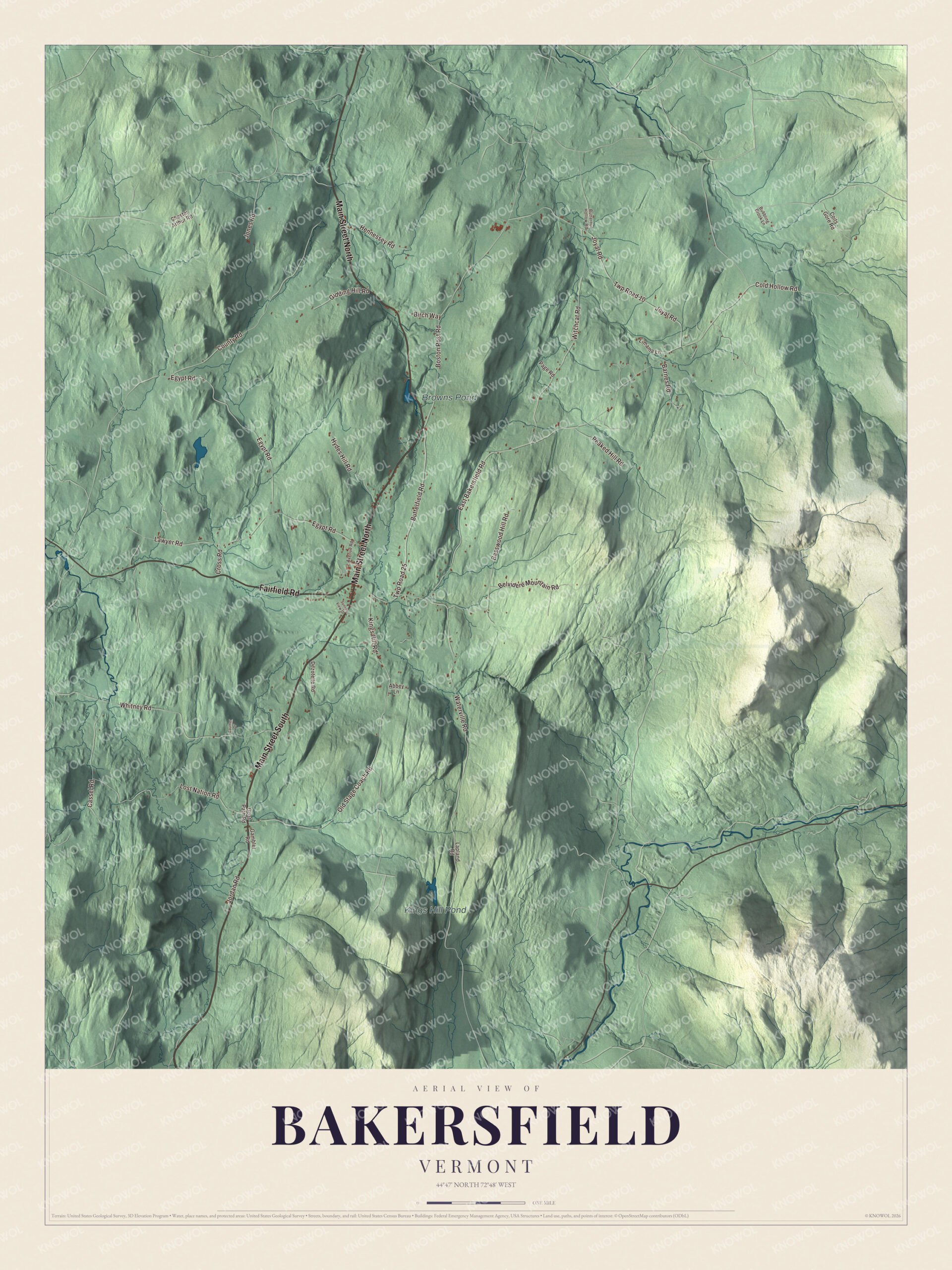
Click to explore a larger preview. The digital watermark does not appear on printed maps.
Names on this map
These names are printed on this map.
Places: Browns Pond and Kings Hill Pond.
Streets and roads: Main Street North, Main Street South, Fairfield Road, Barnes Road, Cross Road, Butterfield Road, County Road, East Bakersfield Road, Egypt Road, Witchcat Road, Kings Hill Road, Waterville Road.
More street names, A to Z
Abbey Lane, Avenue Road, Basswood Hill Road, Belvidere Mountain Road, Birch Way, Boston Post Road, Bubbling Brook Lane, Butternut Hollow Road, Cassel Road, Chester Arthur Road, Coits Gore Road, Cold Hollow Road, Dezotelle Road, Gambler Road, Gauther Drive, Gidding Hill Road, Goat Path Road, Hennessey Road, Hydes Hill Road, Jones Road, Jordan Road, Joyal Road, Lapland Road, Lawyer Road, Limama Lane, Lost Nation Road, Old Stage Coach Road, Page Road, Peaked Hill Road, Sunset View Drive, Twp Road 10, Twp Road 25, Whitney Road.
See it on a wall
The Bakersfield map as a framed print. Swipe for more.


Roads out of the village
Route 108 runs through the center of town, north to Enosburg Falls and south to Jeffersonville, and Route 36 leads west from the village center to St. Albans, the county seat. The academy building sits on the north side of Academy Lane, next to the town’s present school. Browns Pond and Kings Hill Pond are both printed on the map, and so are Fairfield Road, East Bakersfield Road, County Road, Barnes Road, Cross Road and Butterfield Road.
This Bakersfield map makes a handsome addition to an office, library or den, and it can even help teach children the geography and history of a town known for its academies. It’s made for anyone who calls Bakersfield home, from the academy to Kings Hill Pond. KNOWOL created it in 2026, and it’s printed on museum quality archival paper. Zoom in on the preview above to explore the details, then click here to get your copy of the Bakersfield, Vermont map.

Sources