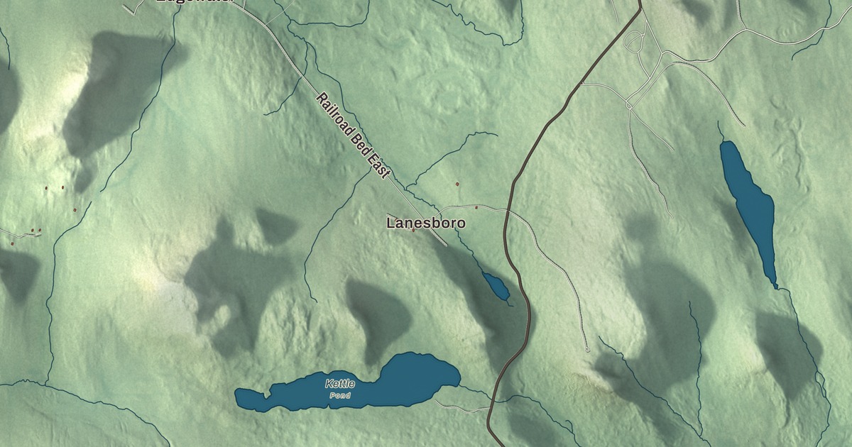
Marshfield reaches from the Winooski River and Route 2 south into the woods and ponds of Groton State Forest. This map prints New Discovery Road, Cabot Road, Maple Hill Road, Pigeon Pond Road, Bailey Pond Road and Jerusalem Road, with Lanesboro, Edgewater and Turtlehead Pond.
Marshfield is a town in Washington County, Vermont.
KNOWOL made this map in 2026 from public survey data and gave it the look of an old county atlas, shading the hills from United States Geological Survey elevation data and drawing the roads and town line from the Census Bureau. The town covers 43.4 square miles, and 1,583 people lived here at the 2020 census. Click here to purchase a print of this map for your wall.
Captain Marsh’s town
The town is named for Captain Isaac Marsh, who bought the original town site. Vermont granted it on October 18, 1782, and chartered it on June 22, 1790. Marshfield organized on March 10, 1800, while it still belonged to Caledonia County, and it stayed there until Washington County was organized in 1811. Stephen Pitkin was its first representative in the legislature, going in 1804 and serving through 1819 with a few years’ break. The village of Marshfield was incorporated in 1910.
The Martin Covered Bridge crosses the Winooski River off U.S. Route 2 in southern Marshfield, about a mile north of Plainfield village. Herman F. Townsend, a well-known local bridgewright, built it about 1890 on a private farm road, which makes it one of the few surviving 19th-century bridges in the state that began on a private road. It’s the only historic covered bridge left in town and is now open only to people on foot. Up on Hollister Hill Road, the Theodore Wood House, built in the 1880s, is the only known surviving work of the local builder Chester James Wood and the town’s only significant surviving example of Second Empire architecture.
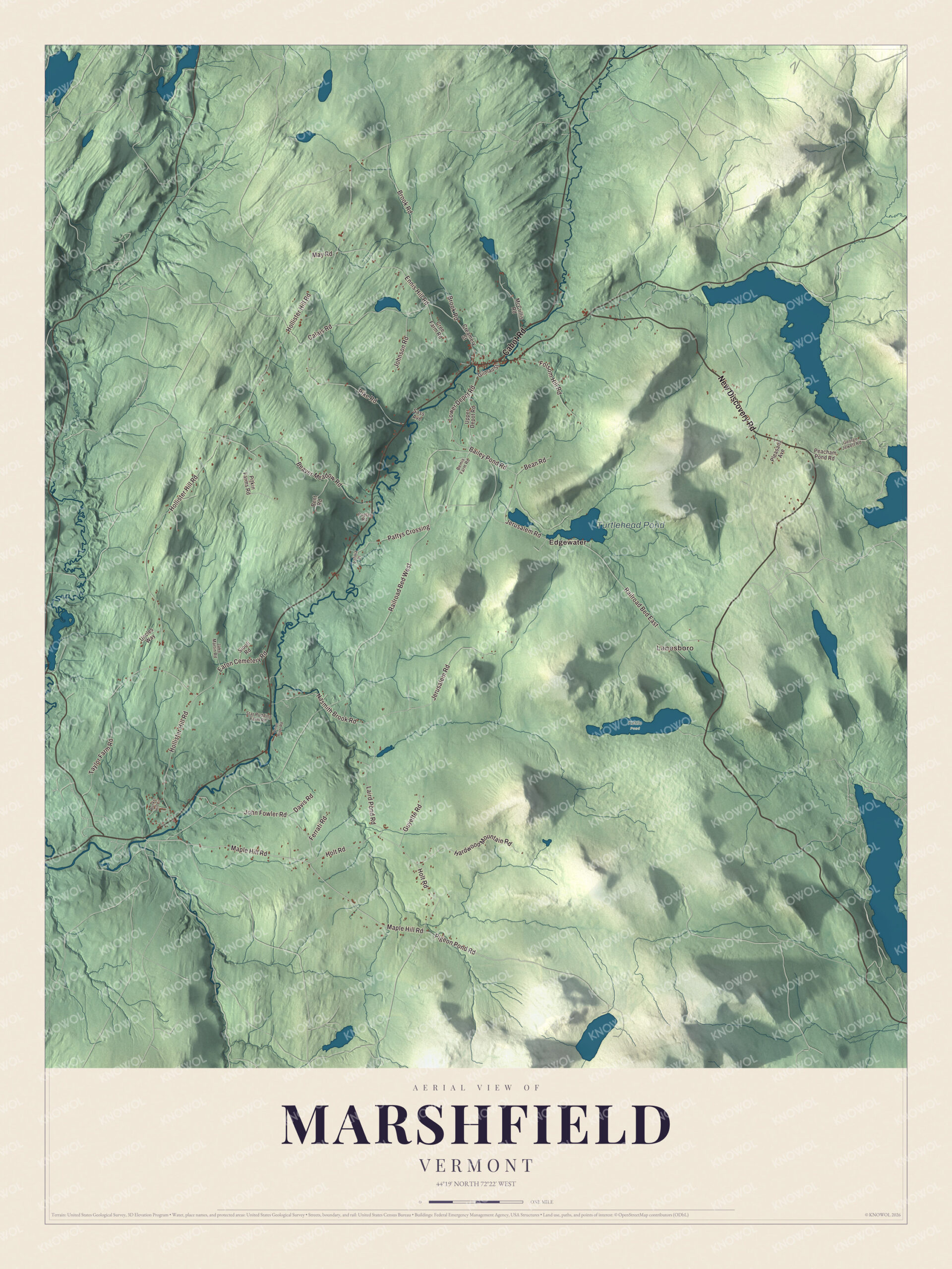
Click to explore a larger preview. The digital watermark does not appear on printed maps.
Names on this map
These names are printed on this map.
Places: Lanesboro, Turtlehead Pond, Kettle Pond and Edgewater.
Streets and roads: New Discovery Road, Cabot Road, Maple Hill Road, Pigeon Pond Road, Bailey Pond Road, Jerusalem Road, Ennis Hill Road, Lower Depot Road, Hollister Hill Road, Beaver Meadow Road, Brook Road, Calais Road.
More street names, A to Z
Bean Road, Bemis Farm Road, Bent Road, Bunker Hill Circle, Creamery Street, Cree Farm Road, Davis Road, Eaton Cemetery Road, Ferrati Road, Folsom Hill Road, George Jewett Road, Gilman Street, Guyette Road, Hardwood Mountain Road, Holt Road, Jake Martin Road, John Fowler Road, Johnson Road, Lafiria Place, Laird Pond Road, May Road, McCrillis Road, Nasmith Brook Road, Onion River Road, Pattys Crossing, Peacham Pond Road, Pike Road, Pitkin Farms Road, Pleasant Avenue, Poplar Road, Railroad Bed East, Railroad Bed West, Sass Avenue, Sioufi Road, Star Pudding Farm Road, Taylor Farm Road, Uncles Way, Upper Depot Road.
See it on a wall
The Marshfield map as a framed print. Swipe for more.


Ponds and forest
Part of Groton State Forest, 26,164 acres that stretch across seven towns, lies in Marshfield. Among the forest’s eight lakes and ponds is Turtlehead Pond, also called Marshfield Pond, 69 acres, and New Discovery State Park is one of its seven state parks. Vermont Route 232, once the Groton to Marshfield State Highway, runs through the forest from U.S. Route 302 in Groton and enters Marshfield, where its route page says it passes the junction with New Discovery Road and enters the hamlet of Lanesboro. It continues past Mollys Falls Pond to meet Route 2. That pond is a reservoir of 411 acres, also known as Marshfield Reservoir, made in the late 1920s by the Molly’s Falls Electric, Light and Power Company to generate electricity for the Marshfield area. The Vermont Land Trust bought the land around it in 2012, and in 2015 it became Molly’s Falls Pond State Park, which lies in Cabot and Marshfield.
Marshfield people
Levi P. Powers was born in Marshfield in 1828, moved to Wisconsin, and became a lawyer, editor, legislator and county judge there. The singer and conductor Larry Gordon made his home in Marshfield. He co-founded the Onion River Chorus in the late 1970s and founded Village Harmony in 1989, whose summer camps have taught traditional choral music to teenagers every year since 1990, and he’s credited with bringing shape note singing back to New England in the 1970s. Parts of the 1983 film of Robert Cormier’s novel I Am the Cheese were shot in Marshfield.
On the map, follow Cabot Road and New Discovery Road, then take Maple Hill Road, Pigeon Pond Road, Bailey Pond Road and Jerusalem Road. Lanesboro and Edgewater are printed, and so is Turtlehead Pond. Marshfield dates to 1790.
This map of Marshfield is made for everyone who calls Marshfield home, and it shows the town as it looks today, from the Winooski River to Turtlehead Pond. Hang it in an office, library or den, or use it to teach children the geography and history of their town. It’s printed on museum quality archival paper. Zoom in on the preview above to explore the details, then click here to get your copy of the Marshfield, Vermont map.

Sources
- Marshfield, Vermont, Wikipedia
- Town histories and representatives, M towns, Vermont Legislature
- List of municipalities in Vermont (page source), Wikipedia
- Martin Covered Bridge, Wikipedia
- Theodore Wood House, Wikipedia
- Groton State Forest, Wikipedia
- Vermont Route 232, Wikipedia
- Molly’s Falls Pond State Park, Wikipedia
- Levi P. Powers, Wikipedia
- Larry Gordon (musician), Wikipedia
- I Am the Cheese (film), Wikipedia