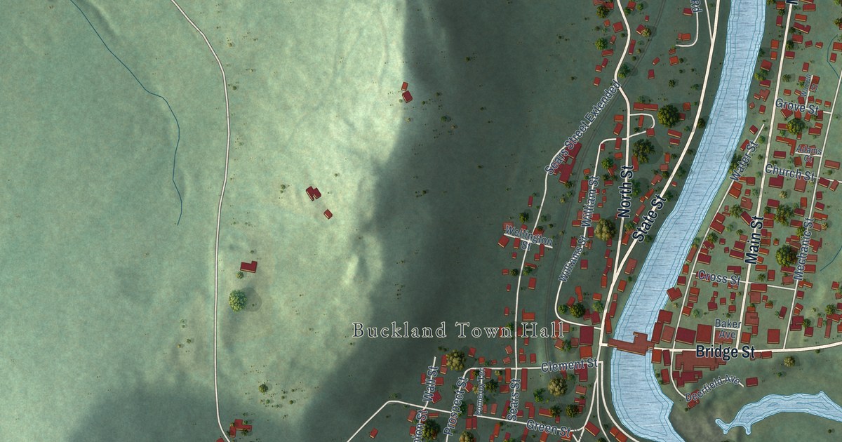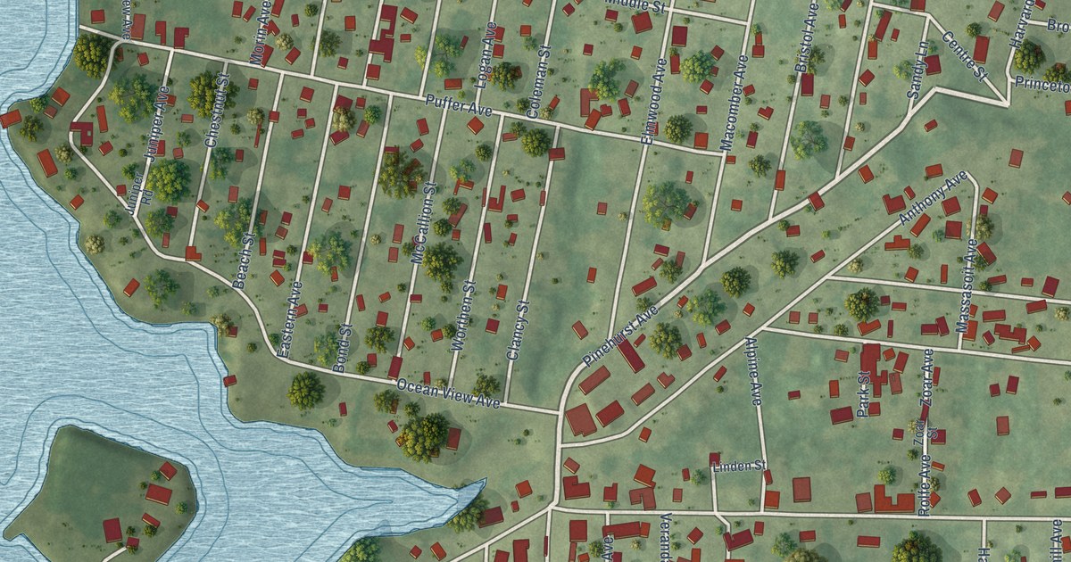
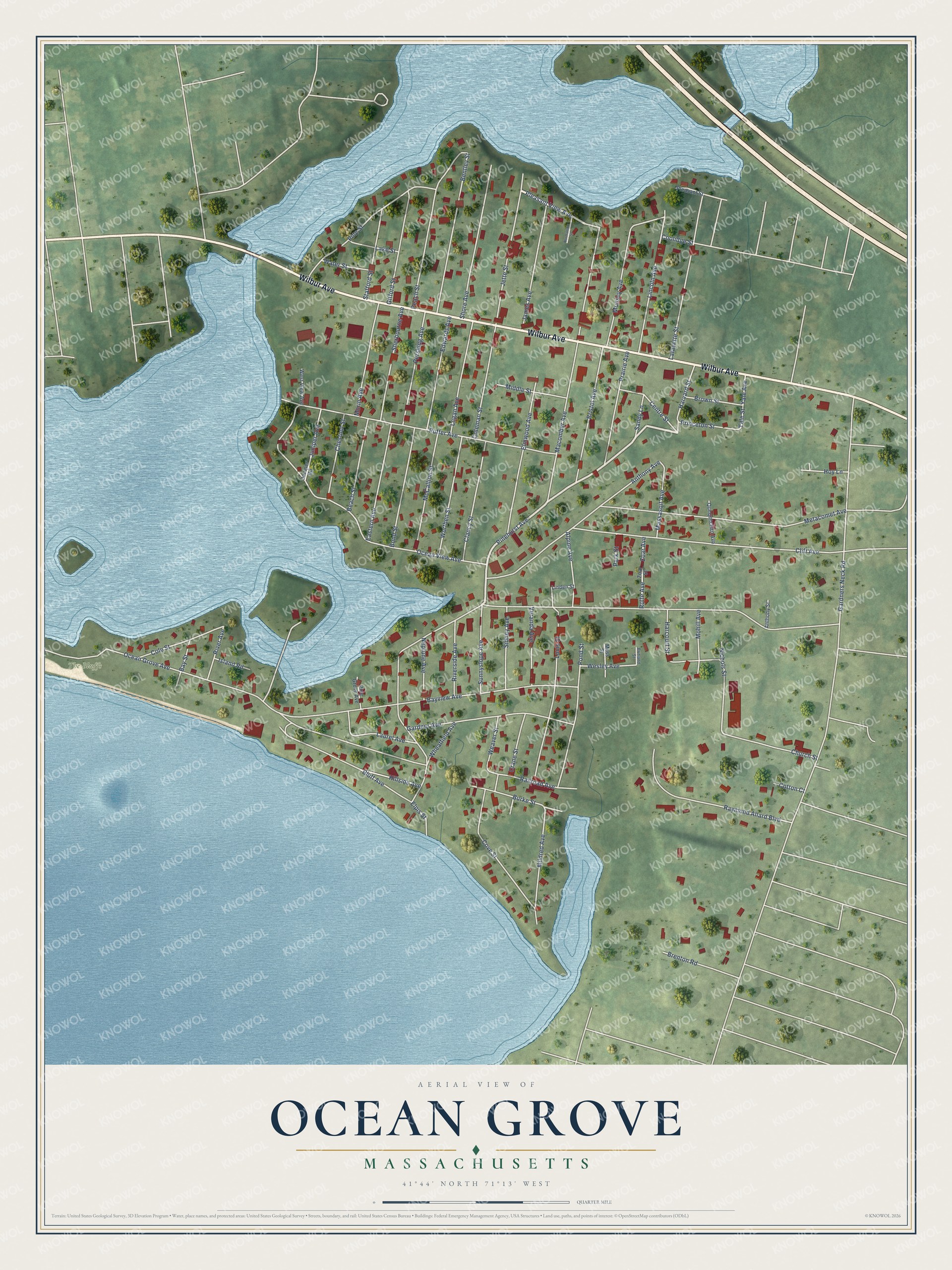
This beautifully detailed map of Ocean Grove, Massachusetts was created in 2026 using aerial imagery combined with modern topographical, census, street and landmark data. It's a modern aerial view of Ocean Grove in Bristol County, Massachusetts, that combines modern data with a vintage aesthetic. The roads feature printed names, and if you look closely you can find your exact house accurately shown in its correct location.
Explore an aerial view of Ocean Grove, Massachusetts
On this map you'll find The Bluffs, Wilbur Avenue, Pleasant View Avenue, Sandy Lane, Pinehurst Avenue, Ocean Grove Avenue, Gardners Neck Road, Ocean View Avenue, Macomber Avenue, Puffer Avenue, Cliff Avenue, Bluff Avenue, and more. Each red shape is a building, so zoom in on the preview and look for yours.
Ocean Grove is a community in Bristol County. The Census Bureau counted 2,904 people here in 2020. The map prints the town name in its title panel, with the coordinates below it.
Take a closer look at the Ocean Grove map
Names on this map
These names are printed on this map.
Places: The Bluffs.
Streets and roads: Wilbur Avenue, Pleasant View Avenue, Sandy Lane, Pinehurst Avenue, Ocean Grove Avenue, Gardners Neck Road, Ocean View Avenue, Macomber Avenue, Puffer Avenue, Cliff Avenue, Bluff Avenue, Metacomet Avenue.
More street names, A to Z
Alpine Avenue, Anthony Avenue, Anthony Street, Bay Street, Bayview Avenue, Beach Street, Bentley Street, Bond Street, Brenton Road, Bristol Avenue, Britland Street, Brown Street, Burke Street, Centre Street, Chestnut Street, Church Street, Clancy Street, Coleman Street, Cole Street, Coolidge Street, Cotton Court, Cove Street, Crane Street, Eastern Avenue, Edwards Avenue, Elmwood Avenue, Elpis Street, Gardner Avenue, Gifford Street, Harcourt Street, Harvard Street, Hillside Avenue, Hoy Lane, Island Road, James Avenue, Jette Street, Juniper Avenue, Juniper Road, Lafayette Street, Lake Street, Laurel Avenue, Lincoln Avenue, Linden Street, Logan Avenue, Louis Street, Massasoit Avenue, McCallion Street, Middle Street, Mildred Avenue, Mohill Avenue, Morin Avenue, Moss Street, Munsey Avenue, Neptune Avenue, Nichols Street, Normandin Street, Park Street, Peach Street, Pershing Avenue, Pine Grove Avenue, Pine Street, Pleasant Street, Pond Street, Prairie Avenue, Princeton Street, Quequechan Avenue, Railroad Avenue, Raymond Allard Boulevard, River Avenue, Riverside Avenue, Rolfe Avenue, Sherbourne Avenue, Shore Avenue, Sidney Avenue, Stafford Street, Sunnyslope Avenue, Veranda Avenue, Water Street, Weaver Street, Wesley Avenue, West View Avenue, Wheatfield Avenue, Worthen Street, Yale Avenue, Yale Street, Zoar Avenue, Zoar Street.
See it on a wall
The Ocean Grove map as a framed print. Swipe for more.


Created by KNOWOL in 2026. The buildings are small red shapes, the roads carry their printed names, and shaded relief shows the shape of the land. The title panel reads "AERIAL VIEW OF OCEAN GROVE, MASSACHUSETTS" with 41°44' NORTH 71°13' WEST.
It suits a den, a classroom or a front hall, and it makes a gift for anyone with Ocean Grove roots. Open the preview and find the block you know. See sizes and frames for the Ocean Grove map.