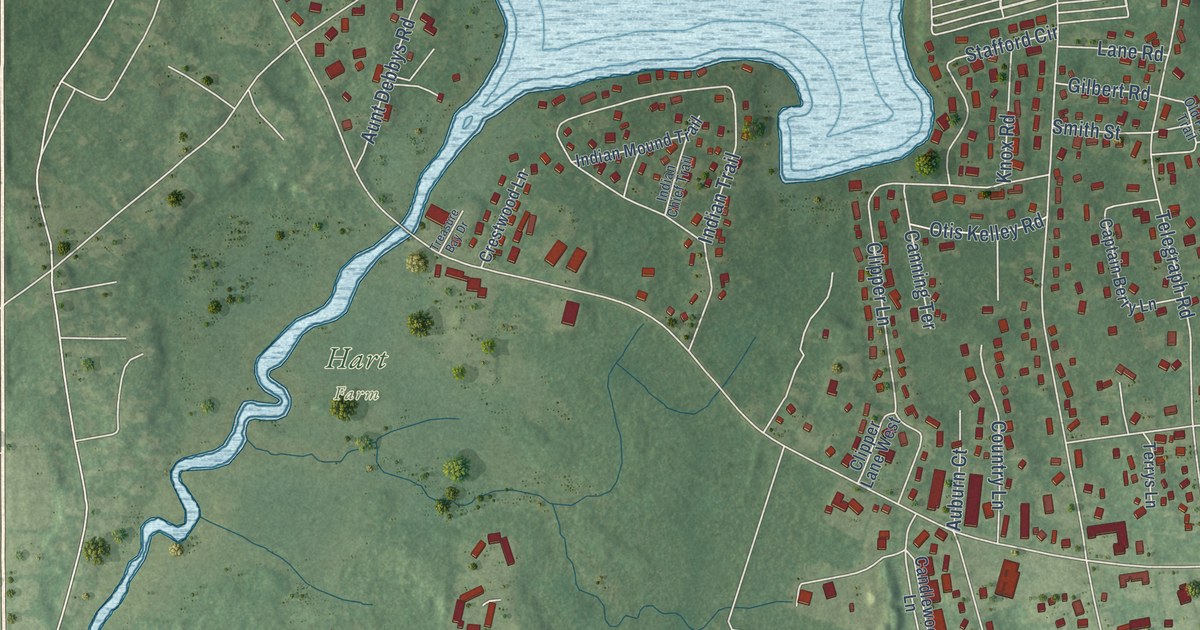
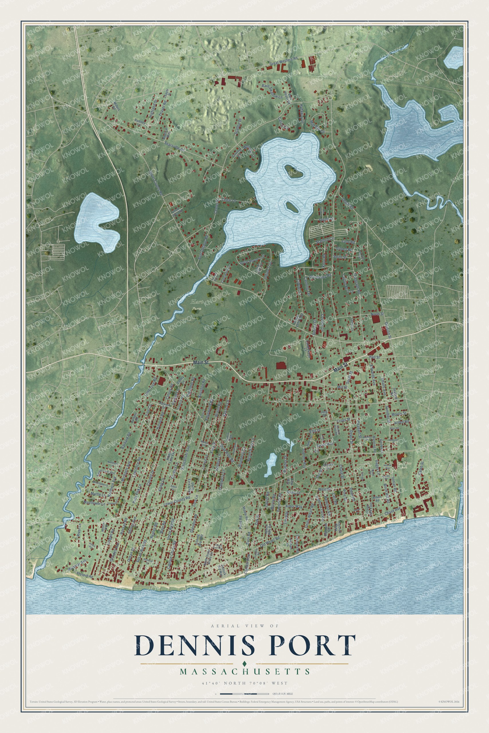
This beautifully detailed map of Dennis Port, Massachusetts was created in 2026 using aerial imagery combined with modern topographical, census, street and landmark data. It's a modern aerial view of Dennis Port in Barnstable County, Massachusetts, that combines modern data with a vintage aesthetic. The roads feature printed names, and if you look closely you can find your exact house accurately shown in its correct location.
Explore an aerial view of Dennis Port, Massachusetts
On this map you'll find Hart Farm, Sea View Park, Main Street, Yale Circle, Lorree Lane, Harvard Road, Hall Street, Gages Lane, Depot Street, Upper County Road, Center Street, Lower County Road, and more. Each red shape is a building, so zoom in on the preview and look for yours.
Dennis Port is a community in Barnstable County. The Census Bureau counted 3,487 people here in 2020. The map prints the town name in its title panel, with the coordinates below it.
Take a closer look at the Dennis Port map
Names on this map
These names are printed on this map.
Places: Hart Farm and Sea View Park.
Streets and roads: Main Street, Yale Circle, Lorree Lane, Harvard Road, Hall Street, Gages Lane, Depot Street, Upper County Road, Center Street, Lower County Road, Old Wharf Road, Sea Street.
More street names, A to Z
Adams Avenue, Albert Road, Arbor Way, Arden Road, Auburn Court, Aunt Debbys Road, Aunt Lauras Lane, Bain Road, Bambi Lane, Barnard Road, Barn House Road, Barn Road, Barn Swallow Lane, Bassett Lane, Bayberry Lane, Beach Hills Road, Beach Plum Lane, Beaten Road, Birch Hill Road, Blueberry Lane, Caleb Street, Calico Circle, Candlewood Lane, Canning Terrace, Captain Berry Lane, Captain Chase Road, Captain Row, Carodor Road, Carr Road, Cedar Lane, Chase Avenue, Chase Street, Clipper Lane, Clipper Lane West, Coffey Lane, Colony Road, Cornell Drive, Country Lane, County Circle, Cranberry Lane, Crestwood Lane, Cross Street, Cynthia Lane, Dean Road, Depot Road, Division Street, Drury Lane, Easy Street, Eden Lane, Edgewood Road, Edwards Avenue, Eldridge Lane, Ellis Drive, Fenway, Ferncliff Road, Fishing Rip Way, Flakeyard Road, Franklin Road, Garden Lane, Gilbert Road, Glendon Road, Gosling Lane, Great Western Road, Greeneedle Lane, Grindell Avenue, Hamilton Road, Harvard Drive, Hassan Road, Heintz Road, Helen's Way, Highbank Cart Way, Highbank Circle, Highland Street, Holiday Lane, Huckleberry Lane, Hydaway Lane, Indian Chief Trail, Indian Mound Trail, Indian Trail, Inman Road, James Street, June Terrace, Kibby Lane, Kibby Lane Extension, Knox Road, Lane Road, Laurel Road, Lawrence Road, Little Way, Lone Tree Road, Long Drive, Longell Road, Lora Lane, Manning Road, Marks End, Mayflower Lane, Michaels Avenue, Middle Road, Mild Bay Circle, Millers Road, Mill Street, Miramar Avenue, Morris Street, Myrtle Lane, Myrtle Road, Naushon Road, Nautical Way, Neil Road, Nipigon Lane West, Northern Avenue, Northern Lane, North Ocean Grove Circle, North Street, Oak Street, Ocean Drive, Ocean Park East, Old Pine Trail, Otis Kelley Road, Pelham Lane, Pine Street, Plashes Drive, Pleasant Street, Pollock Rip Way, Polly Fisk Lane, Pond Road, Puritan Lane, Ramsey Lane, Raycroft Parkway, Redwing Place, Regis Road, Rhyspah Road, Ribbon Reef Way, River Lane, Scallop Drive, Seafield Road, Searsville Road, Shad Hole Road, Shirley Avenue, Siasconset Avenue, Smalls Avenue, Smith Street, South Street, Spruce Way, Stafford Circle, Standish Way, Stanley Road, Summer Street, Sunken River Road, Sunset Lane, Supreme Way, Susan-Ruth Road, Telegraph Road, Terrys Lane, Thayer Road, Thayer Street, The Other Road, Tom's Path, Treasure Bay Drive, Uncle Ezra's Path, Uncle Joes Road, Uncle Rolf Road, Union Wharf Road, Vester Drive, Webster Way, West Street, Whistler Lane, Whortleberry Lane, Wixon Road, Wood Road.
See it on a wall
The Dennis Port map as a framed print. Swipe for more.


Created by KNOWOL in 2026. The buildings are small red shapes, the roads carry their printed names, and shaded relief shows the shape of the land. The title panel reads "AERIAL VIEW OF DENNIS PORT, MASSACHUSETTS" with 41°40' NORTH 70°08' WEST.
It looks right in a kitchen, an office or a den, and it's a gift for anyone who grew up in Dennis Port or moved away. Open the preview and find your street. See sizes and frames for the Dennis Port map.