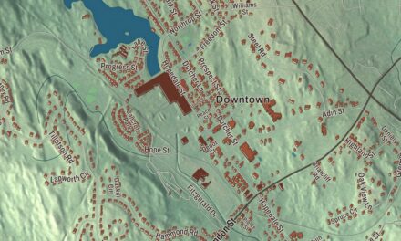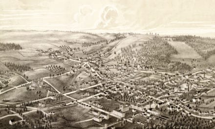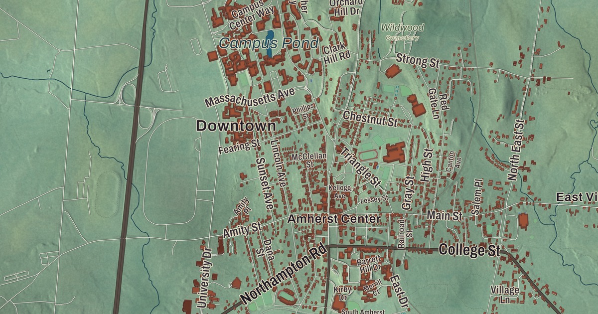
In Amherst, the local saying goes, “only the ‘h’ is silent,” a joke about both the way natives say the name, AM-erst, and the town’s politically active people. This map lays out the whole of it, with College Street, South Pleasant Street, West Street, Northampton Road, Belchertown Road and Montague Road printed by name, and the Fort River, Campus Pond at the university, Factory Hollow Pond, the Atkins Reservoir, East Village and Bare Mountain. Click here to purchase a print of this map for your wall.
Amherst is in Hampshire County, in the Connecticut River valley.
KNOWOL made this map in 2026 from public survey data and gave it the look of an old atlas. The shaded terrain comes from United States Geological Survey elevation data. The town’s high point, about 1,100 feet, sits on the northern shoulder of Mount Norwottuck in the Holyoke Range at the southern town line. The roads and the town line come from the Census Bureau. Amherst had 39,263 people at the 2020 census, the most of any town or city in Hampshire County.
From Hadley’s outlands to a town
The oldest known record of this land is a deed from December 1658, when John Pynchon of Springfield bought it from three native inhabitants, Umpanchla, Quonquont and Chickwalopp, for wampum and a coat. Nathaniel Dickinson surveyed the land for Hadley, Amherst’s mother town, by 1665. The Town of Amherst’s recorded history dates European settlement to 1703 in the state’s list, while the town page puts the first permanent English settlement in 1727. Amherst stayed part of Hadley, becoming a precinct in 1734 and a township in 1759, and it celebrated its 250th anniversary in 2009. The state’s list gives 1775 as the year Amherst was incorporated as a town. The colonial governor named it for Jeffery Amherst, 1st Baron Amherst, commander of the British forces in North America during the French and Indian War; his letter recommending smallpox-infected blankets against Native Americans has led to occasional efforts to rename the town. The town remains part of Hampshire County today. It has a council and manager form of government and counts as a city under state law, but it keeps “The Town of” in its official name.
Villages and mills
East Village was one of Amherst’s main civic and commercial centers until the railroad reached Amherst Center in 1853. A second parish was set up there in 1783, and the village did well in the first half of the 1800s from industry on the Fort River, just east of its center. The East Village Historic District, listed on the National Register in 1986, centers on the junction of Main and East streets and holds 49 buildings, among them the Daniel Kellogg House of 1758 and the Greek Revival Second Congregational Church of 1839. Up in northeastern Amherst, Cushman Village grew around the falls on the Mill River, where Nathaniel Kellogg was granted water rights for a gristmill in 1738, and mills run by the Cushman brothers led the local economy from about 1835 to 1930. North Amherst has a historic district of its own, and its page says the Henry Street salamander tunnels, which help spotted salamanders cross the road to reach their breeding pools, are the first amphibian tunnels in the United States.
Three colleges and a poet
Amherst is home to Amherst College, Hampshire College and the University of Massachusetts Amherst, three of the Five Colleges. The university began as Massachusetts Agricultural College, whose principal founder was William S. Clark. Its Campus Pond was made in the winter of 1890 and 1891, when two students dammed a stream to give the college natural ice for its dairy and orchards; the Fine Arts Center borders it to the south. Melvil Dewey devised the Dewey Decimal System while working as an assistant librarian at Amherst College in 1876, and Robert Frost taught at the college and retired here.
Emily Dickinson was born in 1830 in the Dickinson Homestead on Main Street, which her grandfather built in 1813, and she lived there from 1855 until her death in 1886. Her poems were found in her bedroom after she died. The Homestead and the Evergreens next door, built by her father for her brother Austin, are now the Emily Dickinson Museum, and the Homestead is a National Historic Landmark. Helen Hunt Jackson, author of Ramona and A Century of Dishonor, was also born in Amherst. Click here to learn more about the history of Amherst.
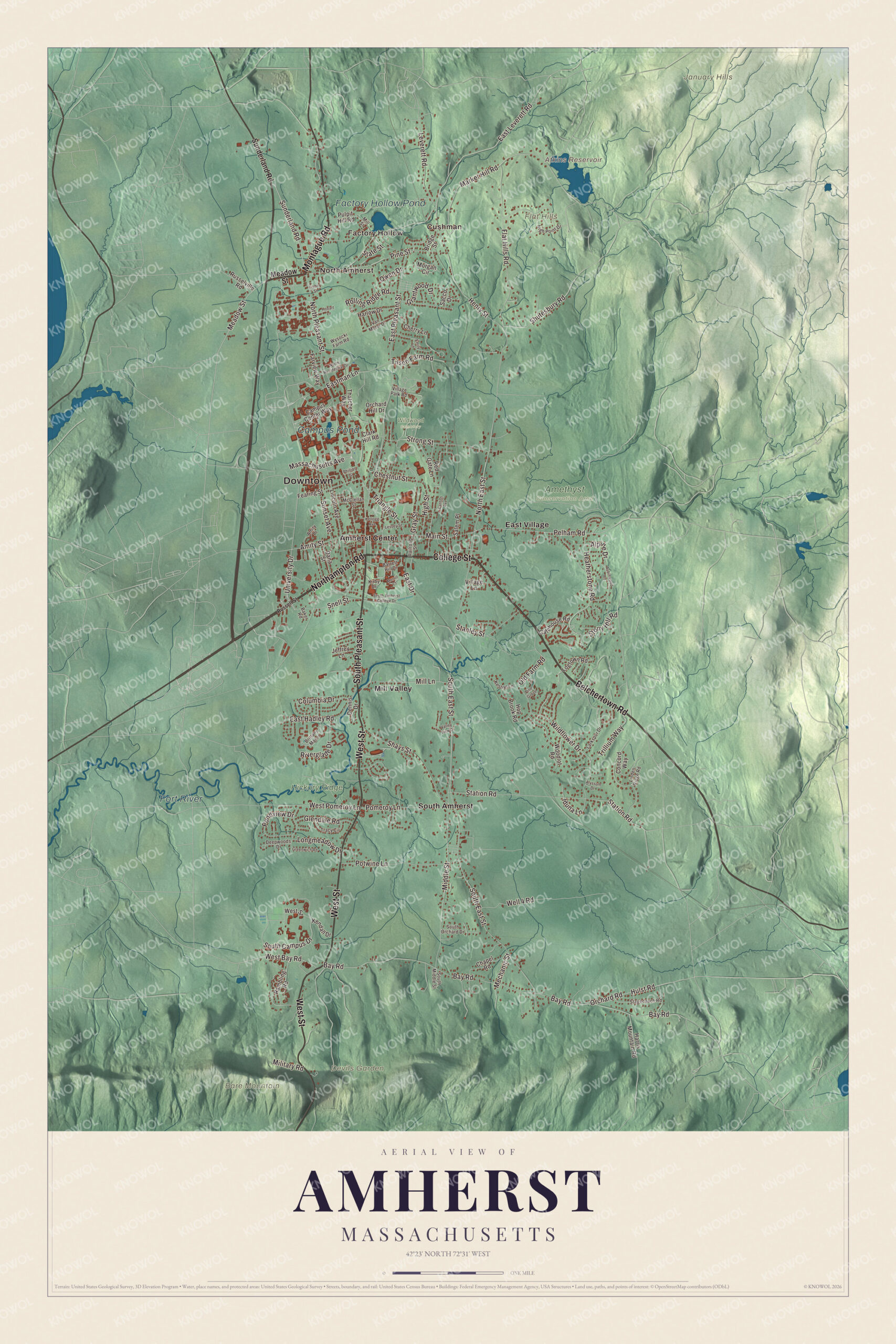
Click to explore a larger preview. The digital watermark does not appear on printed maps.
Names on this map
These names are printed on this map.
Places: Downtown, Factory Hollow, North Amherst, Cushman, Bare Mountain, Devils Garden, Flat Hills, January Hills, Atkins Reservoir, Factory Hollow Pond, Fort River, Campus Pond, Amethyst Conservation Area, Hickory Ridge, Wildwood Cemetery, Amherst Center, East Village, Mill Valley and South Amherst.
Streets and roads: Belchertown Road, Northampton Road, College Street, South Pleasant Street, Montague Road, West Street, Sunderland Road, Meadow Street, Market Hill Road, University Drive, Snell Street, Main Street.
More street names, A to Z
Alpine Drive, Alyssum Drive, Amity Place, Amity Street, Aubinwood Road, Baker Road, Barrett Hill Drive, Bay Road, Bridge Street, Brittany Manor, Campus Center Way, Canton Avenue, Chapel Road, Cherry Lane, Chestnut Street, Clark Hill Road, Columbia Drive, Concord Way, Dana Street, Deepwoods Drive, Dennis Drive, East Drive, East Hadley Road, East Leverett Road, Eastman Lane, East Pleasant Street, Emily Lane, Farview Way, Fearing Street, Fisher Street, Flat Hills Road, Gatehouse Road, Glendale Road, Grantwood Drive, Gray Street, Greenwich Road, Harlow Drive, Harris Mountain Road, Heatherstone Road, Henry Street, High Point Drive, High Street, Hobart Lane, Hop Brook Road, Hulst Road, Iduna Lane, Jeffrey Lane, Kellogg Avenue, Kendall Drive, Kestrel Lane, Kirby Drive, Larkspur Drive, Lessey Street, Leverett Road, Lincoln Avenue, Linden Ridge Road, Logtown Road, Longmeadow Drive, Massachusetts Avenue, McClellan Street, Mechanic Street, Merrill Court, Middle Street, Military Road, Mill Lane, Mill Street, Morgan Circle, North East Street, North Pleasant Street, North Residential Drive, Old Farm Road, Orchard Hill Drive, Orchard Road, Owen Drive, Pelham Road, Phillips Street, Pine Grove, Pine Street, Pomeroy Lane, Pondview Drive, Potwine Lane, Pulpit Hill Road, Railroad Street, Rambling Road, Red Gate Lane, Riverglade Drive, Rolling Ridge Road, Russell Street, Russelville Road, Sacco Drive, Salem Place, Shays Street, Shutesbury Road, South Amherst College Drive, South Campus Drive, South East Street, South Middle Street, South Orchard Drive, Stagecoach Road, Stanley Street, State Street, Station Road, Stony Hill Road, Strong Street, Sunset Avenue, Thatcher Way, Tilson Farm Road, Tracy Circle, Triangle Street, Trillium Way, Valley View Drive, Van Meter Drive, Village Lane, Village Park Road, Well 4 Road, West Bay Road, West Pomeroy Lane, Wildflower Drive, Woodlot Road, Wysocki Farm Road.
See it on a wall
The Amherst map as a framed print. Swipe for more.


Around the map
The Fort River has no dams at all, and its page calls it the longest free-flowing tributary of the Connecticut River. It starts as Adams Brook at a pond in Shutesbury and takes the name Fort River where Amethyst Brook joins it. Bare Mountain, 1,014 feet, is a bald peak of the Holyoke Range with wide views; it lies in Amherst and South Hadley, and its summit is within South Hadley, where it’s the town’s highest point. The Atkins Reservoir and Factory Hollow Pond are printed on the map too. Start with Factory Hollow, follow Belchertown Road, Northampton Road, College Street, South Pleasant Street, Montague Road or West Street across town, then look outward toward North Amherst, Cushman, Amherst Center, East Village and Mill Valley. Hadley lies to the west, Sunderland and Leverett to the north, Shutesbury, Pelham and Belchertown to the east, and Granby and South Hadley to the south.
This Amherst map makes an attractive addition to an office, library or den, and it can help teach children the geography and history of the town where Emily Dickinson wrote. It’s made for people who call Amherst home, from Factory Hollow to the Holyoke Range, and for everyone who studied here. KNOWOL created it in 2026, and it’s printed on museum quality archival paper. Zoom in on the preview above to explore the details, then click here to get your copy of the Amherst, Massachusetts map.

Sources
- Amherst, Massachusetts, Wikipedia
- East Village Historic District (Amherst, Massachusetts), Wikipedia
- Cushman Village Historic District, Wikipedia
- North Amherst, Massachusetts, Wikipedia
- Campus Pond (Amherst, Massachusetts), Wikipedia
- Emily Dickinson Museum, Wikipedia
- Fort River, Wikipedia
- Bare Mountain (Massachusetts), Wikipedia
- City and Town Incorporation and Settlement Dates, Secretary of the Commonwealth of Massachusetts (archived copy)