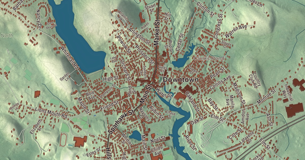
Amesbury grew up where the Powwow River drops over falls through the middle of town on its way to the Merrimack. This map prints the streets around it, Main Street, Market Street, Macy Street, Sparhawk Street, Pond View Avenue and Haverhill Road, along with Salisbury Point, Lake Attitash, Tuxbury Pond, Bailey Pond, Clarks Pond, and Batt Hill, Bear Hill and Beech Hill. Click here to purchase a print of this map for your wall.
Amesbury is in Essex County, on the north bank of the Merrimack River near its mouth.
KNOWOL made this map in 2026 from public survey data and gave it the look of an old atlas. The shaded terrain comes from United States Geological Survey elevation data; the highest ground is Powwow Hill, 331 feet, once a gathering place for powwows, with views to Maine and Cape Ann. The roads and the city line come from the Census Bureau. Amesbury had 17,366 people at the 2020 census, and it’s one of the two northernmost towns in Massachusetts, along with Salisbury next door.
Old Town and New Town
When English settlers came, the land north of the Merrimack was home to the Pentucket people of the Pennacook confederation, and the Powwow River, Powwow Hill and Lake Attitash still carry, or have been given back, native names. In 1638 the General Court created a plantation called Merrimac on the river’s north bank. It was named Colchester, then renamed Salisbury in 1640, perhaps at the suggestion of Christopher Batt of Salisbury, England, who trained the town’s militia. Settlers began taking up lots west of the Powwow, and in 1654 Salisbury agreed to split into Old Town and New Town, with the river as the line. The City of Amesbury’s recorded history dates European settlement to 1654, in the state’s list.
New Town still had to send its people to church in Old Town, several miles away, and settlers were fined for every meeting they missed. The burden grew so heavy that New Town built its own meeting house and asked the General Court for a preacher, and in 1666 the court granted it the liberty of a township. It was called New Salisbury at first, then Amesbury, after the English town of Amesbury next to Salisbury. Amesbury was incorporated as a town in 1668, on April 29. In 1876 Merrimac was formed from West Amesbury, and in 1886 Amesbury annexed West Salisbury, bringing the mill districts on both banks of the Powwow into one town. Amesbury became a city in 1996, and today Amesbury is a city in Essex County.
Carriages, hats and dories
The Powwow River drops about 90 feet through the center of Amesbury, and that gave the town its early water power. Textile mills and a nail factory rose at the falls in the 1800s. Beginning around 1800, Amesbury built carriages, a trade that grew into making automobile bodies. Leading makers included the Walker Body Company, the Briggs Carriage Company and Biddle and Smart, and the industry ended with the Great Depression. The Merrimac Hat Company, founded in 1856, became “one of the top hat producers in the nation,” as the town page puts it.
Lowell’s Boat Shop, at 459 Main Street on the Merrimack, dates to 1793, when Simeon Lowell built it, though its oldest standing buildings are from the 1860s. Its page says it’s considered the birthplace of the New England fishing dory. His grandson Hiram developed the simpler Banks dory that fishing fleets came to rely on, and a beam in the shop records that 2,029 boats were built there by hand in 1911 alone. It’s a National Historic Landmark and still a working boat shop and museum.
John Greenleaf Whittier, the poet and abolitionist, lived at 86 Friend Street from 1836 until his death in 1892 and wrote most of his work there, including Snow-Bound, in the Garden Room. The house is a National Historic Landmark and a museum. Josiah Bartlett was born in Amesbury in 1729; at the Continental Congress he was the first delegate asked to vote for independence, and he said yes. His page counts him the second signer of the Declaration of Independence, and a bronze statue of him stands in Amesbury’s town square. The “Doughboy,” a memorial by Leonard Craske, has stood in front of Amesbury Middle School since 1929, and the cartoonist Al Capp, creator of Li’l Abner, lived in Amesbury for most of his life.
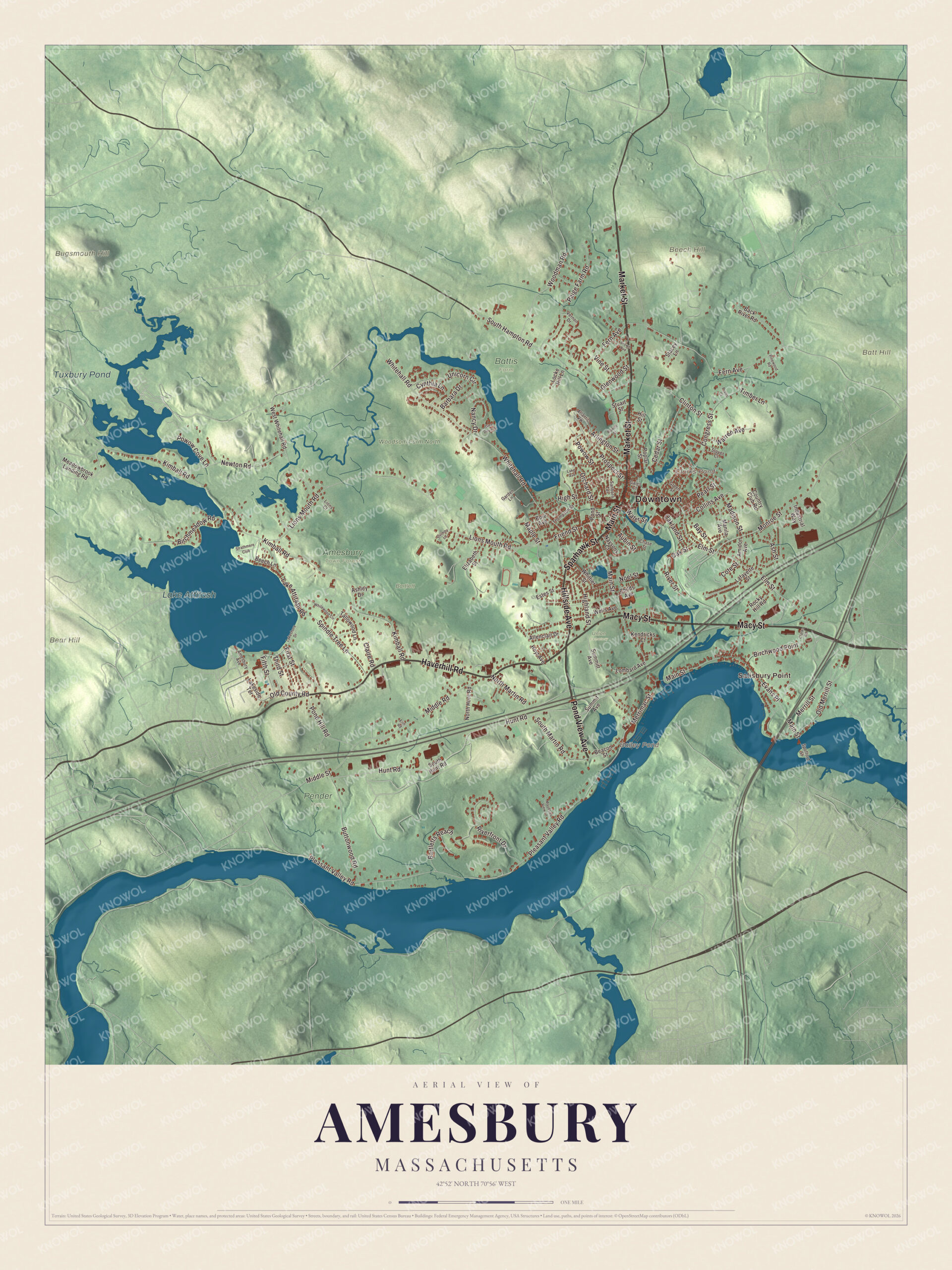
Click to explore a larger preview. The digital watermark does not appear on printed maps.
Names on this map
These names are printed on this map.
Places: Downtown, Salisbury Point, Batt Hill, Bear Hill, Beech Hill, Bugsmouth Hill, Bailey Pond, Clarks Pond, Lake Attitash, Tuxbury Pond, Amesbury Town Forest, Bartlett, Battis Farm, Pender Farm, Union Cemetery and Woodsom Farm North.
Streets and roads: Market Street, Pond View Avenue, Main Street, Macy Street, Haverhill Road, Sparhawk Street, Hillside Avenue, Elm Street, Kimball Road, Lions Mouth Road, Middle Street, Pleasant Valley Road.
More street names, A to Z
Allenclair Drive, Amesbury Avenue, Amidon Avenue, Arlington Street, Ashley Drive, Ash Street, Atlantic Vw, Aubin Street, Back River Road, Barbara Drive, Bartletts Reach, Bay Street, Beacon Street, Beech Lane, Birchmeadow Road, Birchwood Point, Boie Avenue, Brown Avenue, Buttonwood Road, Cedar Street, Chase Street, Childs Avenue, Claire Road, Clarks Road, Clinton Street, Collins Avenue, Congress Street, Cote Street, Country Club Road, Cynthia Lane, Elizabeth Street, Erin Road, Estes Street, Evans Place, Fern Avenue, Fifth Street, First Street, Friend Street, Gales Court, Garden Lane, Glen Devin Street, Glenwood Street, Green Street, Highland Street, High Street, Hill Street, Hoyt Avenue, Hunt Road, Industrial Way, Kendricks Court, Lafayette Street, Lake Attitash Road, Lake Avenue, Lakeshore Drive, Lakeside Terrace, Lions Court, Locke Hill Lane, Lombard Avenue, Madison Street, Manila Avenue, Maple Street, Maudsley View Lane, Meadowbrook Landing Road, Merrill Street, Merrimac Street, Middle Road, Monroe Street, Nancy Drive, Naysons Court, Newton Road, Noel Street, North Hunt Road, North Martin Road, Oakland Street, Oak Street, Old County Road, Old Merrill Street, Orchard Street, Paige Farm Road, Pearl Street, Pinewood Road, Pond Hill Road, Pond Street, Poplar Street, Powow Cove Lane, Powow Street, Pratts Court, Prospect Street, Quimby Lane, Riverfront Drive, River Street, Rocky Hill Road, Rowell Street, Sanborn Terrace, South Hampton Road, South Hunt Road, South Martin Road, Spindle Tree Lane, Spofford Street, Stacey Lane, Stover Court, Strathmere Club, Stuart Street, Summit Avenue, Summitt Avenue, Tallowood Lane, Third Street, Thompson Street, Timber Lane, Unicorn Circle, Vernon Drive, Vine Street, Warren Avenue, Water Street, Wells Avenue, West Whitehall Road, Whitehall Road, Whitewood Circle, Whittier Street, Woodman Road.
Ponds on the Powwow
The Powwow River comes in from New Hampshire through Tuxbury Pond, which straddles the state line with South Hampton and has two islands. Below the pond it winds along the state line before entering Massachusetts for good at Lake Gardner, then joins the Back River near the center of town. Lake Attitash, a 360-acre great pond shared with Merrimac, was once called Kimball’s Pond; its name is said to be the native word for huckleberry, and it supplies at least part of Amesbury’s water. Bailey Pond, Clarks Pond, Batt Hill, Bear Hill and Beech Hill are printed on the map too. Start with Salisbury Point, then follow Market Street, Pond View Avenue, Main Street, Macy Street, Haverhill Road or Sparhawk Street across the city. The town forest connects to Woodsom Farm.
Put this Amesbury map on the wall of an office, library or den, and use it to teach children the geography and history of the city of carriage makers, hat makers and dory builders. It’s made for people who call Amesbury home, from Lake Attitash to the Merrimack. KNOWOL created it in 2026, and it’s printed on museum quality archival paper. Zoom in on the preview above to explore the details, then click here to get your copy of the Amesbury, Massachusetts map.

We made a map for every town and city in Massachusetts. Explore the complete Massachusetts map collection and find your town.
Sources
- Amesbury, Massachusetts, Wikipedia
- Powwow River, Wikipedia
- Lowell’s Boat Shop, Wikipedia
- John Greenleaf Whittier Home, Wikipedia
- Josiah Bartlett, Wikipedia
- Lake Attitash, Wikipedia
- Tuxbury Pond, Wikipedia
- City and Town Incorporation and Settlement Dates, Secretary of the Commonwealth of Massachusetts (archived copy)