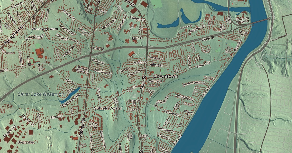
Agawam has two sections, Agawam and Feeding Hills, and residents generally accept Line Street as the border between them. This map prints the roads on both sides: Main Street, Springfield Street, Suffield Street, Southwick Street, and South Westfield Street and North Westfield Street, with Leonard Pond, Harts Pond, Spears Pond, the Silver Lake Reservoir, Kelly Hill, King Hill, Liswell Hill and Big Island. Click here to purchase a print of this map for your wall.
Agawam is in Hampden County, on the west side of the Connecticut River across from Springfield.
KNOWOL made this map in 2026 from public survey data and gave it the look of an old atlas. The shaded terrain comes from United States Geological Survey elevation data, and it rises highest on the western boundary, where Provin Mountain, a narrow traprock ridge of the Metacomet Ridge, holds the town’s highest point. The roads and the town line come from the Census Bureau. Agawam had 28,692 people at the 2020 census, and its ZIP code, 01001, is the lowest standard ZIP code in the contiguous United States.
Ten coats and ten hoes
The name comes from the native village on the river’s west bank, spelled many ways, from Agawam to Auguam. Its meaning is a guess; the town page offers “unloading place” or “fishcuring place,” perhaps for fish unloaded from canoes at Agawam Falls near the mouth of the Westfield River. On May 15, 1636, William Pynchon bought land on both sides of the Connecticut River from the Pocomtuc people known as Agawam. For the Agawam part he paid 10 coats, 10 hoes, 10 hatchets, 10 knives and 10 fathoms of wampum. The Town of Agawam’s recorded history dates European settlement to 1635, in the state’s list. Agawam and West Springfield left Springfield together as the parish of West Springfield in 1757, the two split in 1800, and Agawam was incorporated as a town in 1855, on May 17. The town remains part of Hampden County today, though it has a city form of government and the state’s list counts it among the communities that call themselves towns.
John Porter moved to Agawam in 1771 and founded a gin distillery nine years later. His grandson Harry carried it on as the H. Porter Distilling Company. The plant was sold in 1917; during Prohibition the building turned out potato chips and cider, and after repeal it made gin again until it closed for good in 1938. The building, on Main Street near River Road, later served as the town’s public works garage. The Agawam Woolen Mill on Elm Street dates to 1812, and after a fire it was rebuilt in brick in 1889; that building still exists.
Two town halls
The first Agawam town hall went up in 1874 at the corner of Main and School streets. Like today’s town hall it held the town offices, and the town’s first library was in its Tower Room. Feeding Hills had a town hall of its own from 1906, almost identical to Agawam’s, at the corner of Springfield and South Westfield streets. Both are gone now; Benjamin Phelps Elementary School stands on the first site and the Clifford M. Granger Elementary School on the second. Feeding Hills keeps its own ZIP code and post office, and in the early to middle 1800s a ditch was dug along Line Street to separate the two sections. Feeding Hills holds about a quarter of the town’s people, many moderate-sized farms and Provin Mountain, where WWLP television has kept its transmitter since signing on in 1953.
Feeding Hills is the birthplace of Anne Sullivan, born there in 1866. Nearly blind from an eye disease she caught at five, she was educated at the Perkins School for the Blind and became Helen Keller’s teacher and lifelong companion. Benjamin Wade, a United States senator from Ohio and a Radical Republican, was born in Feeding Hills in 1800.
Biplanes, Seabiscuit and Riverside
Bowles Agawam Airport held “grand openings” on May 29, 1930, and June 1, 1931, the second with a visit from 100 biplanes of the Army Air Corps. A horse track was built beside the airport, and in October 1935 Seabiscuit won the Springfield Handicap there in track record time. The track ran until 1938, the airport flew until 1982, and both were torn down in the late 1980s for an industrial park. On the Connecticut River, the amusement park long known as Riverside Park began as a picnic grove and is now Six Flags New England, which its page calls the oldest amusement park in the Six Flags chain.
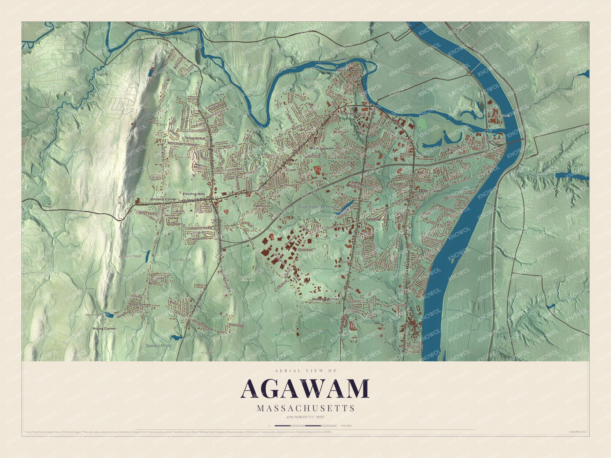
Click to explore a larger preview. The digital watermark does not appear on printed maps.
Getting around Agawam
Start with Shea Corner. Follow Main Street, Suffield Street, Springfield Street, Southwick Street, South Westfield Street or North Westfield Street across town, then look outward toward Feeding Hills, Hubbard Corner, Johnson Corner, North Agawam and O’Briens Corner. Harts Pond, Leonard Pond, the Silver Lake Reservoir, Spears Pond, Kelly Hill, King Hill, Liswell Hill and Big Island are all printed on the map. West Springfield lies to the north, Springfield to the northeast, Longmeadow to the east, Suffield, Connecticut, to the south, Southwick to the west and Westfield to the northwest. The Metacomet-Monadnock Trail follows Provin Mountain’s ridge.
Hang this Agawam map in an office, library or den, and use it to teach children the geography and history of the place where Anne Sullivan was born and Seabiscuit set a track record. It’s made for people who call Agawam home, on either side of Line Street. KNOWOL created it in 2026, and it’s printed on museum quality archival paper. Zoom in on the preview above to explore the details, then click here to get your copy of the Agawam, Massachusetts map.

We made a map for every town and city in Massachusetts. Explore the complete Massachusetts map collection and find your town.
Sources