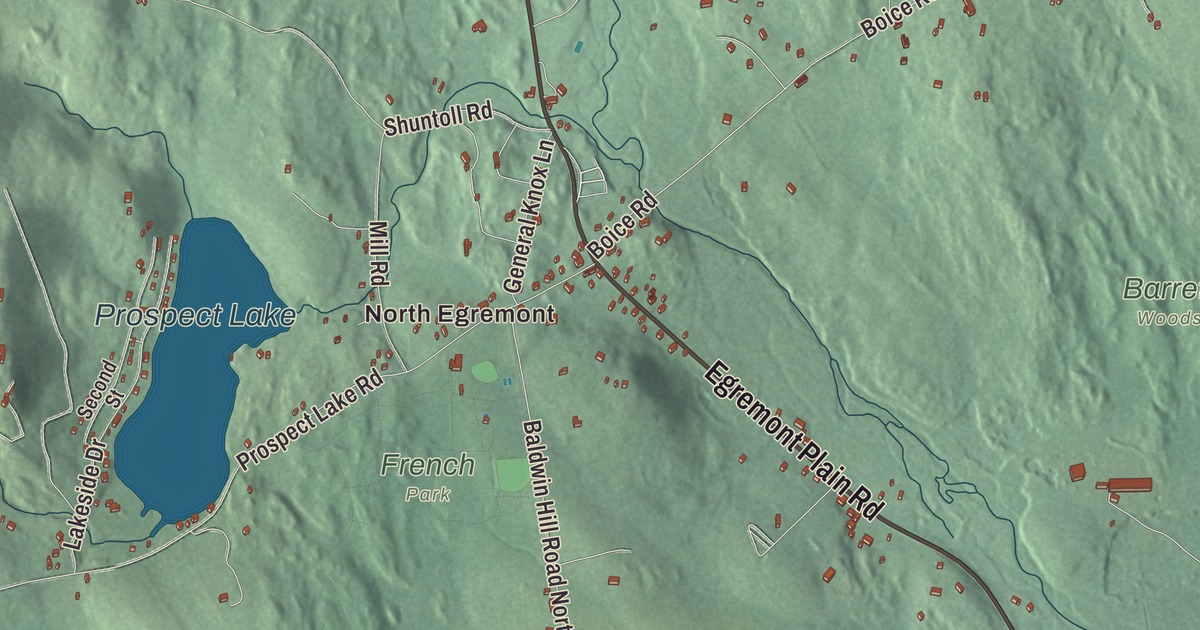
Egremont is two villages and a lot of open country between them, on the far western edge of Massachusetts, with New York just over the mountains. This map prints Hillsdale Road, Egremont Plain Road, North Undermountain Road, Main Street, Ox Bow Road and Mount Washington Road, with Prospect Lake, Davis Pond, Harman Marsh Pond, Marsh Pond and Baldwin Hill. Click here to purchase a print of this map for your wall.
Egremont is in Berkshire County, on the state’s western border.
KNOWOL made this map in 2026 from public survey data and gave it the look of an old atlas. The relief comes from United States Geological Survey elevation data, and the roads and the town line come from the Census Bureau. Egremont covers 18.9 square miles in a valley east of the Taconic Range. Alford lies to the north, Great Barrington to the east, Sheffield to the southeast and Mount Washington to the southwest, while Copake and Hillsdale, New York, sit across the state line to the west. The town had 1,372 people at the 2020 census.
Dutch farmers and a Revolutionary road
The Town of Egremont’s recorded history, in the Secretary of the Commonwealth’s list, dates European settlement to 1730 and gives 1775 as the year Egremont was incorporated as a town. The town’s own page tells it a little differently: Dutch settlers from New York came first, in 1722, English settlers followed a few years later, and Massachusetts incorporated the town in 1761. Nobody is sure whether the name comes from the English town of Egremont or from Charles Wyndham, the Earl of Egremont, who handled the American colonies for the Crown at the time. Egremont remains part of Berkshire County today, and for most of its history it’s been a farming town, with only a small mill area around South Egremont.
Around New Year’s Day of 1776, Henry Knox came through town hauling the cannons from Fort Ticonderoga that would help end the Siege of Boston. His route is now called the Knox Trail, and a historical marker stands in North Egremont. The two states put up its plaques in 1926 and 1927. In 1975 the markers between Kinderhook, New York, and Alford were updated, after new research backed up what North Egremont’s postmaster, Joseph Elliott, had argued: Knox didn’t pass through Claverack, New York.
Two villages on two turnpikes
North Egremont grew up at a crossroads. A tavern went up there in 1790, served by saw and grist mills on Prospect Lake, and the village took shape after two turnpikes were built, one from Hillsdale, New York, toward Alford (today’s Prospect Lake Road) and one in 1803 from South Egremont to Kinderhook, New York (today’s Route 71). A general store opened in 1814 and is still in business as the Old Egremont Country Store. The North Egremont Historic District takes in about 236 acres around the junction, with a house that has parts dating to 1764, a Baptist meetinghouse from 1816, an 1861 Methodist church and the 1880 North Egremont School.
South Egremont owes its shape to the turnpike the state built through it in 1801, now Route 23. Travelers stopped there, and small shops along Karner Brook turned out shoes and carriage axles. The Mt. Everett Academy opened in 1832 as the town’s first secondary school, and the Egremont Village Inn, built in 1780, was moved in 1801 to sit closer to the new road. The village has changed so little that of the 55 buildings drawn on an 1844 map, 44 still stand. In the 1930s Hugh Smiley founded Olde Egremont to keep that streetscape as it was, and the South Egremont Village School of 1880 is counted as one of the last one-room schoolhouses in continuous operation in the United States.
The Burghardts of Egremont Plain
By the early 1800s, the Black Burghardt family had settled in the Egremont Plain area, a few miles outside the center of Great Barrington. W. E. B. Du Bois, the scholar and civil rights leader who helped found the NAACP, came from that family. He spent the first five years of his life in his grandfather Othello Burghardt’s house, and in 1928 he wrote of it as “a delectable place.” He went on to become the first African American to earn a doctorate at Harvard. The site of that house, the W. E. B. Du Bois Boyhood Homesite on South Egremont Road, is a National Historic Landmark, and its page places it in Great Barrington.
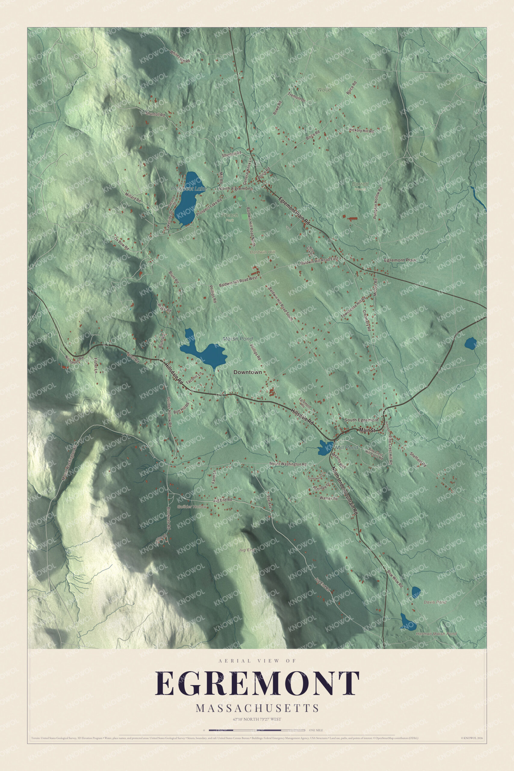
Click to explore a larger preview. The digital watermark does not appear on printed maps.
Names on this map
These names are printed on this map.
Places: Downtown, North Egremont, Egremont Plain, South Egremont, Baldwin Hill, Guilder Hollow, Jug End, Davis Pond, Harman Marsh Pond, Prospect Lake, Marsh Pond, Mill Pond, Barrett Woods, French Park and Wolfe.
Streets and roads: Hillsdale Road, Egremont Plain Road, North Undermountain Road, Main Street, Baldwin Hill Road East, Ox Bow Road, Mount Washington Road, Pumpkin Hollow Road, Guilder Hollow Road, Jug End Road, Baldwin Hill Road South, Townhouse Hill Road.
More street names, A to Z
Baldwin Hill Road North, Baldwin Hill Road West, Blunt Road, Boice Road, Bott Hill Road, Bow Wow Road, Brookvale Road, Buttonball Lane, Creamery Road, Egremont Heights, Farm Lane, Fisher Lane, General Knox Lane, Greenwood Circle, Hickory Hill Road, Hilltop Road, Lakeside Drive, McGee Road, Mearns Way, Millard Road, Miller View Road, Mill Road, Nicholson Road, Partridge Drive, Phillips Road, Pine Crest Hill Cross Road, Pine Crest Hill Road, Prospect Lake Road, Ridge Road, Rowe Road, Second Street, Sheffield Road, Shuntoll Road, Taconic Lane, The Avenue, Tremont Drive, Tyrell Road, Warner Road, Whites Hill Road.
Mountains on the west side
Mount Whitbeck divides Egremont from the town of Mount Washington, and Mount Fray and its neighbors stand between the town and New York. Catamount, the ski area on Mount Fray, opened in 1939 with three rope tows, and its slopes run across the state line into Hillsdale. Its summit is in Massachusetts, while part of its ski terrain is in New York. Mount Whitbeck and the Jug End make up the Jug End State Reservation and Wildlife Management Area, where the Appalachian Trail passes through before turning east toward Great Barrington. The reservation sits on the site of the old Jug End Barn ski resort, which ran from 1938 until it closed for good in 1983 and has since been left to grow back wild. The Green River, a branch of the Housatonic, runs through town.
Around the map
Start with North Egremont, then follow Hillsdale Road, Egremont Plain Road, North Undermountain Road, Main Street, Ox Bow Road and Mount Washington Road across town. The old mills of North Egremont stood on Prospect Lake. Look outward toward Egremont Plain and South Egremont, and find Guilder Hollow in the hills. Davis Pond, Harman Marsh Pond, Prospect Lake, Marsh Pond and Baldwin Hill are all printed on the map.
The Egremont map makes a fine addition to an office, library or den, and it can help teach children the geography and history of a valley town on the New York line. It’s made for people who call Egremont home, from North Egremont to South Egremont, and it shows the town as it looks today. Zoom in on the preview above to explore the details, then click here to get your copy of the Egremont, Massachusetts map.

We made a map for every town and city in Massachusetts. Explore the complete Massachusetts map collection and find your town.
Sources
- Egremont, Massachusetts, Wikipedia
- Henry Knox Trail, Wikipedia
- North Egremont Historic District, Wikipedia
- South Egremont Village Historic District, Wikipedia
- W. E. B. Du Bois Boyhood Homesite, Wikipedia
- Catamount Ski Area, Wikipedia
- Jug End State Reservation and Wildlife Management Area, Wikipedia
- City and Town Incorporation and Settlement Dates, Secretary of the Commonwealth of Massachusetts (archived copy)