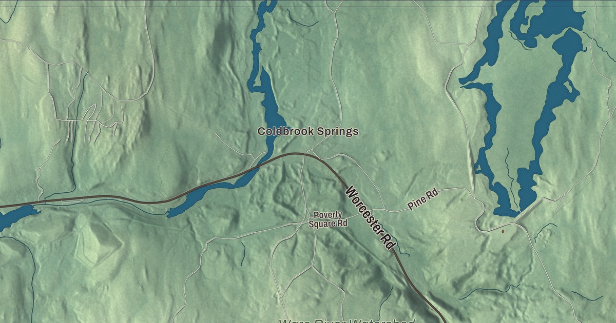
Oakham’s town center grew up around the crossroads of Coldbrook Road and Ware Corner Road. This map prints both, along with Old Turnpike Road, Worcester Road, Pine Road and North Brookfield Road, and with Browning Pond, Long Pond and Dean Pond. Click here to purchase a print of this map for your wall.
Oakham is in Worcester County.
KNOWOL made this map in 2026 from public survey data, with the look of an old atlas sheet. United States Geological Survey elevation data shapes the hills, and the Census Bureau supplied the streets and the town line. Oakham covers 21.5 square miles in western Worcester County and had 1,851 people at the 2020 census. Barre lies to the northwest, Rutland to the northeast, Paxton to the southeast, Spencer to the south and New Braintree to the southwest. Oakham, New Braintree, Spencer and North Brookfield share a town corner, but it sits within feet of Brooks Pond, so there’s no direct way from Oakham to North Brookfield there.
Oakhampton
The Town of Oakham’s recorded history, in the Secretary of the Commonwealth’s list, dates European settlement to 1749, when colonists settled here as part of Rutland. The town was first named Oakhampton, and the name was changed for a reason no one knows. The town page gives 1762 for its incorporation; Oakham was incorporated as a town in 1775 by the state’s list, and the historic district’s page agrees. Settlement was spread out and agricultural at first. The town center began to take shape in 1770, when William Hunter gave land near a crossroads for a church, a school, an animal pound and a burying ground. Residents are known as Oakhamites.
The Oakham Center Historic District, listed on the National Register in 2020, keeps houses from the early 1800s, many of which once had small workshops, and the oldest house in the village, a Georgian Cape of about 1790 on Coldbrook Road. The Congregational church was built in 1814 and given its Greek Revival look in the 1840s. Nearby stands the Fobes Memorial Library, paid for by the Fobes family and built of fieldstones that townspeople gave from their own land. The public library itself dates to 1892.
Coldbrook Springs
Near the Barre line, the village of Coldbrook Springs grew up at a natural iron spring. A railroad depot was built nearby in the 1830s, and the village came to have a hotel, a tavern, a medicinal spa and a number of houses. The area is part of the Ware River Watershed and now part of the state forest, cleared of all its buildings for the Quabbin Reservoir aqueduct system. On Old Turnpike Road stands the West Brick School, built about 1827 and one of the town’s few surviving nineteenth-century brick buildings; it closed as a school in 1920, became a summer retreat in 1936, and the town bought it in 2002. The town remains part of Worcester County today.
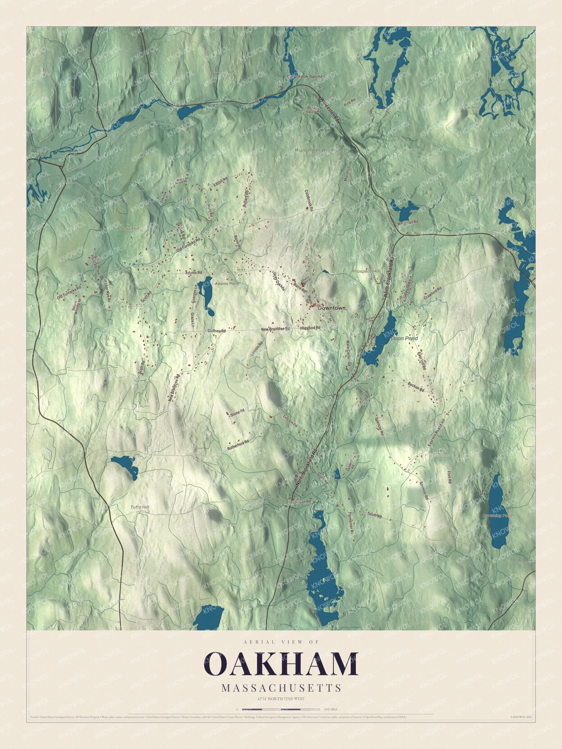
Click to explore a larger preview. The digital watermark does not appear on printed maps.
Names on this map
These names are printed on this map.
Places: Downtown, Coldbrook Springs, Oak Hill, Prospect Hill, Rocky Hill, Tufts Hill, Adams Pond, Browning Pond, Long Pond, Dean Pond, Eva's Woods, Oakham State Forest and Ware River Watershed.
Streets and roads: North Brookfield Road, Worcester Road, Ware Corner Road, Pine Road, Old Turnpike Road, Coldbrook Road, New Braintree Road, Spencer Road, Lincoln Road, South Road, East Hill Road, East Hill Road East.
More street names, A to Z
Adams Road, Barre Plains Road, Barre Road, Bechan Road, Bullard Road, Crawford Road, Crocker Nye Road, Deacon Allen Drive, Dennis Whitney Road, Edson Road, Farm Pond Road, Flint Road, Forest Hill Drive, Gaffney Road, Georges Lane, Grace Lane, Gray Oaks Lane, Hapgood Road, Happy Hollow Road, Hunt Road, Maple Street, Marsh Lane, Oakview Lane, Parmenter Road, Pine Lane, Poverty Square Road, Robinson Road, Rutherford Road, Rutland Road, Sanders Road, Scott Road, Skyline Road, Stone Road, Tomlinson Road, Whitehall Road.
See it on a wall
The Oakham map as a framed print. Swipe for more.


Around the map
Start with Coldbrook Springs. Follow North Brookfield Road, Worcester Road, Ware Corner Road, Pine Road, Old Turnpike Road and Coldbrook Road across town. Adams Pond, Browning Pond, Long Pond, Dean Pond, Oak Hill, Prospect Hill and Rocky Hill are all printed on the map. Browning Pond is an 89-acre great pond in Oakham and Spencer, the headwaters of the Seven Mile River, with an old copper mine shaft in the middle of it and a boat ramp at its southwest corner. A ridge in Rutland State Park divides the waters there: north of it they flow into Long Pond and the Ware River watershed, and south of it into Browning Pond.
The Oakham map is a fine addition to an office, library or den, and it can help teach children the geography and history of a small town in western Worcester County. It’s made for anyone who calls Oakham home, from Coldbrook Springs to Browning Pond, and it shows the town as it looks today. Zoom in on the preview above to explore the details, then click here to get your copy of the Oakham, Massachusetts map.

Sources