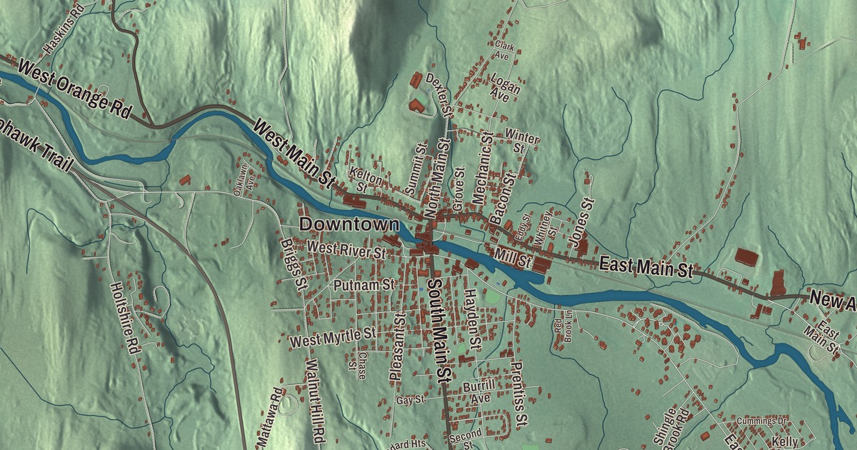
Orange’s center was settled where a bridge crossed the Millers River. This map prints the town’s roads today, East Main Street, West Main Street, Daniel Shays Highway, Mohawk Trail, New Athol Road and West Orange Road, with Lake Mattawa, Hastings Pond and Gales Pond. Click here to purchase a print of this map for your wall.
Orange is in Franklin County.
KNOWOL made this map in 2026 from public survey data and gave it the feel of an old atlas. United States Geological Survey elevation data raises the hills, and the Census Bureau supplied the streets and the town line. Orange covers 36.0 square miles, the easternmost town in Franklin County along the Worcester County line, and had 7,569 people at the 2020 census. The Millers River flows through the center of town, swamps dot much of the northern half, and Chestnut Hill in the south is the town’s highest point. Royalston lies to the northeast, Athol to the southeast, New Salem to the south, Wendell to the southwest, a bit of Erving to the west and Warwick to the northwest.
A mill town on the Millers
The Town of Orange’s recorded history, in the Secretary of the Commonwealth’s list, dates European settlement to 1746, on land taken from Royalston, Warwick and Athol. The land wasn’t fully settled until late in the century. It became the District of Orange in 1783, named for William, Prince of Orange, and Orange was incorporated as a town in 1810. The center was settled around 1785, when a bridge was built across the Millers River. In 1790 the river was dammed, and industry began in what had been a farming community; by 1840 Orange was thought of as a mill town, and the railroad’s arrival in 1846 sped its growth.
Orange became widely known in the second half of the 1800s for sewing machines. William Barker and Andrew J. Clark moved their sewing machine plant here in 1867, and in 1882 the company took the name New Home. By the late nineteenth century it was the largest industry in town, turning out 1.2 million machines at its peak in 1892. William L. Grout, who had made sewing machines under the New Home name, set his three sons up in business, and Grout Brothers built cars in Orange, steam-powered at first; the Grout name went on them in 1899, and the last were made in 1912. The town page says the Grout is considered the first automobile built in a factory in the United States. The Orange Historical Society Museum keeps two of them. The town also made turbines, boxes, shoes, tools and tapioca.
It Shall Not Be Again
In Memorial Park stands the Massachusetts Peace Statue, a bronze by Joseph Pollia dedicated on May 30, 1934, in honor of the town’s World War I veterans. A weary soldier back from France sits on a stump with his arm around a schoolboy, and the base carries the words “It Shall Not Be Again” and eleven stars for the eleven young men from Orange who died in the war. On February 25, 2000, the legislature named it the official peace statue of the Commonwealth. The Orange airport opened as the Orange-Athol Airport in 1929, and in the 1970s Jerry Bird’s skydiving team moved there and became the Wings of Orange, setting a world record in 1974. More recently the town stood in for Castle Rock in the Hulu series based on Stephen King’s work. The town remains part of Franklin County today.
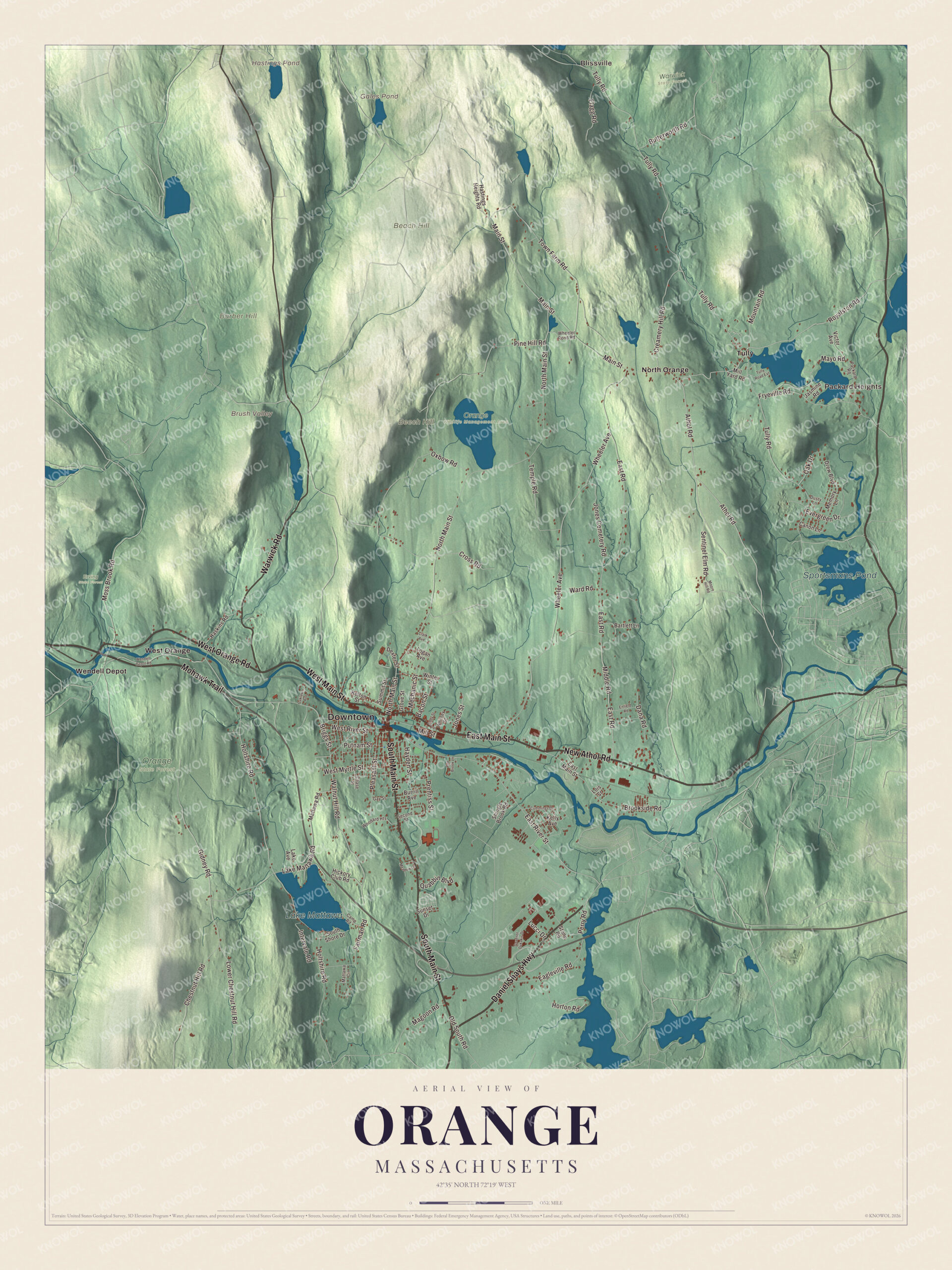
Click to explore a larger preview. The digital watermark does not appear on printed maps.
Names on this map
These names are printed on this map.
Places: Downtown, Blissville, Packard Heights, Barber Hill, Beach Hill, Beech Hill, Brush Valley, Gales Pond, Hastings Pond, Lake Mattawa, Sportsmans Pond, Erving State Forest, Orange State Forest, Orange Wildlife Management Area, Warwick State Forest, North Orange, Tully, Wendell Depot and West Orange.
Streets and roads: Daniel Shays Highway, East Main Street, West Main Street, New Athol Road, West Orange Road, Mohawk Trail, Warwick Road, South Main Street, Athol Road, Royalston Road, Brookside Road, West River Street.
More street names, A to Z
Bacon Street, Bartlett Lane, Briggs Street, Burrill Avenue, Butterworth Road, Camp Road, Canon Lane, Chase Street, Chestnut Hill Road, Clark Avenue, Creamery Hill Road, Cross Road, Cummings Drive, Dana Road, Dexter Street, Drew Boulevard, Dusty Lane, Eagleville Road, East River Street, East Road, Eddy Street, Enfield Road, Evergreen Drive, Fairman Road, Flagg Road, Fryeville Road, Gay Street, Gidney Road, Govenor Dukakis Drive, Grove Street, Haskins Road, Hastings Heights Road, Hayden Street, Hickory Club Road, Holtshire Road, Horton Road, Intervale Road, Jasmine Road, Jones Cemetery Road, Jones Street, Kelly Avenue, Kelton Street, Lake Avenue, Lake Mattawa Road, Logan Avenue, Lois Street, Lower Chestnut Hill Road, Lucci Drive, Magoon Road, Main Street, Mattawa Circle, Mattawa Road, Mayo Road, Meadow Lane, Mechanic Street, Memory Lane, Middle Road, Mill Street, Mill Yard Road, Moore Hill Road, Moss Brook Road, Mountain Road, North Main Street, Oak Drive, Oaklawn Avenue, Old South Road, Oxbow Road, Packard Road, Perry Road, Pine Hill Road, Pleasant Street, Prentiss Street, Putnam Street, Quabbin Boulevard, Red Brook Lane, Second Street, Sentinel Elm Road, Shingle Brook Road, South Shore Drive, Stone Road, Summit Street, Sunset Drive, Temple Road, Town Farm Road, Tully Road, Tully Road Extension, Victor Avenue, Walnut Hill Road, Ward Road, Wendell Depot Road, West Myrtle Street, Wheeler Avenue, Wheeler Pond Road, Whitney Street, Winter Street, Woodard Heights.
Around the map
Start with Blissville. Follow Daniel Shays Highway, East Main Street, West Main Street, New Athol Road, West Orange Road and Mohawk Trail across town. Then look outward toward Packard Heights, North Orange, Tully, Wendell Depot and West Orange. Gales Pond, Hastings Pond, Lake Mattawa, Sportsmans Pond, Barber Hill, Beach Hill, Beech Hill and Brush Valley are all printed on the map. The Orange Center Historic District runs along North and South Main Streets from School Street to River Street, south of the river, and a short way along East and West Main Streets, taking in the 1868 town hall, two churches and an old railroad freight house.
The Orange map makes a fine addition to an office, library or den, and it can help teach children the geography and history of a mill town on the Millers River. It’s made for anyone who calls Orange home, from Blissville to West Orange, and it shows the town as it looks today. Zoom in on the preview above to explore the details, then click here to get your copy of the Orange, Massachusetts map.

We made a map for every town and city in Massachusetts. Explore the complete Massachusetts map collection and find your town.
Sources
- Orange, Massachusetts, Wikipedia
- Orange Center Historic District (Orange, Massachusetts), Wikipedia
- Janome, Wikipedia
- Grout (automobile), Wikipedia
- Massachusetts Peace Statue, Wikipedia
- Orange Municipal Airport, Wikipedia
- Jerry Bird (skydiver), Wikipedia
- City and Town Incorporation and Settlement Dates, Secretary of the Commonwealth of Massachusetts (archived copy)