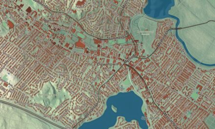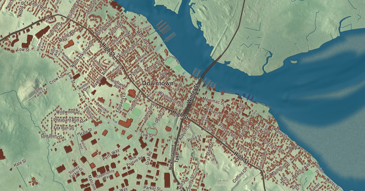
Newburyport’s old streets climb the bank of the Merrimack River, and this map has them: Merrimac Street along the old shipyards, High Street near the top of the ridge and State Street crossing between them, with Winter Street and Storey Avenue. The Plum Island Turnpike crosses the marsh to Plum Island, and Carr Island and the City Forest are printed too. Click here to purchase a print of this map for your wall.
Newburyport is in Essex County.
KNOWOL made this map in 2026 from public survey data and gave it the look of an old atlas. The ridge and the marsh come from United States Geological Survey elevation data, and the streets and the city line come from the Census Bureau. Newburyport sits on the south bank of the Merrimack near its mouth, 35 miles northeast of Boston, between the river and the Newbury marshes. The city covers 10.6 square miles, 8.4 of them land, and had 18,289 people at the 2020 census.
The waterside town
The City of Newburyport’s recorded history, in the Secretary of the Commonwealth’s list, dates European settlement to 1635, when this was part of Newbury. By the 1760s the people who lived by the water, mostly merchants, traders and craftsmen, and the farmers of the rest of Newbury could no longer agree on how to run the town, and the General Court made the waterside its own town of Newburyport. It covered just 647 acres, the smallest town in Massachusetts at the time, with 2,800 people in 357 homes, three shipyards and several ferries, and one ferry, at the foot of Greenleaf Lane, now State Street, carried the Portsmouth Flying Stage Coach between Portsmouth, New Hampshire and Boston. Newburyport was incorporated as a town in 1764, and it was incorporated as a city in 1851.
The town lived on fishing, shipbuilding and shipping, and it had a silverware industry. It was a center for privateering in the Revolution and the War of 1812, sent out whaling ships from about 1832, and later built clipper ships. Its historic district, more than 2,500 buildings over some 750 acres, is dominated by Federal architecture from the city’s main period of prosperity, which the War of 1812 brought to an end. The Custom House on Water Street, designed by Robert Mills, is now the Custom House Maritime Museum.
Whitefield, Garrison and Sarter
The preacher George Whitefield, who helped inspire the First Great Awakening, came to Newburyport in 1740. The congregation that grew out of his visits began meeting in 1746, and in 1756 more than 100 men built its meetinghouse on Federal Street, Old South, in three days. Whitefield died in its parsonage in 1770 and was buried under the pulpit at his own request, and the bell in its tower was cast by Paul Revere. In 1774 Caesar Sarter, a formerly enslaved man born free in Africa who had bought his freedom and lived in Newburyport, published an “Essay on Slavery” that challenged the colonists to square their calls for liberty with slavery. William Lloyd Garrison was born here in 1805 and learned his trade as an apprentice at the Newburyport Herald from the age of 13 before he founded The Liberator in Boston; a statue of “Garrison the Liberator” stands in Brown Square.
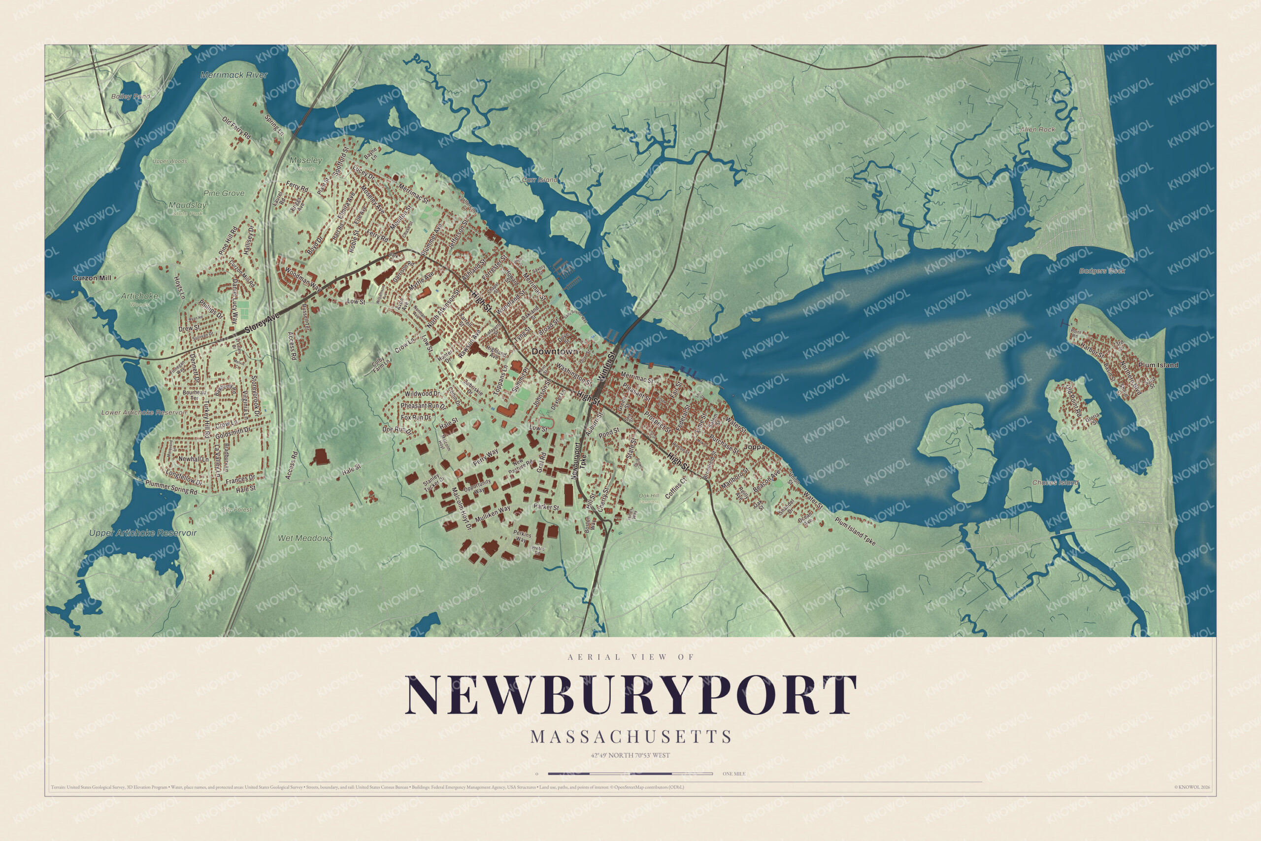
Click to explore a larger preview. The digital watermark does not appear on printed maps.
Names on this map
These names are printed on this map.
Places: Downtown, Plum Island, Allen Rock, Badgers Rock, Carr Island, Chaces Island, Bailey Pond, Lower Artichoke Reservoir, Upper Artichoke Reservoir, Merrimack River, Artichoke Woods, City Forest, Maudslay State Park, Moseley Woods, Oak Hill Cemetery, Pine Grove, Upper Woods, Wet Meadows, Curzon Mill and Joppa.
Streets and roads: Storey Avenue, High Street, Winter Street, Merrimac Street, Plum Island Turnpike, State Street, Northern Boulevard, Ferry Road, Old Point Road, Harbor Street, Woodland Street, Cherry Street.
More street names, A to Z
53rd Street, 73rd Street, Access Road, Ashland Street, Auburn Street, Avon Avenue, Basin Street, Bayberry Road, Bayne Lane, Beacon Avenue, Boston Way, Bourbeau Terrace, Boyd Drive, Bradbury Lane, Briggs Avenue, Broad Street, Bromfield Street, Brown Street, Chapel Street, Chase Street, Coffins Court, Colby Farm Lane, Coltin Drive, Crow Lane, Curzon Mill Road, Daniel Lucy Way, Dennett Drive, Dexter Lane, Doe Run Drive, Dove Street, Drew Street, Elmira Avenue, Erie Avenue, Essex Street, Fair Street, Farrell Street, Federal Street, Finnegan Way, Forrester Street, Fox Run Drive, Frances Drive, Fruit Street, Garrison Road, Gloria Street, Goldsmith Drive, Graf Road, Green Street, Hale Street, Hallisey Drive, Hart Road, Highland Avenue, Hill Street, Hines Way, Horton Street, Howard Street, Hoyts Lane, Hunter Drive, Jefferson Court, Jefferson Street, Johnson Street, Kent Street, Lafayette Street, Laurel Road, La Valley Lane, Lime Street, Longfellow Drive, Low Street, Lt Leary Drive, Lucey Drive, Malcolm Hoyt, Malcolm Hoyt Drive, Marlboro Street, Marquand Lane, Melvin Court, Milk Street, Moseley Avenue, Moulton Street, Mulliken Way, Myrtle Avenue, Newburyport Turnpike, Newhall Lane, New Pasture Road, Noble Street, Norman Avenue, North Atkinson Street, Oakland Street, Oak Street, Ocean Avenue, Old Ferry Road, Olive Street, Opportunity Way, Park Circle, Parker Street, Park Street, Perkins Way, Perry Way, Pheasant Run Drive, Phillips Drive, Pine Hill Road, Plant Street, Pleasant Street, Plummer Avenue, Plummer Spring Road, Point Road, Pond Street, Preble Road, Prospect Street, Purchase Street, Rawson Avenue, Reilly Avenue, Russell Terrace, Ryan Road, Salem Street, Sally Snyder Way, Savory Street, Shandel Drive, Ship Street, Shore Street, Spofford Street, Spring Lane, Stanley Tucker Drive, Storeybrook Drive, Sullivan Drive, Summit Place, Toppans Lane, Turkey Hill Road, Tyng Street, Union Place, Union Street, Virginia Lane, Washington Street, Water Street, Wildwood Drive, Williamson Avenue, Woodman Way, Zabriskie Drive.
See it on a wall
The Newburyport map as a framed print. Swipe for more.


Around the map
Start with Plum Island, then follow Storey Avenue, High Street, Winter Street, Merrimac Street, the Plum Island Turnpike and State Street across the city. Then look outward toward Curzon Mill and Joppa. Bailey Pond, Lower Artichoke Reservoir, Upper Artichoke Reservoir, the Merrimack River, City Forest, Upper Woods, Allen Rock and Carr Island are all labeled on the map, and every one of those names is printed directly on the artwork. Merrimac Street linked the shipyards along the river, and the homes of the seafaring merchants line High Street, many with widow’s walks on the roof for watching for ships; Charles Bulfinch designed the Essex County Superior Courthouse there in 1805. The Newburyport Five Cents Savings Bank, founded on State Street in 1854, is one of the oldest banks in the United States still in operation. Past downtown the bank drops to the marshes of Joppa Flats, and the Plum Island Turnpike runs out over the marsh on a causeway to a drawbridge, the only road onto the island; it began as a private road chartered in 1806 and became a county road in 1905. At the island’s northern tip the Plum Island Lighthouse, built in 1838, marks the mouth of the Merrimack. Upriver, Maudslay State Park covers about 450 acres of bluffs above the Merrimack, with tall white pines and one of the largest natural stands of mountain laurel in the state.
The Newburyport map makes a fine addition to an office, library or den, and it can help teach children the geography and history of a seaport at the mouth of the Merrimack. It’s made for people who call Newburyport home, from High Street down to the waterfront, and it shows the city as it looks today. Zoom in on the preview above to explore the details, then click here to get your copy of the Newburyport, Massachusetts map.

Sources
- Newburyport, Massachusetts, Wikipedia
- Newburyport Historic District, Wikipedia
- United States Customhouse (Newburyport, Massachusetts), Wikipedia
- First Presbyterian Church (Newburyport, Massachusetts), Wikipedia
- Caesar Sarter, Wikipedia
- William Lloyd Garrison, Wikipedia
- Plum Island (Massachusetts), Wikipedia
- Maudslay State Park, Wikipedia
- City and Town Incorporation and Settlement Dates, Secretary of the Commonwealth of Massachusetts (archived copy)