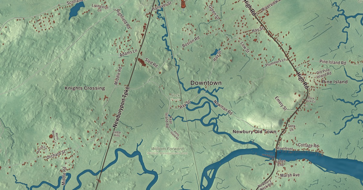
Newbury once took in Newburyport and West Newbury too. This map shows the town that remains: High Road, the Newburyport Turnpike through the middle of town, Highfield Road, Hay Street, Scotland Road and the Plum Island Turnpike. Great Meadow, Archelaus Hill, Browns Island and Chaces Island are printed too. Click here to purchase a print of this map for your wall.
Newbury is in Essex County.
KNOWOL made this map in 2026 from public survey data and gave it the look of an old atlas. The land comes from United States Geological Survey elevation data, and the streets and the town line come from the Census Bureau. Newbury covers 26.3 square miles, and marsh covers much of it, protected in the Parker River National Wildlife Refuge, the Old Town Hill reservation and several state wildlife areas. The Little River and the Parker River drain the town into Plum Island Sound, which separates Plum Island from the mainland. The town has three villages, Old Town, Plum Island and Byfield, each its own voting precinct, and it had 6,716 people at the 2020 census.
The landing on the Parker River
The land may once have been called Quascacunquen, “waterfall,” for the falls in Byfield where Central Street now crosses the Parker River, and it was likely part of the territory of the Agawam sachem Masconomet. The Town of Newbury’s recorded history, in the Secretary of the Commonwealth’s list, dates European settlement to 1635. The Rev. Thomas Parker and the Rev. James Noyes led about 100 settlers from Wiltshire, England, on the ship Mary and John. They first landed at Ipswich in 1634 and reached the river now called the Parker River the next spring. A stone marks the spot where Nicholas Noyes, the first of them to leap ashore, landed at Newbury, named for the town in Berkshire, England. Newbury was incorporated as a town that same year. The town remains part of Essex County today. In 1649, after years of petitions, the General Court settled the town’s claims to Plum Island by giving two-fifths of it to Newbury, two-fifths to Ipswich and one-fifth to Rowley. Newburyport was set off from Newbury in 1764, and West Newbury in 1819.
Byfield’s mills and the academy
The first water-powered mill went up at the Byfield falls in 1636, and gristmills and sawmills followed. The town page credits Byfield with the first textile mill in Massachusetts, in 1794, and the village once had six water-powered mills making goods from woolens to snuff. In 1763 Byfield became home to the Dummer Charity School, founded in memory of the acting governor William Dummer on his family farm; it opened with 28 boys, and as The Governor’s Academy it’s the oldest boarding school in New England. By 1791, 3,000 head of cattle grazed the town’s lands and salt marsh hay. Silver was found in a field in 1878, and the Chipman Silver Mine ran until 1925. By 1905 Newbury had gone back to farming, supplying eggs, milk and poultry.
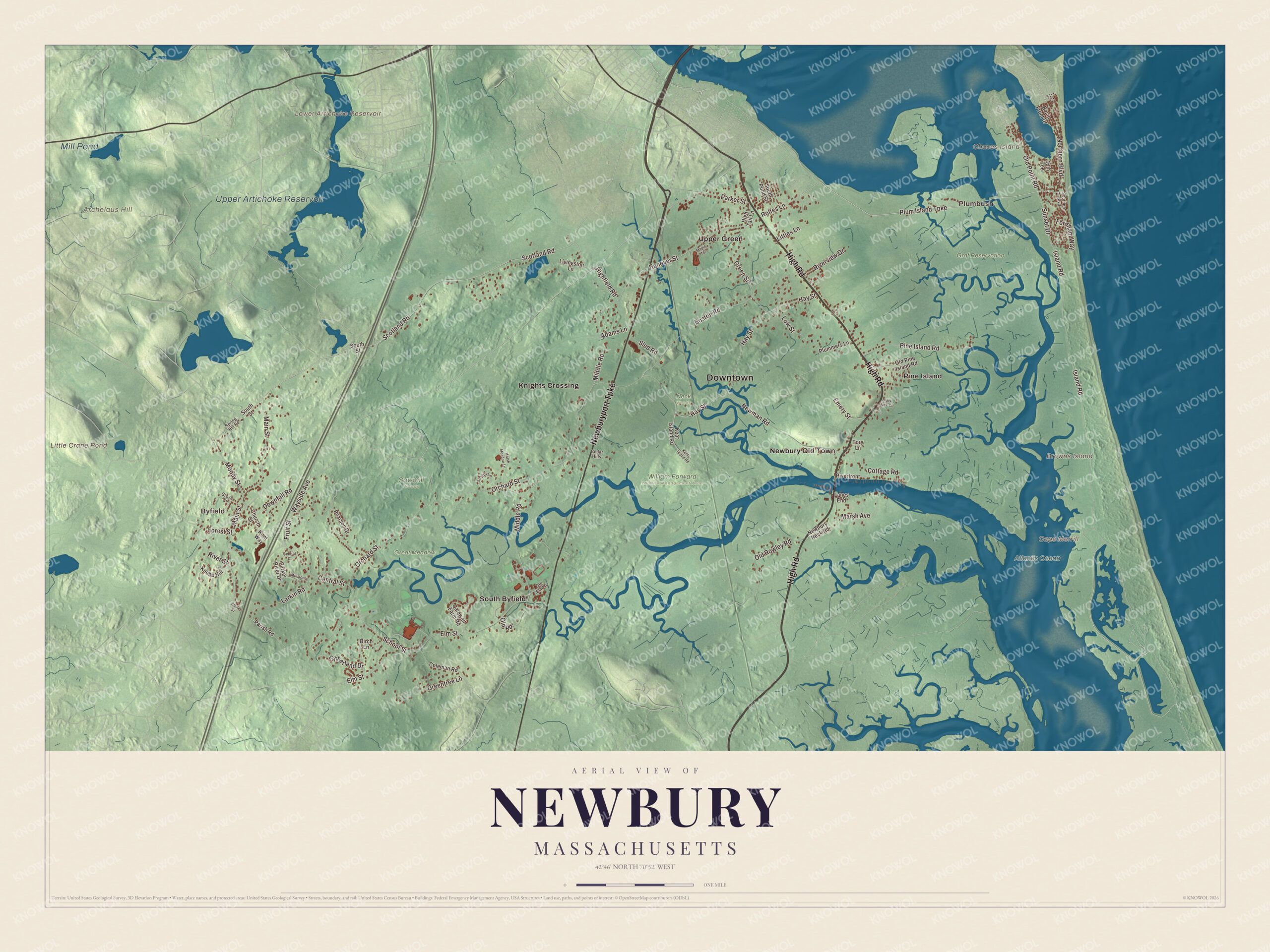
Click to explore a larger preview. The digital watermark does not appear on printed maps.
Names on this map
These names are printed on this map.
Places: Downtown, Byfield, Plumbush, Archelaus Hill, Browns Island, Cape Merrill, Chaces Island, Little Crane Pond, Lower Artichoke Reservoir, Upper Artichoke Reservoir, Mill Pond, Atlantic Ocean, Graf Reservation, Great Meadow, Neck Woods, Sawmill Woods, William Forward Wildlife Management Area, Knights Crossing, Newbury Old Town, Pine Island, South Byfield and Upper Green.
Streets and roads: High Road, Newburyport Turnpike, Plum Island Turnpike, Highfield Road, Hay Street, Scotland Road, Elm Street, Green Street, Northern Boulevard, Rolfes Lane, Forest Street, Hanover Street.
More street names, A to Z
16th Tee, 51st Street, Adams Lane, Austin Lane, Basin Front Drive, Birch Lane, Black Duck Circle, Boston Road, Caldwell Farm Road, Cedar Hills, Central Court, Central Street, Church Street, Chute Street, Coleman Road, Cottage Road, Downfall Road, Emery Street, Fatherland Drive, Fordham Way, Fruit Street, Greentree Lane, Grove Street, High Tail Lane, Island Road, Keat Island Road, Kents Island Road, Kent Way, Knobb Hill, Lanes End, Larkin Road, Littles Lane, Livingston Lane, Low Street, Main Street, Maple Terrace, Marsh Avenue, Marsh Meadow Lane, Middle Road, Millstone Lane, Moody Street, Newbury Neck Road, Newman Road, Old Elm Street, Old Pine Island Road, Old Point Road, Old Road, Old Rowley Road, Orchard Street, Parish Road, Parker River Drive, Parker Street, Pearson Drive, Pine Island Road, Plummers Lane, Riverfront, River Street, Riverview Drive, School Street, Sled Road, Southern Boulevard, South Pond Street, South Street, Spring Hill Road, Sunset Drive, Tory Lane, Wayside Avenue.
See it on a wall
The Newbury map as a framed print. Swipe for more.


Around the map
Start with Byfield, then follow High Road, the Newburyport Turnpike, the Plum Island Turnpike, Highfield Road, Hay Street and Scotland Road across town. Then look outward toward Plumbush, Knights Crossing, Newbury Old Town, Pine Island and South Byfield. Browns Island, Little Crane Pond, Lower Artichoke Reservoir, Upper Artichoke Reservoir, Graf Reservation, Great Meadow, Archelaus Hill and Chaces Island are all labeled on the map, and every one of those names is printed directly on the artwork, along with Plum Island. On High Road, at number 14, the Coffin House began in 1678 on land of Tristram Coffin Jr.; tree-ring dating in 2002 corrected its traditional date of 1654, and the Coffin family kept it until 1929. The Newburyport Turnpike is the local name for U.S. Route 1. The railroad reached Newbury in 1850 and brought tourists who helped make Plum Island a Victorian seaside resort; the Newbury part of the island is one of the town’s three precincts today.
The Newbury map makes a fine addition to an office, library or den, and it can help teach children the geography and history of a town settled in 1635 on the Parker River. It’s made for people who call Newbury home, from Byfield to Old Town to Plum Island, and it shows the town as it looks today. Zoom in on the preview above to explore the details, then click here to get your copy of the Newbury, Massachusetts map.

Sources