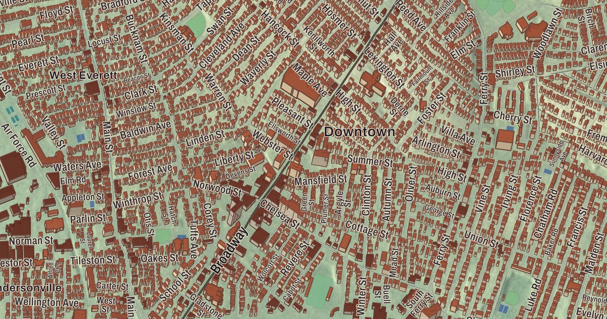
Everett packs a whole city into less than four square miles just across the Mystic River from Charlestown, and if you’re from here you know Broadway, Ferry Street and the parkway by heart. This map prints Broadway, the Revere Beach Parkway, the Santilli Highway, Malden Street, Ferry Street and Chelsea Street, with Belmont Hill, Bunker Hill and the Atlantic Ocean. Click here to purchase a print of this map for your wall.
Everett is in Middlesex County, directly north of Boston.
KNOWOL made this map in 2026 from public survey data and gave it the look of an old atlas. The relief comes from United States Geological Survey elevation data, and the roads and the city line come from the Census Bureau. Everett covers 3.7 square miles, 3.4 of them land. Malden lies to the north, Revere to the east, Chelsea to the southeast, Somerville to the southwest and Medford to the west, with Boston and the Mystic River to the south at Charlestown. The city had 49,075 people at the 2020 census.
From Charlestown to a city of its own
The City of Everett’s recorded history, in the Secretary of the Commonwealth’s list, dates European settlement to 1630. The land was first part of Charlestown and later part of Malden, and when it broke away from Malden it was incorporated as a town in 1870. It took its name from Edward Everett, who was a United States representative and senator, the 15th governor of Massachusetts, minister to Great Britain, secretary of state and president of Harvard, and the featured speaker at the dedication of the national cemetery at Gettysburg. Everett was incorporated as a city in 1892, and on December 13 of that year Alonzo H. Evans beat George E. Smith to become its first mayor. Everett was also the last city in the United States with a two-chamber legislature, a seven-member Board of Aldermen and an eighteen-member Common Council, until voters approved a new charter in 2011.
Everett’s edge on the water has grown over time. Landfill pushed the shoreline out, and sometime between 1905 and 1912 it joined the mainland to what had been White Island in the Mystic River. In 1971 Distrigas of Massachusetts began bringing in liquefied natural gas at its Everett Marine Terminal in the Island End section, the first terminal of its kind in the country. Island End River, which had been sealed in a culvert out of sight for years, was partly opened up again in 2021.
A quarter, a nurse and a scientist
The sculptor Hermon Atkins MacNeil was born in Everett in 1866. He designed the Standing Liberty quarter, struck from 1916 to 1930, and carved Justice, the Guardian of Liberty, on the east pediment of the United States Supreme Court building. Vannevar Bush, the engineer who later led the nation’s Office of Scientific Research and Development, was born in Everett on March 11, 1890, the son of the local Universalist pastor.
Woodlawn Cemetery, organized in 1850 and consecrated on July 2, 1851, is counted as the third-oldest rural cemetery in Greater Boston. It was laid out on land that was then in Malden, and it became part of Everett when the town was set off in 1870. Mary Eliza Mahoney, the first African American to study and work as a professionally trained nurse in the United States, is buried there. She graduated from nursing school in 1879, and in 1968 Helen Sullivan Miller, a winner of the medal named for Mahoney, led a drive to give her grave a proper monument.
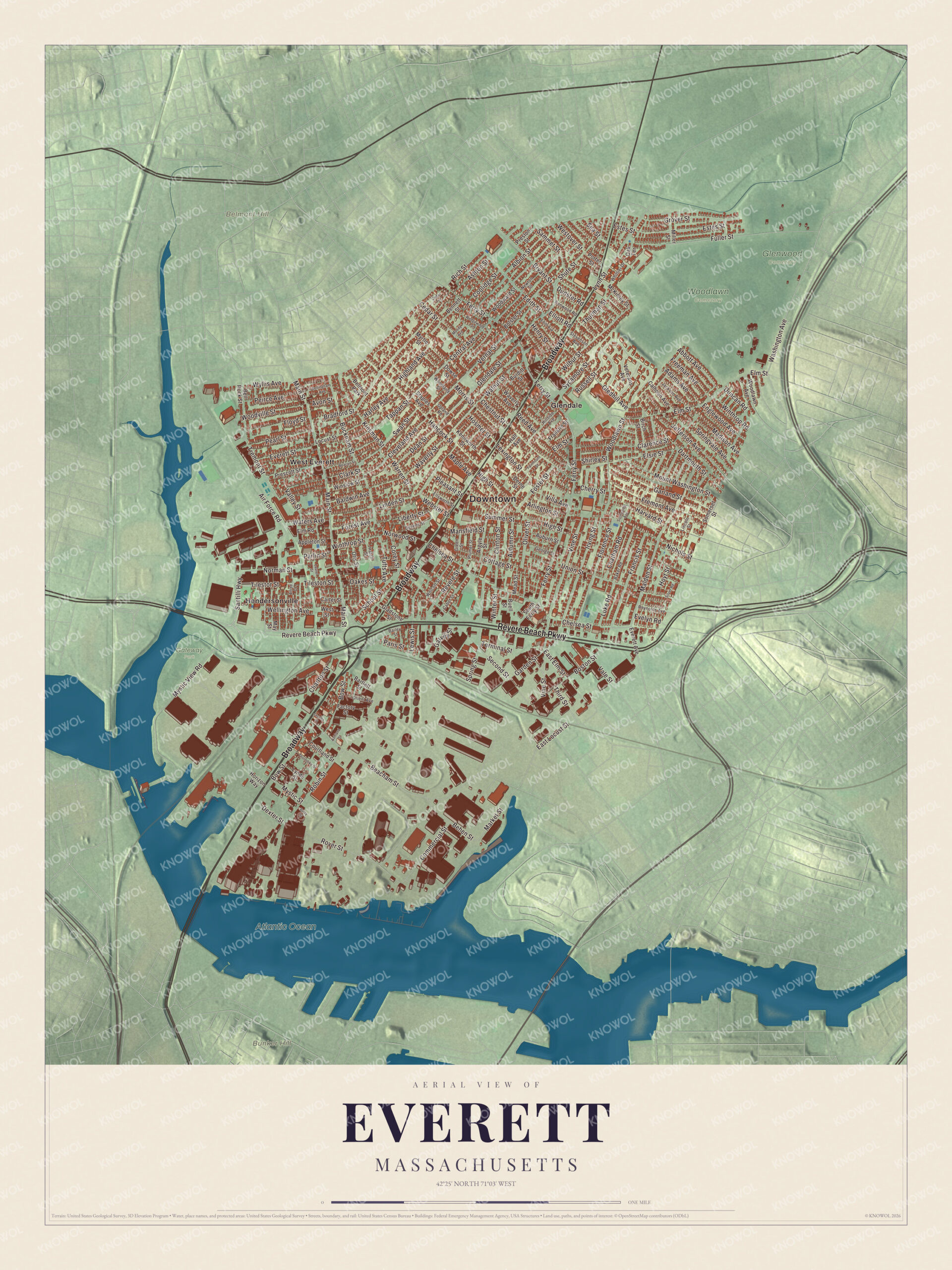
Click to explore a larger preview. The digital watermark does not appear on printed maps.
Names on this map
These names are printed on this map.
Places: Downtown, Belmont Hill, Bunker Hill, Atlantic Ocean, Gateway Park, Glenwood Cemetery, Woodlawn Cemetery, Glendale, Hendersonville, West Everett and Belmont Park.
Streets and roads: Broadway, Revere Beach Parkway, Santilli Highway, Malden Street, Ferry Street, Chelsea Street, Norwood Street, Fremont Avenue, Summer Street, Madison Avenue, Dexter Street, Main Street.
More street names, A to Z
Abbott Avenue, Adams Avenue, Air Force Road, Albion Street, Alfred Court, Appleton Street, Argyle Street, Arlington Street, Ashland Street, Ashton Street, Auburn Street, Autumn Street, Avon Street, Bailey Street, Baker Road, Baldwin Avenue, Bartlett Street, Beacham Street, Beacon Street, Behen Street, Bellingham Avenue, Bell Rock Street, Bennett Street, Betty Street, Birch Street, Bolster Street, Boston Street, Bow Street, Bradford Street, Bryant Street, Bucknam Street, Buell Street, Burditt Street, Cabot Street, Calhoun Avenue, Carter Street, Cedar Street, Cedar Terrace, Central Avenue, Charlton Street, Chatham Road, Cherry Street, Chestnut Street, Clarence Street, Clark Street, Cleveland Avenue, Clinton Street, Commercial Street, Coolidge Street, Corey Street, Cottage Street, Courtland Street, Dartmouth Street, Dean Street, Derne Street, Devens Street, Dowse Street, Duncan Road, Dunster Road, East Elm Street, East Locust Street, Edith Avenue, Edith Street, Elliott Road, Ellsworth Street, Elm Road, Elm Street, Elsie Street, Englewood Avenue, Estes Street, Evelyn Road, Everett Avenue, Everett Street, Factory Street, Fairmount Street, Florence Street, Floyd Street, Forest Avenue, Foster Street, Francis Street, Franklin Street, Freeman Avenue, Fuller Street, Garden Street, Garland Street, Garvey Street, George Street, Gladstone Street, Gledhill Avenue, Glendale Street, Green Street, Grover Street, Hall Avenue, Hancock Street, Harley Avenue, Harvard Street, Hatch Street, Henry Street, Highland Avenue, High Street, Hillside Avenue, Horizon Way, Hosmer Street, Hoyt Street, Irving Street, Jackson Avenue, Jacobs Place, Jefferson Avenue, Kenilworth Street, Kenwood Road, Kinsman Street, Laurel Street, Lewis Street, Lexington Street, Liberty Street, Lincoln Street, Linden Street, Locust Street, Luke Road, Lynde Street, Lynn Street, Mansfield Street, Maple Avenue, Market Street, May Street, McKinley Street, Mead Street, Miller Street, Moody Avenue, Morris Street, Mount Washington Street, Myrtle Street, Mystic Street, Mystic View Road, Newton Street, Nichols Street, Norman Street, Oakes Street, Oak Terrace, Oliver Street, Orient Avenue, Otis Street, Paris Street, Parlin Street, Pearl Street, Peirce Avenue, Pleasant Street, Plumer Street, Porter Street, Prescott Street, Preston Street, Reed Avenue, Revere Street, Reynolds Avenue, Rich Street, Robin Street, Rover Street, Russell Street, Sammet Street, School Street, Sea Street, Second Street, Shirley Street, Shute Street, Silver Road, Somerset Street, South Ferry Street, Spring Street, Springvale Avenue, Staples Avenue, Stevenson Avenue, Sunnyside Avenue, Swan Street, Sycamore Street, Tappan Street, Terminal Street, Third Street, Thorndike Street, Thurman Street, Tileston Street, Tilestor Street, Tremont Street, Tufts Avenue, Union Street, Upland Road, Vale Street, Valley Street, Vernal Street, Veterans Avenue, Villa Avenue, Vine Street, Walnut Street, Warren Street, Washington Avenue, Waters Avenue, Waverly Avenue, Waverly Street, Webster Street, Wedgewood Street, Wellington Avenue, Westover Street, West Street, Whittier Drive, Wilbur Street, Winslow Street, Winter Street, Winthrop Road, Winthrop Street, Wolcott Street, Woodland Street, Woodlawn Avenue, Woodlawn Street, Woodville Street, Woodward Street, Wyllis Avenue.
The parkway to the beach
The Revere Beach Parkway was one of the first parkways the landscape architect Charles Eliot proposed, in an 1893 report, and it was built between 1896 and 1904 so people from inland towns could reach Revere Beach. It runs from Wellington Circle in Medford through Everett and Chelsea to Revere, and the Olmsted Brothers advised on its design. Its last section, from Main Street in Everett to the Fellsway, went in between 1903 and 1905 with a drawbridge over the Malden River, and part of the historic parkway in Everett is listed on the National Register of Historic Places. Glendale Park is the city’s largest park, and some of Everett’s neighborhoods are Glendale, Woodlawn, the Village and the Line.
Around the map
Start with Glendale, then follow Broadway, the Revere Beach Parkway, the Santilli Highway, Malden Street, Ferry Street and Chelsea Street across the city. Look outward toward Hendersonville and West Everett. Bunker Hill, where the 1775 battle is remembered by the monument on Breed’s Hill, is in the Charlestown neighborhood of Boston, across the river. The Atlantic Ocean, Belmont Hill and Bunker Hill are all printed on the map.
The Everett map makes a fine addition to an office, library or den, and it can help teach children the geography and history of a small, busy city on the Mystic. It’s made for people who call Everett home, from Glendale to West Everett, and it shows the city as it looks today. Zoom in on the preview above to explore the details, then click here to get your copy of the Everett, Massachusetts map.

We made a map for every town and city in Massachusetts. Explore the complete Massachusetts map collection and find your town.
Sources
- Everett, Massachusetts, Wikipedia
- Edward Everett, Wikipedia
- Hermon Atkins MacNeil, Wikipedia
- Vannevar Bush, Wikipedia
- Woodlawn Cemetery (Everett, Massachusetts), Wikipedia
- Mary Eliza Mahoney, Wikipedia
- Revere Beach Parkway, Wikipedia
- Bunker Hill Monument, Wikipedia
- City and Town Incorporation and Settlement Dates, Secretary of the Commonwealth of Massachusetts (archived copy)