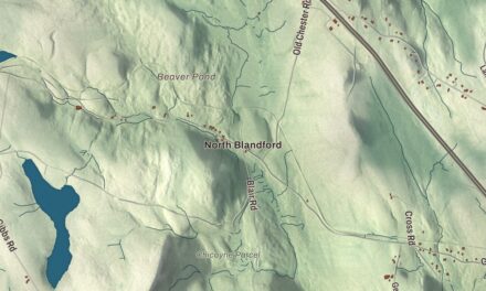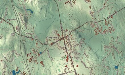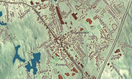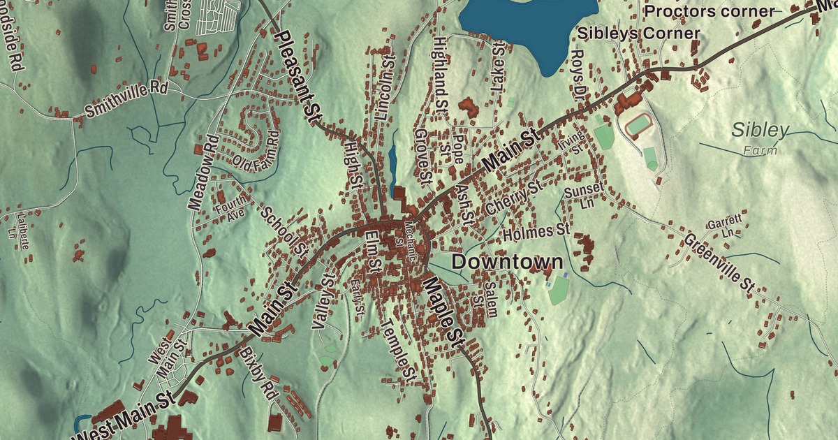
Main Street crosses Spencer from east to west, Pleasant Street and Maple Street cross it at the center, and this map carries the town out to North Spencer, South Spencer, Lower Wire Village, Buck Hill and Brooks Pond. Click here to purchase a print of this map for your wall.
Spencer is in Worcester County.
KNOWOL made this map in 2026 from public survey data and gave it the plain grace of an old atlas. United States Geological Survey elevation data shapes the hills, and the roads and the town line come from the Census Bureau. Spencer is roughly rectangular and covers 34.0 square miles, bounded by Leicester, Charlton, East Brookfield, North Brookfield, New Braintree, Oakham and Paxton. Route 31 running north and south and Route 9 running east and west divide it into quarters. Spencer had 11,992 people at the 2020 census.
On the Post Road
Nathaniel Wood first settled here in 1717, and Samuel Bemis made the first permanent settlement in 1721. The Town of Spencer’s recorded history, in the Secretary of the Commonwealth’s list, dates European settlement to 1721. Spencer split from Leicester on April 12, 1753, taking the name of the acting governor, Spencer Phips, and the state list records its incorporation as a town in 1775. Main Street, now Route 9, began as a Native American trail and served the colonists as a main road east and west. By 1784 Spencer was a major stop on the Boston Post Road’s stage route, where coaches from Boston met coaches from Hartford and passengers changed. Travelers often spent the night at Jenk’s Tavern, as General Henry Knox did while hauling his cannons from Ticonderoga to Boston, and George Washington did in 1789. Colonial milestones along the old Post Road still mark the way. When the Revolution began in 1775, fifty-six Spencer men under Captain Ebenezer Mason set out for Boston at once, and many of them fought at Bunker Hill.
Wire, shoes and the Howes
Spencer’s first mill went up in 1740 on the Seven Mile River, the town’s best source of water power. The Embargo Act of 1807 pushed it toward industry. Elliot Prouty began drawing wire in his own mill in 1812, and the family business lasted until 1916, when it merged with Wickwire Steel; at one time Spencer had 11 factories and 26 buildings for wire drawing. Josiah Green began making shoes in 1811 and built a factory in 1834, and the Prouty family made shoes from 1820. In 1888 and 1889, four leading citizens, David Prouty, Richard Sugden, Luther Hill and Nathaniel Myrick, gave the town a new high school, a library, a park and the Spencer Agricultural Fair Grounds.
The Howe family made Spencer a name in American invention. William Howe invented the Howe truss in 1840, a bridge design widely used in the mid to late 1800s, and his brother Tyler Howe patented a spring bed. Their nephew, Elias Howe Jr., was born in Spencer in 1819, and on September 10, 1846, he received the first United States patent for a sewing machine using a lockstitch. His old estate, with a mill pond and dam he built, is now the Howe Pond parcel of Spencer State Forest, off Route 31. Click here to learn more about the history of Spencer.

Click to explore a larger preview. The digital watermark does not appear on printed maps.
Names on this map
These names are printed on this map.
Places: Downtown, Camp Neyati, North Spencer, Lambs Grove, South Spencer, Bare Hill, Buck Hill, Casey Hill, Flat Hill, Brooks Pond, Buckhill Pond, Stiles Reservoir, Cedar Meadow Pond, Four Chimneys Wildlife Management Area, Proctor Farm, Saint Joseph's Abbey, Sibley Farm, Spencer State Forest, Hillsville, Lower Wire Village, Proctors corner, Sibleys Corner, Tafts Corner and Upper Wire Village.
Streets and roads: Main Street, West Main Street, North Spencer Road, Charlton Road, Maple Street, Pleasant Street, Meadow Road, Thompson Pond Road, Ledge Avenue, South Spencer Road, Browning Pond Road, Borkum Road.
More street names, A to Z
Alta Crest Road, Ash Street, Bacon Hill Road, Barclay Road, Bixby Road, Blueberry Hill Drive, Briarcliff Lane, Briarwood Lane, Brooks Pond Road, Browning Pond Circle, Buteau Road, Castle Lane, Cherry Street, Chickering Road, Clark Road, Collier Circle, Condon Drive, Cooney Road, Cranberry Meadow Road, Debbie Drive, Depot Road, Donnelly Cross Road, Donnelly Crossroad, Donnelly Road, Dufault Road, Early Street, East Charlton Road, Elm Street, Ethier Drive, First Street, Fourth Avenue, Gale Drive, Garrett Lane, Gauthier Road, Gold Nugget Road, Greenville Street, Grove Street, Hastings Road, Hebert Road, Highland Street, High Street, Hiridge Road, Holmes Street, Howe Road, Irving Street, Jolicoeur Avenue, Jolicoeur Road, Kingsbury Road, Kittredge Road, Lake Avenue, Lakeshore Drive, Lake Street, Laliberte Lane, Laurel Lane, Lincoln Street, Lyford Road, Main Avenue, Marble Road, Martin Road, McCormick Road, Mechanic Street, Norcross Road, North Brookfield Road, Northwest Road, Oakland Drive, Old Farm Road, Overlook Drive, Paul's Drive, Paxton Road, Pine Acres Road, Point Eastalee Drive, Polar Springs Road, Pope Street, Roys Drive, Rustic Lane, Salem Street, School Street, Sherman Grove, Sherry Lane, Shore Drive, Smithville Cross Road, Smithville Road, Stiles Avenue, Sunberg Road, Sunset Lane, Taylor Drive, Temple Street, Terkanian Drive, Tom Casey Road, Treadwell Drive, Valley Street, Washburn Drive, Westland Drive, William Casey Road, Wilson Avenue, Wilson Street, Wire Village Road, Woodside Road.
See it on a wall
The Spencer map as a framed print. Swipe for more.


Around the map
Start with North Spencer. Follow Main Street, West Main Street, North Spencer Road, Charlton Road, Maple Street and Pleasant Street across town. Then look outward toward Lambs Grove, South Spencer, Hillsville, Lower Wire Village and Proctors corner. Brooks Pond, Buckhill Pond, Stiles Reservoir, Cedar Meadow Pond, Bare Hill, Buck Hill and Casey Hill are all printed on the map. The town center grew where Main Street meets Pleasant and Maple streets, and the Spencer Town Center Historic District now spreads across Main, Pleasant, Grove, Prouty and High streets and the old mill streets, and its story centers on the peak of Spencer’s industry in the late 1800s. The 92-mile Midstate Trail crosses town, linking the state forest parcels with the Buck Hill and Moose Hill wildlife areas. Since 1950 Spencer has been home to St. Joseph’s Abbey, a monastery of Trappist monks who support themselves by making jams and liturgical vestments. Its brewery made the first certified Trappist beer in the United States until it closed in 2022.
The Spencer map makes a handsome addition to an office, library or den, and it can help teach children the geography and history of an inventors’ town on the old Post Road. It’s made for people who call Spencer home, from North Spencer to Hillsville, and it shows the town as it looks today. Zoom in on the preview above to explore the details, then click here to get your copy of the Spencer, Massachusetts map.

Sources
- Spencer, Massachusetts, Wikipedia
- Spencer Town Center Historic District, Wikipedia
- Elias Howe, Wikipedia
- Howe truss, Wikipedia
- Spencer State Forest, Wikipedia
- St. Joseph’s Abbey (Massachusetts), Wikipedia
- City and Town Incorporation and Settlement Dates, Secretary of the Commonwealth of Massachusetts (archived copy)