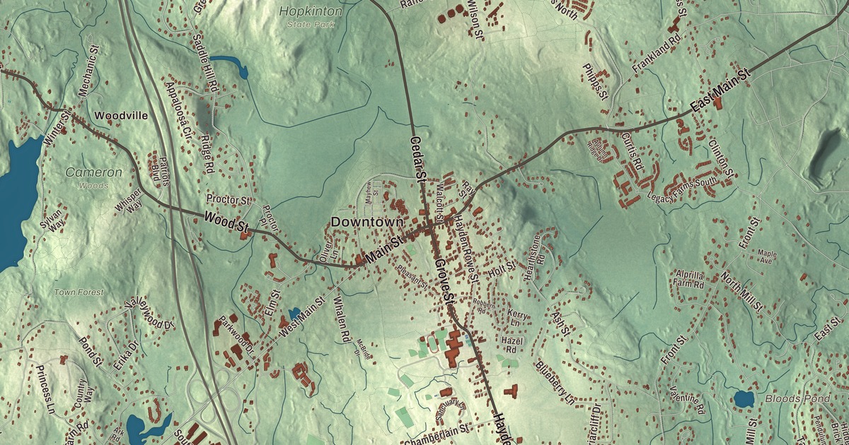
Hopkinton draws national attention every April, but people who live here know it by its roads: Main Street and East Main Street through the village, Grove Street, Cedar Street, Wood Street and Hayden Rowe Street. This map prints them all, with Whitehall Reservoir, North Pond, Bloods Pond, Banner Hill and Bear Hill. Click here to purchase a print of this map for your wall.
Hopkinton is in Middlesex County.
KNOWOL made this map in 2026 from public survey data and gave it the look of an old atlas. The relief comes from United States Geological Survey elevation data, and the streets and the town line come from the Census Bureau. Hopkinton covers 27.9 square miles in the southwest corner of Middlesex County, 17 miles east of Worcester, between Southborough, Ashland, Holliston, Milford, Upton and Westborough. The village sits where Main Street, which is Route 135, meets Cedar Street and Grove Street, which carry Route 85. The town had 18,758 people at the 2020 census.
Named for a gift to Harvard
Hopkinton takes its name from Edward Hopkins, a founder of the Connecticut and New Haven colonies who served as Connecticut’s governor. When he died in 1657 he left money in trust for education, and the trustees of Harvard used the fund to buy 12,500 acres here from the Native residents. The Town of Hopkinton’s recorded history, in the Secretary of the Commonwealth’s list, dates European settlement to 1715. Hopkinton was incorporated as a town that same year, on December 13, 1715, and the town remains part of Middlesex County today.
Farmers grew grain first, then fruit and dairy. In 1840 the boot and shoe trade arrived, and by 1850 the town had eleven boot and shoe factories. The worker housing still standing in the center, set against the open country around it, is a reminder of those years. The Hopkinton Center Historic District takes in 23 properties around the Town Common, on East Main Street and on the south side of Main Street, and it grew to include the Town Hall in 2000 and Center School in 2001. Most of the town’s properties on the State Register of Historic Places, 187 of 215, lie in the Cedar Swamp Archaeological District, which Hopkinton shares with Westborough.
Where the Boston Marathon begins
The Boston Marathon was first run in 1897, from Metcalf’s Mill in Ashland, and in 1924 the starting line moved to Hopkinton. The race’s page calls it the world’s oldest annual marathon. From here the course follows Route 135 and descends through Ashland and Framingham on its way to Boylston Street in Boston, 26.2 miles away, and the town takes pride in welcoming runners from all over the world each Patriots’ Day. Hopkinton is also a sister city of Marathon, Greece. George V. Brown, who served for 30 years as the race’s starter, is on the town’s list of notable people.
The public library began in 1867, started by the Young Men’s Christian Association, and has stood near the Town Common since 1895. Its reading room has a stained glass window of a fountain spilling over an open book, with the words “The fountain of wisdom flows through books.” After a renovation and expansion, the library reopened at 13 Main Street in October 2017.
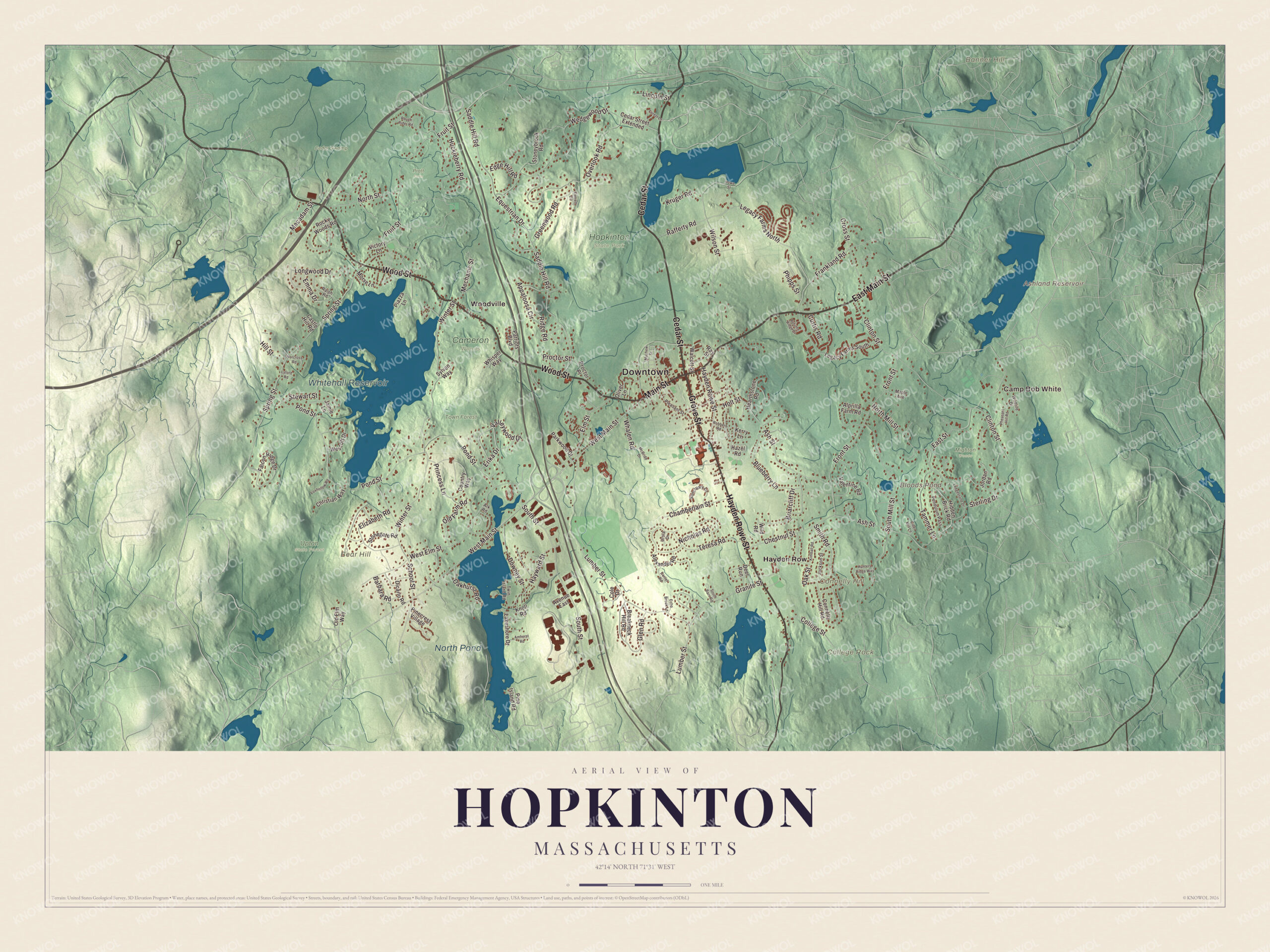
Click to explore a larger preview. The digital watermark does not appear on printed maps.
Names on this map
These names are printed on this map.
Places: Downtown, Camp Bob White, Banner Hill, Bear Hill, College Rock, Connelly Hill, Ashland Reservoir, Bloods Pond, Whitehall Reservoir, North Pond, Cameron Woods, Cedar Swamp, Hopkinton State Park, Mighton Woods, Pratt Farm, Town Forest, Upton State Forest, Hayden Row and Woodville.
Streets and roads: East Main Street, Grove Street, Main Street, Wood Street, Hayden Rowe Street, Cedar Street, West Main Street, Saddle Hill Road, Princess Lane, Spring Street, South Street, Pond Street.
More street names, A to Z
Alexander Road, Alprilla Farm Road, Amherst Road, Appaloosa Circle, Ark Road, Ash Street, Autumn Ridge Drive, Avenue East, Barbara Road, Blueberry Lane, Breakneck Hill Road, Briarcliff Drive, Castle Hill Road, Cedar Street Extended, Chamberlain Street, Chestnut Street, Christian Way, Cider Mill Lane, Clinton Street, Cole Drive, College Street, Connelly Hill Road, Country Way, Cross Street, Curtis Road, Daniel Road, Deer Run, Dicarlo Road, Downey Street, East Street, Echo Brook Lane, Edge Hill Road, Elizabeth Road, Elm Street, Emma Drive, Equestrian Drive, Erika Drive, Everett Circle, Falcon Ridge Drive, Forest Lane, Foxhollow Road, Frankland Road, Front Street, Fruit Street, Glen Road, Granite Street, Greenwood Road, Hayward Street, Hazel Road, Hearthstone Road, Hidden Brick Road, Hill Street, Holt Street, Howe Street, Huckleberry Road, Hunters Ridge Way, Jackson Street, Jamie Lane, Jordan Road, Kerry Lane, Kimball Road, Knoll Road, Kruger Road, Lakeshore Drive, Ledgestone Drive, Legacy Farms North, Legacy Farms South, Lincoln Street, Longwood Drive, Lumber Street, Lyford Road, Macadam Street, Maple Avenue, Mayhew Street, McBride Drive, Mechanic Street, Morse Lane, Nicholas Road, Norcross Road, North Mill Street, North Street, Oakhurst Road, Oak Street, Old Elm Way, Old Farm Road, Oliver Lane, Overlook Road, Parkwood Drive, Patriots Boulevard, Pendulum Pass, Pheasant Hill Road, Phipps Street, Piazza Lane, Pinecrest Village, Pine Island Road, Pleasant Street, Proctor Place, Proctor Street, Rafferty Road, Ralph Road, Ray Street, Ridge Road, Robbern Road, Rocky Woods Road, Rough Rider Road, Sanctuary Lane, School Street, Smith Road, South Barn Road, South Mill Street, Sterling Drive, Stewart Street, Stonegate Road, Stoneybrook Road, Sylvan Way, Tammer Lane, Teresa Road, Twin Island Road, Ursla Drive, Valentine Road, Valleywood Drive, Victory Lane, Walcott Street, Wedgewood Drive, Wescott Drive, West Elm Street, Whalen Road, Whisper Way, Wildlife Drive, Wild Road, Wilson Street, Winter Street.
See it on a wall
The Hopkinton map as a framed print. Swipe for more.


Around the map
Start with Hayden Row, then follow East Main Street, Grove Street, Main Street, Wood Street, Hayden Rowe Street and Cedar Street across town. Look outward toward Woodville, at the north end of Whitehall Reservoir in the west of town. Woodville became a local historic district in 2005, with 97 properties. It was an early cotton cloth center and the site of a major shoe factory, and a grist mill stood on Whitehall Brook as early as 1714. When Boston took Lake Whitehall for its water supply in 1894, the factories on its shores closed or moved. The reservoir left that service in 1947 and became Whitehall State Park, reached from Route 135, which is Wood Street there. Near the lake, people once believed the water draining from a big swamp under Pond Street had healing powers, and visitors came by stagecoach to the Hopkinton Hotel for the mineral baths; the town page says the baths can still be seen beside the stream.
Ashland Reservoir, Bloods Pond, Whitehall Reservoir, North Pond, the Town Forest, Banner Hill, Bear Hill and College Rock are all printed on the map, and every one of those names is right there on the artwork. North Pond, in the southwest, is the headwaters of the Mill River, which flows south to the Blackstone River in Rhode Island. The Hopkinton map makes a fine addition to an office, library or den, and it can help teach children the geography and history of the town where the marathon starts. It’s made for people who call Hopkinton home, from Woodville to Hayden Row, and it shows the town as it looks today. Zoom in on the preview above to explore the details, then click here to get your copy of the Hopkinton, Massachusetts map.

Sources