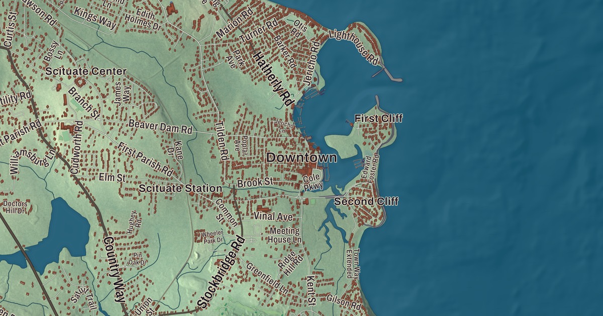
Scituate’s coast runs from First Cliff down to Fourth Cliff and the long, slender peninsula of Humarock, and this map of the South Shore town prints Chief Justice Cushing Highway, Country Way, Hatherly Road, Gannett Road, Cornet Stetson Road and Stockbridge Road, with Egypt, Clapps Corner and Gannett Corners along the way. Click here to purchase a print of this map for your wall.
Scituate is in Plymouth County.
KNOWOL made this map in 2026 from public survey data, finished in the manner of an old atlas. United States Geological Survey elevation data shapes the cliffs and marshes, and the roads and the town line come from the Census Bureau. Scituate covers 31.8 square miles, and 14.2 of them are water. It sits on Massachusetts Bay about 25 miles southeast of Boston, with Marshfield to the south, Norwell and Hingham to the west and Cohasset to the northwest. Route 3A crosses the town as Chief Justice Cushing Highway, named for William Cushing, one of the six original justices of the United States Supreme Court. Scituate had 19,063 people at the 2020 census.
Satuit
The name comes from “satuit,” a Native word the English took to mean “cold brook,” for the brook that runs into the inner harbor; at the time the English arrived, this was Wampanoag land. The town page says English settlement began around 1627 or 1628, with a group from Plymouth Colony who were joined by settlers from Kent in England. The Town of Scituate’s recorded history, in the Secretary of the Commonwealth’s list, dates European settlement to 1630, and Scituate was incorporated as a town in 1636, on October 5. The Williams-Barker House on Barker Road is believed to date from 1634, built by John Williams, who had come from England; it’s now an event venue. Its western part became the town of Hanover in 1717, a section went to Marshfield in 1788, and in 1849 another western section became South Scituate, later renamed Norwell. In 1710 people from Scituate moved to Rhode Island and founded another Scituate there.
The light and the Army of Two
Fishing and sea mossing once carried the local economy, and a small fishing fleet still works out of Scituate Harbor. Old Scituate Light, on Cedar Point at the harbor entrance, was finished on September 19, 1811, the eleventh lighthouse in the country. In September 1814, during the War of 1812, keeper Simeon Bates was away when a British warship sent boats of soldiers toward the harbor. His daughters Rebecca and Abigail, 21 and 17, grabbed a fife and a drum and played them loudly, and the soldiers, thinking the town militia was coming, turned back. The sisters became known as the American Army of Two. The town bought the lighthouse in 1917, and it was relit in 1991. About a mile off Scituate Neck stands Minot’s Ledge Light, nicknamed the “I Love You Lighthouse” for the 1, 4, 3 pattern of its flashes.
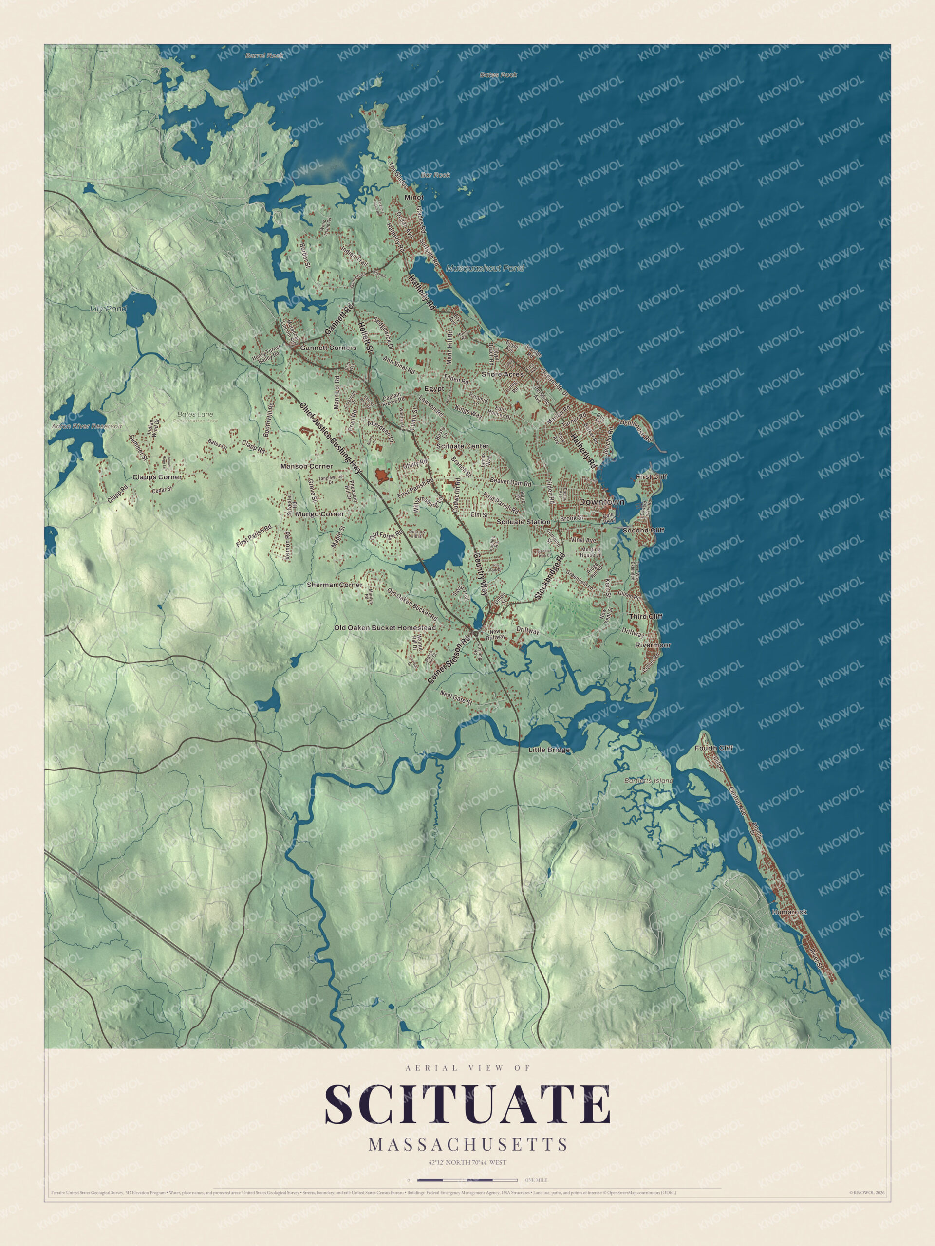
Click to explore a larger preview. The digital watermark does not appear on printed maps.
Names on this map
These names are printed on this map.
Places: Downtown, Humarock, Bar Rock, Barrel Rock, Bartletts Island, Bates Rock, Aaron River Reservoir, Musquashcut Pond, Lily Pond, Bates Lane Conservation Area, Clapps Corner, Egypt, First Cliff, Fourth Cliff, Gannett Corners, Little Bridge, Manson Corner, Minot, Mungo Corner, Old Oaken Bucket Homestead, Rivermoor, Scituate Center, Scituate Station, Second Cliff, Sherman Corner, Shore Acres and Third Cliff.
Streets and roads: Chief Justice Cushing Highway, Country Way, Cornet Stetson Road, Gannett Road, Hatherly Road, Stockbridge Road, Hollett Street, Tilden Road, Brook Street, Beaver Dam Road, First Parish Road, Cudworth Road.
More street names, A to Z
Aberdeen Drive, Acorn Street, Ann Vinal Road, Atlantic Drive, Barker Road, Bates Lane, Booth Hill Road, Border Street, Bossy Lane, Branch Street, Captain Pierce Road, Cedar Street, Central Avenue, Chet Way, Clapp Road, Cliff Road, Cole Parkway, Collier Road, Common Street, Creelman Drive, Curtis Street, Cushing Road, Doctors Hill Drive, Driftway, Edgar Road, Edith Holmes Drive, Edward Foster Road, Egypt Avenue, Egypt Beach Road, Elm Street, Ely Avenue, First Avenue, Garrison Drive, Gilson Road, Glades Road, Greenfield Lane, Grove Street, Hatchet Rock Road, Henry Turner Bailey Road, Hood Road, Hughey Road, Indian Trail, Indian Wind Drive, Irving Road, James Way, Jericho Lane, Jericho Road, Kane Drive, Kent Street, Kings Way, Lawson Road, Lighthouse Road, Mann Hill Road, Mann Lot Road, Maple Street, Marilyn Road, Marion Road, Meeting House Lane, Mordecai Lincoln Road, Mount Hope Lane, Neal Gate Street, New Driftway, New Kent Street, Ocean Avenue, Oceanside Drive, Old Forge Road, Old Oaken Bucket Road, Otis Road, Park Avenue, Pershing Avenue, Pheasant Hill Drive, Pin Oak Drive, Poplar Avenue, Pratt Road, Pyramid Lane, Ridge Hill Road, River Street, Rosa's Lane, Satuit Trail, Seaside Road, Sedgewick Drive, Summer Street, Surfside Road, Sylvester Road, Tanglewood Drive, The Glades, Town Way Extended, Treasure Island Road, Turner Road, Union Street, Utility Road, Vernon Road, Vinal Avenue, Walnut Hill Drive, Watch Hill Drive, Wheeler Park Drive, Whittier Drive, Wigwam Lane, Williamsburg Lane, Wood Island Road.
Around the map
Start with Humarock. Follow Chief Justice Cushing Highway, Country Way, Cornet Stetson Road, Gannett Road, Hatherly Road and Stockbridge Road across town. Then look outward toward Clapps Corner, Egypt, First Cliff, Fourth Cliff and Gannett Corners. Aaron River Reservoir, Musquashcut Pond, Lily Pond and Bartletts Island are all printed on the map. Humarock was joined to the rest of Scituate at Third Cliff until the Portland Gale of 1898 broke through the beach and moved the mouth of the North River; now it’s reached from Scituate only by boat, or by bridge from Marshfield. During World War II the Fourth Cliff Military Reservation guarded the coast with two 6-inch guns, and it’s now a recreation area for Hanscom Air Force Base. Egypt is one of the town’s five public beaches, and North Scituate was once called Gannett Corner. In Scituate Center, Lawson Tower rises 153 feet. It was built in 1902 to enclose a steel water tank after the financier Thomas W. Lawson, who was building his Dreamwold estate next door, objected to the view, and Lawson had ten bells hung at its top. At 47 Old Oaken Bucket Road, the Woodworth House holds the old well that Samuel Woodworth wrote about in his 1817 poem “The Old Oaken Bucket”; the Indiana and Purdue football trophy is named for the poem. Each March the St. Patrick’s Day parade runs from Greenbush and the Driftway to Scituate Harbor.
The Scituate map makes a fine addition to an office, library or den, and it can help teach children the geography and history of a South Shore harbor town. It’s made for people who call Scituate home, from Humarock to First Cliff, and it shows the town as it looks today. Zoom in on the preview above to explore the details, then click here to get your copy of the Scituate, Massachusetts map.

We made a map for every town and city in Massachusetts. Explore the complete Massachusetts map collection and find your town.
Sources
- Scituate, Massachusetts, Wikipedia
- Old Scituate Light, Wikipedia
- American Army of Two, Wikipedia
- Humarock, Wikipedia
- Lawson Tower, Wikipedia
- Woodworth House, Wikipedia
- Williams-Barker House, Wikipedia
- City and Town Incorporation and Settlement Dates, Secretary of the Commonwealth of Massachusetts (archived copy)