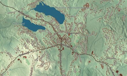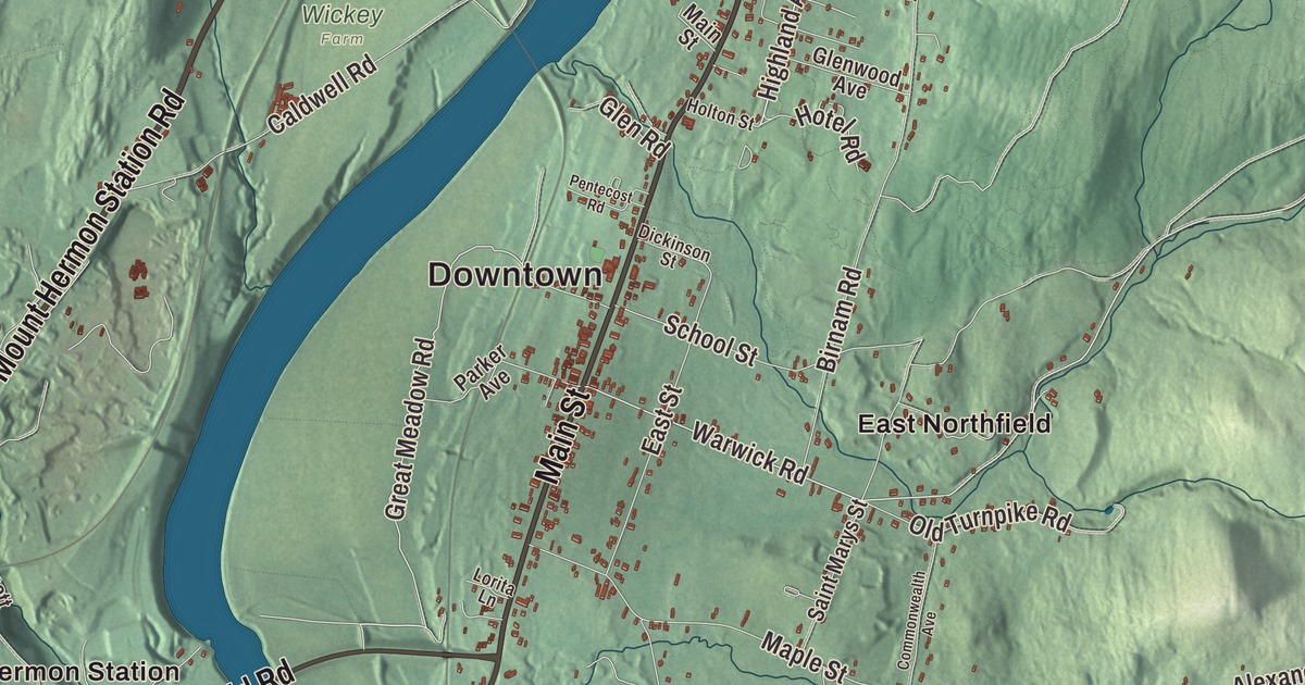
Northfield’s Main Street was laid out in the 1600s on a terrace above the Connecticut River, and it’s still the main road on the river’s east side. This map prints it with Millers Falls Road, Hinsdale Road, Wanamaker Road, Northfield Road and Mount Hermon Station Road, and with Northfield Mountain Reservoir, Bennett Meadow and Beers Mountain. Click here to purchase a print of this map for your wall.
Northfield is in Franklin County.
KNOWOL made this map in 2026 from public survey data and gave it the feel of an old atlas. United States Geological Survey elevation data raises the mountain and the river terraces, and the Census Bureau supplied the streets and the town line. Northfield had 2,866 people at the 2020 census. The Connecticut River runs through the town, dividing West Northfield from East Northfield and the village of Northfield, where the town hall is.
Squakheag and Main Street
The village of Squakheag, or Skakeat, stood on the site of today’s Northfield, home to Nipmuc and Sokoki Abenaki people. The Town of Northfield’s recorded history, in the Secretary of the Commonwealth’s list, dates European settlement to 1673; the Main Street district’s page gives 1672 and says the settlers left during the wars of the late 1600s and early 1700s, with permanent settlement beginning in 1714. Northfield was incorporated as a town in 1723. The Main Street Historic District runs more than 2 miles from Pauchaug Brook to Millers Brook and keeps many of the old lot lines. Its Federal and Greek Revival houses owe much to Calvin and Samuel Stearns, builders who had worked for Charles Bulfinch in Boston and came to town in 1799. The Pine Street School, just east of Main Street, was built in 1904 as the first of the town’s schools with indoor plumbing and central heating, and it has been the town museum since 1943.
Moody’s Northfield
The evangelist Dwight Lyman Moody was born in Northfield in 1837, the son of a farmer and stonemason. He came back to a farm near his birthplace, founded the Northfield Seminary for Girls in 1879 on a hillside in East Northfield, and two years later started the Mount Hermon School for boys across the river in Gill. His summer religious conferences drew thousands of visitors each year, and the town grew into a summer resort, especially after the Northfield Hotel opened in 1887. Francis Schell, a New York capitalist drawn by Moody’s work, had Bruce Price design a 99-room chateau on Highland Avenue, finished in 1903, and he gave the money for the Schell Bridge across the Connecticut River, a steel truss built from 1901 to 1903. The hotel and the chateau are gone, both demolished in the 1960s, and the Schell Bridge was barricaded in 1985. The two schools merged in 1971 as Northfield Mount Hermon School. Moody’s birthplace and grave on the old Northfield campus remain a historic site, Thomas Aquinas College has held classes there since 2019, and in 2016 about 1,300 acres of forest land that had belonged to the school were permanently protected as part of Northfield State Forest.
The historian James Kendall Hosmer, who served in the Civil War and became president of the American Library Association, was born in Northfield. The town remains part of Franklin County today.
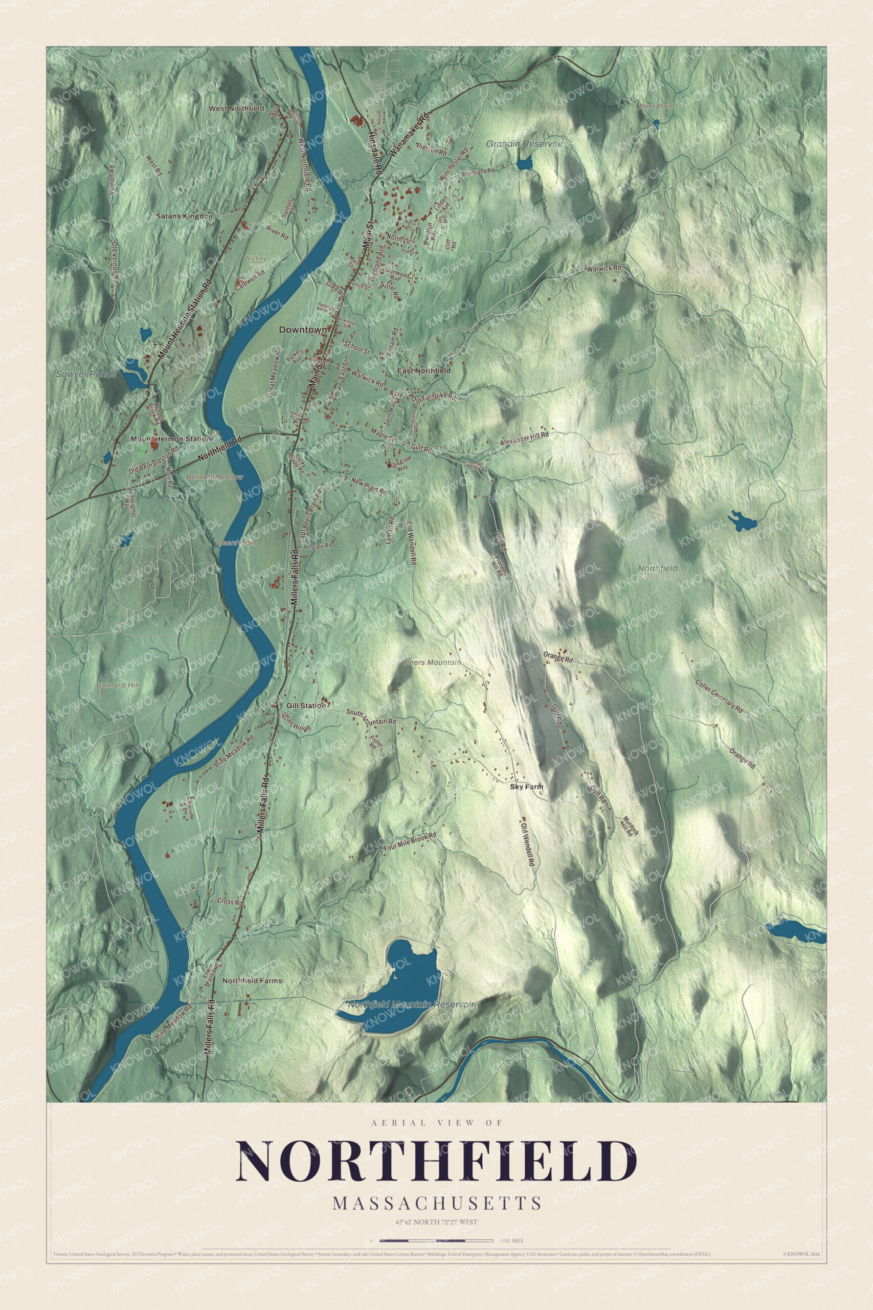
Click to explore a larger preview. The digital watermark does not appear on printed maps.
Names on this map
These names are printed on this map.
Places: Downtown, West Northfield, Northfield Farms, Barnard Hill, Beers Mountain, Beers Plain, Bennett Meadow, Bent Pond, Northfield Mountain Reservoir, Sawyer Ponds, Grandin Reservoir, Northfield State Forest, Wickey Farm, East Northfield, Gill Station, Mount Hermon Station, Satans Kingdom and Sky Farm.
Streets and roads: Millers Falls Road, Main Street, Wanamaker Road, Hinsdale Road, Mount Hermon Station Road, Northfield Road, Highland Avenue, North Lane, Gulf Road, Pine Meadow Road, Warwick Road, Winchester Road.
More street names, A to Z
Adams Road, Alexander Hill Road, Ashuelot Road, Bennett Brook Road, Birnam Road, Bolton Road, Caldwell Road, Capt Beers Plain Road, Cliff Road, Coller Cemetary Road, Commonwealth Avenue, Cross Road, Dickinson Street, East Street, Fisher Road, Four Mile Brook Road, Glen Road, Glenwood Avenue, Great Meadow Road, Holton Street, Hotel Road, Lamplighter Way, Linden Avenue, Lorita Lane, Louisiana Road, Lower Farms Road, Lucky Clapp Road, Lyman Hill Road, Lyman Road, Main Road, Maple Street, Murdock Hill Road, New Plain Road, Oak Terrace, Old Bernardston Road, Old Elm Way, Old Turnpike Road, Old Vernon Road, Old Wendell Road, Orange Road, Parker Avenue, Pentecost Road, Pierson Road, Pine Street, Pratt Hollow Road, Prospect Hill Road, Railroad Station Road, Randall Road, River Road, Riverview Drive, Saint Marys Street, School Street, Slate Road, South Mountain Road, Vernon Road, West Northfield Road, West Road, Woodruff Way.
See it on a wall
The Northfield map as a framed print. Swipe for more.


Around the map
Start with West Northfield. Follow Millers Falls Road, Main Street, Wanamaker Road, Hinsdale Road, Mount Hermon Station Road and Northfield Road across town. Then look outward toward Northfield Farms, East Northfield, Gill Station, Mount Hermon Station and Satans Kingdom. Bent Pond, Northfield Mountain Reservoir, Grandin Reservoir, Barnard Hill, Beers Mountain and Bennett Meadow are all printed on the map. Northfield Mountain Reservoir is the man-made upper pool of a pumped-storage power plant built underground in Northfield and Erving; it covers 300 acres about 800 feet above the river, and the plant began running in 1972. Route 10 crosses the river on Bennett’s Meadow Bridge, built in 1969, the third bridge at or near a crossing once served by a horse boat ferry. Satan’s Kingdom, a village near the Vermont line, holds an 1,800-acre wildlife management area, and stories say it got its name when a churchgoer leaving a sermon on hellfire saw a forest fire across the river.
The Northfield map makes a lovely addition to an office, library or den, and it can help teach children the geography and history of a town on both banks of the Connecticut River. It’s made for anyone who calls Northfield home, from West Northfield to East Northfield, and it shows the town as it looks today. Zoom in on the preview above to explore the details, then click here to get your copy of the Northfield, Massachusetts map.

Sources
- Northfield, Massachusetts, Wikipedia
- Northfield Main Street Historic District, Wikipedia
- Pine Street School (Northfield, Massachusetts), Wikipedia
- Dwight L. Moody, Wikipedia
- Northfield Chateau, Wikipedia
- Schell Bridge, Wikipedia
- James Kendall Hosmer, Wikipedia
- Northfield Mountain (hydroelectricity facility), Wikipedia
- Bennett’s Meadow Bridge, Wikipedia
- Satan’s Kingdom, Massachusetts, Wikipedia
- City and Town Incorporation and Settlement Dates, Secretary of the Commonwealth of Massachusetts (archived copy)