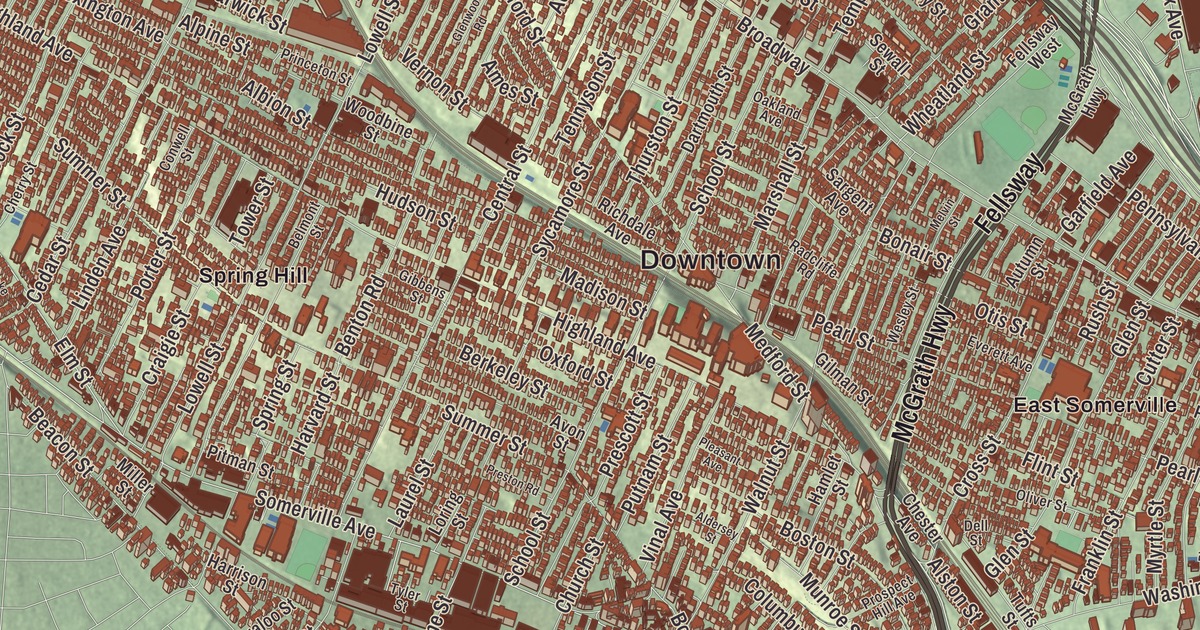
If you know Somerville by its hills and its squares, this map will feel familiar: Winter Hill, Spring Hill and Clarendon Hill rise between McGrath Highway, Powder House Boulevard and the Mystic River, with Ten Hills and East Somerville on one side and West Somerville on the other. Click here to purchase a print of this map for your wall.
Somerville is in Middlesex County.
KNOWOL made this map in 2026 from public survey data and finished it in the manner of an old city atlas. The rise of each hill comes from United States Geological Survey elevation data, and the streets and the city line come from the Census Bureau. Somerville covers about 4.1 square miles of land on the west bank of the Mystic River, bordered by Cambridge, Medford, Everett, Arlington and the Charlestown section of Boston. With 81,045 people at the 2020 census, it’s the most densely populated municipality in New England, and it has won the All-America City Award three times, in 1972, 2009 and 2015.
Beyond the Neck
People lived along the Mystic River for thousands of years before the English came. In the 1600s the Mystic people here were led by a woman sachem and her son Wonohaquaham, and written records point to a settlement near College Hill. In 1639 the sachem deeded the land that became Somerville to the English. The City of Somerville’s recorded history dates European settlement to 1630, the year John Woolrich, a trader, came out from the Charlestown peninsula and settled near today’s Dane Street. For two centuries the area was part of Charlestown, called “beyond the Neck” for the thin strip of land that joined it to the peninsula, and much of it was pasture known as the Stinted Pasture or Cow Commons.
In 1631 Governor John Winthrop was granted 600 acres here, named Ten Hills Farm for its ten small knolls, and the Ten Hills neighborhood has kept the name for more than 300 years. Winthrop launched the first ship in Massachusetts there, the Blessing of the Bay, and it’s seen as a forerunner of the United States Navy. Research has also found enslaved Native American captives on the farm within a decade of Winthrop’s arrival. Washington Street was probably the earliest road through Somerville, laid out by the mid-1630s, and Broadway followed in 1636 as the road to Menotomy, now Arlington. Somerville Avenue was Milk Row, the way dairy farmers drove to market in Charlestown and Boston.
The Powder Alarm and Prospect Hill
The Old Powder House was built as a windmill by John Mallet in 1703 or 1704 and sold to the colony in 1747 as a gunpowder magazine; it’s the oldest stone building in Massachusetts. Just after dawn on September 1, 1774, about 260 British regulars rowed up the Mystic River to a landing near Winter Hill, marched to the Powder House and carried off all its gunpowder. Rumors spread through the countryside, and thousands of militiamen started for Boston and Cambridge. The Powder Alarm is considered a turning point on the road to war and a dress rehearsal for Lexington and Concord. Seven months later, Paul Revere outran two British officers by galloping up Broadway toward Winter Hill. During the Siege of Boston, Prospect Hill was the central post of the American lines north of the city, called the Citadel. The plaque on its stone tower of 1903 says the flag of the United Colonies first waved there on January 1, 1776, and reenactors hold a flag raising there each New Year’s Day.
Somerville’s people asked to leave Charlestown, and on March 3, 1842, the governor signed the bill making it a town. Charles Miller of the separation committee proposed the name, and a report for the Somerville Historical Society called it a purely fanciful name, taken from no one person. Somerville was incorporated as a town in 1842, and it was incorporated as a city in 1872.
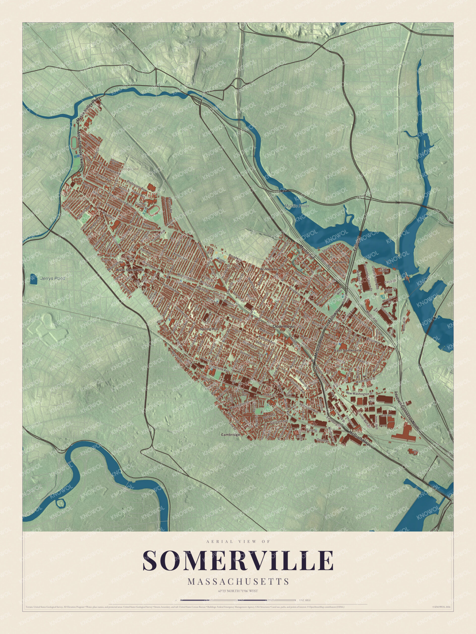
Click to explore a larger preview. The digital watermark does not appear on printed maps.
Names on this map
These names are printed on this map.
Places: Downtown, Clarendon Hill, College Hill, Jerrys Pond, Mystic River, Cambridge, East Somerville, Spring Hill, Ten Hills, West Somerville and Winter Hill.
Streets and roads: Fellsway, Mystic Avenue, Alewife Brook Parkway, McGrath Highway, Mystic Valley Parkway, Leverett Connector North, Powder House Boulevard, Shore Drive, Bailey Road, College Avenue, Curtis Street, Somerville Avenue.
More street names, A to Z
Adams Street, Adrian Street, Albion Street, Aldersey Street, Allen Street, Alpine Street, Alston Street, Ames Street, Assembly Square Drive, Austin Street, Autumn Street, Avon Street, Bailey Street, Banks Street, Beacon Street, Belmont Street, Benton Road, Berkeley Street, Billingham Street, Bolton Street, Bonair Street, Bond Street, Boston Avenue, Boston Street, Bow Street, Broadway, Bromfield Road, Burnham Street, Butler Drive, Cameron Avenue, Canal Street, Cedar Street, Central Street, Chandler Street, Cherry Street, Chester Avenue, Chester Street, Chestnut Street, Chetwynd Road, Church Street, Claremon Street, Clarendon Avenue, Clark Street, Clyde Street, Columbia Street, Columbus Avenue, Concord Avenue, Conners Drive, Conwell Avenue, Conwell Street, Craigie Street, Cross Street, Cutter Avenue, Cutter Street, Dane Avenue, Dane Street, Dartmouth Street, Dawes Street, Day Street, Dell Street, Derby Street, Dimick Street, Earle Street, Edgar Avenue, Electric Avenue, Elm Street, Elmwood Street, Endicott Avenue, Everett Avenue, Fairfax Street, Fellsway West, First Avenue, Fisk Avenue, Fitchburg Street, Flint Street, Foley Street, Foskett Street, Francesca Avenue, Franey Road, Franklin Street, Fremont Street, Garfield Avenue, Gibbens Street, Gilman Street, Glen Street, Glenwood Road, Gordon Street, Gorham Street, Governor Winthrop Road, Grand Union Boulevard, Grant Street, Great River Road, Hall Avenue, Hamilton Road, Hamlet Street, Hancock Street, Hanson Street, Harrison Street, Harvard Street, Heath Street, Highland Avenue, High Street, Hill Street, Hinckley Street, Holland Street, Holyoke Road, Howard Street, Hudson Street, Inner Belt, Inner Belt Road, Ivaloo Street, Jaques Street, Josephine Avenue, Joy Street, Kidder Avenue, Kingston Street, Lake Street, Laurel Street, Lexington Avenue, Liberty Avenue, Lincoln Avenue, Linden Avenue, Line Street, Linwood Street, Loring Street, Lowden Avenue, Lowell Street, Lower Campus Road, Madison Street, Main Street, Mallet Street, Mansfield Street, Marshall Street, Mason Street, Meacham Road, Medford Street, Melvin Street, Memorial Road, Middlesex Avenue, Miller Street, Moosal Place, Moreland Street, Morrison Avenue, Mount Vernon Street, Munroe Street, Murdock Street, Myrtle Street, Nashua Street, Newbury Street, New Road, Newton Street, New Washington Street, North Street, North Union Street, Oakland Avenue, Oak Street, Oliver Street, Orchard Street, Otis Street, Oxford Street, Park Street, Partridge Avenue, Paulina Street, Pearl Street, Pearson Avenue, Pearson Road, Pennsylvania Avenue, Perkins Street, Perry Street, Pinckney Street, Pitman Street, Pleasant Avenue, Porter Street, Prescott Street, Preston Road, Princeton Street, Professors Row, Properzi Way, Prospect Hill Avenue, Prospect Street, Puritan Road, Putnam Street, Radcliffe Road, Raymond Avenue, Revolution Drive, Richdale Avenue, Rose Street, Rush Street, Saint James Avenue, Sargent Avenue, School Street, Sewall Street, Simpson Avenue, South Street, Springfield Street, Spring Street, Stone Avenue, Sturtevant Street, Summer Street, Sycamore Street, Sydney Street, Talbot Avenue, Temple Street, Ten Hills Road, Tennyson Street, Third Avenue, Thurston Street, Tower Street, Tremont Street, Trull Street, Tufts Street, Tyler Street, Upland Road, Vernon Street, Victoria Street, Vinal Avenue, Walker Street, Wallace Street, Walnut Street, Ware Street, Warner Street, Warwick Street, Washington Street, Webster Avenue, Wesley Street, West Street, Wheatland Street, White Street, Whitfield Road, Whitman Street, Willow Avenue, Wilson Avenue, Windom Street, Winslow Avenue, Winter Street, Woodbine Street, Wyatt Street, Yorktown Street.
City of homes
Brickyards came first, then meatpacking, which made Somerville “The Chicago of New England”; in 1920, 73 percent of the meatpacking in Massachusetts happened here. Ford opened a plant at Assembly Square in 1926. The city reached its peak of 105,883 people in 1940, and the building boom of those years made the dense blocks of the “city of homes.” Archibald Query invented Marshmallow Fluff in Somerville, and since 2006 Union Square has thrown a Fluff Festival called “What the Fluff?” The first Economy Grocery Store opened here in 1914 and grew into Stop & Shop. Every May, Porchfest brings about 200 bands to play at residents’ houses.
Around the map
Start with East Somerville. Follow the Fellsway, Mystic Avenue, Alewife Brook Parkway, McGrath Highway, Mystic Valley Parkway and Powder House Boulevard across the city. Then look outward toward Spring Hill, Ten Hills, West Somerville and Winter Hill. Jerrys Pond, the Mystic River, Clarendon Hill and College Hill are all printed on the map. Clarendon, Spring and Winter hills are three of the seven glacial drumlins people call Somerville’s Seven Hills. McGrath Highway carries Route 28 and becomes the Fellsway north of Mystic Avenue, and the Alewife Brook and Mystic Valley parkways were planned in the 1890s to take city people out to the metropolitan parks. Powder House Boulevard was laid out in 1900, running northwest from Broadway at Nathan Tufts Park, where the Powder House stands. Just north of the square, Charles Tufts gave 20 acres of land he’d inherited on Walnut Hill for Tufts College, chartered in 1852, and said he would “put a light on it.” The Somerville and Medford line still runs through the campus and splits its library.
The Somerville map makes a fine addition to an office, library or den, and it can help teach children the geography and history of a city of hills and squares. It’s made for people who call Somerville home, from East Somerville to West Somerville, and it shows the city as it looks today. Zoom in on the preview above to explore the details, then click here to get your copy of the Somerville, Massachusetts map.

We made a map for every town and city in Massachusetts. Explore the complete Massachusetts map collection and find your town.
Sources