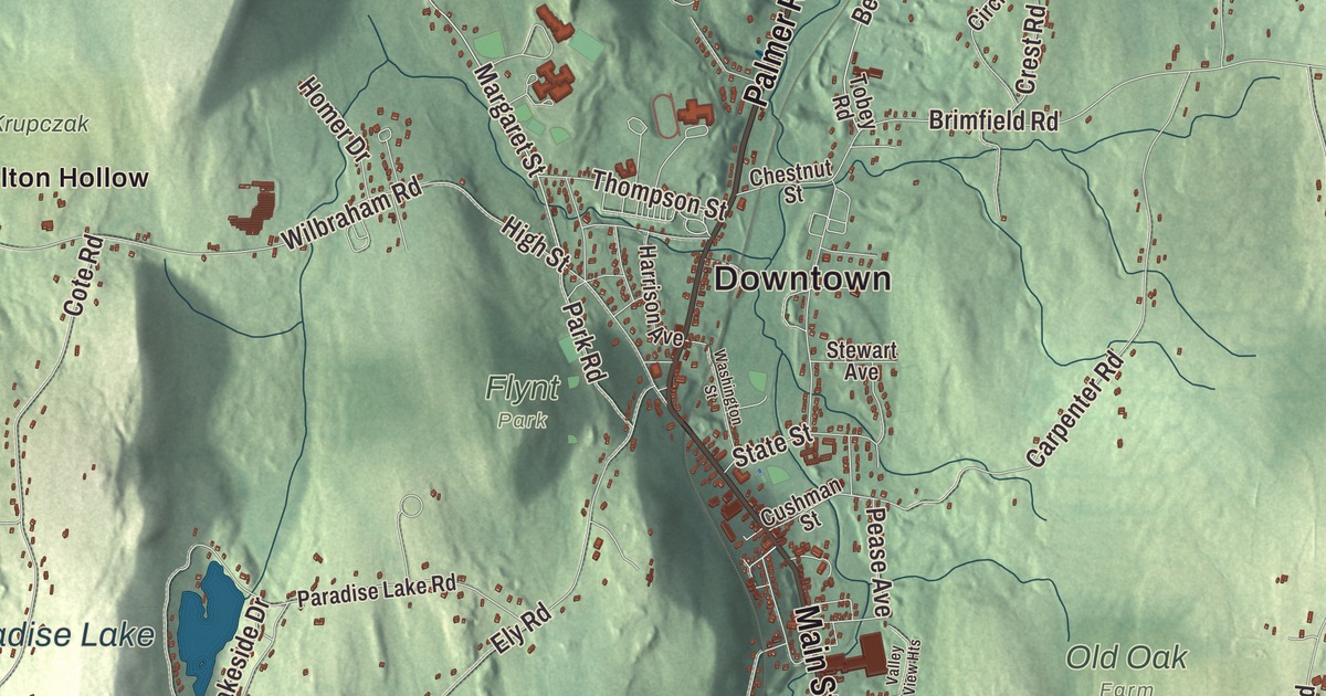
The poet Emily Dickinson’s mother grew up in Monson, and it was here that Edward Dickinson, then training as a lawyer in Amherst, met her in 1826. This map prints Main Street, Palmer Road, Wilbraham Street, Boston Road, Stafford Road and Hospital Road, with Conant Brook Reservoir, Paradise Lake, Bunyan Mountain and Chicopee Mountain. Click here to purchase a print of this map for your wall.
Monson is in Hampden County.
KNOWOL made this map in 2026 from public survey data and drew it with the quiet look of an old atlas. United States Geological Survey elevation data shapes the hills, and the Census Bureau supplied the streets and the town line. Monson covers 44.8 square miles in eastern Hampden County, bordered by Palmer on the north, Brimfield and Wales on the east, Stafford, Connecticut, on the south, and Hampden and Wilbraham on the west, and it had 8,150 people at the 2020 census. Chicopee Brook runs north through the center of town toward the Quaboag River, and Route 32 comes up from Connecticut to become Main Street downtown.
On the Bay Path
The first colonist in what’s now Monson was granted 200 acres by the General Court in 1657 and built a tavern on the Bay Path, the main road from Springfield to Boston, which crossed the north part of town. It was the first house between Springfield and Brookfield, but it was given up within a year or two. The Town of Monson’s recorded history, in the Secretary of the Commonwealth’s list, dates European settlement to 1715, the year the first permanent settlers came. The land became part of Brimfield in 1735, and its western part later split off. Monson was incorporated as a town in 1775, on August 23, the same day as nearby Ludlow, and named for Sir John Monson, president of the British Board of Trade and a friend of Governor Thomas Pownall. The town remains part of Hampden County today.
In the 1800s and early 1900s mills went up along Chicopee Brook. Woolen mills, run by men such as Joseph L. Reynolds, Dwight W. Ellis, C. W. Holmes and S. F. Cushman, were among the most successful, and Heiman and Lichten made straw and felt goods on Main Street. Monson granite came out of a quarry first opened in 1809 east of today’s Margaret Street, and for a short time it supplied stone to the Springfield Armory. Rufus Flynt opened a commercial quarry on the site in 1825 with five workers, and by 1900 the W. N. Flynt Granite Company had almost 500 employees. The quarry worked until about 1935.
Born in Monson
Emily Norcross was born in Monson in 1804, one of nine children of Joel and Betsy Norcross. Her father believed in educating women and sent her to Monson Academy. When Edward Dickinson came to Monson on legal business in 1826, the two began a correspondence of ninety-three letters, and they married and made their home in Amherst, where their daughter Emily, the poet, was born. Samuel Robbins Brown, who grew up in Monson, went to China as a missionary in 1838 and opened the first Protestant school in the Chinese Empire, where his pupils included Yung Wing. Later, in Japan, he helped translate the New Testament into Japanese and helped found the Asiatic Society of Japan. He’s buried in Monson.
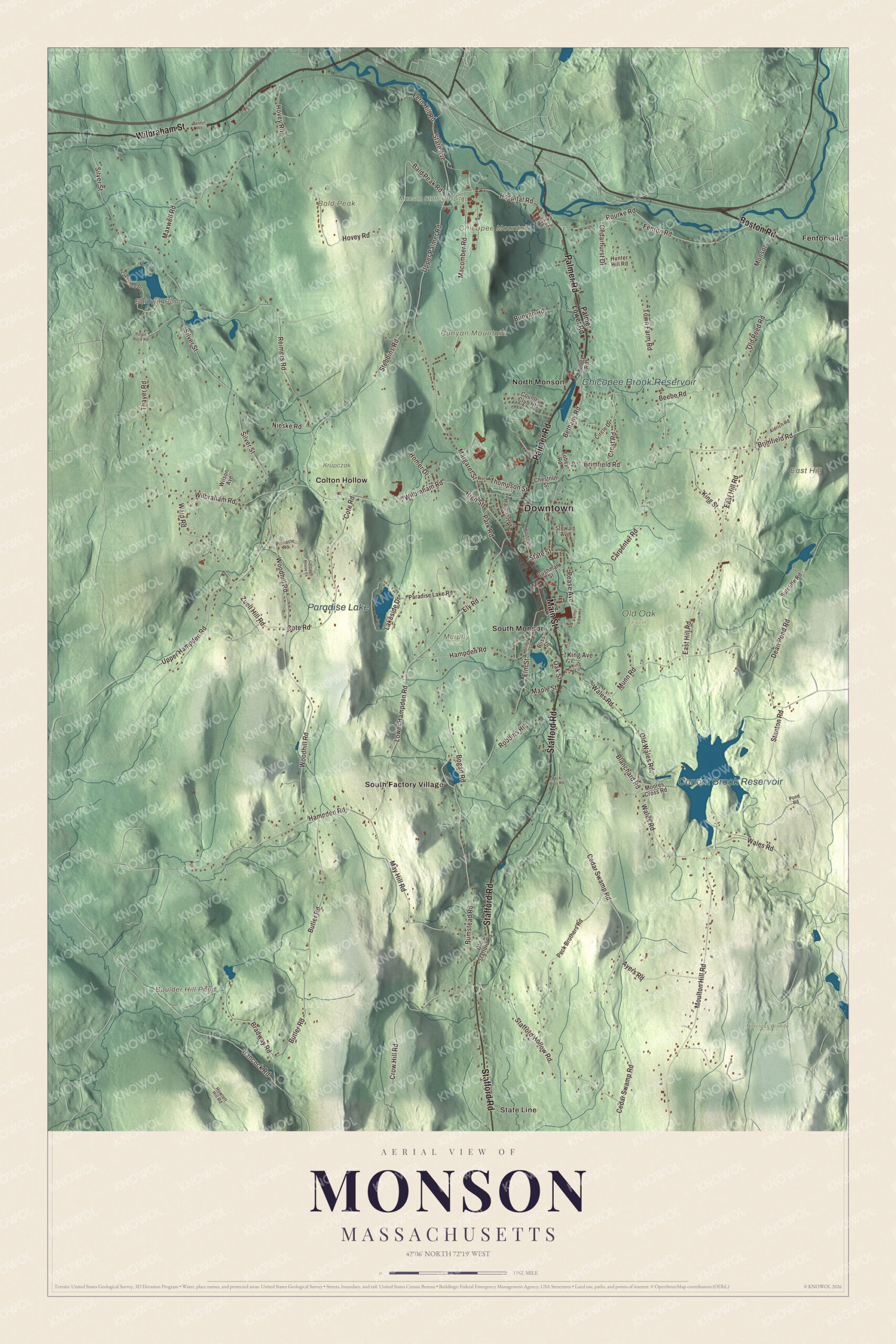
Click to explore a larger preview. The digital watermark does not appear on printed maps.
Names on this map
These names are printed on this map.
Places: Downtown, State Line, Bald Peak, Bunyan Mountain, Chicopee Mountain, East Hill, Baldwin Pond, Boulder Hill Pond, Conant Brook Reservoir, Paradise Lake, Chicopee Brook Reservoir, Flynt Park, Krupczak, Monson State Hospital, Murphy Farm, Norcross Wildlife Sanctuary, Old Oak Farm, Colton Hollow, Fentonville, North Monson, South Factory Village and South Monson.
Streets and roads: Wilbraham Street, Palmer Road, Boston Road, Main Street, Stafford Road, Hospital Road, Upper Palmer Road, Margaret Street, Elm Street, Hampden Road, State Avenue, Cedar Swamp Road.
More street names, A to Z
Aldrich Road, Ayers Road, Bald Peak Road, Beebe Road, Bethany Road, Blanchard Road, Bliss Street, Bogan Road, Bradway Road, Bridge Street, Brimfield Road, Bumstead Road, Bunyan Road, Butler Road, Carpenter Road, Carriage House Lane, Cedarhurst Drive, Chestnut Street, Circle Drive, Cote Road, Country Club Heights, Crest Road, Crow Hill Road, Cushman Street, Dean Pond Road, East Hill Road, Ely Road, Fenton Road, Fern Hill Road, Hancock Road, Harrison Avenue, High Street, Homer Drive, Hovey Road, Howlett Hill Road, Hunter Hill Road, King Avenue, King Lane, King Street, Lakeshore Drive, Lakeside Drive, Lower Hampden Road, Macomber Road, Maple Street, Maxwell Road, May Hill Road, Monson, Moores Cross Road, Moulton Hill Road, Munn Road, Nieske Road, Oak Street, Old Reed Road, Old Stafford Road, Old Wales Road, Palmer Lower Road, Paradise Lake Road, Park Road, Pease Avenue, Peck Bros Road, Peck Brothers Road, Pinnacle Road, Pond Road, Pulpit Rock Road, Reimers Road, Robbins Road, Rourke Road, Silva Street, Silver Street, Stafford Hollow Road, Stanton Road, State Street, Stebbins Road, Stewart Avenue, Sutcliffe Road, Thayer Road, Thompson Street, Tobey Road, Town Farm Road, Upper Hampden Road, Valley View Heights, Waid Road, Wales Road, Washington Street, Wilbraham Road, Wilson Avenue, Woodhill Road, Zuell Hill Road.
See it on a wall
The Monson map as a framed print. Swipe for more.


Around the map
Start with State Line. Follow Wilbraham Street, Palmer Road, Boston Road, Main Street, Stafford Road and Hospital Road across town. Then look outward toward Colton Hollow, Fentonville, North Monson, South Factory Village and South Monson. Baldwin Pond, Boulder Hill Pond, Conant Brook Reservoir, Paradise Lake, Bald Peak, Bunyan Mountain and Chicopee Mountain are all printed on the map, with every name set on the artwork itself.
Conant Brook Reservoir lies behind the Conant Brook Dam, built by the Army Corps of Engineers between 1964 and 1966 to hold back floods on the Quaboag, Chicopee and Connecticut rivers. Its storage area is normally empty, and 4.7 miles of trails for hiking, mountain biking and riding cross the project land, with the main entrance on Wales Road. Elsewhere in Monson, the Trustees of Reservations care for about 2,000 acres at Peaked Mountain, pronounced “pea-kid.” From the 1,227-foot summit the view takes in Connecticut’s Shenipsit State Forest to the south, Mount Monadnock to the north and Mount Wachusett to the northeast.
The Monson map makes a fine addition to an office, library or den, and it can help teach children the geography and history of a mill and quarry town on Chicopee Brook. It’s made for people who call Monson home, from North Monson to State Line, and it shows the town as it looks today. Zoom in on the preview above to explore the details, then click here to get your copy of the Monson, Massachusetts map.

Sources