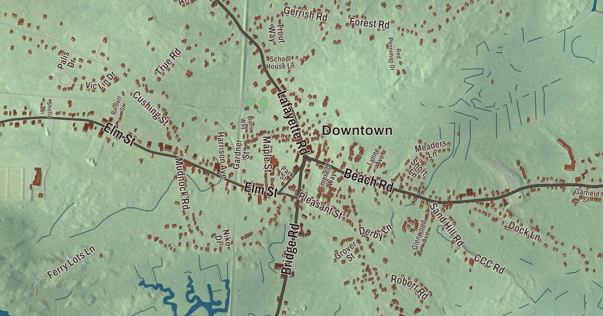
Salisbury is the northernmost town in Massachusetts, where the Merrimack River meets the Atlantic, and this map runs Beach Road out past Browns Point to Salisbury Beach, with Bridge Road, Lafayette Road, Pike Street, Collins Street and North End Boulevard around it. Click here to purchase a print of this map for your wall.
Salisbury is in Essex County.
KNOWOL made this map in 2026 from public survey data and gave it the feel of an old atlas. United States Geological Survey elevation data sets the low ground of the marshes and dunes, and the roads and the town line come from the Census Bureau. Salisbury covers 17.9 square miles on the north bank of the Merrimack at its mouth, with the Atlantic Ocean to the east, the river and Newburyport to the south, Amesbury to the west and Seabrook, New Hampshire, to the north. Marsh covers much of the town, especially in the east. Salisbury had 9,236 people at the 2020 census.
Colchester on the Merrimack
When the English came, the land north of the Merrimack belonged to the Pentucket people of the Pennacook confederation, who came to the coast in season to fish in the wetlands. The Town of Salisbury’s recorded history, in the Secretary of the Commonwealth’s list, dates European settlement to 1638 and says Salisbury was incorporated as a town in 1639; the town page gives 1640 for the incorporation. The English first called the place Colchester. Its later name comes from Salisbury in Wiltshire, England, the birthplace of Christopher Batt, who was chosen to train the settlers’ militia. Salisbury was settled under a land grant from the Massachusetts Bay Colony’s General Court and laid out close together for defense, in a half circle around a garrison house, with a night watch and a militia. Those first roads still exist, though the shape is now a triangle bounded by Elm Street, School Street and Bridge Road.
Each first settler got a small house lot near the center, a larger planting lot just outside it and a share of the marsh near the beach, where it seems they cut salt hay. Salisbury was one of the six towns of Old Norfolk County, and in 1679, when four of the others became the Province of New Hampshire, it was joined to Essex County. In 1654 its sixty commoners voted to send thirty families west of the Powwow River, and that new settlement became the town of Amesbury in 1668.
The beach
In 1866 Beach Road was built across the Great Marsh to the town’s five miles of beach, and Salisbury Beach grew into a busy summer resort of hotels, restaurants, shops, cottages, arcades and amusement parks. A carousel called the Flying Horses, carved by Charles I. D. Looff, was installed in 1914, John Miller built the beach’s first roller coaster, the Sky Rocket, and a Dodgem ride first built by Max and Harold Stoeher of Methuen ran there in one form or another from 1920 to 1980. Glenn Miller, Ella Fitzgerald, Louis Armstrong, Frank Sinatra and Liberace all played the beach. The resort stayed lively through the 1960s and then slowly faded, and today the Salisbury Beach Boardwalk has souvenir shops, restaurants, cafes and arcades facing the ocean.
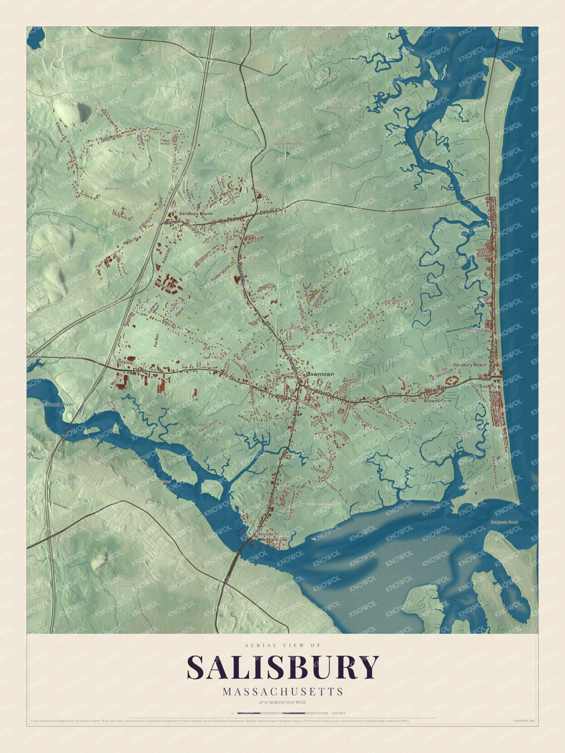
Click to explore a larger preview. The digital watermark does not appear on printed maps.
Names on this map
These names are printed on this map.
Places: Downtown, Allen Rock, Badgers Rock, Batt Hill, Carr Island, Beckmans Pond, Cains Millpond, Merrimack River, Conservation Land, Salisbury Salt Marsh Wildlife Management Area, Browns Point, Cushing, Rings Island, Salisbury Beach and Salisbury Plains.
Streets and roads: Beach Road, Pike Street, North End Boulevard, Collins Street, Lafayette Road, Bridge Road, Elm Street, Main Street, Toll Road, March Road, Cable Avenue, State Reservation Road.
More street names, A to Z
18th Street West, Allen Drive, Atlantic Avenue, Baker Road, Bartlett Street, Bayberry Lane, Black Snake Road, Caroline Drive, Catherine Way, CCC Road, Congress Street, Corporal Patten Way, Cushing Street, Daniel Court, Deluca Drive, Derby Lane, Dock Lane, Elizabeth Lane, Elmwood Street, Emerald Way, Fanaras Drive, Ferry Lots Lane, Ferry Road, Folly Mill Road, Forest Road, Fox Run, Gardner Street, Garfield Street, Gerrish Road, Glenwood Avenue, Grover Street, Harrison Avenue, Highback Road, High Street, Island Way, Jak-Len Drive, Jon Street, Joy Road, Kel Lori Drive, Kendell Lane, Learned Lane, Leary's Way, Lena Maes Way, Libby Avenue, Liberty Street, Linda Lane, Lions Way, Locust Street, Longmeadow Drive, Lynne Avenue, Maple Street, Mason Lane, Meaders Lane, Merrill Street, Mudnock Road, Niko Drive, Ocean Front South, Old County Road, Old Elm Street, Palis Drive, Park Street, Pine Street, Pleasant Street, Poor Farm Road, Rabbit Road, Railroad Avenue, Red Penniman Drive, Robert Road, Samantha Way, Sand Hill Road, School House Lane, Seabrook Road, Sholtz Terrace, Short Lane, State Beach Road, Sweet Apple Tree Lane, Trout Way, True Road, Twelfth Street West, Vic Lin Drive, Viking Street.
Around the map
Start with Browns Point. Follow Beach Road, Pike Street, North End Boulevard, Collins Street, Lafayette Road and Bridge Road across town. Then look outward toward Cushing, Rings Island, Salisbury Beach and Salisbury Plains. Merrimack River, Conservation Land, Batt Hill, Allen Rock and Carr Island are all printed on the map. Browns Point lies between Salisbury Beach and the center of town, and Salisbury Plains is in the northwest corner. Salisbury Beach State Reservation takes in the whole seacoast, with a 3.8-mile ocean beach, a campground with 484 sites and non-swimming beaches on the river; it’s one of the most heavily used state parks in Massachusetts, with more than a million visitors a year. Harbor seals often rest on Badgers Rocks in the river in fall and winter. Carr Island and Ram Island, out in the Merrimack, are state wildlife management areas. Hannah Webster Foster, born in Salisbury, wrote The Coquette, a best-selling novel published without her name in 1797; her name didn’t appear on its title page until 1866.
The Salisbury map makes a fine addition to an office, library or den, and it can help teach children the geography and history of a beach town at the mouth of a great river. It’s made for people who call Salisbury home, from Salisbury Plains to Salisbury Beach, and it shows the town as it looks today. Zoom in on the preview above to explore the details, then click here to get your copy of the Salisbury, Massachusetts map.

We made a map for every town and city in Massachusetts. Explore the complete Massachusetts map collection and find your town.
Sources