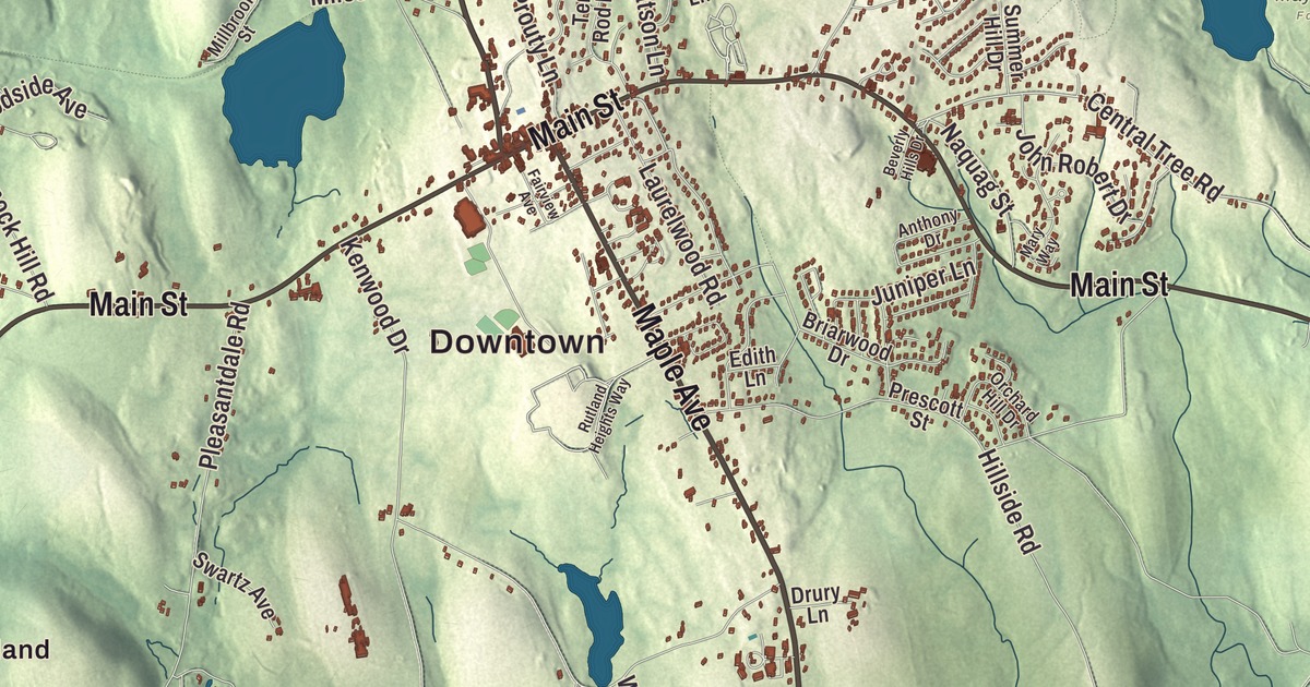
Rutland sits at the geographic center of Massachusetts, high on the hills northwest of Worcester, and this map of the town prints Main Street, East County Road, Barre Paxton Road, Pommogussett Road, Maple Avenue and Turkey Hill Road, with North Rutland, Muschopauge and West Rutland around them. Click here to purchase a print of this map for your wall.
Rutland is in Worcester County.
KNOWOL made this map in 2026 from public survey data and set it in the style of an old atlas. United States Geological Survey elevation data shapes the hills, and the roads and the town line come from the Census Bureau. Rutland covers 36.4 square miles, with Princeton to the northeast, Holden to the east, Paxton to the southeast, Oakham to the southwest and Barre and Hubbardston to the northwest. It’s about 13 miles northwest of Worcester, and the town common stands 1,200 feet above sea level; the town page calls Rutland the highest town between the Berkshires and the Atlantic. Rutland had 9,049 people at the 2020 census.
Naquag
The town page says Europeans first settled here in 1666, when the place was called Naquag, a name that came from the Nipmuc. The Town of Rutland’s recorded history, in the Secretary of the Commonwealth’s list, dates European settlement to 1686. Both agree that Rutland was incorporated as a town in 1713. The first town was far bigger than today’s, taking in what are now Barre, Hubbardston, Oakham, Princeton and the northern half of Paxton. During the Revolution, North Rutland held camps for captured Hessian soldiers, the German troops hired by the British. The town’s public library was founded around 1865.
Rufus Putnam’s house on Main Street
Rufus Putnam was George Washington’s chief engineer in the Revolutionary War. In early March of 1776 his plan of timbers and bundled brush let American troops fortify Dorchester Heights overnight, above Boston Harbor, though the ground was frozen. After the war he settled in Rutland, held several town offices and served as a representative to the General Court. His house at 344 Main Street was built between 1760 and 1765 by John Murray, a Loyalist official who fled in 1774 and never came back, and the state took it during the war; Putnam bought it from the government and lived there until 1788. That year he led a group of Revolutionary War veterans west and founded Marietta, Ohio, the first permanent American settlement in the Northwest Territory, and he became known as the “Father of Ohio.” The General Rufus Putnam House is a National Historic Landmark, it appears on the town seal, and it’s now a bed and breakfast.
Rutland made medical history too. The state sanatorium for tuberculosis on Rutland Heights opened on October 3, 1898, the first state sanatorium for the disease in the country. Its early treatment leaned on fresh air, exercise and plenty of food, and commissions from other states and visitors from England, Canada and Korea toured it as a model. It accepted 21,304 patients in its first 50 years, closed in 1991 and was torn down in 2004.
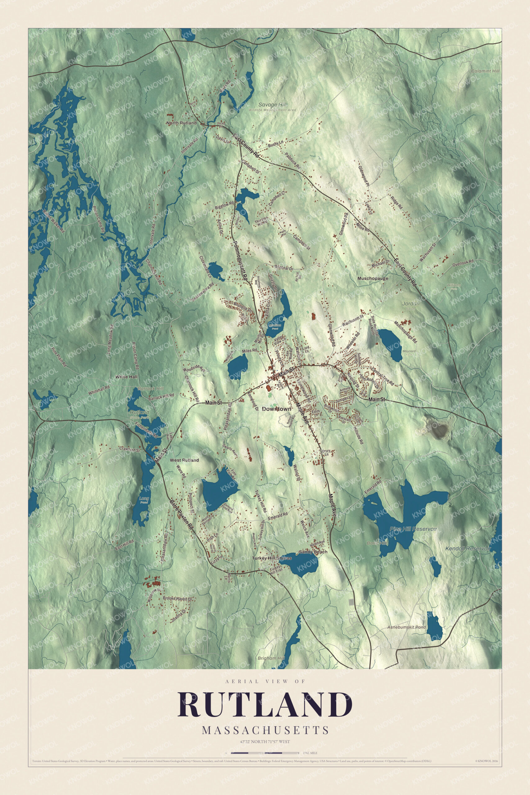
Click to explore a larger preview. The digital watermark does not appear on printed maps.
Names on this map
These names are printed on this map.
Places: Downtown, North Rutland, Sandy Beach, Barrack Hill, Bond Hill, Brigham Hill, Calamint Hill, Asnebumskit Pond, Pine Hill Reservoir, Kendall Reservoir, Jordan Farm, Long Pond, Maynard Farm, Moulton Pond, Rutland State Park, Savage Hill Wildlife Management Area, Williams Farm, Muschopauge, Turkey Hill Shores, West Rutland and White Hall.
Streets and roads: Barre Paxton Road, East County Road, Main Street, Pommogussett Road, Maple Avenue, Turkey Hill Road, Central Tree Road, Intervale Road, Whitehall Road, River Road, Pleasantdale Road, Prison Camp Road.
More street names, A to Z
Ab Test Road, Anthony Drive, Arline Drive, Arrowhead Way, Barrack Hill Road, Bethany Drive, Beverly Hills Drive, Bigelow Road, Briarwood Drive, Brintnal Drive, Brooke Haven Drive, Brunelle Drive, Bushy Lane, Campbell Court, Campbell Street, Charnock Hill Road, Cloverdale Lane, Crawford Street, Davis Street, Demond Pond Row, Drury Lane, East Hill Road, Edith Lane, Emerald Road, Fairview Avenue, Finn Park Road, Fishermans Road, Glenwood Place, Glenwood Road, Grizzly Drive, Helen Avenue, Hillside Road, Irish Lane, Jaimie Ann Drive, Joanna Drive, John Robert Drive, Juniper Lane, Kenwood Drive, Lake Avenue, Laurelwood Road, Lizzy Lane, Locke Road, Long Meadow Road, Lord Lane, Lowry Lane, Maggies Way, Maple Spring Drive, Marjorie Lane, Mary Way, Michael Drive, Miles Road, Millbrook Street, Milne Road, Morris Lane, Moulton Mill Road, Muschopauge Road, Naquag Street, Nates Way, Orchard Hill Drive, Overlook Road, Paddock Road, Patriot Lane, Pine Plain Road, Prescott Street, Prospect Street, Prouty Lane, Ridge Road, Ruben Walker Road, Rutland Heights Way, Sassawanna Road, State Hospital Road North, Summer Hill Drive, Swartz Avenue, Ten Rod Road, Thurston Hill Road, Turkey Hill Drive, Turkey Hill Trail, Valley View Circle, Vista Circle, Wachusett Street, Walnut Street, Ware Road, Watson Lane, Welch Avenue, Wheeler Road, Wildbrook Drive, Woodside Avenue.
See it on a wall
The Rutland map as a framed print. Swipe for more.


Around the map
Start with North Rutland. Follow Barre Paxton Road, East County Road, Main Street, Pommogussett Road, Maple Avenue and Turkey Hill Road across town. Then look outward toward Sandy Beach, Muschopauge, Turkey Hill Shores, West Rutland and White Hall. Asnebumskit Pond, Pine Hill Reservoir, Kendall Reservoir, Barrack Hill, Bond Hill, Turkey Hill and Brigham Hill are all printed on the map. Rutland counts five villages, New Boston, West Rutland, Muschopauge, North Rutland and Turkey Hill. A tree, the Central Tree, on Central Tree Road, marks the general spot of the state’s geographic center. Rutland State Park covers 300 acres in town, with a beach and boat ramp on Whitehall Pond and trails that meet the Massachusetts Central Rail Trail and the Midstate Trail. Each summer the town holds a four-day Fourth of July celebration that starts on July 1, with music, a chicken barbecue by the Fire Brigade, a Historical Society lemonade social, fireworks and a parade on the Fourth.
The Rutland map makes a fine addition to an office, library or den, and it can help teach children the geography and history of the town at the middle of the state. It’s made for people who call Rutland home, from North Rutland to Turkey Hill, and it shows the town as it looks today. Zoom in on the preview above to explore the details, then click here to get your copy of the Rutland, Massachusetts map.

Sources