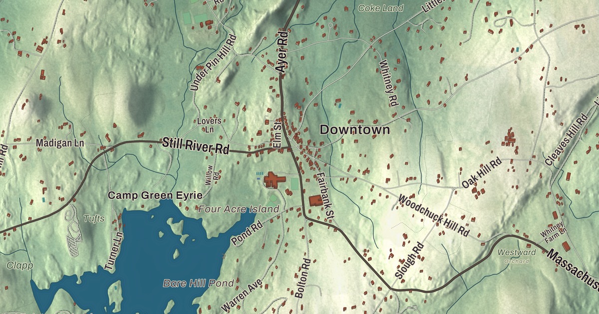
Harvard is apple orchards and Bare Hill Pond, the old Shaker village and Fruitlands up on Prospect Hill, with Still River down by the Nashua. This map prints Ayer Road, Massachusetts Avenue, Still River Road, Buena Vista Street, Saratoga Boulevard and Patton Road, with Bare Hill Pond, Mirror Lake, Brown Hill and the Oxbow National Wildlife Refuge. Click here to purchase a print of this map for your wall.
Harvard is in Worcester County.
KNOWOL made this map in 2026 from public survey data, finished in the manner of an old atlas. The hills come from United States Geological Survey elevation data, and the Census Bureau supplied the streets and the town line. Harvard covers 27 square miles about 25 miles west-northwest of Boston, mostly between Interstate 495 and Route 2, and it had 6,851 people at the 2020 census. The town page describes it as largely wooded, with rolling hills, fields and wetlands, and a large ridge along its eastern side.
A town named for a college
The town page says Europeans first settled here in the 1600s along a road between Lancaster and Groton that was formally laid out in 1658, on land bought from the Nashaway sachem Sholan and his nephew George Tahanto. The Town of Harvard’s recorded history, in the Secretary of the Commonwealth’s list, dates European settlement to 1704. Harvard was incorporated as a town in 1732 from parts of Lancaster, Groton and Stow, on the condition that it settle a minister and build a meetinghouse within two years. How it got its name is uncertain, but according to The Harvard Crimson, Josiah Willard, who had attended Harvard College, named the town for it. The town remains part of Worcester County today.
In 1734 the town counted five districts: Oak Hill, Bare Hill, Still River, Old Mill and Shabikin, which is present day Devens. The Benjamin Ball Pencil Company worked in the Old Mill district from 1830 to 1860 and made some of the first writing instruments produced in the United States. Still, Harvard lived mostly by farming until the middle of the 1900s, and its apple orchards, whose most notable product is cider, still show that past. The clockmaker Levi Hutchins, born in Harvard in 1761, claimed to have made the first American alarm clock, in 1787.
Shakers and Fruitlands
In 1769 a group of Harvard residents led by Shadrack Ireland broke from the town church and built what became known as the Square House. Mother Ann Lee met with them in 1781, and they joined her Shakers. The Harvard Shaker Village Historic District, roughly on Shaker Road, South Shaker Road and Maple Lane, was listed on the National Register in 1989. The community reached about 200 members in the 1850s and closed in the late 1910s. One of the early Shaker hymns, “The Humble Heart,” came from Harvard, with words by Eunice Wyeth and music by Thomas Hammond.
In June 1843 Amos Bronson Alcott brought his family, including ten-year-old Louisa May Alcott, to Harvard, where he and Charles Lane started Fruitlands, a farm community meant to grow everything it ate, on the slopes of Prospect Hill. It lasted seven months, but Henry David Thoreau and Ralph Waldo Emerson came to visit, and the town page says Louisa drew on her time there for Little Women. Clara Endicott Sears restored the farmhouse and opened it as a museum in 1914. She later moved a Shaker building from the village to the grounds, and both the town page and the Shaker district page call it the first Shaker museum in the United States. In 2023 USA Today readers voted Fruitlands one of the ten best history museums in the country.
Bare Hill Pond, Oak Ridge and the Oxbow
Bare Hill Pond, 320 acres with a town beach, a dock and several small islands, is a central spot in town. Up on the eastern ridge, Harvard College set up the Oak Ridge Observatory at 609 feet on Pinnacle Road, which the town page calls the highest point between Mount Wachusett and the ocean. For more than seventy years it served Harvard University, and the town page says it was at one time the most extensively equipped observatory in the eastern United States.
Along the Nashua River, the Oxbow National Wildlife Refuge covers about 1,667 acres of floodplain forest, wetland and upland in Ayer, Shirley, Harvard and Lancaster. It was formed mainly from land transferred by the Army’s Fort Devens, which operated from 1917 to 1996, and in 2001 the refuge added about 120 acres of the old Watt Farm along Still River Depot Road. The village of Still River lies where the Still River joins the Nashua at the Bolton Flats, and bricks were made there from colonial times into the 1800s. Harvard’s notable people include the cookbook author Fannie Farmer, the philosopher Willard Van Orman Quine and Gary K. Wolf, who created Roger Rabbit.
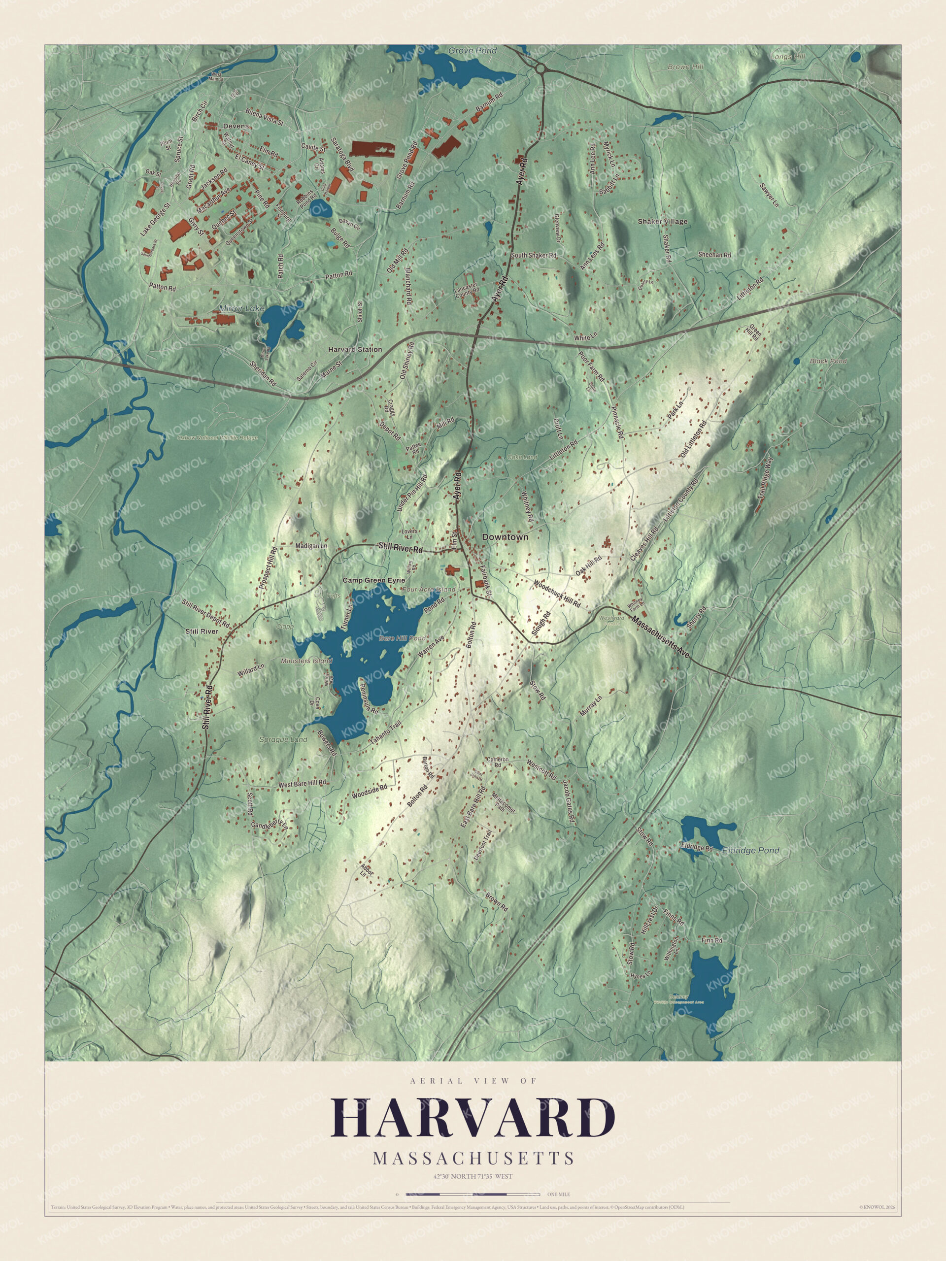
Click to explore a larger preview. The digital watermark does not appear on printed maps.
Names on this map
These names are printed on this map.
Places: Downtown, Devens, Brown Hill, Four Acre Island, Longs Hill, Ministers Island, Bare Hill Pond, Black Pond, Grove Pond, Mirror Lake, Eldridge Pond, Clapp, Coke Land, Delaney Wildlife Management Area, Oxbow National Wildlife Refuge, Sprague Land, Tufts, Westward Orchard, Camp Green Eyrie, Harvard Station, Shaker Village and Still River.
Streets and roads: Ayer Road, Massachusetts Avenue, Still River Road, Buena Vista Street, Saratoga Boulevard, Patton Road, Littleton Road, El Caney Street, Fairbank Street, Lake George Street, Macarthur Avenue, Barnum Road.
More street names, A to Z
Abbot Lane, Adams Circle, Ann Lee Road, Ann Lees Road, Babbitt Lane, Barton Road, Birch Circle, Blanchard Road, Bolton Road, Bowers Road, Brown Road, Bulge Road, Cameron Road, Candleberry Lane, Cavite Street, Cleaves Hill Road, Cold Harbor, Cove Drive, Craggs Road, Cruft Lane, Davao Circle, Deerfoot Trail, Depot Road, East Bare Hill Road, Eldridge Road, Elm Road, Elm Street, Feinburg Street, Finn Road, Finns Road, Givry Street, Glenview Drive, Grant Road, Green Hill Road, Grove Pond Road, Hillcrest Drive, Hospital Road, Hynes Lane, Jackson Road, Jacob Gates Road, Lancaster County Road, Littleton County Road, Locust Street, Lovers Lane, Madigan Lane, Marne Street, Mettacomet Path, Mill Road, Mirror Lake Road, Murray Lane, Myrick Lane, Oak Hill Road, Oak Street, Ohlin Lane, Old Littleton Road, Old Mill Road, Old Shirley Road, Park Lane, Patch Road, Pattee Road, Peninsula Road, Pine Road, Pinnacle Road, Plum Street, Pond Road, Poor Farm Road, Prospect Hill Road, Quarry Lane, Quebec Street, Queenstown Street, Robbins Pond Road, Saint Barbara Street, Saint John Lane, Salerno Circle, Sawyer Lane, Scott Road, Shaker Road, Sheehan Road, Sheridan Road, Sherry Road, Shiloh Street, Slough Road, South Shaker Road, Spruce Street, Still River Depot Road, Stow Road, Tahanto Trail, Trail Ridge Way, Turner Lane, Under Pin Hill Road, Vip Drive, Walnut Street, Warren Avenue, West Bare Hill Road, Westcott Road, West Main Street, White Lane, Whitney Farm Lane, Whitney Road, Willard Lane, Willow Road, Wilroy Avenue, Withington Lane, Woodchuck Hill Road, Woodside Road.
See it on a wall
The Harvard map as a framed print. Swipe for more.


Around the map
Start with Devens. Follow Ayer Road, Massachusetts Avenue, Still River Road, Buena Vista Street, Saratoga Boulevard and Patton Road across town. Then look outward toward Harvard Station, Shaker Village and Still River. Bare Hill Pond, Black Pond, Grove Pond, Mirror Lake, the Oxbow National Wildlife Refuge, Brown Hill, Longs Hill, Four Acre Island and Ministers Island are all printed on the map, and every one of those names is right there on the artwork. Devens itself is shared with Ayer and Shirley.
The Harvard map makes a handsome addition to an office, library or den, and it can help teach children the geography and history of a farm town that drew some unusual communities. It’s made for people who call Harvard home, from Still River to Devens, and it shows the town as it looks today. Zoom in on the preview above to explore the details, then click here to get your copy of the Harvard, Massachusetts map.

Sources
- Harvard, Massachusetts, Wikipedia
- Harvard Shaker Village Historic District, Wikipedia
- Fruitlands Museum, Wikipedia
- Levi Hutchins, Wikipedia
- Oxbow National Wildlife Refuge, Wikipedia
- Still River (Nashua River), Wikipedia
- Devens, Massachusetts, Wikipedia
- City and Town Incorporation and Settlement Dates, Secretary of the Commonwealth of Massachusetts (archived copy)