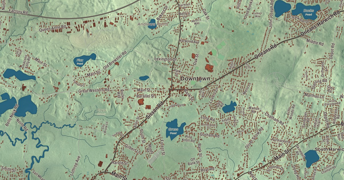
Harwich is seven villages on the south side of the Cape, from the bogs of North Harwich to the three harbors of Harwich Port and Long Pond up on the Brewster line. This map prints Main Street, Pleasant Lake Avenue, Orleans Road, Orleans-Harwich Road, Brewster-Chatham Road and Sisson Road, with Long Pond, Andrews Pond, Bells Neck and the Town Forest. Click here to purchase a print of this map for your wall.
Harwich is in Barnstable County.
KNOWOL made this map in 2026 from public survey data and gave it the look of an old atlas. United States Geological Survey elevation data gives the land its relief, and the streets and the town line come from the Census Bureau. Harwich covers 33.1 square miles, more than a third of it water, on the south side of Cape Cod facing Nantucket Sound. It had 13,440 people at the 2020 census, and the town page says that number grows to roughly 37,000 in the summer season.
From Yarmouth’s edge to the Harwiches
The Town of Harwich’s recorded history, in the Secretary of the Commonwealth’s list, dates European settlement to 1670, when the land was part of Yarmouth. Harwich was incorporated as a town in 1694, and at first it took in the lands of today’s Brewster. It was named for the English town of Harwich, and the town remains part of Barnstable County today. Its villages, sometimes called the Harwiches, are West Harwich, North Harwich, East Harwich, South Harwich, Harwich Center, Harwich Port and Pleasant Lake. On September 14, 1994, the town celebrated its tricentennial, 300 years to the day after its founding.
Harwich Center was first known as Broadbrooks, after a family that settled part of it, later shortened its name to Brooks and put up at least eight of the village’s buildings. Its village center sits where Main Street meets Pleasant Lake Avenue. The Harwich Historic District, listed on the National Register in 1975, runs along Main and Parallel streets from the cemetery to Brooks Park, where millstones from Ebenezer Broadbrooks’s mill mark the site of his 1732 homestead. Sidney Brooks founded Brooks Academy in 1844, and the village’s most prominent building is the First Congregational Church of 1832. In 1975 a time capsule was buried in front of Brooks Academy, due to be opened in 2075.
Cranberries, decoys and a branded hand
Early Harwich lived by fishing and farming. The town page says Harwich is considered by some to be the birthplace of the cranberry industry, with the first commercial operation opened in 1846, and many bogs remain, especially in North Harwich. Since 1976 the town has held the Harwich Cranberry Festival each September, noted for its fireworks.
A. Elmer Crowell, born in 1862, was a master decoy carver from East Harwich who specialized in shorebirds, waterfowl and miniatures. In 1876 he built a gunning stand on Pleasant Lake, where his father owned land. His page says his decoys are consistently regarded as some of the finest ever made, and his preening pintail drake and Canada goose share the world record for a decoy at $1.13 million. His barn workshop was moved near the Harwich Historical Society and is open as a museum. Beside the same society stands a plaque to Jonathan Walker, a Harwich-born fishing captain who in 1844 tried to carry seven people escaping slavery from Florida to freedom in the British West Indies. He was caught, tried and branded on the hand, and became a national hero. John Greenleaf Whittier wrote the poem “The Branded Hand” about him.
Harbors, ponds and ballfields
Harwich Port, on Nantucket Sound, takes its motto “Three Harbors, One Port” from Saquatucket, Wychmere and Allen harbors. Long Pond, which the town page calls the largest lake on the Cape, is shared with Brewster and doubles as a landing place for seaplanes, and the village of Pleasant Lake sits at its southwest corner. The Harwich Mariners of the Cape Cod Baseball League play at Whitehouse Field in Harwich Center, and more than 100 of the club’s players have gone on to the major leagues. The Cape Cod Rail Trail also crosses the town, with its rotary in North Harwich near Main Street. Other names tied to Harwich include John Kendrick, a maritime fur trader who was one of the first Americans to visit the Pacific Northwest, Hawaii and China, and Joseph N. Welch, the Army counsel who asked Senator Joseph McCarthy, “At long last, have you left no sense of decency?” The politician Tip O’Neill kept a vacation home near Bank Street Beach and is buried in Mount Pleasant Cemetery.
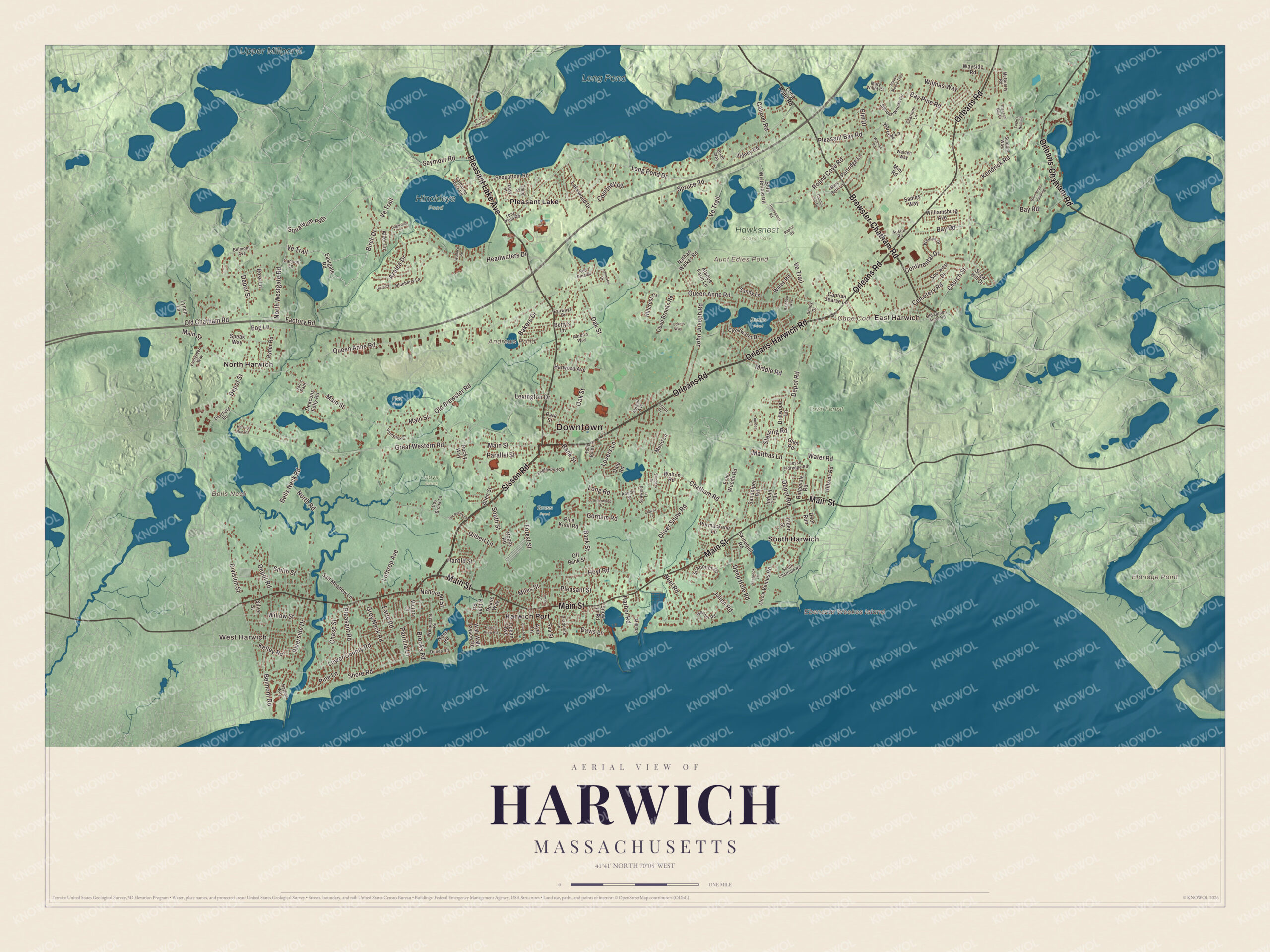
Click to explore a larger preview. The digital watermark does not appear on printed maps.
Names on this map
These names are printed on this map.
Places: Downtown, East Harwich, West Harwich, Bells Neck, Cape Cod, Ebenezar Weekes Island, Eldridge Point, Andrews Pond, Aunt Edies Pond, Long Pond, Upper Millpond, Bucks Pond, Coys Brook, Flax Pond, Grass Pond, Hawksnest State Park, Hinckleys Pond, Town Forest, Harwich Port, North Harwich, Pleasant Lake and South Harwich.
Streets and roads: Sisson Road, Brewster-Chatham Road, Orleans Road, Orleans-Harwich Road, Main Street, Pleasant Lake Avenue, Orleans-Chatham Road, Ve Trail, Long Pond Drive, North Westgate Road, Squantum Path, Seymour Road.
More street names, A to Z
Aaron's Way, Abigail Avenue, Acorn Drive, Adams Street, Aladoe Farm Lane, Alden Street, Alder Lane, Allen Street, Auston Road, Ayer Lane, Azalea Drive, Bakers Drive, Bank Street, Bay Pine Road, Bay Road, Bells Neck Road, Belmont Avenue, Belmont Road, Betty's Lane, Birch Drive, Blueberry Lane, Blue Heron Landing, Bog Lane, Braddock Lane, Brian Way, Brooks Road, Cahoon Lane, Cahoon Road, Cannon Hill Drive, Captian Bearse Lane, Catharine Rose Road, Cemetery Road, Charlene Lane, Chase Street, Chatham Road, Church Street, Clearwater Drive, Continental Drive, Cornerwood Drive, Courtney Road, Coy Brook Lane, Daisy Street, Dale Road, Davis Lane, Deacons Folly Road, Deep Hole Road, Deerfield Road, Deer Run, Depot Road, Depot Street, Division Street, Doane Way, Dogwood Lane, Driftwood Lane, Dundee Circle, Dunes Road, Eagle's Nest Road, Earle Road, Eastgate Road, Echo Woods Road, Elm Drive, Englewood Drive, Evergreen Way, Factory Road, Fairways Drive, Forest Street, Gilbert Lane, Glen Road, Gorham Road, Great Western Road, Grey Neck Road, Harbor Road, Harbor View Road, Harbor Way, Harding Lane, Harold Street, Harwood Avenue, Hawksnest Road, Headwaters Drive, Herring Run Road, Hillcrest Drive, Hillside Road, Hoyt Road, Indian Trail, Jan's Path, Jasper Moore Trail, Jesse Eldredge Road, John Joseph Road, Julia Court, Julien Road, Kelley Road, Kendrick Road, Kildee Road, Lakeview Drive, Lakewood Drive, Leavitt Lane, Lewis Lane, Lexington Drive, Long Pond Road, Long Road, Lothrop Avenue, Lovers Lane, Lower County Road, Lynch Lane, Marthas Lane, Mary Beth Lane, Mary Willet Court, McGuerty Road, Mello Lane, Middle Road, Miles Street, Mill Road, Mini Road, Moody Road, Nathan Walker Road, Neel Road, Nehoiden Street, Nons Road, North Road, Oak Street, Obed Brooks Road, Ocean Avenue, Off Bank Street, Old Brewster Road, Old Chatham Road, Old Queen Anne Road, Oliver Snow Road, Parallel Street, Park Street, Partridge Lane, Patricia Lane, Pine Knoll Road, Pine Lane, Pleasant Bay Court, Pleasant Bay Road, Pleasant Road, Pleasant Street, Prince Charles Drive, Purmackene Lane, Quason Lane, Queen Anne Road, Rainbow Way, Raptor Road, Red Pine Drive, Ridgevale Road, Riverside Drive, Rocky Way, Rose Lane, Round Cove Road, Ryder Road, Sadies Way, Salt Meadow Lane, Sandpiper Road, Sandy Lane, Schooner Drive, Scotlin Way, Seabrook Lane, Sea Street, Seaward Lane, Sequattom Road, Seth Whitefield Road, Shady Drive, Shore Road, Sidney Road, Silver Street, Six Penny Lane, Skinequit Road, Skippers Drive, Smith Street, Snow Inn Road, Sou'west Drive, South Chatham Road, South Street, Speak Way, Spruce Road, Standish Woods Circle, Sterling Road, Sugar Hill Drive, Third Street, Tody Bole Lane, Tuckers Way, Uncle Venies Road, Victory Drive, Vineyard Lane, Wah Wah Taysee Road, Walden Way, Wales Road, Wallace Road, Walther Road, Walton Road, Water Road, Wayside Road, Wequasset Road, Whelan Road, Whidah Drive, Williamsburg Avenue, Willow Street, Wilmas Way.
See it on a wall
The Harwich map as a framed print. Swipe for more.


Around the map
Start with East Harwich. Follow Sisson Road, Brewster-Chatham Road, Orleans Road, Orleans-Harwich Road, Main Street and Pleasant Lake Avenue across town, then look outward toward West Harwich, Harwich Port, North Harwich, Pleasant Lake and South Harwich. Andrews Pond, Long Pond, the Town Forest, Bells Neck and Ebenezar Weekes Island are all printed on the map, and each of those names is right there on the artwork.
The Harwich map makes a fine addition to an office, library or den, and it can help teach children the geography and history of a Cape Cod cranberry town. It’s made for people who call Harwich home, from East Harwich to Harwich Port, and it shows the town as it looks today. Zoom in on the preview above to explore the details, then click here to get your copy of the Harwich, Massachusetts map.

Sources
- Harwich, Massachusetts, Wikipedia
- Harwich Historic District, Wikipedia
- Harwich Center, Massachusetts, Wikipedia
- Harwich Port, Massachusetts, Wikipedia
- North Harwich, Massachusetts, Wikipedia
- A. Elmer Crowell, Wikipedia
- Jonathan Walker (abolitionist), Wikipedia
- Harwich Mariners, Wikipedia
- City and Town Incorporation and Settlement Dates, Secretary of the Commonwealth of Massachusetts (archived copy)