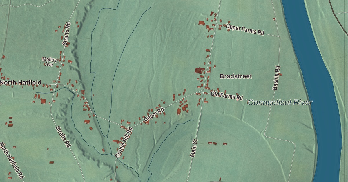
Hatfield sits on the west bank of the Connecticut River, farm fields running out from the village toward Horse Mountain, with the Mill River winding through the middle of town. This map prints Main Street, Prospect Street, Elm Street, Maple Street, South Street, West Street and Mountain Street, with Great Pond, Chestnut Mountain, Horse Mountain and Canary Island. Click here to purchase a print of this map for your wall.
Hatfield is in Hampshire County.
KNOWOL made this map in 2026 from public survey data, styled after an old atlas. The ridges and the river valley come from United States Geological Survey elevation data, and the Census Bureau supplied the streets and the town line. Hatfield covers 16.8 square miles at the mouth of the Mill River, about 25 miles north of Springfield, and it had 3,352 people at the 2020 census. The village of Hatfield lies in the southern part of town beside the river, while Westbrook, North Hatfield and Bradstreet sit near the northern line and West Hatfield toward Northampton.
A town across the river from Hadley
The town page says Hatfield was founded in 1660 on land granted to General Daniel Dennison and Governor William Bradford. The Town of Hatfield’s recorded history, in the Secretary of the Commonwealth’s list, dates European settlement to 1661. At first the settlement belonged to Hadley, whose church stood across the Connecticut River. One theory of the split, as the town page tells it, is that people on the west bank asked to build a church on their own side, so they wouldn’t have to cross the river every week, especially in winter when it froze, and Hadley said no. They voted to go their own way, and Hatfield was incorporated as a town in 1670. The town remains part of Hampshire County today.
The region raised cattle, sheep, corn and tobacco. The town suffered raids during King Philip’s War, and during the Revolution it was an important source of supplies and men for the rebels. In 1786 it served as a gathering place for the discontented who joined Shays’ Rebellion. One family, the Hastings, gave Hatfield its doctors for generations, from Dr. Thomas Hastings, born in 1652, who was also the town’s first schoolteacher, to Dr. John Hastings, born in 1765.
Sophia Smith and Rebecca Dickinson
Sophia Smith was born in Hatfield in 1796 and made it her home. Deaf from the age of 40 and unmarried, she inherited a large fortune from her family and, with the encouragement of the Reverend John Morton Greene, left it to found a college for women. Smith College, in Northampton, was chartered in 1871 and opened in 1875 with 14 students. Her will also paid for Smith Academy, a coeducational high school in Hatfield that is still the town’s public school for grades 6 through 12, and in 2000 she was named to the National Women’s Hall of Fame.
Rebecca Dickinson, born in Hatfield in 1738, was a gownmaker who chose to live single and supported herself by her trade. She learned mantua making as a girl, became a well-known gownmaker in Massachusetts and trained apprentices of her own. Her surviving journal, kept by the Pocumtuck Valley Memorial Association in Deerfield, has served as the basis for scholarship in early American women’s history.
Prospect Street and the Borden Base Line
The Mill-Prospect Street Historic District follows Prospect Street, which roughly cuts Hatfield in half, from Elm Street north past Chestnut Street, and centers on the Mill River. A gristmill stood near the Prospect Street crossing by 1661, and water powered industry worked there into the 1970s. The most notable of the surviving mill buildings is the Shattuck Gun Factory, now the Old Mill Inn. The district was listed on the National Register in 2002.
The south end of the Borden Base Line is in that district too. This survey line, 7.42 miles long, runs north from Hatfield into South Deerfield and was completed in 1831 for the state’s first formal geographic survey. Its page calls the measurement the first project of its kind undertaken in America, made with a new device invented by Simeon Borden that kept steady readings as the temperature changed. The American Society of Civil Engineers named it a National Historic Civil Engineering Landmark in 1981.
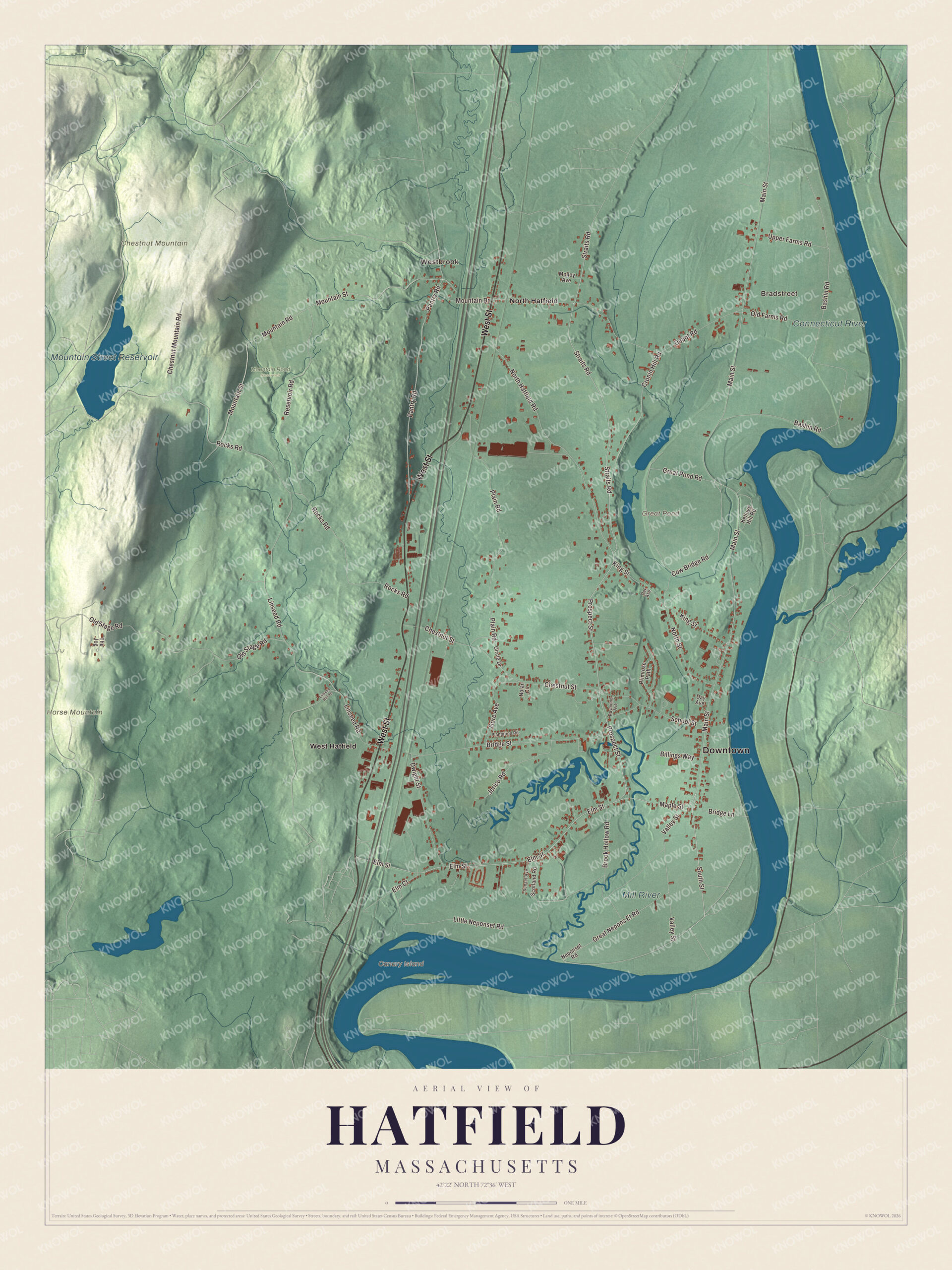
Click to explore a larger preview. The digital watermark does not appear on printed maps.
Names on this map
These names are printed on this map.
Places: Downtown, Bradstreet, Westbrook, Canary Island, Chestnut Mountain, Horse Mountain, Great Pond, Mountain Street Reservoir, Mill River, Connecticut River, Mountain Road Reservoir, North Hatfield and West Hatfield.
Streets and roads: West Street, Main Street, Prospect Street, South Street, Maple Street, Elm Street, Straits Road, North Hatfield Road, Elm Court, Rocks Road, Little Neponset Road, Bashin Road.
More street names, A to Z
Billings Way, Bridge Lane, Bridge Street, Brook Hollow Road, Chestnut Mountain Road, Chestnut Street, Circle Drive, Cow Bridge Road, Cronin Hill Road, Day Avenue, Depot Road, Dwight Street, Gore Avenue, Great Nepons Et Road, Great Pond Road, Jerico Road, Kellogg Hill Road, King Street, Linseed Hill Road, Linseed Road, Molloy Avenue, Mountain Drive, Mountain Road, Mountain Street, Neponset Road, Nolan Circle, North Street, Oak Avenue, Old Farms Road, Old Stage Road, Pantry Road, Plain Road, Plantation Road, Primrose Path, Raymond Avenue, Reservoir Road, School Street, Scotland Road, Sunset Avenue, The Jog, Upper Farms Road, Valley Street.
See it on a wall
The Hatfield map as a framed print. Swipe for more.


Around the map
Start with Bradstreet. Follow West Street, Main Street, Prospect Street, South Street, Maple Street and Elm Street across town, then look outward toward Westbrook, North Hatfield and West Hatfield. Great Pond, the Mountain Street Reservoir, the Mill River, the Connecticut River, Chestnut Mountain, Horse Mountain and Canary Island are all printed on the map, and every one of those names is right there on the artwork. The town page describes Horse Mountain, on the western edge, as a typical New England granite glacial remnant.
The Hatfield map makes a fine addition to an office, library or den, and it can help teach children the geography and history of an old farm town on the Connecticut. It’s made for people who call Hatfield home, from Bradstreet down to the village, and it shows the town as it looks today. Zoom in on the preview above to explore the details, then click here to get your copy of the Hatfield, Massachusetts map.

Sources