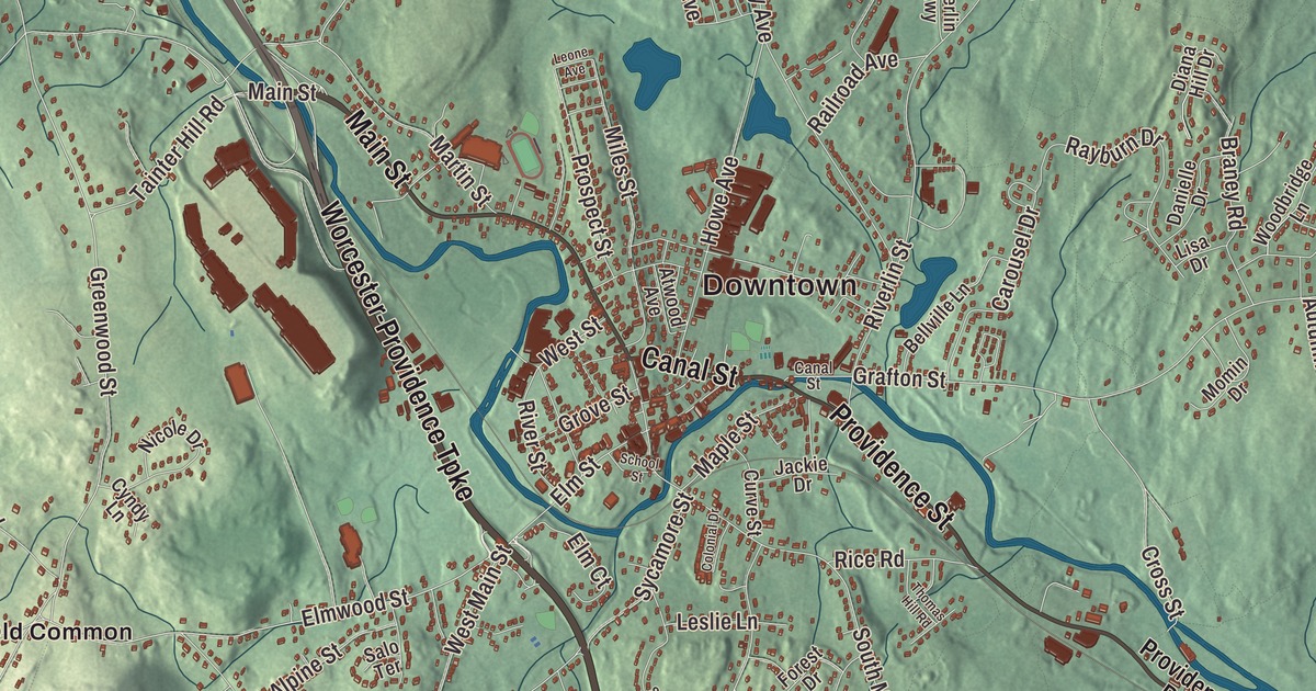
Millbury’s name tells its story: a mill town on the Blackstone River, where one spinning mill has turned since the 1750s and still makes the insides of major league baseballs. This map prints Main Street, Canal Street, Providence Street, Grafton Road and Park Hill Avenue, with Singletary Pond, Ramshorn Pond, Dorothy Pond and Pakachoag Hill. Click here to purchase a print of this map for your wall.
Millbury is in Worcester County.
KNOWOL made this map in 2026 from public survey data and styled it after the town plates in an old atlas. The rise and fall of the land comes from United States Geological Survey elevation data, and the Census Bureau supplied the streets and the town line. Millbury covers 16.3 square miles in the Blackstone Valley and had 13,831 people at the 2020 census. The Blackstone River, which begins in Worcester, flows southeast through Millbury and on through Sutton, Grafton and the valley towns into Rhode Island, where it turns tidal and flows into the Seekonk River just north of Providence.
The North Parish
The Town of Millbury’s recorded history, in the Secretary of the Commonwealth’s list, dates European settlement to 1716. Until 1813 Millbury was the Second, or North, Parish of Sutton. Getting from one end of Sutton to the other for meetings took a long time, so the people of the North Parish asked the General Court to divide the town. Millbury was incorporated as a town in 1813, by an act dated June 11, and it took its name from its long history of mills. The town remains part of Worcester County today.
Mills on the Blackstone
Millbury’s mill history starts in 1735, when John Singletary began running a mill on Singletary Brook. Around 1753 he built the S and D Spinning Mill, which still runs, and the town page counts it among the oldest continuously operated mills in the United States. It appears on the town seal, and it makes the inner parts of the Rawlings baseballs used in Major League Baseball. During the Industrial Revolution the Blackstone River powered many textile mills and factories here. The inventor William Crompton, whose fancy-goods loom was patented in 1837, spent part of his later career making cotton and woolen goods in Millbury; by 1900, at least three-fourths of all woolen goods made in the United States were woven on Crompton looms or looms built on their principles. In 1824, the mineral vermiculite was first found in Millbury.
Asa Waters and his brother Elijah learned to make firearms from their father, then bought land along the Blackstone and built mills that turned out guns, scythes and sawmill equipment. Their armory, opened in 1808, ran until it closed suddenly in 1841 and reopened when the Civil War began in 1861. Asa built the Asa Waters Mansion at 123 Elm Street between 1826 and 1832 to a design by the architect Asher Benjamin, a three-story house fronted by fluted two-story columns. It joined the National Register in 1978, and the Millbury Historical Society has its headquarters there. Louise Torrey married Alphonso Taft in Millbury in 1853 and lived here for many years, and their son, President William Howard Taft, spent summer vacations in town as a boy. As president he came back to visit his aunt, Delia C. Torrey, for Millbury’s centennial, and the Torrey House where he stayed is now known as the Taft House. In 2004, Millbury was named a Preserve America community.
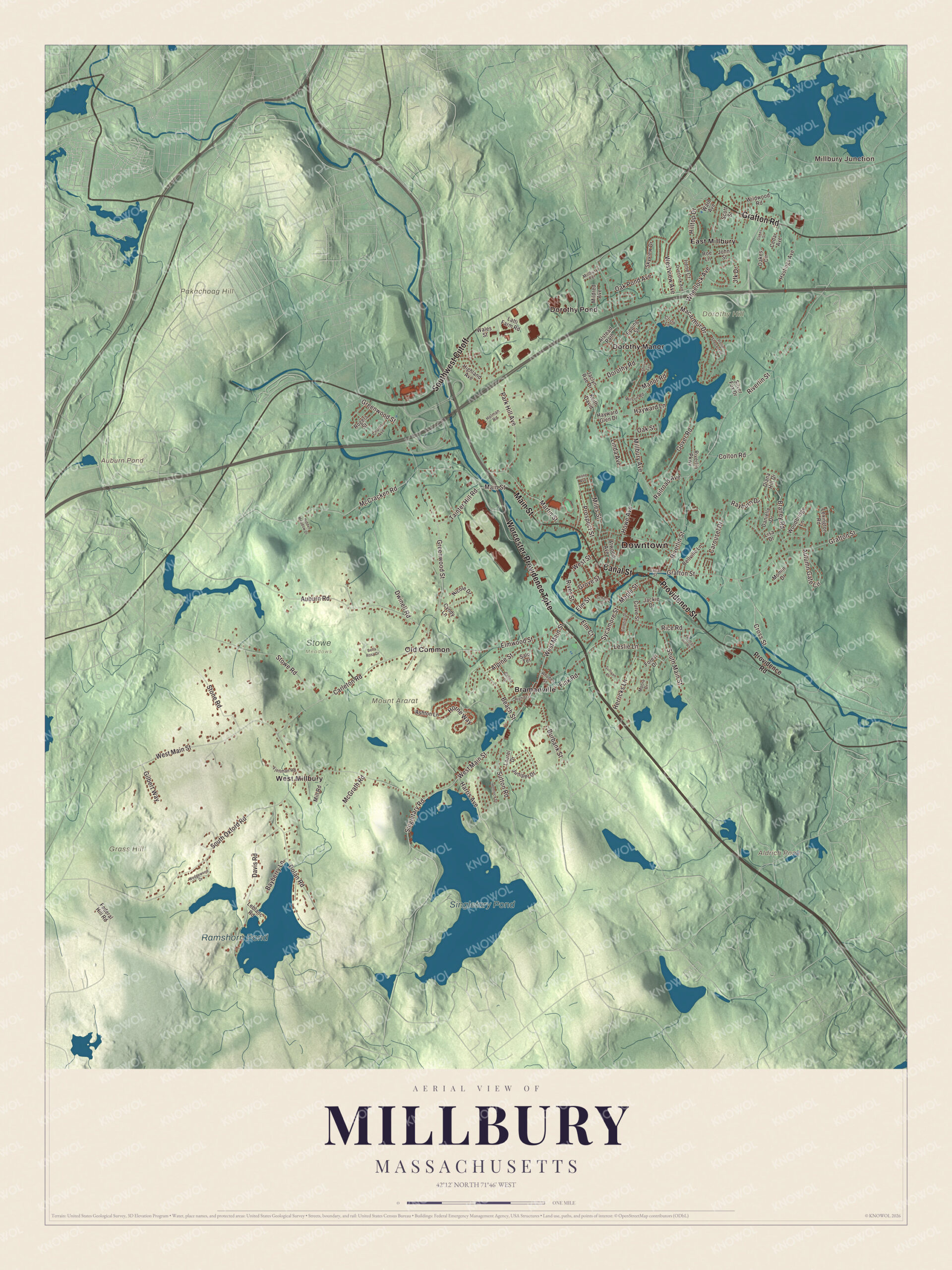
Click to explore a larger preview. The digital watermark does not appear on printed maps.
Names on this map
These names are printed on this map.
Places: Downtown, Millbury Junction, Dorothy Hill, Grass Hill, Mount Ararat, Pakachoag Hill, Aldrich Pond, Auburn Pond, Singletary Pond, Ramshorn Pond, Stowe Meadows, Bramanville, Dorothy Manor, Dorothy Pond, East Millbury, Old Common and West Millbury.
Streets and roads: Worcester-Providence Turnpike, Canal Street, Main Street, Providence Street, Southwest Cutoff, Grafton Road, Park Hill Avenue, Greenwood Street, Elmwood Street, West Main Street, Grafton Street, Harris Avenue.
More street names, A to Z
Alpine Street, Alstead Path, Ashton Lane, Atwood Avenue, Auburn Road, Autumn Gate Circle, Ballard Lane, Bayberry Lane, Beach Street, Bella Rosa Drive, Bellville Lane, Braney Road, Burbank Street, Carleton Road, Carousel Drive, Cedar Avenue, Chunis Avenue, Colonial Drive, Colton Road, Cristo Lane, Cross Street, Curve Street, Cyndy Lane, Danielle Drive, Davis Road, Diana Hill Drive, Dolan Road, Dorothy Road, Dwinell Road, Elm Court, Elm Street, Epping Street, Federal Hill Road, Fink Road, Fjellman Road, Forest Drive, Gilbert Way, Gover Road, Grove Street, Hastings Avenue, Hayward Glen Drive, Hayward Lane, Hemlock Drive, Herricks Lane, Hidden Meadow Drive, Highland Avenue, High Street, Hilltop Drive, Holman Road, Horne Way, Howe Avenue, Irene Court, Jackie Drive, Jaclyn Rae Drive, Jfk Drive, John Street, Juniper Drive, Keith David, Latti Farm Road, Laurel Drive, Leblanc Road, Leone Avenue, Leslie Lane, Lexington Road, Linda Avenue, Lisa Drive, Macarthur Drive, Manor Road, Maple Street, Martin Street, McCracken Road, McGrath Road, Mildred Avenue, Miles Street, Millbury Avenue, Millbury Terrace, Mill Road, Momin Drive, Moore Drive, Nicole Drive, Oakes Circle, Oakes Street, Oak Pond Avenue, Oak Street, Overlook Avenue, Prospect Street, Providence Road, Railroad Avenue, Rayburn Drive, Rhodes Street, Rice Road, Riverlin Parkway, Riverlin Street, River Street, Roe Lane, Rogers Street, Rollie Shepard Drive, Salo Terrace, School Street, Scott Street, Shore Terrace, Silver Fox Drive, Singletary Road, Skyview Drive, South Main Street, South Oxford Road, Stone Road, Stowe Road, Sullivan Place, Sutton Road, Sycamore Street, Tainter Hill Road, Thomas Hill Road, Wales Street, Ward Avenue, Wedgewood Drive, West Street, Westview Avenue, Wheelock Avenue, Wildwood Road, Wilson Road, Woodbridge Lane.
See it on a wall
The Millbury map as a framed print. Swipe for more.


Around the map
Start with Millbury Junction. Follow the Worcester-Providence Turnpike, Canal Street, Main Street, Providence Street, Grafton Road and Park Hill Avenue across town. Then look outward toward Bramanville, Dorothy Manor, Dorothy Pond, East Millbury and Old Common. Aldrich Pond, Auburn Pond, Singletary Pond, Ramshorn Pond, Park Hill, Dorothy Hill, Grass Hill and Pakachoag Hill are all printed on the map, lettered right onto the artwork.
The Millbury map makes a good addition to an office, library or den, and it can help teach children the geography and history of a Blackstone Valley mill town. It’s made for people who call Millbury home, from Bramanville to East Millbury, and it shows the town as it looks today. Zoom in on the preview above to explore the details, then click here to get your copy of the Millbury, Massachusetts map.

Sources