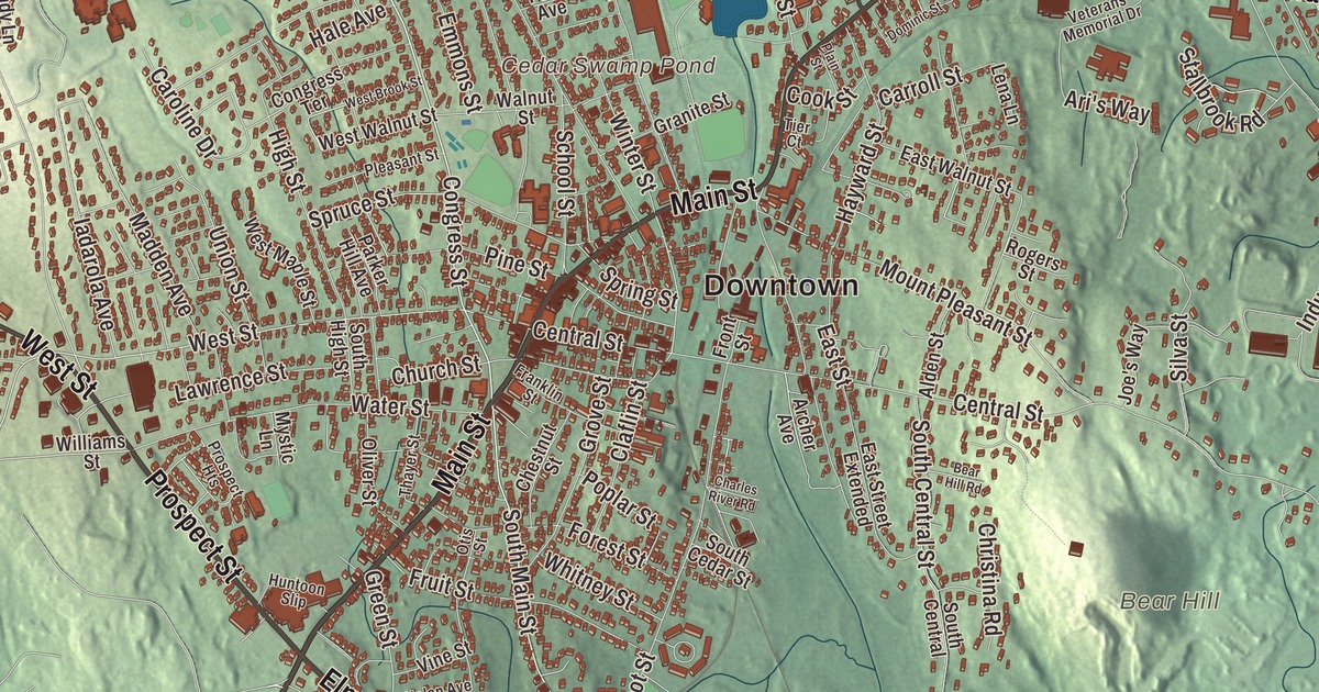
Pink granite from Milford’s quarries went into the Boston Public Library and New York’s old Pennsylvania Station, and closer to home into Memorial Hall on School Street. This map prints Main Street, East Main Street, Medway Street, Prospect Street, Elm Street and Cape Road, with Milford Pond, Echo Lake, Cedar Swamp Pond and Magomiscock Hill. Click here to purchase a print of this map for your wall.
Milford is in Worcester County.
KNOWOL made this map in 2026 from public survey data and drew it in the spirit of an old town atlas. United States Geological Survey elevation data gives the hills their shape, and the Census Bureau supplied the streets and the town line. Milford covers 14.9 square miles, drained by the Charles River, and it had 30,379 people at the 2020 census. Interstate 495 and state routes 16, 85, 109 and 140 all cross the town; the interstate opened here in 1969 with exits at Route 85 and Route 109, and many big stores have opened in Milford since.
The mill fords
Milford began as part of Mendon, on land that Native people, among them the sachem Quashaamit, granted to the early settlers. The Town of Milford’s recorded history, in the Secretary of the Commonwealth’s list, dates European settlement to 1662. King Philip’s War destroyed the settlement in 1676, and the settlers came back in 1680. The Mill River crossed the land at several well-known fords that Native people had long used and the settlers used too, and those “mill fords” are said to have given Milford its name. Milford was incorporated as a town on April 11, 1780. Its first town hall, a brick building later called the Town House School, went up in 1819, and the present town hall was built in 1854 by the architect Thomas Silloway. The town remains part of Worcester County today.
For a time Hopedale was part of Milford too. In 1841 the minister Adin Ballou and his Practical Christians named the place Hopedale, and the next year they founded the Hopedale Community there, a commune built on Christian and socialist ideals. Through a long career as a minister, Ballou argued for the immediate end of slavery and for nonviolence, and in 1882 he wrote one of the earliest complete histories of Milford. The community failed in 1856, and loom makers Ebenezer and George Draper bought its assets; Hopedale separated from Milford in 1886. Governor Eben Sumner Draper gave Milford its hospital in 1903, and it’s now the Milford Regional Medical Center. The surgeon Joseph E. Murray was born in Milford on April 1, 1919, and graduated from Milford High School in 1936. On December 23, 1954, he performed the first successful human kidney transplant, between the twin brothers Ronald and Richard Herrick, and in 1990 he shared the Nobel Prize in Physiology or Medicine.
Milford pink
Milford pink granite was found around 1870; local legend credits two brothers, James and William Sherman, with the discovery at Rocky Woods. At its height more than 1,000 men worked dozens of quarries in Milford and nearby Hopkinton, and the quarries carried the town’s economy until about 1940. The stone is also called Braggville granite, after the quarries of Braggville, a village now split between Holliston and Milford. Milford pink went into Worcester City Hall, the Bancroft Memorial Library in Hopedale, the McKim Building of the Boston Public Library, New York’s General Post Office and its original Pennsylvania Station, and much later Singapore Changi Airport in 2002. A sample sits at the Smithsonian Institution.
Memorial Hall at 30 School Street was built in 1884 as a Civil War tribute, designed by the Milford architect Frederick Swasey in local granite and Longmeadow brownstone, with carved panels reading “Grant” and “Farragut” and a bronze plaque carrying Lincoln’s Gettysburg Address. It joined the National Register in 1985 and is home to the Milford Historical Commission and its museum. In St. Mary’s Cemetery stands a round tower in the Irish style, built of local granite and dedicated on July 10, 1896; the town page calls it the only Irish round tower in the United States.
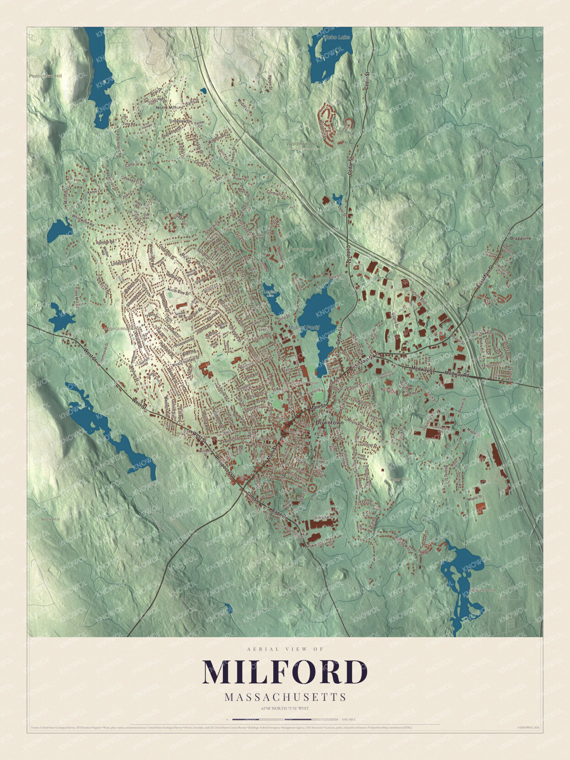
Click to explore a larger preview. The digital watermark does not appear on printed maps.
Names on this map
These names are printed on this map.
Places: Downtown, North Milford, Rocky Hill, Bear Hill, Magomiscock Hill, Neck Hill, Peppercorn Hill, Beaver Pond, Cedar Swamp Pond, Echo Lake, Milford Pond, Louisa Lake, Town Forest, Waldenwoods Conservation Area and Braggville.
Streets and roads: Cape Road, Elm Street, Medway Street, Prospect Street, Main Street, East Main Street, West Street, Cedar Street, Medway Road, South Main Street, Congress Street, Whitewood Road.
More street names, A to Z
Agnes Road, Alden Street, Alfred Road, Allen Road, Appleton Street, Archer Avenue, Ari's Way, Ariel Circle, Asylum Street, Balian Way, Bandy Lane, Bay Road, Bear Hill Road, Beaver Pond Road, Beaver Street, Birch Street, Blanchard Road, Bodio Circle, Bowdoin Drive, Briar Drive, Brookfield Road, Brook Hollow Road, Calvin Drive, Camp Street, Capitol Road, Caroline Drive, Carp Road, Carroll Street, Casey Drive, Casey Road, Central Street, Charles River Road, Chestnut Street, Christina Road, Church Street, Claflin Street, Claudette Drive, Colonial Road, Commercial Way, Como Court, Congress Terrace, Cook Street, Coolidge Road, Cormier Circle, Cornell Drive, Country Club Lane, Countryside Drive, Courtland Street, Cunniff Avenue, Dartmouth Drive, Debbie Lane, Deer Street, Deluca Road, Depot Street, Dewey Circle, Diantonio Drive, Dilla Street, Dominic Street, East Street, East Street Extended, East Walnut Street, Eben Street, Emmons Street, Esther Drive, Evans Road, Farmer Circle, Fells Avenue, Ferguson Street, Field Pond Road, Fiske Mill Road, Fordham Drive, Forest Street, Fortune Boulevard, Fountain Street, Fox Lane, Franklin Street, Front Street, Fruit Street, Geneseo Circle, Gillon Street, Godfrey Lane, Governors Way, Granite Street, Grant Street, Green Street, Grove Street, Hale Avenue, Hamilton Avenue, Hancock Street, Harding Street, Harvard Drive, Haven Street, Hayward Street, Highland Street, High Street, Howard Street, Huff Road, Huntoon Slip, Iadarola Avenue, Industrial Road, Ivy Lane, James Street, Janock Road, Jencks Road, Jillson Circle, Jionzo Road, Joan Circle, Joe's Way, Julie Circle, Kalen Circle, Karen Lane, Kennedy Lane, Lantern Lane, Larson Road, Lawrence Street, Leah Lane, Lena Lane, Littlefield Road, Longview Drive, Lucia Drive, Lydia Lane, Madden Avenue, Maple Street, Mark Drive, Mason Drive, McGill Lane, Meade Street, Mike Circle, Mill Pond Circle, Morey Way, Mount Pleasant Street, Muriel Lane, Mystic Lane, Nancy Road, National Street, Nolan Avenue, North Street, North Vine Street, Oak Terrace, Oliver Street, Otis Street, Parker Hill Avenue, Paula Road, Penny Lane, Pine Island Road, Pine Street, Pinewood Road, Plain Street, Pleasant Street, Poplar Street, Prairie Street, Princeton Drive, Prospect Heights, Purchase Street, Purdue Drive, Quarry Drive, Quinshipaug Road, Ramble Road, Reagan Road, Redwood Drive, Reservoir Street, Rich Road, Ridge Road, Rogers Street, Roland Way, Rolling Green Drive, Rosenfeld Avenue, Rose Road, Rupert Road, Salvia Road, School Street, Senate Road, Shadowbrook Lane, Sherwood Drive, Silva Street, Silver Hill Road, Simmons Drive, Sousa Circle, South Cedar Street, South Central, South Central Street, South High Street, Spring Street, Spruce Street, Stallbrook Road, Stony Brook Lane, Sumner Street, Sunset Drive, Taft Street, Tall Pine Road, Tanglewood Drive, Tara Circle, Temple Street, Thayer Street, Thomas Street, Thoreau Trail, Tier Court, Tina Road, Tyler Street, Union Street, University Drive, Veterans Memorial Drive, Victor Drive, Village Circle, Vine Street, Violet Circle, Virginia Drive, Walden Way, Wales Street, Walnut Street, Water Street, Wayne Road, West Brook Street, Western Avenue, West Fountain Street, West Maple Street, West Walnut Street, Whispering Pine Drive, Whitney Street, Whittier Road, Wildwood Drive, Williams Street, Willow Road, Windsor Road, Winter Street, Woodridge Road, Wood Street, Yale Drive, Zain Circle.
See it on a wall
The Milford map as a framed print. Swipe for more.


Around the map
Start with North Milford. Follow Cape Road, Elm Street, Medway Street, Prospect Street, Main Street and East Main Street across town. Then look outward toward Rocky Hill and Braggville. Beaver Pond, Echo Lake, Milford Pond, Town Forest, Bear Hill, Magomiscock Hill, Neck Hill and Cedar Swamp Pond are all printed on the map, with each name set directly on the artwork. Each July the town shoots off its Independence Day fireworks at Plains Park and holds a parade, and the Portuguese Club hosts a two-night Portuguese Picnic.
The Milford map belongs in an office, library or den, and it can help teach children the geography and history of a granite town on the Charles. It’s made for people who call Milford home, from North Milford to Braggville, and it shows the town as it looks today. Zoom in on the preview above to explore the details, then click here to get your copy of the Milford, Massachusetts map.

Sources
- Milford, Massachusetts, Wikipedia
- Hopedale, Massachusetts, Wikipedia
- Adin Ballou, Wikipedia
- Joseph E. Murray, Wikipedia
- Milford pink granite, Wikipedia
- Memorial Hall (Milford, Massachusetts), Wikipedia
- Irish round tower, Wikipedia
- City and Town Incorporation and Settlement Dates, Secretary of the Commonwealth of Massachusetts (archived copy)