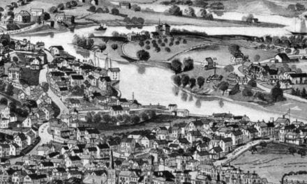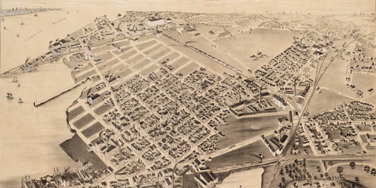
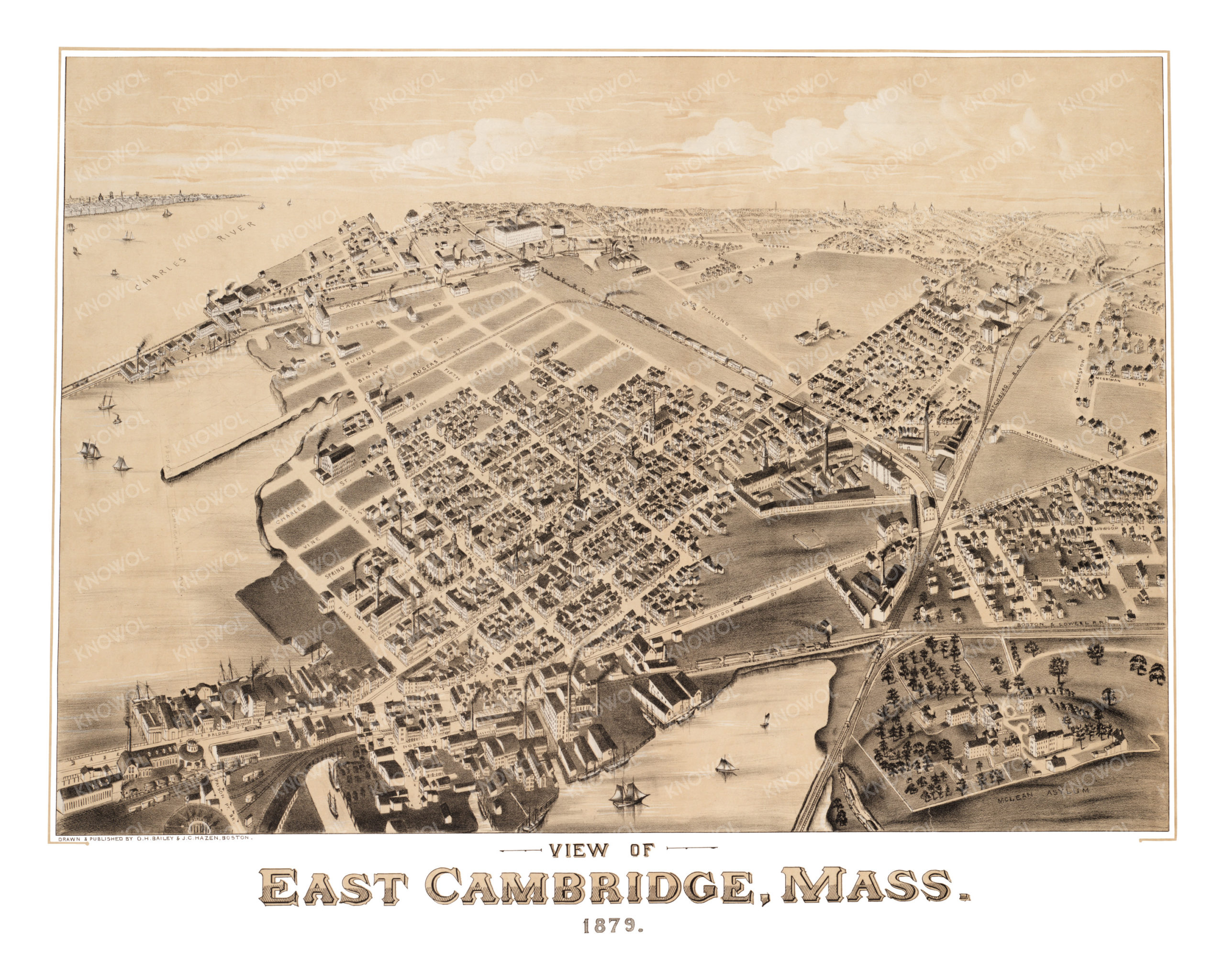
This map of East Cambridge, Massachusetts was created in 1879 by O.H. Bailey & J.C. Hazen, a prominent team of 19th century map makers. The map shows a bird’s eye view of East Cambridge including street names and old landmarks.
Landmarks on the map include the Charles River, Fitchburg Railroad, McLean Asylum, Boston & Lowell Railroad, Boston & Albany Railroad, and more. At the time, Commercial Ave had not yet been built. The map features a sketch of the proposed path of Commercial Ave over the Charles River.
This historic map of East Cambridge has been restored by KNOWOL. Reproductions of the map are available here.
Bird’s Eye View of East Cambridge, Mass in 1879
This historic map of East Cambridge will make an attractive addition to your office, library, or den and can even be used to teach children the geography and history of the area. When you’re done exploring, click here to get your copy.