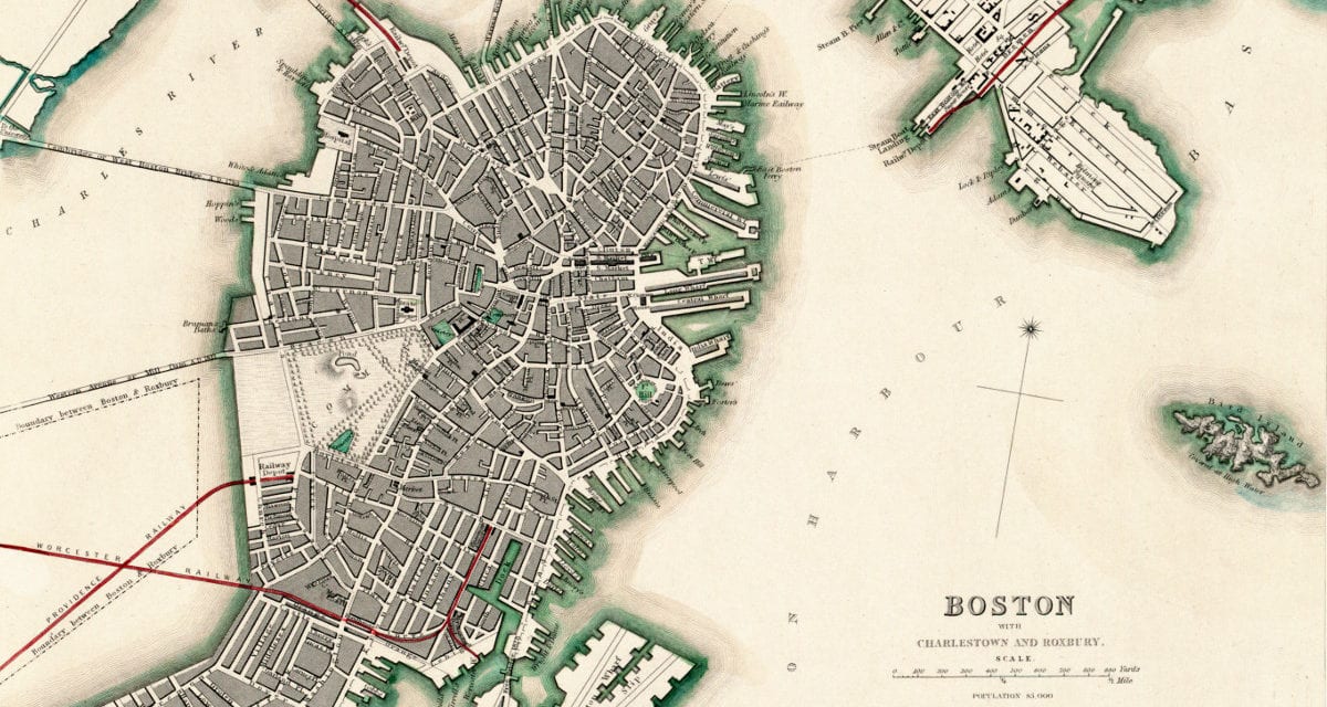
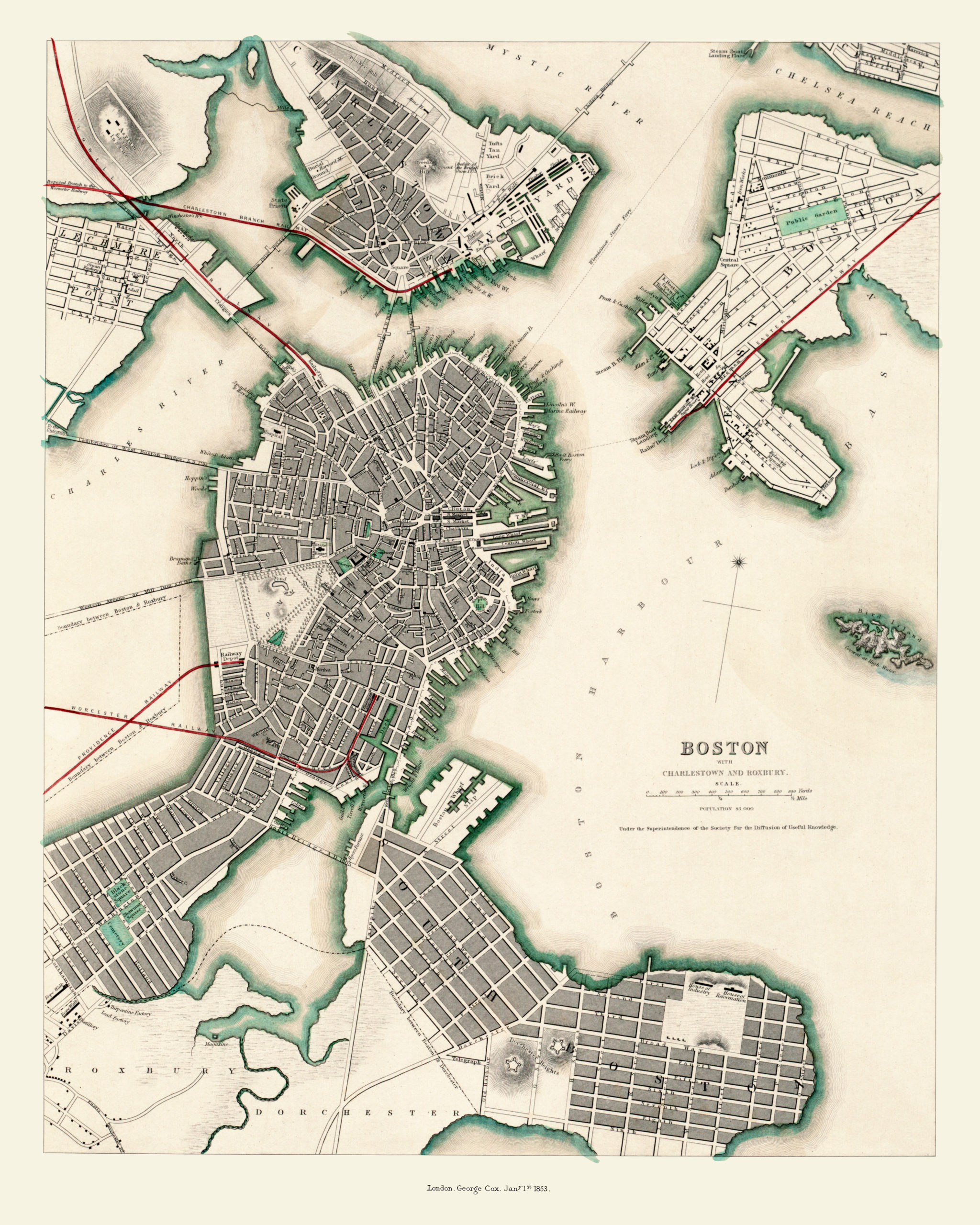
This map of Boston by Benjamin Rees Davies was published in 1853 by the Society for the Diffusion of Useful Knowledge. The society was founded in 1826 with the goal of publishing information for people who didn’t obtain formal teaching.
The society’s accomplishments included publishing a series of nearly 200 steel engraved maps and plans of great cities around the world. This map is from that series and provides an aerial view of Boston, Charlestown and Roxbury shortly after the area became a haven for Irish Catholic immigrants following the potato famine of 1845–49.
The map is beautifully adorned with red lines marking the multiple rail lines that serviced Boston at the time, including the Providence, Worcester and Eastern railways. Prominent buildings on the map include an Asylum for the Insane, Fort Hill, the East Boston Sugar House, a distillery in Roxbury and the Breed’s Hill monument in Charlestown.
Click here to see the full size map.
This historical map of Boston will make an attractive addition to your office, library, or living room. When you’re done exploring, click here to get a museum quality reproduction printed on matte, archival paper.