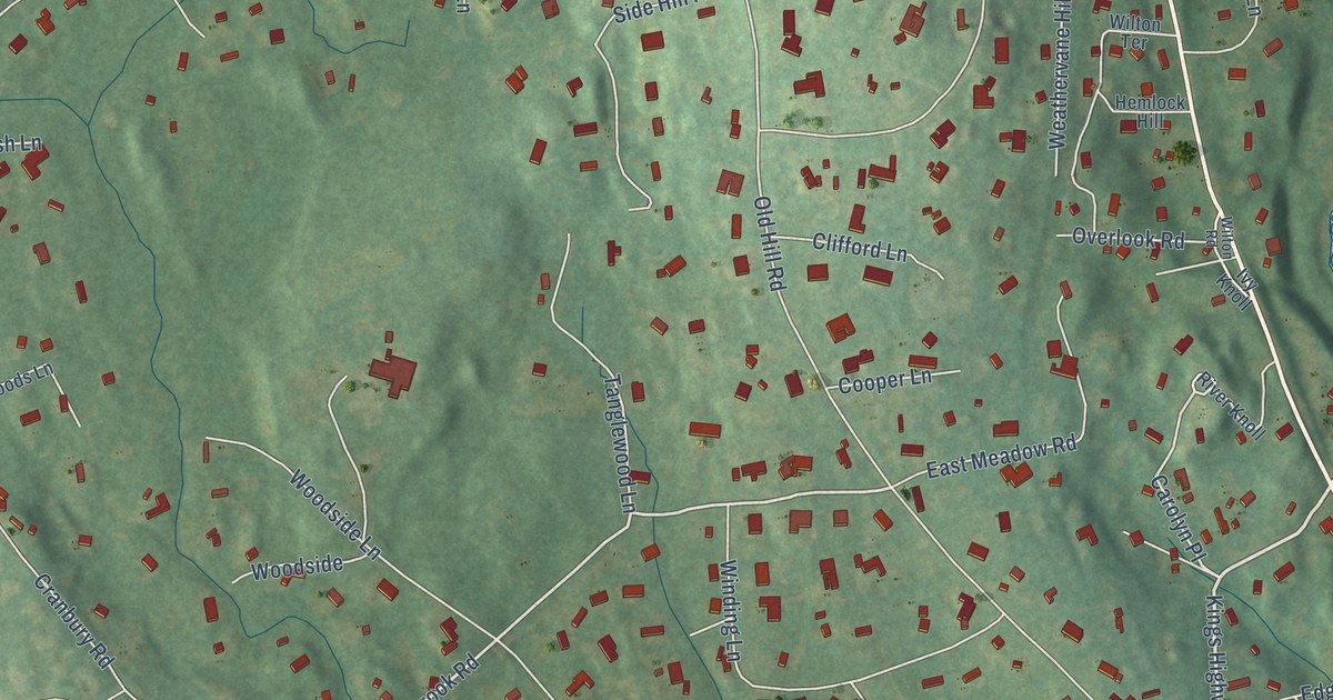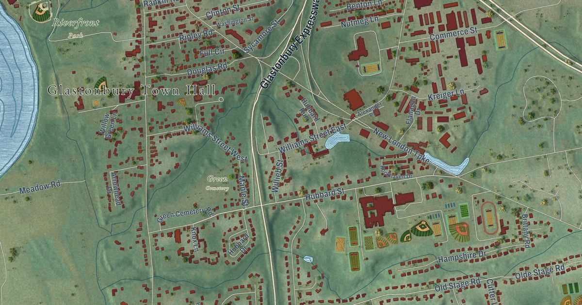
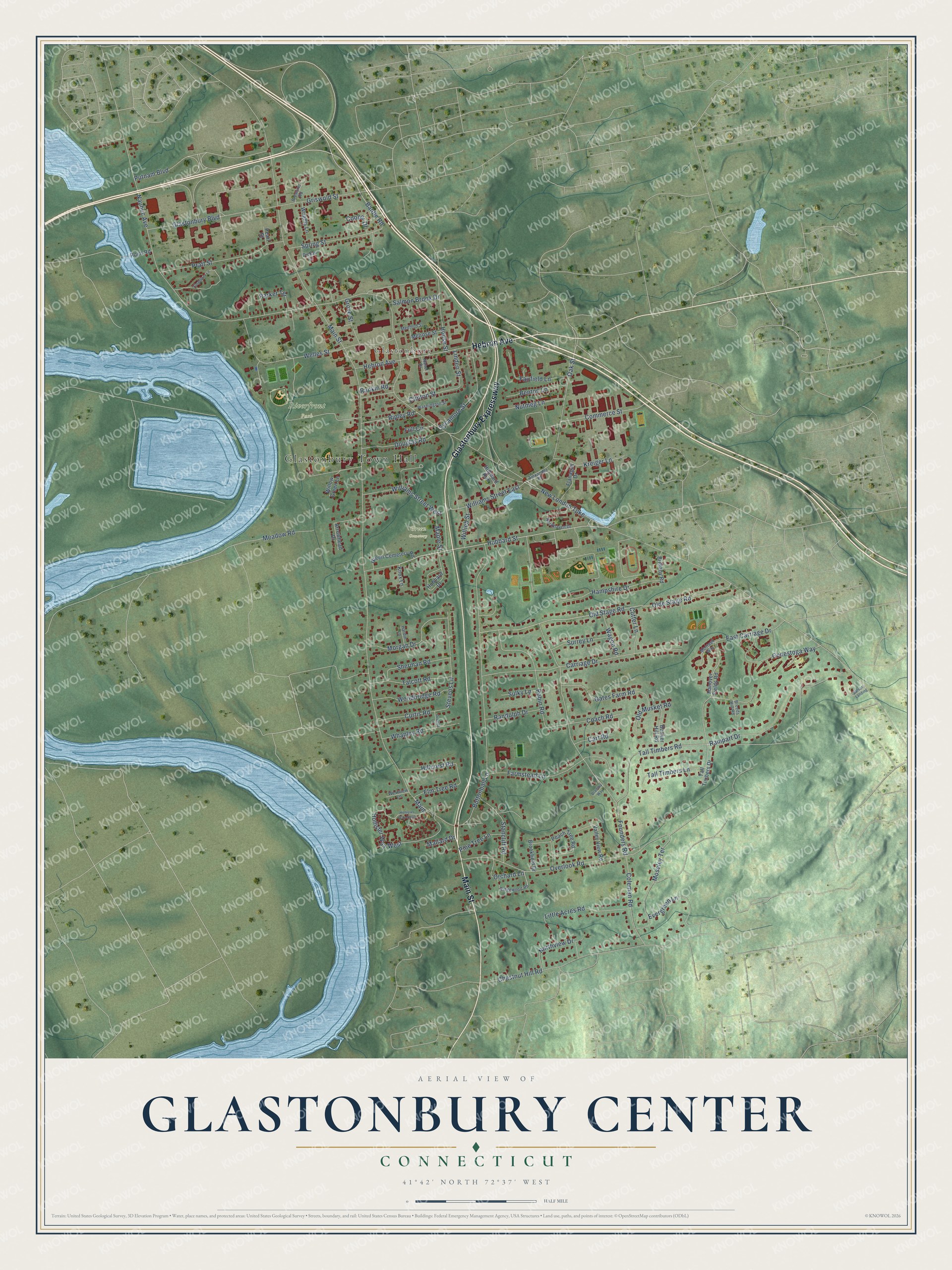
This beautifully detailed map of Glastonbury Center, Connecticut was created in 2026 using aerial imagery combined with modern topographical, census, street and landmark data. It's a modern aerial view of Glastonbury Center in Capitol Planning Region, Connecticut, that combines modern data with a vintage aesthetic. The roads feature printed names, and if you look closely you can find your exact house accurately shown in its correct location.
Explore an aerial view of Glastonbury Center, Connecticut
On this map you'll find Glastonbury Town Hall, Glastonbury, Green Cemetery, Riverfront Park, Main Street, Glastonbury Expressway, Hebron Avenue, Hubbard Street, Rampart Drive, Bantle Road, New London Turnpike, Naubuc Avenue, and more. Each red shape is a building, so zoom in on the preview and look for yours.
Glastonbury Center is a community in Capitol Planning Region. The Census Bureau counted 8,459 people here in 2020. Glastonbury Center sits about 4 miles east of Wethersfield, 4 miles south of East Hartford and 6 miles southeast of Hartford. The map prints the town name in its title panel, with the coordinates below it.
Take a closer look at the Glastonbury Center map
Names on this map
These names are printed on this map.
Places: Glastonbury Town Hall, Glastonbury, Green Cemetery and Riverfront Park.
Streets and roads: Main Street, Glastonbury Expressway, Hebron Avenue, Hubbard Street, Rampart Drive, Bantle Road, New London Turnpike, Naubuc Avenue, Buttonball Lane, Tall Timbers Road, Old Stage Road, Olde Stage Road.
More street names, A to Z
Alexander Place, Arrowhead Drive, Balsam Landing, Benton Lane, Bradlwy Way, Breeds Hill Road, Brewster Road, Brittany Road, Brookfield Drive, Bunker Hill Road, Carriage Drive, Cart Road, Chestnut Hill Road, Clinton Street, Coach Road, Coleman Road, Commerce Street, Conestoga Way, Cooper Drive, Curtis Road, Cutter Lane, Di Bella Lane, Dickau Court, Douglas Road, East Carriage Drive, Elm Tree Road, Evergreen Lane, Fairfield Lane, Farmstead Lane, Flanagan Drive, Founders Road, Full Circle, Gates Farm Road, Glastonbury Boulevard, Green Cemetery Road, Griswold Street, Grove Street, Hampshire Drive, Hanover Fields Road, Hardin Lane, Hillcrest Road, Hollister Way North, Hollister Way West, House Street, Hubbard Drive, Hubbard Run, Kingsbury Lane, Knox Lane, Kreiger Lane, Linden Street, Little Acres Road, Main, Mallard Drive, Maple Street, Meadow Road, Medford Street, Melrose Street, Montauk Way, Morgan Drive, Moseley Terrace, Nanel Drive, Northview Drive, Nutmeg Lane, Oak Street, Old Musket Road, Orchard Lane, Overlook Road, Parker Terrace, Peach Tree Road, Pearl Street, Pine Tree Lane, Point Road, Pratt Street, Putnam Boulevard, Randolph Drive, Rankin Road, Ridgewood Road, Ripley Road, Robin Road, Rockhaven Drive, Salmon Brook Drive, Sherman Road, Spring Street, Stancliff Road, Stevens Lane, Sulky Lane, Surrey Lane, Sycamore Street, Talcott Road, Tall Timbers Drive, Tall Timbers Lane, Valley View Road, Wagon Road, Washington Street, Welles Street, Westview Lane, Whapley Road, Williams Street East, Williams Street West, Willieb Street, Willow Green Lane, Woodbridge Road, Wrights Lane.
See it on a wall
The Glastonbury Center map as a framed print. Swipe for more.


Created by KNOWOL in 2026. The buildings are small red shapes, the roads carry their printed names, and shaded relief shows the shape of the land. The title panel reads "AERIAL VIEW OF GLASTONBURY CENTER, CONNECTICUT" with 41°42' NORTH 72°37' WEST.
It looks right in a kitchen, an office or a den, and it's a gift for anyone who grew up in Glastonbury Center or moved away. Open the preview and find your street. See sizes and frames for the Glastonbury Center map.