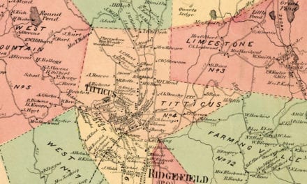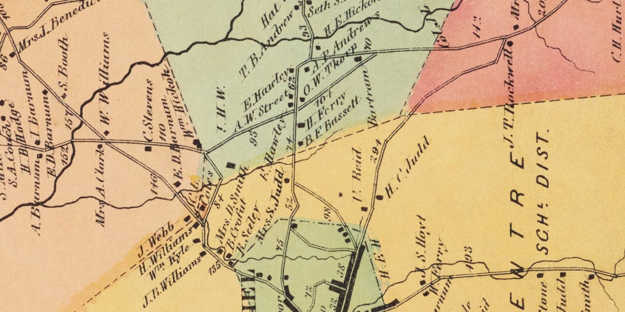
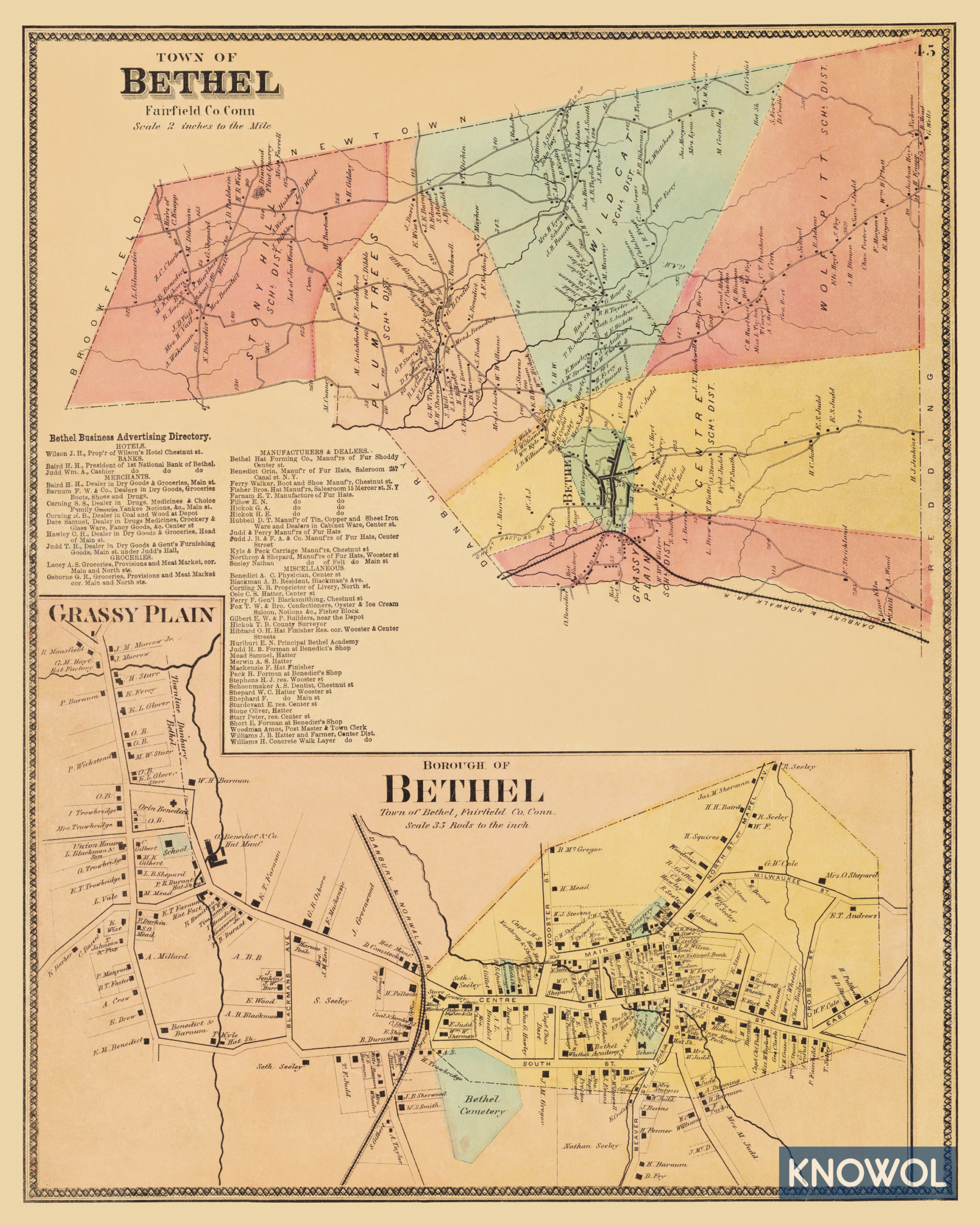
This historic landowners map of Bethel, Connecticut was created in 1867 by F.W. Beers, A.D. Ellis & G.G. Soule, cartographers from New York. The map shows the town divided into six school districts: Stony Hill, Plum Trees, Wild Cat, Wolf Pitt, Grassy Plains, and Centre School District.
Each plot of land is labeled with the name of the person who owned the land at that time. Landmarks on the map include Bethel Academy, Kyle & Peck Carriage Company, Northrup & Shepard Hats, Danbury & Norwalk Railroad, Diamond Flint Quarry, Fox Brothers Oyster & Ice Cream Saloon, Great Pasture Road, and more.
This historic map of Bethel was restored by KNOWOL. Reproductions of the restored map are available here.
Landowners Map of Bethel, CT from 1867
This vintage map of Bethel makes an attractive addition to your office, library, or den and can even be used to teach children the geography and history of the area. When you’re done exploring, click here to get your copy.