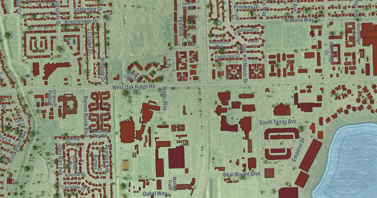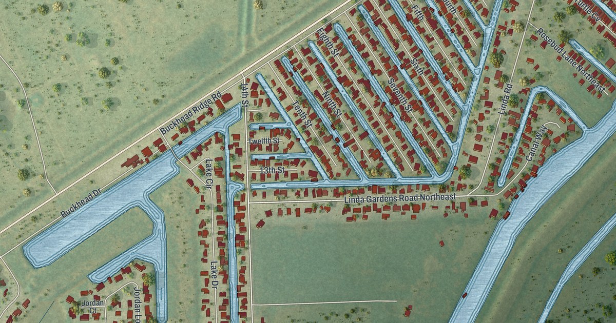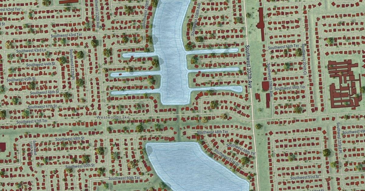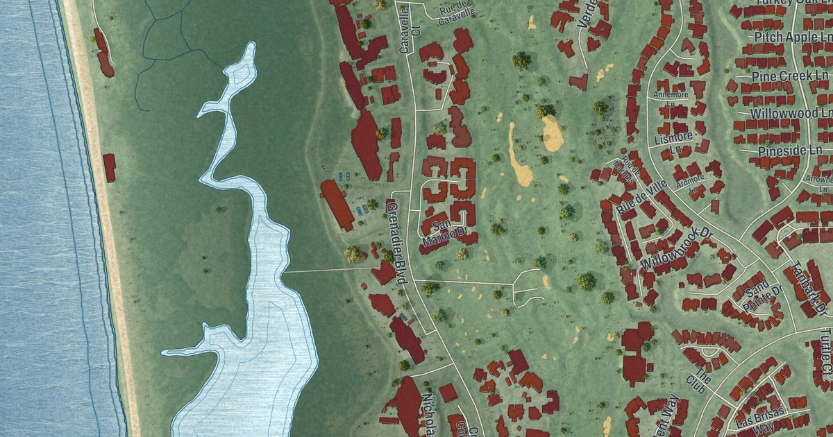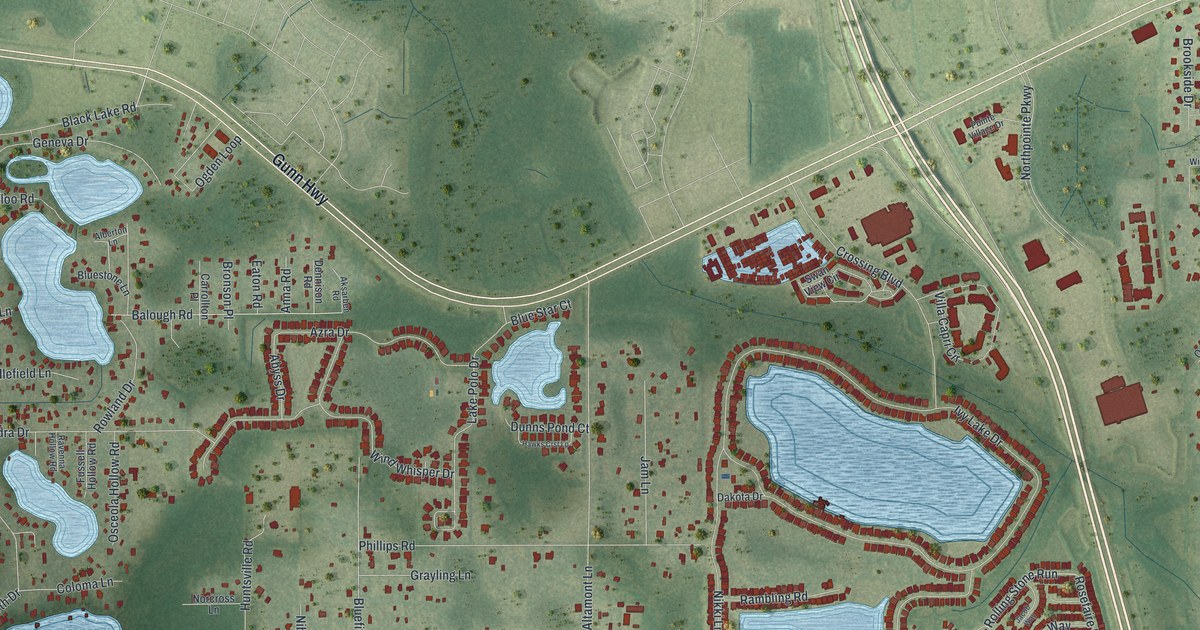
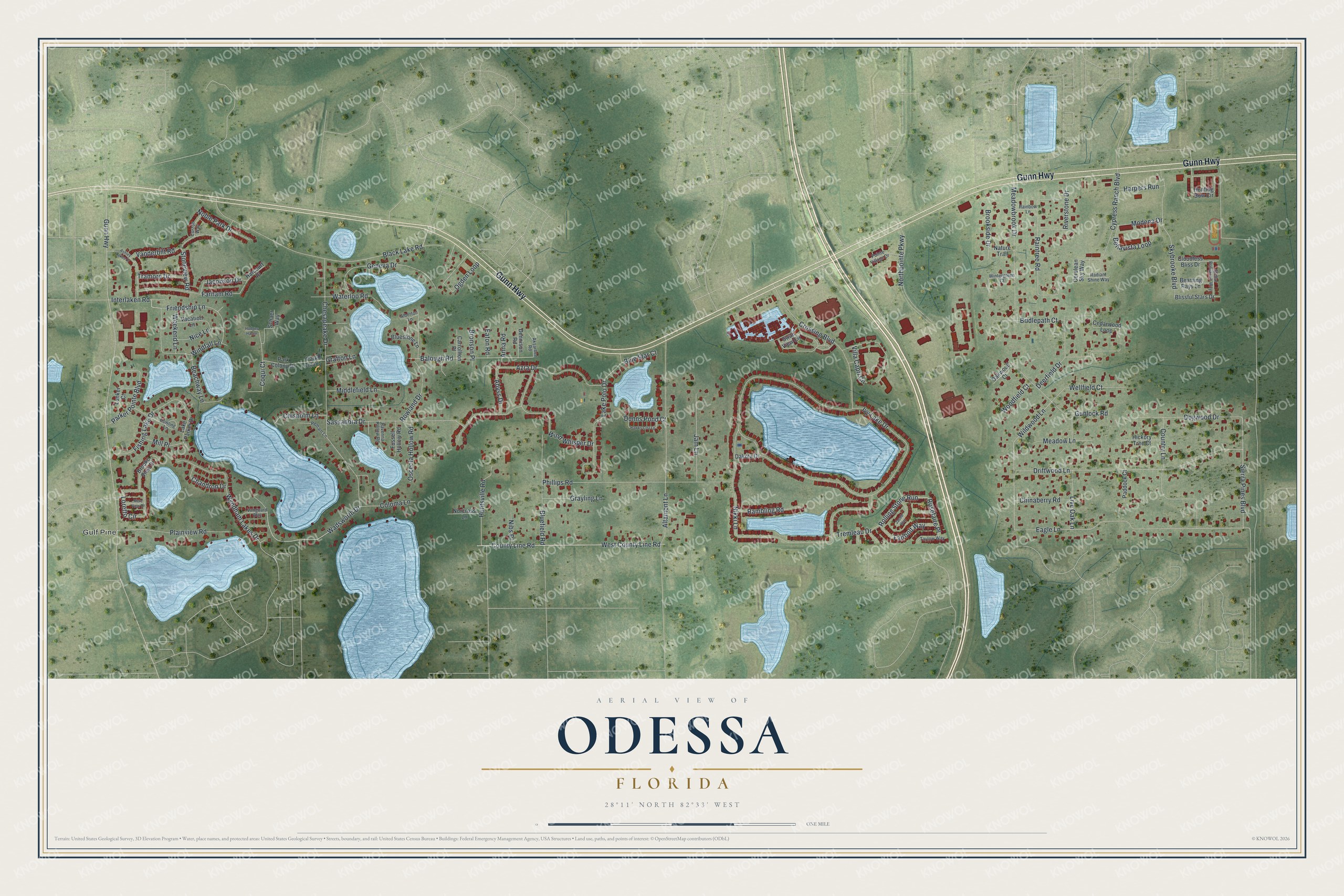
This beautifully detailed map of Odessa, Florida was created in 2026 using aerial imagery combined with modern topographical, census, street and landmark data. It's a modern aerial view of Odessa in Pasco County, Florida, that combines modern data with a vintage aesthetic. The roads feature printed names, and if you look closely you can find your exact house accurately shown in its correct location.
Explore an aerial view of Odessa, Florida
On this map you'll find Gulf Pine, Gunn Highway, Rolling Stone Run, Black Lake Road, Interlaken Road, Wadsworth Drive, West County Line Road, Wildwood Lane, Sierra Pines Boulevard, Balough Road, Ivy Lake Drive, Nikki Lane, and more. Each red shape is a building, so zoom in on the preview and look for yours.
Here is a piece of Odessa history. Odessa is believed to have been named in the 1880s by Peter A. Demens, the Russian immigrant who helped finance the Orange Belt Railway from Sanford to St. Petersburg. Demens named St. Petersburg too, and both names came from cities in Russia. A post office opened at Odessa on May 22, 1900, with Peter Strand as the first postmaster. That's from the West Pasco Historical Society.
Odessa is a community in Pasco County. The Census Bureau counted 8,080 people here in 2020.
Take a closer look at the Odessa map
Names on this map
These names are printed on this map.
Places: Gulf Pine.
Streets and roads: Gunn Highway, Rolling Stone Run, Black Lake Road, Interlaken Road, Wadsworth Drive, West County Line Road, Wildwood Lane, Sierra Pines Boulevard, Balough Road, Ivy Lake Drive, Nikki Lane, Chesapeake Drive.
More street names, A to Z
Abyss Drive, Aksarben Road, Alberton Lane, Altamont Lane, Anna Road, Ashley Lakes Drive, Azra Drive, Beachway Lane, Beaming Rays Lane, Bellavista Loop, Blissful Stars Drive, Bluefield Road, Blue Star Court, Bluestone Lane, Bridlepath Court, Bronson Place, Brooke View Drive, Brookside Drive, Carrollton Place, Cedarwood Loop, Cerulean Sky Way, Chandron Drive, Chinaberry Road, Chisholm Lane, Cloudless Bliss Drive, Coloma Lane, Coqui Court, Country Lane, County Line Road, Crossing Boulevard, Curzon Way, Cypress Ranch Boulevard, Dakota Drive, Deerfield Drive, Dennison Road, Dogwood Drive, Dowling Lane, Driftwood Lane, Dunns Pond Court, Eagle Lane, Eaton Road, Fairbolt Way, Farham Road, Fishing Lake Drive, Friendship Lane, Fussell Hollow Road, Geneva Drive, Grafton Lane, Grayling Lane, Gunlock Road, Harcourt Place, Harpers Run, Hawks Crst Lp, Hickory Tree Court, Hodges Haven, Hunting Bow Circle, Huntsville Road, Jacobson Drive, Jacob Way, Jam Lane, Lake Parker Drive, Lake Polo Drive, Live Oak Lane, Loretto Circle, Lunker Court, Meadowbrook Drive, Meadow Lane, Mere View Drive, Middlefield Lane, Mill Place, Modena Drive, Nature Trail, Nibs Place, Nice Lane, Noble Park Drive, Norcross Lane, Northpointe Parkway, Oakwood Court, Ogden Loop, Osceola Hollow Road, Paddock Court, Park Colony, Park Colony Drive, Parker Pointe Boulevard, Pelham Lane, Phillips Road, Plainview Road, Pointe Village Drive, Radiant Shine Way, Rainbow Lane, Raintree Road, Rambling Road, Ravenna Hollow Road, Riverstone Drive, Rosefaire Place, Rowland Drive, Sassandra Drive, Schaer Way, Skybrooke Boulevard, Stellar Brilliance Way, Stoneview Road, Swan View Circle, Taylow Way, Tramore Drive, Tremleau Drive, Vacation Lane, Vanderbilt Road, Vanguard Way, Villa Capri Circle, Waterloo Road, Weekend Lane, Wellfield Court, Windfall Lane, Wind Whisper Drive, Wintergreen Court, Woodfield Court, Wyndham Lakes Drive.
See it on a wall
The Odessa map as a framed print. Swipe for more.


Created by KNOWOL in 2026. The buildings are small red shapes, the roads carry their printed names, and shaded relief shows the shape of the land. The title panel reads "AERIAL VIEW OF ODESSA, FLORIDA" with 28°11' NORTH 82°33' WEST.
It suits a den, a classroom or a front hall, and it makes a gift for anyone with Odessa roots. Open the preview and find the block you know. See sizes and frames for the Odessa map.