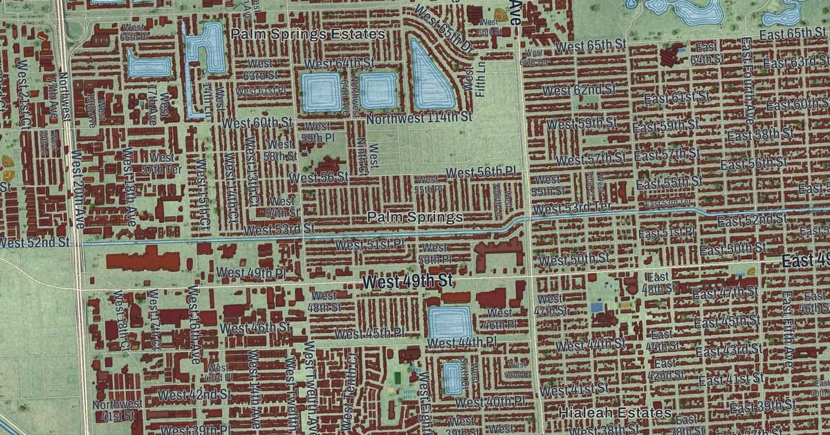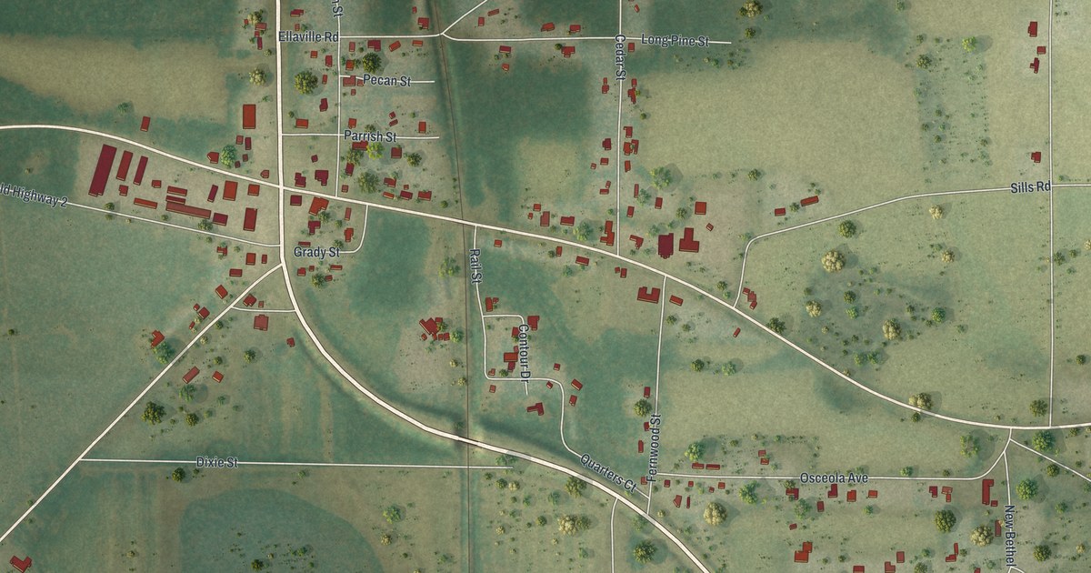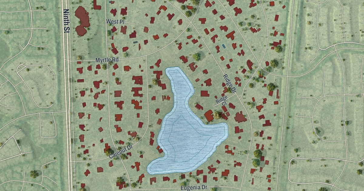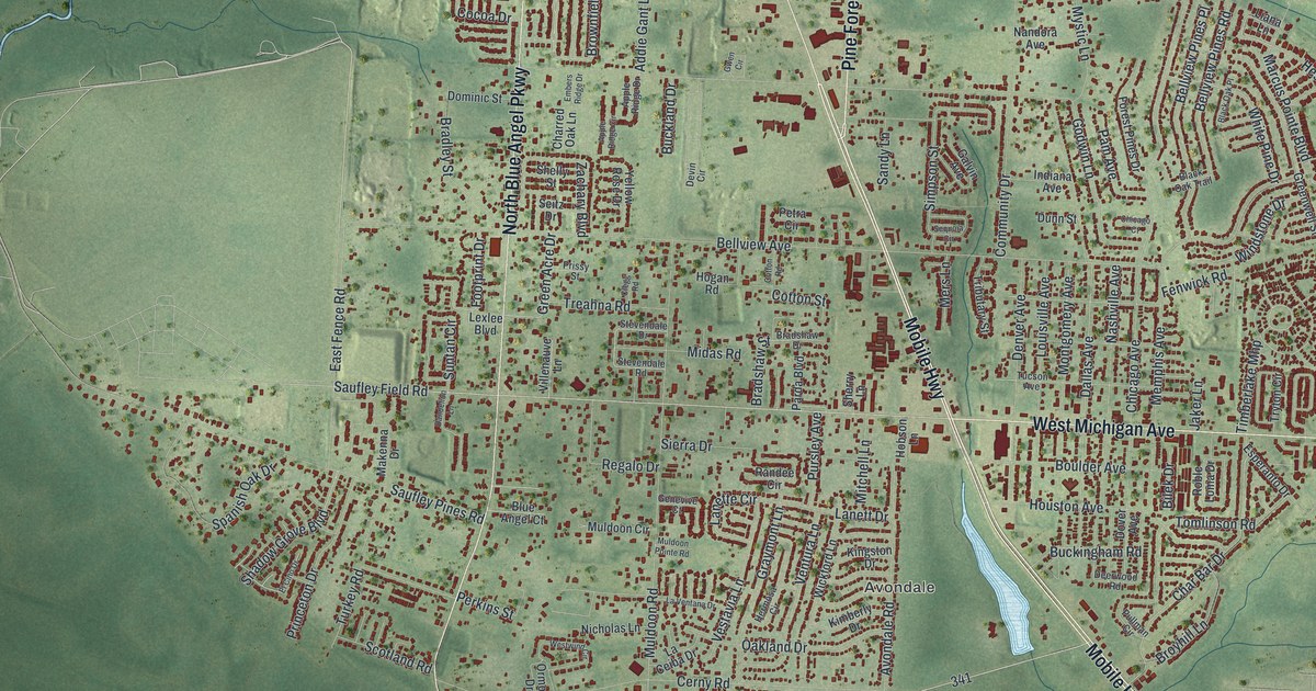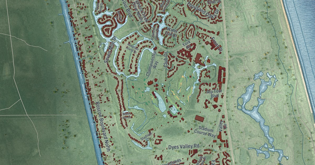
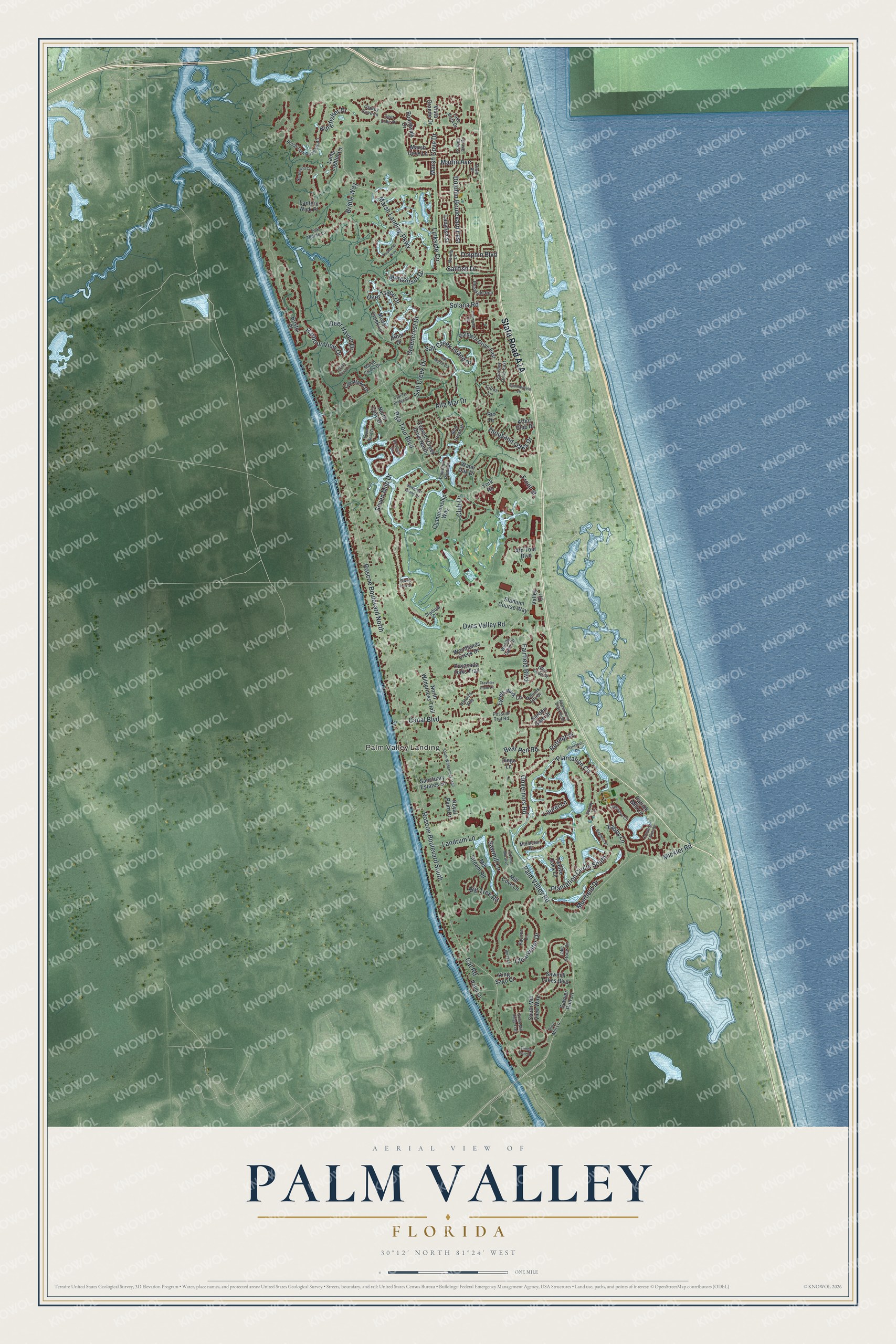
This beautifully detailed map of Palm Valley, Florida was created in 2026 using aerial imagery combined with modern topographical, census, street and landmark data. It's a modern aerial view of Palm Valley in St. Johns County, Florida, that combines modern data with a vintage aesthetic. The roads feature printed names, and if you look closely you can find your exact house accurately shown in its correct location.
Explore an aerial view of Palm Valley, Florida
On this map you'll find Palm Valley Landing, State Road A1A, Pga Tour Boulevard, Roscoe Boulevard North, Roscoe Boulevard South, Marsh Landing Parkway, Seven Mile Drive, Palm Valley Road, Dolphin Boulevard, Solana Road, Harbour View Drive, Plantation Circle, and more. Each red shape is a building, so zoom in on the preview and look for yours.
Palm Valley has a story worth telling. Palm Valley was once a small settlement called Diego, and it became Palm Valley in 1907. Since the early 1700s the grasslands along the North and San Pablo rivers there had held the San Diego cattle ranch of Don Diego de Espinosa. Espinosa ringed his ranch house with cedar posts 15 feet high, and as Fort San Diego it fell in 1740 to Gen. James Oglethorpe of Georgia, who made it his headquarters in a failed attempt to capture St. Augustine. That's from the Florida Place Names.
Palm Valley is a community in St. Johns County. The Census Bureau counted 21,827 people here in 2020.
Take a closer look at the Palm Valley map
Names on this map
These names are printed on this map.
Places: Palm Valley Landing.
Streets and roads: Pga Tour Boulevard, Roscoe Boulevard North, Roscoe Boulevard South, Marsh Landing Parkway, Seven Mile Drive, Palm Valley Road, Dolphin Boulevard, Solana Road, Harbour View Drive, Plantation Circle, Plantation Circle South, Clearwater Drive.
More street names, A to Z
Alta Mar Drive, Arbor Club Drive, Arbor Drive, Atp Tour Boulevard, Azalea Point Drive South, Baytree Lane, Bear Pen Road, Berry Lane, Big Tree Road, Blue Heron Drive, Boardwalk Drive, Bonita Drive, Bridle Way, Bristol Place, Burnham Circle, Canal Boulevard, Cat Road, Championship Way, Citrus Lane, Clearlake Drive, Club Drive, Cranes Lake Drive, Crosscove Circle, Crossroad Lakes Drive, Cypress Bridge Circle, Cypress Creek Drive North, Deer Haven Drive, Deer Lake Drive, Deer Trace Drive, Diego Lane, Dolphin Boulevard East, Drum Place, Dyes Valley Road, Egrets Walk Lane, Fairfield Boulevard, Founders Way, Front Street, Garden Gate Drive, Glen Cove Place, Governors Road, Greencrest Drive, Indian Cove Lane, Ironwood Drive, Kingfisher Drive, King Sago Court, Ladyfish Street, Lake Stone Circle, Lake Vista Drive, Lamp Lighter Lane, Landrum Lane, Lantern Wick Place, Laurel Lane, Linkside Circle, Marlin Avenue, Marsh Cove Drive, Marsh Cove Lane, Marsh Creek Drive, Merganser Drive, Mickler Road, Middleton Place, Mill Cove Lane, Mill Stream Road, Moss Creek Lane, Muirfield Drive, Natures Isle Drive, Natures Way, North Cove Drive, North Wilderness Trail, Northwind Court, Odoms Mill Boulevard, Osprey Cove Lane, Palmera Drive East, Palmetto Point Drive, Palm Lane, Patrick Mill Circle, Payasada Oaks Trail, Pheasant Run, Pine Mill Lane, Plantation Drive, Possum Trot Road, Regents Place, Retreat Place, Rio Drive, Royal Palm Drive, Royal Tern Road South, Sailfish Drive, Salt Creek Drive, Salt Creek Island Drive, Salt Marsh Circle, Sanchez Drive East, Sanctuary Estates Lane, Sawgrass Island Drive, Sawmill Lakes Boulevard, Sawmill Lane, Sawyer Run Lane, Seven Iron Court, South Bend Drive, South Mill Ridge Trail, South Mill View Way, South Wilderness Trail, Stadium Course Way, Stadium Court, Summerfield Drive, Surrey Lane, Tabby Lane, Teal Pointe Lane, Thousand Oaks Drive, Timber Pond Drive, Traveler Palm Court, Twelve Oaks Lane, Valley Circle, Vista Grande Drive, Water Oak Drive, Woodlands Creek Drive, Woody Creek Drive, York Road.
See it on a wall
The Palm Valley map as a framed print. Swipe for more.


Created by KNOWOL in 2026. The buildings are small red shapes, the roads carry their printed names, and shaded relief shows the shape of the land. The title panel reads "AERIAL VIEW OF PALM VALLEY, FLORIDA" with 30°12' NORTH 81°24' WEST.
It looks right in a kitchen, an office or a den, and it's a gift for anyone who grew up in Palm Valley or moved away. Open the preview and find your street. See sizes and frames for the Palm Valley map.