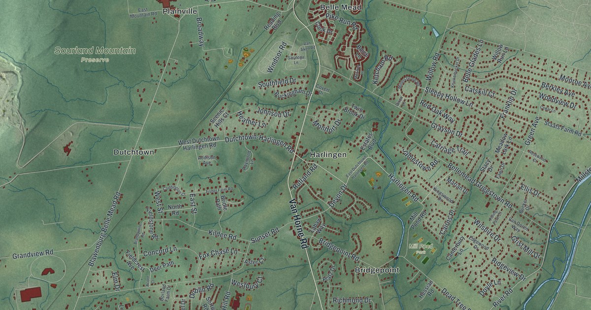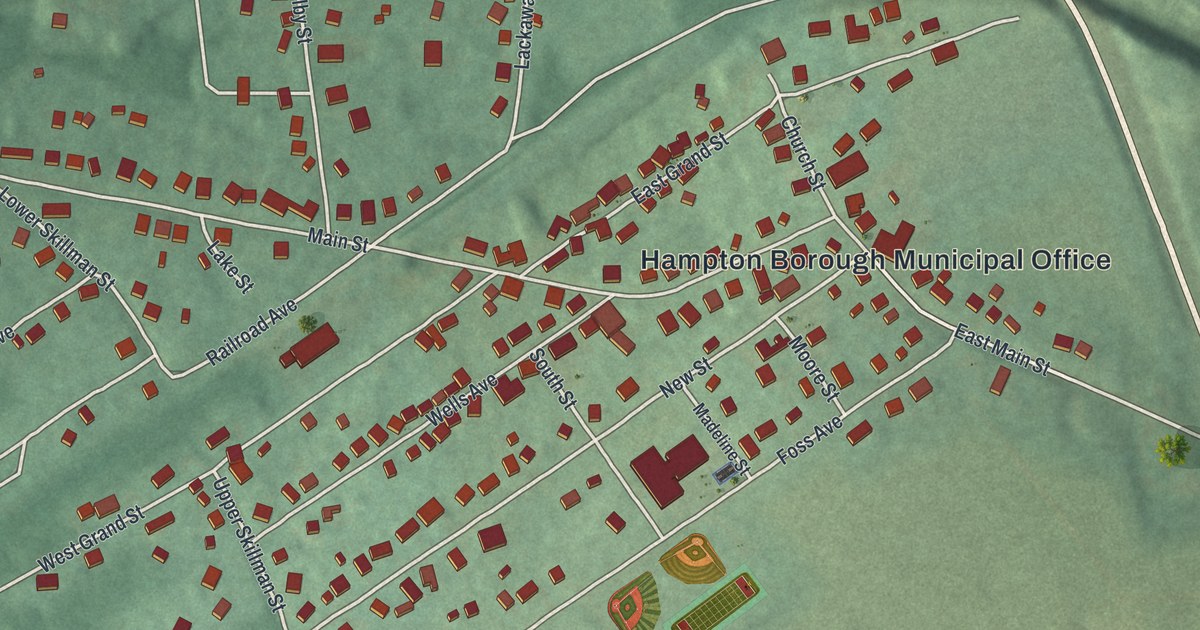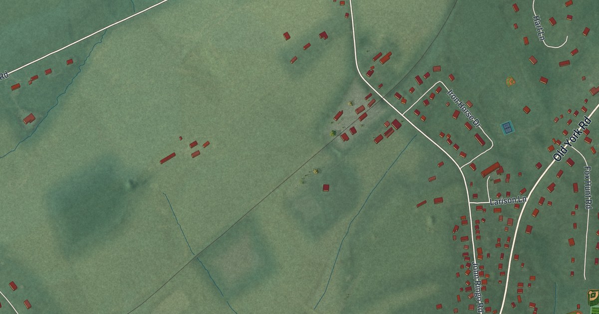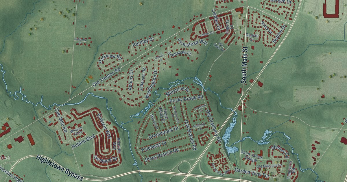
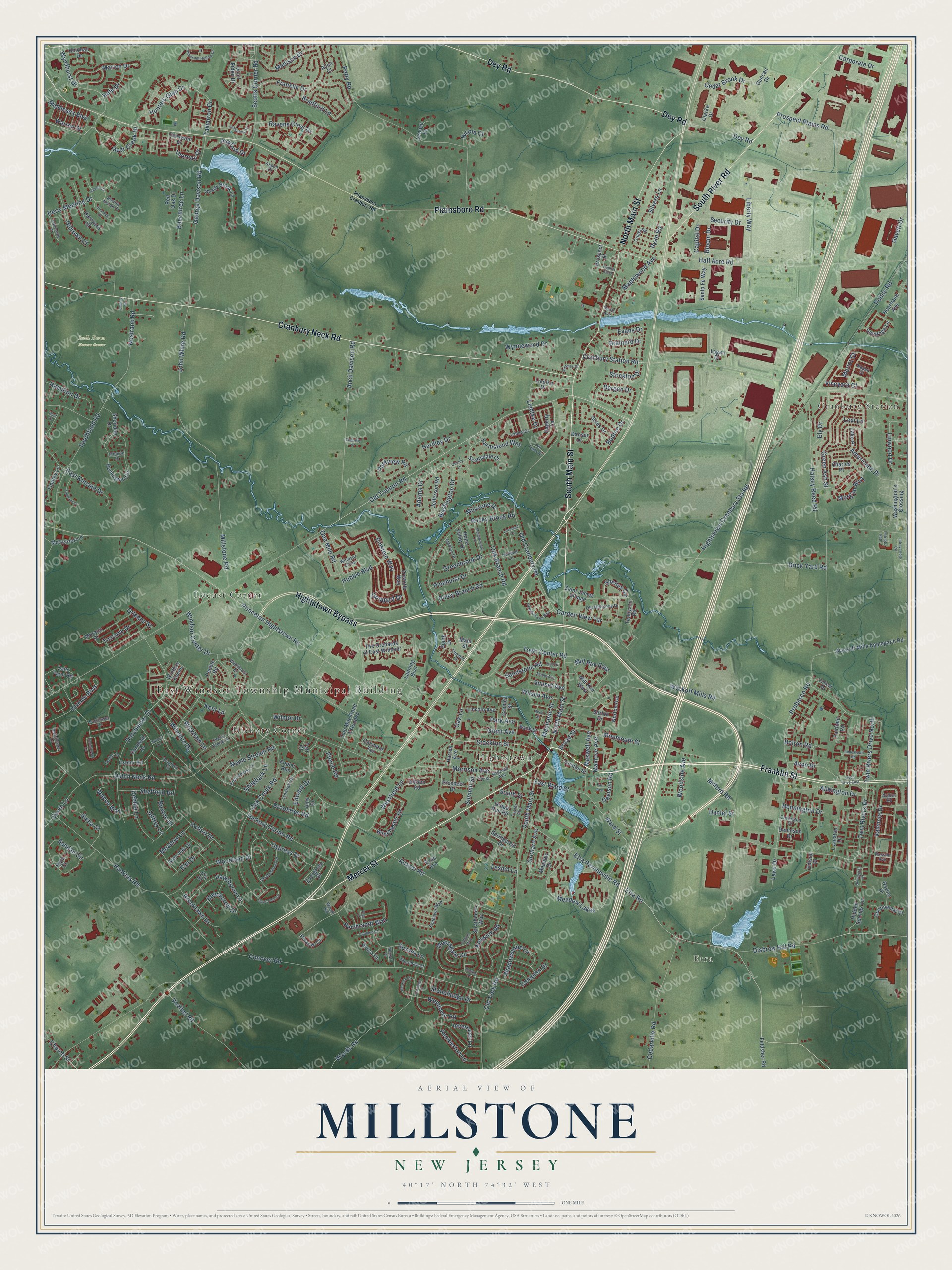
This beautifully detailed map of Millstone, New Jersey was created in 2026 using aerial imagery combined with modern topographical, census, street and landmark data. It’s a one-of-a-kind view of Millstone that combines accurate data with a vintage aesthetic. The map shows every building in its true location, many of the roads carry their names, and the shaded topographic relief shows the shape of the land.
Explore an aerial view of Millstone, New Jersey
On the map you’ll find East Windsor Township Municipal Building, Etra, Cranbury Station, Bulk Farm Nature Center, Hickory Corner, Locust Corner, and Hightstown, along with Franklin Street, South Main Street, North Main Street, Plainsboro Road, Cranbury Neck Road, and more. If you look closely you can even find your house accurately drawn in its correct location. Zoom in on the preview to look for yours.
Did You Know?
From Internet Archive: "Hendrick settled (date unknown) on a large tract of land extending from Harlingen to the Millstone River, and on this he built a log house."
Millstone is a community in Mercer County.
Take a closer look at the Millstone map
Names on this map
These names are printed on this map.
Places: East Windsor Township Municipal Building, Etra, Cranbury Station, Bulk Farm Nature Center, Hickory Corner, Locust Corner and Hightstown.
Streets and roads: Franklin Street, South Main Street, North Main Street, Plainsboro Road, Cranbury Neck Road, Hightstown Bypass, Dey Road, Mercer Street, South River Road, Old Trenton Road, Stockton Street, Wyndhurst Drive.
More street names, A to Z
Abbington Drive, Adams Drive, Airport Road, Alfalfa Circle, Allen Court, Allison Road, Americana Place, Amy Drive, Ancil Davison Road, Aristotle Way, Ashford Drive, Aspen Drive, Avalon Road, Avon Drive, Avon Drive East, Bank Street, Barnyard Court, Barton Drive, Beechcroft Drive, Beechtree Lane, Bennington Drive, Bergen Drive, Berkley Place, Berwick Circle, Bloom Drive, Bodine Drive, Bolton Road, Bradford Lane, Brainerd Drive, Briardale Court, Brick Yard Road, Broad Street, Brooklawn Drive, Brooktree Road, Bunker Hill Drive, Buxton Drive, Capital Drive, Carriage Court, Cedar Brook Drive, Cedarville Road, Charles Place, Charred Oak Lane, Cherry Brook Lane, Church Street, Clarke Drive, Clinton Street, Clydesdale Court, Compton Drive, Conover Road, Continental Court, Copland Court, Cornwall Drive, Corporate Drive, Covington Drive, Cranbury Station Road, Cubberly Court, Cypress Drive, Daniel Street, Danser Drive, Davino Drive, Davison Road, Debbie Lane, Deer Creek Drive, Dennison Drive, Derry Meeting Drive, Dey Street, Disbrow Hill Road, Dorchester Drive, Duncan Drive, Dutch Neck Road, East Kincaid Drive, East Ward Street, Edison Drive, Edward Drive, Einstein Way, Elm Drive, Ely Drive, Endeavor Boulevard, Endicott Lane, Enfield Drive, Etra Perrineville Road, Etra Road, Evan Avenue, Evans Drive, Evanston Drive, Evergreen Drive, Exeter Court, Exeter Road, Fairfield Road, Farmstead Way, Farr Avenue, Feldsher Road, Findley Lane, Franklin Drive, Fulham Way, Garden View Terrace, Gavett Drive, George Davison Road, Georgetowne Boulevard, Glen Oak Drive, Goddard Drive, Grande Boulevard, Grant Avenue, Grape Run Road, Greeley Street, Green Ash Street, Greenbrook Drive, Griggs Road, Hagerty Lane, Hale Drive, Half Acre Road, Halsey Reed Road, Hamilton Drive, Hampshire Drive, Hankins Road, Hardley Drive, Harron Avenue, Hawthorne Lane, Heartland Avenue, Hickory Corner Road, Hidden Springs Lane, Hightstown Cranbury Sta Road, Hilltown Court, Holland Lane, Holohan Drive, Hope Valley Drive, Hubble Boulevard, Hunt Court, Hunters Glen Drive, Huntington Drive, Intravartolo Circle, Inverness Lane, Iris Drive, Jake Place, Jamestown Road, Jefferson Road, Jeffrey Lane, John White Road, Kent Lane, Keswick Road, Klee Court, Labaw Drive, Lake Drive, Lanning Boulevard, Lenape Court, Leshin Lane, Lexi Lane, Liberty Way, Liedike Drive, Liedtke Drive, Lincoln Avenue, Linwood Drive, Logan Drive, Loveland Court, Lynnfield Drive, Madison Drive, Main Street, Manlove Avenue, Maple Avenue, Maple Stream Road, Maplewood Avenue, Marilyn Drive, Marion Drive, Maxwell Avenue, McGetrick Lane, Meadowbrook Drive, Meadow Drive, Meadow Lakes, Meadow Lane, Meadowview Drive, Mechanic Street, Merlot Court, Middlesex Boulevard, Milford Road, Mill Run East, Mill Run West, Millstone Drive, Millstone Road, Monmouth Street, Monroe Drive, Moorsgate Circle, Morgan Way, Morrison Avenue, Mozart Court, Murano Drive, Nappa Court, Narrow Brook Court, Nicola Court, Norton Avenue, Nostrand Road, Oak Branch Road, Oak Creek Circle, Oak Creek Road, Oak Lane, Oakmont Terrace, Old Cranbury Road, Old Millstone Drive, Old York Road, One Mile Road, One Mile Road Extended, Orchard Avenue, Orleans Street, Oxford Drive, Park Avenue, Parkview Road, Patriots Path, Pebble Road, Pemberton Lane, Petty Road, Pheasant Hollow Drive, Picasso Court, Pierce Road, Pinehurst Drive, Piney Branch Road, Pin Oaks Drive, Pliansboro Cranbury Road, Pollack Court, Poplar Run, Princeton Hightstown Road, Probasco Road, Prospect Drive, Prospect Plains Road, Prospect Street, Public Road, Quail Ridge Drive, Quarry Court, Quincy Lane, Railroad Avenue, Rainflower Lane, Ravens Crest Drive, Red Oak Drive, Reed Street, Rembrandt Way, Remington Circle, Rocky Brook Road, Rossini Avenue, Ryan Road, Saint James Village, Samjan Circle, Sandstone Road, Santa Fe Way, Saratoga Lane, Scott Avenue, Scotts Corner Road, Scottsdale Court, Security Drive, Seva Court, Shadowstone Lane, Shady Brook Lane, Shagbark Lane, Sheffield Road, Shelley Circle, Sheridan Drive, Shoreham Court, Siena Court, Silvers Lane, Sousa Court, South Drive, Southfield Road, South Lane, South Street, Springcrest Drive, Stanford Court, Stites Drive, Stockton Drive, Stonehedge Drive, Strathmore Way, Summit Street, Sunflower Lane, Sunset Avenue, Surrey Lane, Sussex Lane, Symmes Court, Taft Court, Tamarron Drive, Taylor Avenue, Tennyson Drive, Tennyson Road, The Orchards of East Windsor, Thomas Street, Thoreau Drive, Town Center Road, Tunicflower Lane, Tuscany Drive, Twin Rivers Drive, Twin Rivers Drive North, Valencia Drive, Vineyard Court, Voelbel Road, Ward Street, Warren Street, Washington's Crossing, Washington Drive, Wayne Way, Wendover Road, Westfield Lane, Wickham Lane, Wilmor Drive, Wilson Avenue, Wiltshire Drive, Winchester Drive, Windsor Castle, Windsor Center Drive, Windsor Cmns, Woodland Drive, Woodside Avenue, Woods Road, Wyckoff Mills Applegarth Road, Wyckoff Mills Road, Wyeth Road, Wyndmoor Drive, Wynnewood Drive, Zaitz Farm Road.
See it on a wall
The Millstone, Mercer County map as a framed print. Swipe for more.


This beautifully detailed map of Millstone, Mercer County makes an attractive addition to your office, library, or den, and it can even be used to teach children the geography and history of the area. It also makes a great gift for anyone with Millstone roots. When you’re done exploring, click here to get your copy of the Millstone, Mercer County map.